Trail Canyon Trail
Angeles National Forest, 4/12/03
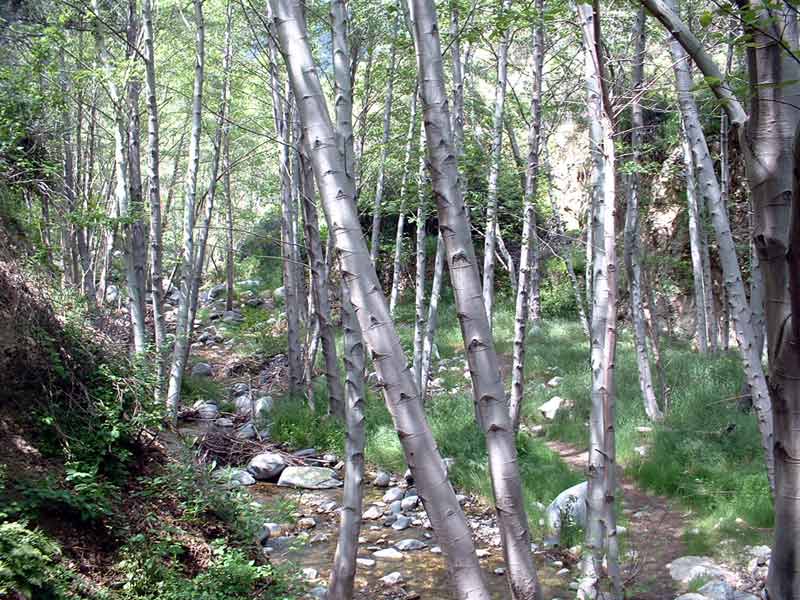 Stream-bank trail |
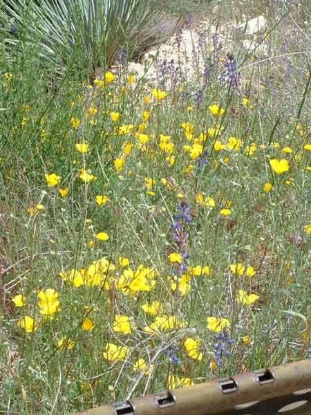 Wildflowers along the path |
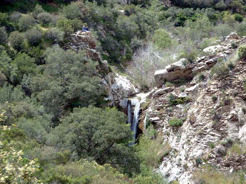 First view of the waterfall from a bend in the trail |
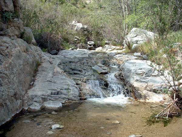 Rocky streambed |
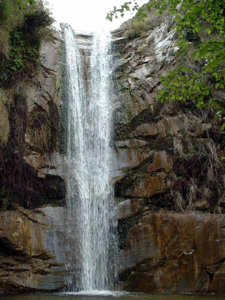 At the base of the waterfall |
The Trail Canyon Trail is a 12 mile long (one-way) path in the Angeles National Forest, but most of the books that I've read describe only the first couple of miles of the trail. That's because after hiking 2 miles in, there is a breathtaking 50 foot waterfall, which makes for a nice short day-hike. If you keep going up into the canyon, you reach the Tom Lucas Trail Camp (3 mile mark), Indian Ben Saddle at the Mendenhall Ridge Road (7 mi), and Deer Springs near the Mt. Gleason Road (12 mi). I don't know how these roads are, but it might make for a reasonable one day shuttle if you could arrange someone to drop you off at the Messenger Flats campground or the Lightning Point campground (both near Deer Springs) and hike mostly downhill to the trailhead at Trail Canyon Road near Big Tujunga Canyon Road. That's just a thought, since it's unlikely that I would ever be in such a position to do this traverse of the canyon.
Anyway, I stuck to the regular itinerary and drove to the trailhead off of Big Tujunga Canyon Road. Note that the trailhead is at the end of the Trail Canyon Road, which is not well marked if you're coming from Sunland. Look for the red and white marker signs at the side of the road. The turnoff is to the left at the 2.01 mile marker, which is just before a sign that says "Delta Flats 500 feet". If you reach the picnic areas, you've gone too far. Once you get on the narrow, winding and bumpy dirt road, it's about a quarter mile to a big, obvious parking lot. Since it's in the Angeles National Forest, you should probably bring a parking pass, unless you want to chance it that the rangers won't ticket you.
I left the trailhead at about 1:00 pm, having dropped my fiancée off at school earlier in the day. The trail followed a stream through a small group of cabins that were built about 80 years ago. Then at a fork in the road, I headed right, away from the stream and up the right side of the canyon on a sunny dirt road. This road climbed through chaparral, passed around a bend and then descended to a single track, well marked trail.
The trail then approached the stream again, and the trees changed to more stream-side, broad-leaf types. Several stream crossings followed through this particularly beautiful section of trail. After crossing a boulder field from an old landslide, the trail began to climb up the left side of the canyon, away from the river. This afforded great views of the canyon as it snaked through the mountains. There were lots of wildflowers (and bees) out. After some light climbing, I reached a bend in the trail, where I could see the falls tumbling over a drop in the canyon floor not more than a quarter mile away.
I hiked up to the falls, but since the trail was above the falls and curved through some heavy vegetation, there was no good view of the waterfall from the trail. I headed upstream and had a break where the stream crossed the trail. The streambed was colorful and cut in places with dikes of lava that had been compressed into pink streaks.
On the way back, I heard some voices just off the trail, and I thought that this might be where the view of the waterfall was. So I walked a little off the trail, but it was just a couple of women hanging out on a rock overlook. They told me that I could have hiked down from the stream crossing to see the waterfall from above. Or to see it from the bottom, I could hike down just off the main trail near a metal erosion control gate.
I chose the view from the bottom since I had to pick up my fiancée and I didn't have too much time. I reached the gate and saw an obvious trail that dropped steeply off the main trail. While it was really steep, there weren't any exposed, hairy sections, and in a few minutes I was at the canyon bottom, looking up at the full drop of the falls. They were in a cool, shady granite pocket of the canyon, two streams coalescing into one fall on their way to the ground. It was a breathtaking sight. After snapping some pictures, I scrambled back up the canyon wall, and headed back to the trailhead.
Last updated: 05/13/2003