i had originally planned hiking up to pierce lake, upper pierce lake, and then summitted mt.macfarlaneon the 26th with the bc mountaineering club, but ended up going a week earlier, with the chilliwack outdoor club.
here's what i was expecting. a hike up up up for hours, arriving upon a beautiful lake with canoe, hiking more up to the upper lake, and then hiking more to summit macfarlane.
here's what i got.
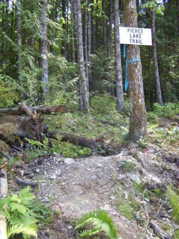
the hike starts on a logging road. a couple switchbacks (10min) and your at the trailhead marked Pierce Lake Trail. immediately you are thrown into shaded forest. the forest is just like any other 2nd growth forest. 97% of trees are growing on nurse logs, a lot downfall, moss, bark chunks, etc. beautiful by any means. after a couple hours you'll get to a creek you need to cross, this is pierce creek. fill up your water bottle here, you wont be able to get more water until you hit the snow.
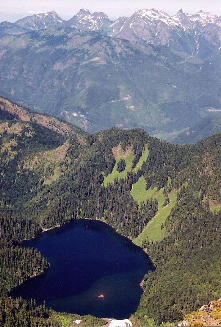
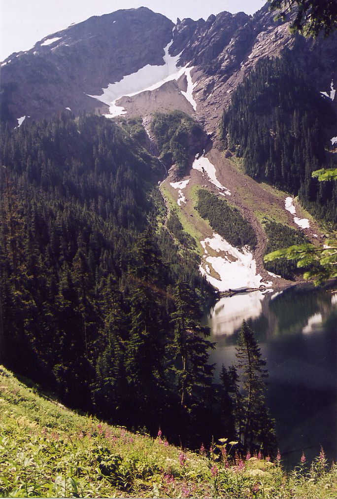
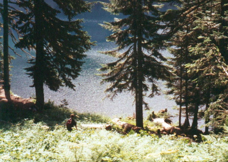
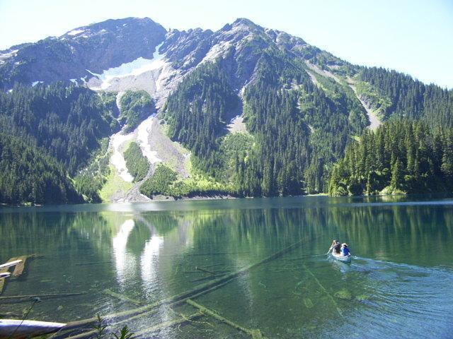
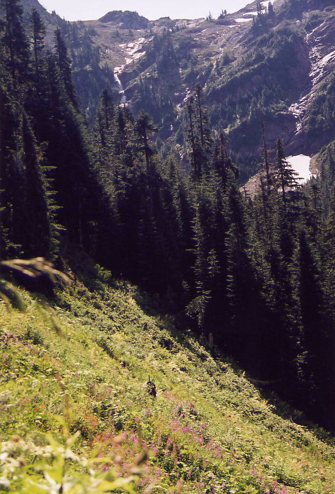
soon you will get your first view of anything. thank you rock slides! down to your left is something strange. its like a field in the middle of a forest. i have no clue why anybody cleared a field there. a mountain covered in trees is in front of you. you can clearly see the paths where water makes its way down. one more rock slide crossing, an hour later, and you get a glimpse of the lake, with macfarlane's snow covered slopes through the trees. pick your chin up off the ground and keep going. 1 minute later you'll see a path leading down, this is towards the campsite and the canoe at pierce lake. if you want to get to upper pierce, and macfarlane's peak, keep going. you'll soon enter a meadow. here you get your first entire view of mt.macfarlane, and the lake. what an array of flowers there was. this is a good place to put on your gators and take out your ice-axe.
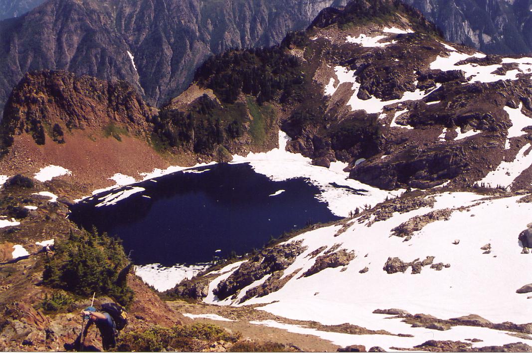
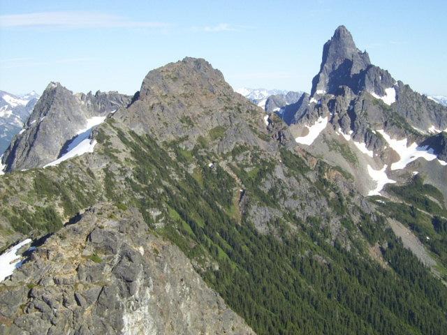
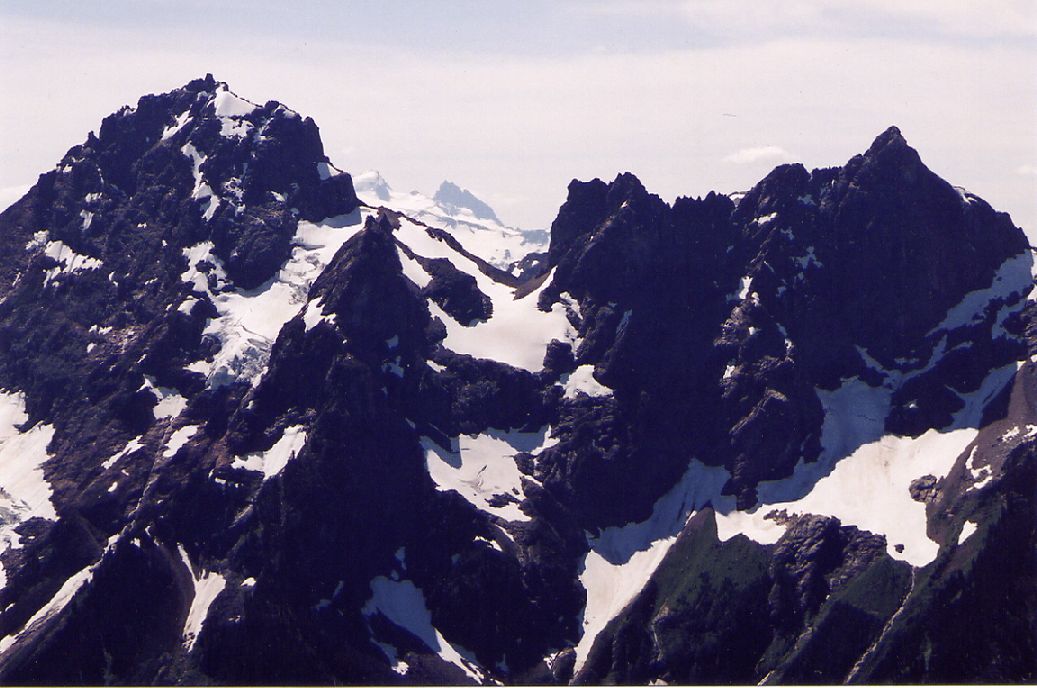
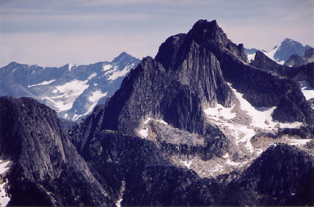
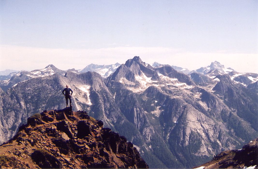
keep going. after some more forest hiking 15-20 mins, you come out at the base of the summit of macfarlane. head towards the stream coming down macfarlane. youll be walking on snow. be careful because there are two streams running underneath of you. once you get to the stream, keep to the left. there is a rope assist section on this part. keep going right, there is flagging. this was the part i was not expecting. this was more like rock climbing to me, i was frightened, but pressed on. we were a group of about 13, i was in the middle so i figured i couldnt fall too far. plus i had the axe. eventually you'll get to upper pierce. it was still frozen, with the edges a tranquil blue. there's two routes up to the summit from here. i didnt want to go up to the summit because it looked too imtimidating. from what i hear though it really isnt very hard. nothing harder than what you did to get to this point. i had no regrets though. i found a spot to lie down, with the cheam range off to my left in the distance, Mt.Slesse'speak to my right. mt pierce to my extreme right. not a cloud in the sky. not a sound in the air. except for the god damn fly. man did i hate that fly. this wasn't your average fly either. this was your 2km up in the sky fly. peaceful nonetheless.
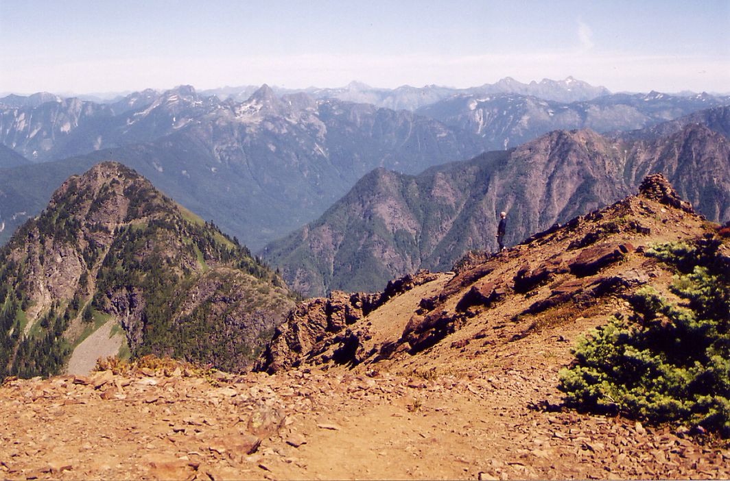
going down was intense. i didnt enjoy it all. i had one slip, the axe worked very well. the enjoyment came back once we had gotten down the slopes back to the base of the creek. from here i glissaded down about 100 ft or so. if you summit macfarlane, you can slide over 800ft!. the rest of the downhill sucked. thats all i can say. dairyqueen tasted good though.
mike.