March 2006 Trip to Costa Rica!
return HOME
Page 2
return to Photo Menu
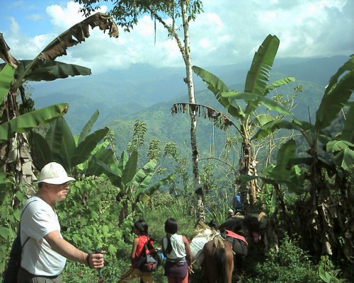 This is almost the beginning of the foot trail down to the village. I have to be selective of photos to post, because of capacity allowed by GeoCities, so I chose not to post the actual start. I think this picture is a great representation of Costa Rica, so I decided to start with this picture. And just to give some orientation, the village would be above that fellows white hat, only in the bottom of that valley. If that helps any. Also, it's about a 4 hour hike to the village from where the road ends. We spent a week living with the Chirripo indians helping them build a community center. People from other villages walk for hours to go to church in this village. After church, it's dangerous to walk home in the dark, so they sleep where ever they can for the night. This community center will get them off the wet ground, and hopefully keep the rain off, too.
If you have Google Earth, you can get an idea of where the village is at by going to these coordinates.
lattitude - 9�44'54.80"N
longitude - 83�23'11.26"W
Then zoom out until you can see San Jose, and you will get an idea of where we went.
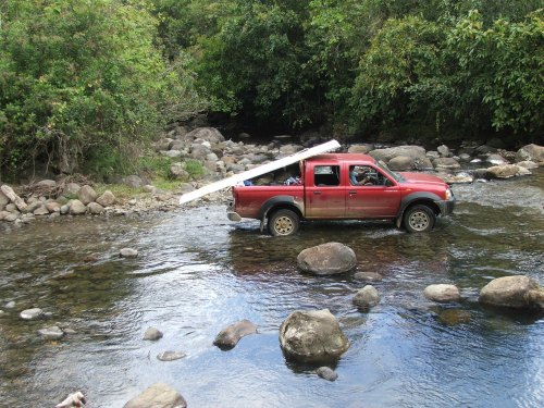 Before we get to the reservation, we spend many hours traveling through the mountains. Here is one of the pickups crossing a stream basically at the entrance to the reservation. "Just playing in the water!!"
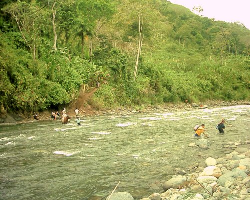 Crossing the river! Being from Kansas, what do I know about crossing a river? One would not guess that crossing a river that was waist deep would be such a challenge. The locals have actually been swept away and died while crossing this river. In the rainy season, it is completely impassable. Anyone want to fund a foot bridge over this thing?
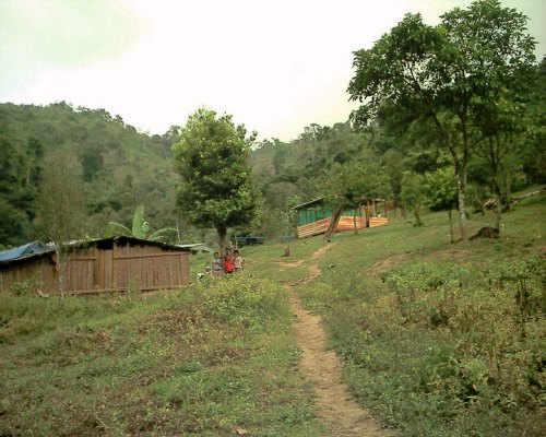 This is the view as you come into the village. This was taken close to the end
of the week. Notice how the kids pose for a camera! The kids are by a typical house. It's bamboo walls with a tin roof. If you have a good eye, you can see a blue tarp behind the house, this is over a fenced area and was called the daycare. They just drop their kids in there and leave! And of course, the community center we helped build is up the hill a bit.
This is the view as you come into the village. This was taken close to the end
of the week. Notice how the kids pose for a camera! The kids are by a typical house. It's bamboo walls with a tin roof. If you have a good eye, you can see a blue tarp behind the house, this is over a fenced area and was called the daycare. They just drop their kids in there and leave! And of course, the community center we helped build is up the hill a bit.
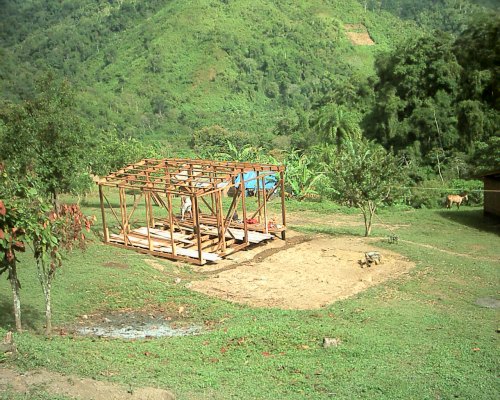 The group before us built the basic frame of the community center. This was taken about lunch time on the first day. We had several boards down for the floor, that actually went pretty quickly. Also, notice we are looking the other way from the village entrance. The blue tarp (day care) is pretty obvious here. To the right is the pastor's house. And the church is also over there somewhere. But I really want to point out the bean field on the hill side. It's the tan square at the top of the picture, just right of center. That hill is so steep, one can barely stand on it, and they had a bean field there! We figured that field was about 2 miles away, just to give you and idea of the size.
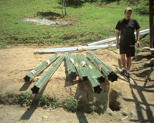 One thing we were wondering was how the indians were going to carry the Tin sheets for the roof down the jungle trail. Well, this is how they do it. Most of those rolls are 2 sheets, but some were 4 sheets stacked, then rolled up, and tied with string. Obvious, right? And that would be our fearless leader, Darris.
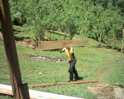 These men worked hard to carry that lumber! The trees in the jungle never dry out, so the lumber is dripping wet! That piece is just over an inch thick, 12 inches wide, and 11 feet long. It weighed a LOT! The group before us had GPS, and said the tree they were cutting up was 2.2 miles away. Think about that the next time your have to carry groceries from the store to your car....
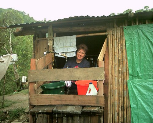 These people are definitely willing to use technology. I didn't hike up the hill to see exactly how it was done, but somehow they used a pipe to divert some creek water into a holding tank. Then they ran cheap black hose (like the kind used for drip irrigation) to each house from the tank. This way, each house had running water. It improved sanitation a lot. Here, our cheif cook is washing a few pans after dinner (noon). This gives a pretty good example of the construction of the buildings. Bamboo walls, log frame, and a tin roof. I believe "we" hung the tarps because of the wind messing with the propane stove we brought.
return HOME
Page 2
return to Photo Menu
|