 |
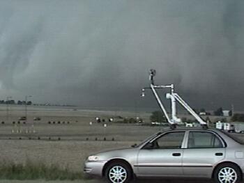
| An Overview of the 6-29-00 Bird City, KS Tornado |
| This was my first real opportunity to see a supercell tornado while driving a probe vehicle for Project STEPS 2000. The day looked rather promising as a shortwave was evident at 500 mb entering the STEPS domain in northwesterly flow. This 50+kt mid-level jet streak rode over moist southerly surface winds creating a 50-60 kt 0-6 km shear vector (plenty of speed and directional shear for supercellular development). A surface low developed in northeastern Colorado increasing surface winds and convergence as dry northwesterly flow (AKO 90/39) pushed into relatively moist southerly flow (GLD 88/58). Late afternoon storms fired along this boundary and the mesonets were deployed. |
|
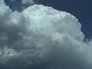
| Here is a first look at the towering cumulus as we turned around and headed northeast. This is near Idalia, CO. |
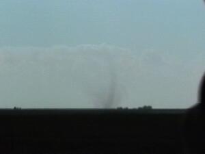 |
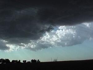
| After we arrived under the updraft to begin taking transects we noticed a weak landspout type tornado to our west. I don't know if this was ever recorded as a tornado in the record books, but I did see pictures from a NWS employee of a funnel cloud associated with this dust column (making it a true tornado). |
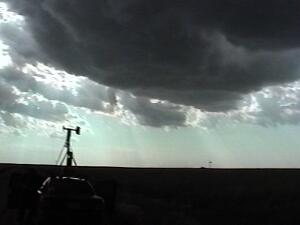 |
| The radar operators informed us that mid-level rotation was evident within our targeted storm. This was a high based LP supercell with a developing dry-slot as rear flank downdraft air cut a slice through the updraft base and wrapped around the mesocyclone (top right).. |
 |
| As the RFD continued to tightly wrap around the meso, dust whirls on the ground were present (the beginings of a tornadic circulation). Tornadoes are not common under high-based storms as this. A high updraft base implies large dewpoint depressions, and large dewpoint depressions will efficiently evaporate precipitation. This cools the air and causes it to become negatively bouyant. Negatively bouyant air then spreads out and away from the updraft effectively cutting off the updrafts low level inflow. This wasn't the case on 6-29-00 though. Strong mid and upper level wind transported most of the precipitation downstream away from the updraft and the RFD may have had some special qualities that led to tornadogenesis. |