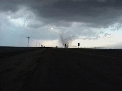
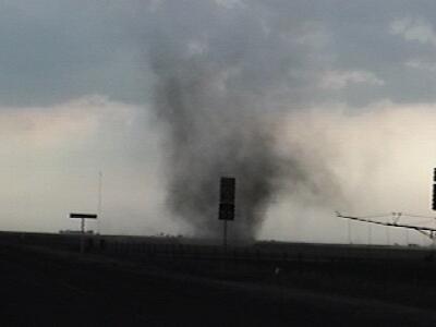
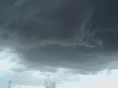
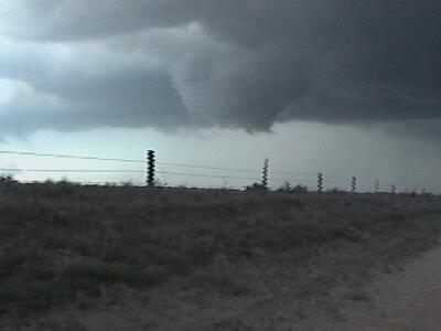
| On this day a boundary sat across the northern TX panhandle with ENE winds to the north and SE winds south of the boundary. An isolated storm fired on the boundary, anchored to it, slowly moved east and developed supercellular characteristics. Several dust whirls were observed under this storms updraft along it's rear flank downdraft boundary. A few of the circulations tapped into the storms main updraft turning them into weak gustnado/landspout hybrids. The only chance this storm did have to produce a tornado occurred when a rotating wallcloud developed and sustained itself for several minutes, only to die a horrible death. |