I lived in Bern, Switzerland for three years (1995-1998). During my stay there, I did plenty of hiking in the mountains, mostly in the Berner Oberland (Interlaken/Grindelwald area). I had visited Zermatt many times between 1994 and 2004, skiing a couple of times but never hiking there. The 2002 and 2004 trips to Zermatt were with my wife, though she had traveled to Switzerland often during the period that I was living there and had visited Zermatt a couple of times with others.
I am a fast hiker, generally an enthusiastic adventurer. Though it has been seven years since I last hiked in the Alps, for me to admit being out of shape for a hike would be tacitly admitting I am getting "old." In other words, it's not going to happen. I exercise regularly, and am in quite good shape, even at 40 years old.
My wife, also 40, also exercises regularly and is also in good shape. However, I am a foot taller than she, and exercise usually twice a day to her once a day. One handicap for her in mountain hiking is a fear of heights, but she toughs it out in order to enjoy the mountains (we also go skiing annually).
Note: Many of the following photos can be seen in greater detail by clicking on them.
Since December 2004, my wife and I had been planning this European vacation for her sister's and her sister's husband's initial trip to Europe. We wanted to show them the Matterhorn (being American Midwesterners, they were not accustomed to mountains, and we wanted to show them the majesty of the Alps). I found a Hike Around Zermatt website and decided that we should, weather-permitting, hike from Schwarzsee (location 4) to the Berghaus Matterhorn (location 5). According to the site, the hike would be "From the Hotel Schwarzsee a well marked zigzag trail leads to the Mountain House Matterhorn/Hörnli Hut." Estimated climb time -- 2.5 hours. The website indicated the restaurant would be open until the end of September. We had visions of hiking up to "the Hut" midday, having some beer and wine with our roesti lunch in the shadow of the Matterhorn, then leisurely hiking back down. That was the plan we sold to my in-laws, who, though eight years our senior, were also in good shape (and my brother-in-law would also never admit to being out of shape).
On the morning of the 27th, we awoke in our hotel in Brig (much less expensive than Zermatt). The weather forecast for Zermatt was for a cloudy morning, clearing in the afternoon. Though we had "Plan B" destinations in case it the weather was bad in Zermatt, we decided the weather was good enough for our planned hike. We went to the Migros supermarket in Brig and bought bottled water, Chocky cookies, and a 400 gram Tourist chocolate bar as snacks for our trip. I also bought a Pepsi Light for the train ride to Zermatt for my caffeine intake since I do not drink coffee.
Taking the 9:07AM train from Brig, we arrived in Zermatt shortly after 10AM, went to our hotel to check in, and then planned to head to the cable car to take us to Schwarzsee. When we told the the woman at the hotel reception that we planned to hike from Schwarzsee to the Berghaus Matterhorn, she said that it is a nice hike and would take about 1.5 to 2 hours and that the restaurant there was a nice place for a lunch. She also gave us hiking trail maps, similar to the one on the Hike Around Zermatt website.
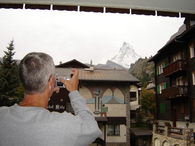 In our rooms, we were encouraged by being
able to see the Matterhorn from our balconies (we could not in 2002,
which greatly disappointed my wife). Side note: My brother-in-law had become
quite the shutterbug on this trip (his wife said he never uses the
camera at home), so I took many photos of him taking photos.
In our rooms, we were encouraged by being
able to see the Matterhorn from our balconies (we could not in 2002,
which greatly disappointed my wife). Side note: My brother-in-law had become
quite the shutterbug on this trip (his wife said he never uses the
camera at home), so I took many photos of him taking photos.
We quickly packed our backpacks with only our hiking essentials (i.e. removing stuff we did not need for the hike) and headed for the cable car to take us to Schwarzsee. In accordance with the plan, we were at the cable car base station by 11AM. Using our Swisspass, we got our 25% discount on the roundtrip tickets (31.50 Swiss francs each instead of 42 without the pass). A couple of short cable car rides later, we were at Schwarzsee (elevation 2583 meters, or 8475 feet). The air seemed cool, so we opted to put on our fleeces.
The hike actually began with a small descent, toward a small body of water I presume is the Schwarzsee (Black Sea). My brother-in-law and I strayed off the main path to see if we could get photos of the Matterhorn reflecting off the lake, but we could not get the proper angle to view the mountain behind the immediate ridge. It was not long until we caught up to our wives and began the first big ascent with switchbacks up the ridge. Once at the top of the ridge, we stopped at a well-placed bench for a water and air break, and it was time for the men to take the fleeces off, as we were starting to sweat underneath. None of us was used to the thin air, though my brother-in-law and I would not let it slow us down.
Once again, the trail went into another descent, which I jokingly told the others was to build up momentum for going up the other side. The path changed from a narrow trail worn through grass to what looked like a wide gravel road. We were starting to rise above the vegetation line as we took the gravel road upward.
 A the top of the gravel road was a small building, which is the upper
terminus of a T-bar in the winter (lift "R" according to winter map on
the back of our hiking map).
A the top of the gravel road was a small building, which is the upper
terminus of a T-bar in the winter (lift "R" according to winter map on
the back of our hiking map).
Beyond the "gravel road," the trail became much narrower and we were faced with sheer drop-offs for the first time. I thought it was cool. The fear of heights started to affect my wife, but she battled on through. Then we came to the metal bridges, inserting along the rock face in places where there was no ledge for a trail. They had obviously been hit by falling rocks on a few occasions, and the grated flooring allowed us to look down below.
 After the metal bridges, I decided to shares the cookies to take the women's
minds off the heights involved. It was a good time for a stop, and we were
getting our first glimpses of the Hut. It didn't look very far away.
After the break, we climbed another series of switchbacks to ascend this ridge,
until the trail took us to the other side of the ridge. The next stretch
was rather flat, wide, and without immediate drop-offs. Those with a fear
of heights were much happier. We had the opportunity to look across the
valley to the mountains and glaciers there.
After the metal bridges, I decided to shares the cookies to take the women's
minds off the heights involved. It was a good time for a stop, and we were
getting our first glimpses of the Hut. It didn't look very far away.
After the break, we climbed another series of switchbacks to ascend this ridge,
until the trail took us to the other side of the ridge. The next stretch
was rather flat, wide, and without immediate drop-offs. Those with a fear
of heights were much happier. We had the opportunity to look across the
valley to the mountains and glaciers there.
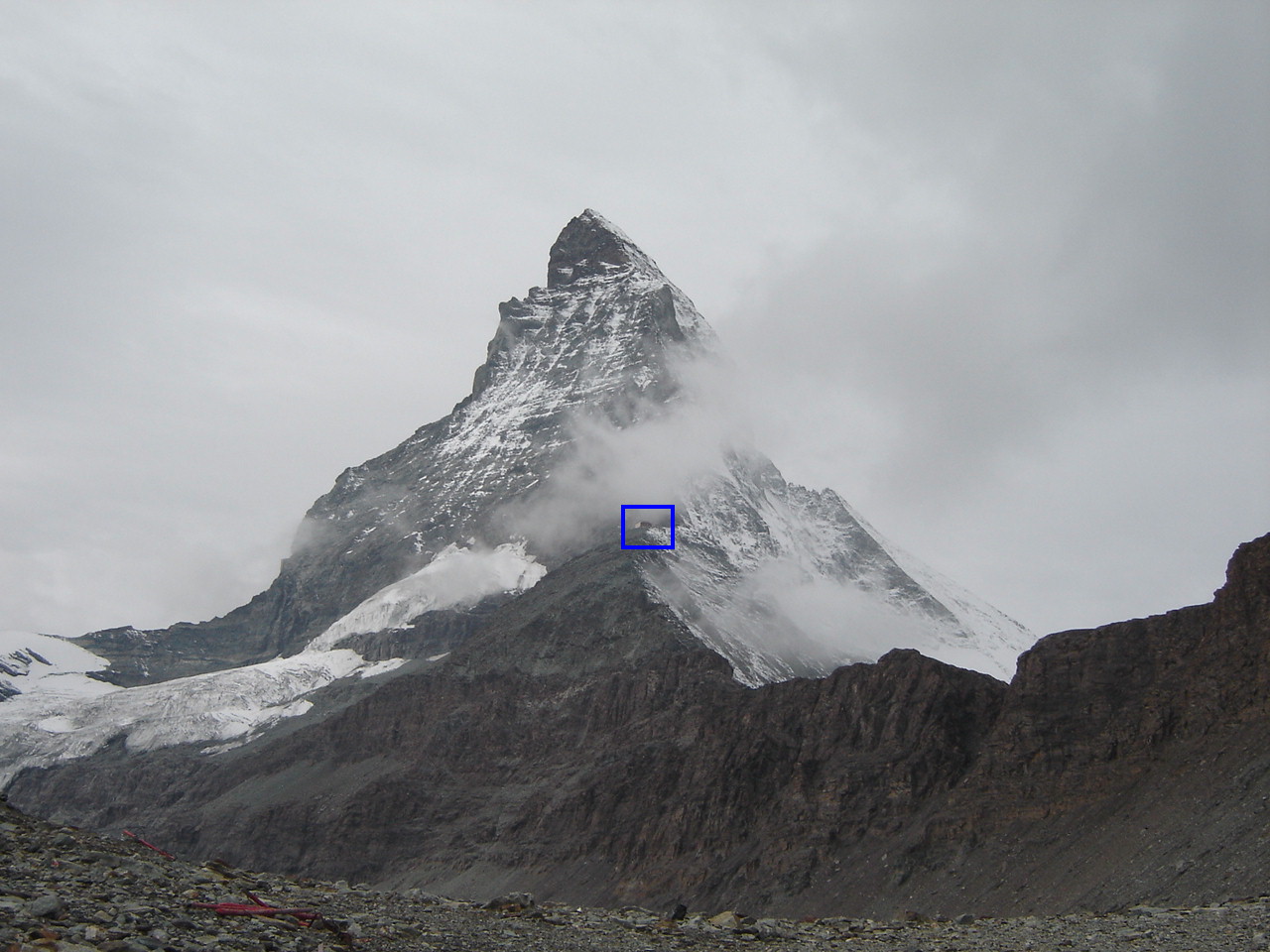
Being in the lead, I had time to look around while waiting for the others. Below is my favorite photograph from the hike:
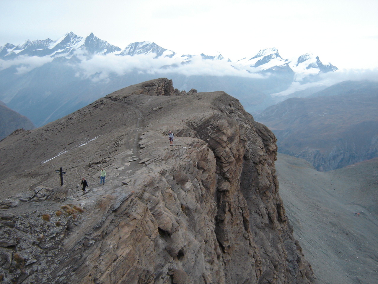
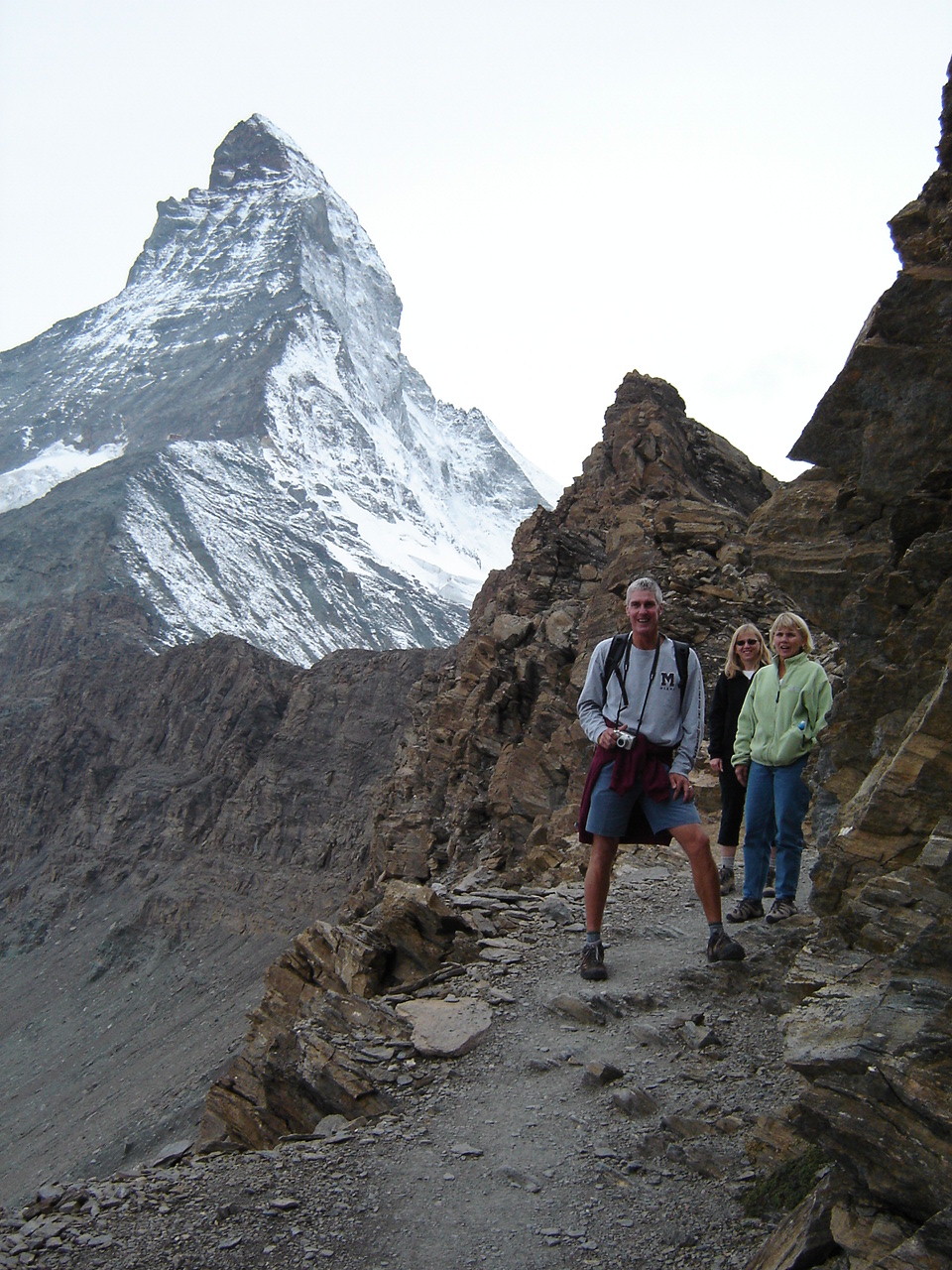
As the background indicates, we were now around the cloud level. There is also a trace of snow, a harbinger of things to come. Furthermore, we are about to pass the last trace of vegetation. The signpost on the left indicates where the trail from location 3 on the "Hike Around Zermatt" map joins our trail from location 4 to location 5. What the signpost did not indicate was that the trail was about to become much more difficult. My brother-in-law took the following photo of me at the point where I took the above photo:
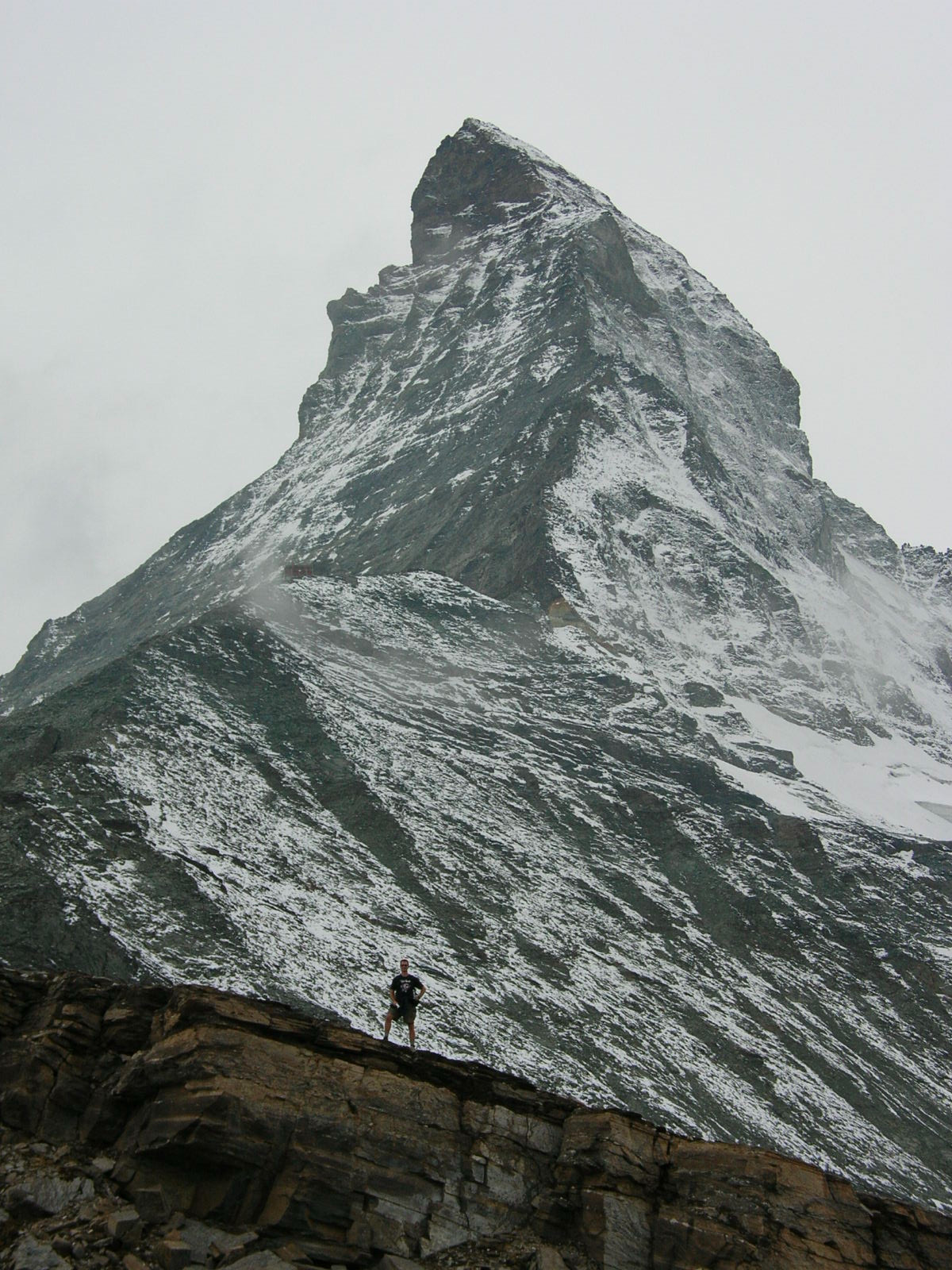 Vertically,
the Hut is about halfway between me and the peak (over my right shoulder). It now looked so close,
but looks can be deceiving.
Vertically,
the Hut is about halfway between me and the peak (over my right shoulder). It now looked so close,
but looks can be deceiving.
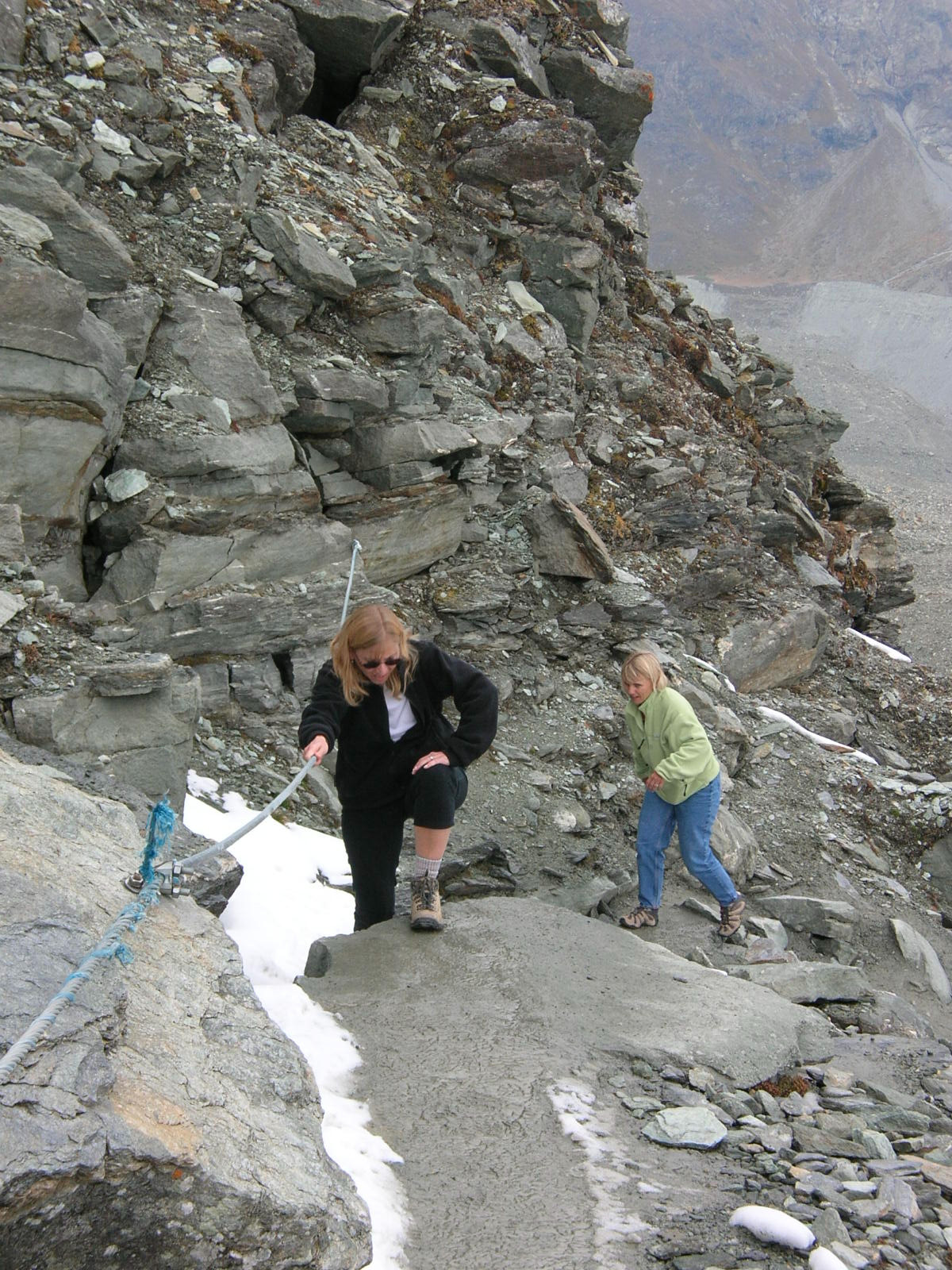 The trail became much steeper as we encountered a series of
switchbacks. Adding to the challenge was the snow on the north face of the
ridge, where little direct sunlight falls. Traction was difficult, even
with hiking boots, and we wished we had walking sticks like the descending
hikers had. Fortunately, the makers of the trail installed ropes along
particularly narrow stretches of trail, giving us something to steady ourselves
during the climb. Eventually, we crossed over to the south face of the
ridge, and encountered no more snow on the ascent.
The trail became much steeper as we encountered a series of
switchbacks. Adding to the challenge was the snow on the north face of the
ridge, where little direct sunlight falls. Traction was difficult, even
with hiking boots, and we wished we had walking sticks like the descending
hikers had. Fortunately, the makers of the trail installed ropes along
particularly narrow stretches of trail, giving us something to steady ourselves
during the climb. Eventually, we crossed over to the south face of the
ridge, and encountered no more snow on the ascent.
Still faced with a series of switchbacks, we could at least start seeing the Hut looking ever so close, which helped inspire us to keep pressing on. At last, my brother-in-law and I arrived at the Berghaus Matterhorn (elevation 3260 meters, or 10696 feet). It took just over 2 hours for the ascent, including stops for photos, food, and air.
 I went back down the trail a
short way to photograph our spouses making the
final ascent. While doing so, I encountered a group of American college
students on a guided tour during a semester abroad program. I heard one of the
winded students ask the guide, "Is there any other way up here
beside hiking?" I laughed to myself.
I went back down the trail a
short way to photograph our spouses making the
final ascent. While doing so, I encountered a group of American college
students on a guided tour during a semester abroad program. I heard one of the
winded students ask the guide, "Is there any other way up here
beside hiking?" I laughed to myself.
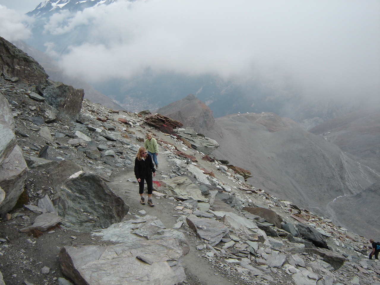
In this photo of our wives making the final ascent to the Hut, way off in the distance to the right of them are the roofs of the buildings at Schwarzsee, where we started our hike. The hiker in the lower right corner of the picture we would meet later.
When our wives arrived, winded and with tired legs, we gave them hugs in triumph. There was something odd about the place, though. There were no tables or seats on the deck, just one picnic table on the patio by a locked door. All the window shutters were closed. We walked around back, looking for an open entrance, but only found the restroom outside the building. In back, we met a man from northern Italy (South Tyrol, he told us), who had hiked up all the way from Zermatt after having ridden his bike from Taesch to Zermatt. He told us that the restaurant was closed. I said that the website said it was open from July through September, to which he replied, "Yes, the first of September." I was certain the website said until the end of September, but I did not argue the point.
 We
went back around to the front and decided to make our own lunch. The hiker
from South Tyrol joined us, and he produced a cutting board, a knife, a loaf of
bread, a block of cheese, and a stick of salami from his backpack. He cut
these into small pieces and offered us food. We in return offered him our
cookies and chocolate. Now that we were sitting down, with our backpacks
off, the sweat on our t-shirts was cold. My brother-in-law and I opted to
put our fleeces back on. We had a nice lunch conversation, but after half an hour we were
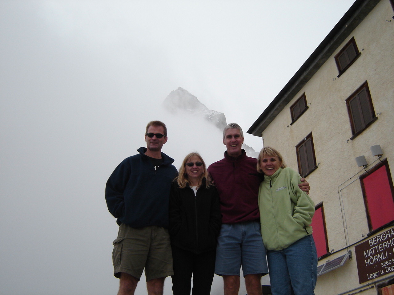
all getting too cold. Before we left, our friend from South Tyrol took this photo of us at the Hut, with the Matterhorn. The clouds are obscuring the peak, but at least we can see part of the sign indicating that we had made it to the Hut. Then it was time to
go, with the desire for the warmth of walking trumping the desire for more
recovery time for tired legs.
We
went back around to the front and decided to make our own lunch. The hiker
from South Tyrol joined us, and he produced a cutting board, a knife, a loaf of
bread, a block of cheese, and a stick of salami from his backpack. He cut
these into small pieces and offered us food. We in return offered him our
cookies and chocolate. Now that we were sitting down, with our backpacks
off, the sweat on our t-shirts was cold. My brother-in-law and I opted to
put our fleeces back on. We had a nice lunch conversation, but after half an hour we were
all getting too cold. Before we left, our friend from South Tyrol took this photo of us at the Hut, with the Matterhorn. The clouds are obscuring the peak, but at least we can see part of the sign indicating that we had made it to the Hut. Then it was time to
go, with the desire for the warmth of walking trumping the desire for more
recovery time for tired legs.
As we began our descent, some stragglers from the college student group were making the final ascent. I gave words of encouragement -- "You're almost there. Five more minutes, just three switchbacks to go."
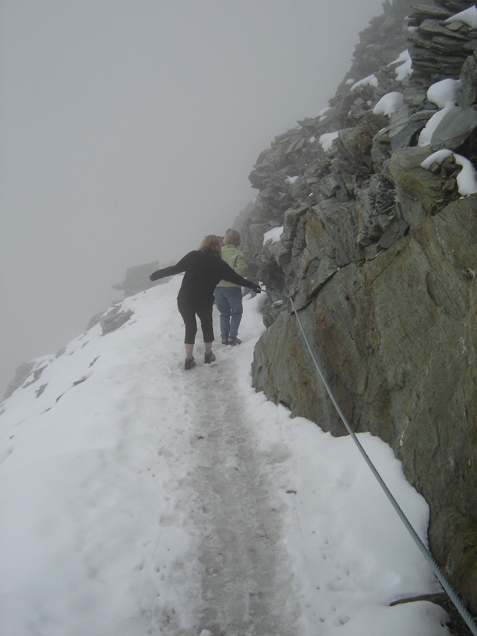 The
first part of the descent was much more difficult than the ascent. The
snow seemed more slippery on the way down, perhaps because we were now headed in
the direction that we could fall. Combined with the snow and a fear of
heights, the trail seemed a lot scarier to my wife. The ropes proved even more useful on
the decent. At one point my brother-in-law had to help her around a
switchback, transitioning from one guide rope to another. As the
clouds continued to roll in and through, our visibility diminished, which may or
may not have helped (which is worse -- seeing where you might fall, or not being
able to see where you might fall?).
The
first part of the descent was much more difficult than the ascent. The
snow seemed more slippery on the way down, perhaps because we were now headed in
the direction that we could fall. Combined with the snow and a fear of
heights, the trail seemed a lot scarier to my wife. The ropes proved even more useful on
the decent. At one point my brother-in-law had to help her around a
switchback, transitioning from one guide rope to another. As the
clouds continued to roll in and through, our visibility diminished, which may or
may not have helped (which is worse -- seeing where you might fall, or not being
able to see where you might fall?).
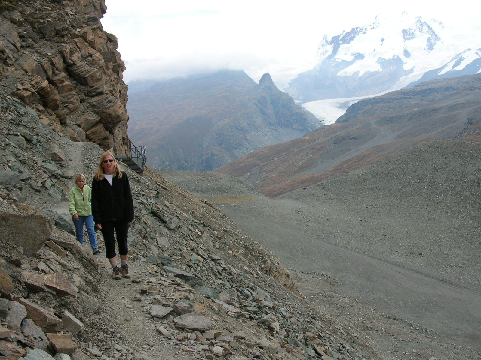
Once we got back to the signpost, we knew the difficult part was now behind us -- no more ropes, snow, or clouds, though still some narrow paths with drop-offs. My brother-in-law and I deviated from the trail to ham it up for the camera in front of dramatic backdrops.
When we got back to the top of the "gravel road", we opted for a different path, one that gave us a better view of the Schwarzsee below and Zermatt even further below. It was steeper, but at least there was no snow and no ropes required. The fastest of the college student group overtook us as we stopped for photos along the way. With the end in sight, we were in no rush, and I did not take it as a sign that I was slow (I was holding back, as it was the women and my meandering brother-in-law who were slow).
 Back
at Schwarzsee, we opted to head to the restaurant instead of the cable
car. It was not yet 16:00 (4PM), and the last cable car did not leave
until 16:40 (4:40PM). It was time to have some beers, and those beers tasted
good, as we had earned them. We of course took more photos of the
Matterhorn from the deck, though clouds were intermittently obscuring the Hut
from our view. After a few beers, we walked to the cable car and went back
to Zermatt. We returned to our hotel in triumph, having made it to the Hut
and back.
Back
at Schwarzsee, we opted to head to the restaurant instead of the cable
car. It was not yet 16:00 (4PM), and the last cable car did not leave
until 16:40 (4:40PM). It was time to have some beers, and those beers tasted
good, as we had earned them. We of course took more photos of the
Matterhorn from the deck, though clouds were intermittently obscuring the Hut
from our view. After a few beers, we walked to the cable car and went back
to Zermatt. We returned to our hotel in triumph, having made it to the Hut
and back.
As I told the others, the hike was more than we had expected, but well within our abilities. The important thing is that we did it, we have a bunch of photos documenting the adventure. We also decided it was good that the Hut was closed, as having alcohol in our systems would have made the descent that much more dangerous. Having beers at the Hotel Schwarzsee was much better as the remaining walking would be mostly on paved surfaces. Furthermore, the sun never really came out, and we were actually relieved because we were warm enough from hiking.
That evening in Zermatt, we had roesti for dinner with beer and wine. Before leaving town, we found postcards that showed the Hut so that we could point out our destination to others.
In Bern, we showed our digital photos to our friends, and they laughed when they saw what I had put the others through. One former co-worker said it looked like a hike I would do, which is why she never went hiking with me ("I've still got it," I jokingly thought to myself).
We had planned for everything but the weather, and even then we did pack both sunscreen and anoraks with us. According to the website for the Berghaus Matterhorn: "Open: Beginning of July until approx. the end of September." I guess the 27th was close enough to the end for them. Our chocolate and cookies would have been sufficient food (we finished neither), though not the most nutritious lunch.
My wife and I did what we set out to do -- we gave our in-laws a vacation adventure they will never forget. Even now, mention of the "the Hut" elicits a smile or a chuckle.