 Mt. Whitney/
Southern Sierras
September 1-11, 2000
Mt. Whitney/ A beautiful trip to sunny California! Jen and I took advantage of the holiday week and stormed the southern Sierra Mountains. We flew into L.A. on the 1st of September, rented a car, drove up toward Lone Pine, CA that night (slept in the car) and arrived at the ranger station to beg for a permit through Inyo N.F.
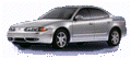 On a side note: The rented Oldsmobile Alero with its fold-down back seat and remote door locks/trunk opener was quite the successful mini-Winnabego for us. :)
Thanks to everyone!
I had gotten much of the info I had on the area from friends who had hiked the John Muir Trail (thanks Laura and Martha) and a friend of mine from work (Stan) who used to be a ranger out there. He gave me the number of another ranger that still works out there who gave me lots of great info on what we needed to prepare for the trip and a great suggestion for a trail (THANKS AGAIN CALDER!!!). When we saw the line at the ranger station we were a bit nervous, but found out that almost everyone there was looking for permits to enter through the Whitney Portal, the regular entrance/straight-shot to Mt. Whitney. Our plan was to backpack in from further north and reach Mt. Whitney from the back side. As a result, we were able to take advantage of a cancellation that day and we were able to hit the trail on the 2nd instead of waiting until the 3rd. (Thanks to Jan at Lone Pine R.S. for her amazing patience!).
Bear-reality check
 We drove north through Independence and west to the base of the Sierras. We made our last minute changes to our packs, filled our two bear canisters to the rim, threw out any food we couldn't take along, moved all of our remaining gear into the trunk and set off. We had gotten quite a bit of information about the bears in the area breaking into cars so we took care to follow recommendations of removing food as well as hiding any remaining gear from prying human-eyes. Thankfully we weren't one of the three cars with smashed in windows (bears) when we returned.
Lightweight packs
 All forecasts indicated lows in the 40's at night, so we took advantage of the warm-weather trip and packed as light as we could. I had bought a new pack (Kelty Flight 60) that performed wonderfully, and Jen bought an Arc'teryx Khamsin 52. Both packs were under 4 lbs (I know I had mine stripped down to 3lb 5oz).
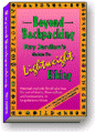
 Thanks to the incredible sewing skills of Mom (Love ya Mom), I designed a two-person sleeping quilt that weighed only 2.5lbs for both of us (including the waterproof stuff sack) similar to what Ray Jardine prescribes in his book "Beyond Backpacking". In addition, we slept under a tarp that weighed around 19 oz and I made an Esbit fuel tab stove that weighed under an ounce. Not including water, we left with our packs weighing about 26lbs and 20lbs. This was despite bear canisters weighing nearly 3lb each and 7-8 days of food. Overall we were quite happy with our pack weights.
| Weather-reality check |
|
Climatology

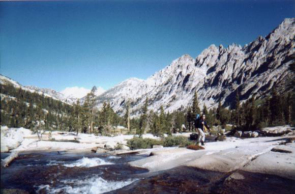
 Our first day on the trail told us how beautiful the entire trip would be. We started hiking with a few other people and often "leap-frogged" during breaks. As usual for these trips however, once out of 'dayhiker range' the land becomes shared by only a few. There was an abundance of streams and ponds that crossed the trail and it seemed that the land must have had to struggle to stay as arid as it was. To the east of the Sierras lies desert climate - including Death Valley's Badwater, the lowest point in North America. The trail high in the eastern Sierras reflected these dry conditions throughout the trip, however, each stream cultivated green grass at its sides and many ponds acted as an oasis for plantlife. Despite this, the rocky soil didn't seem to allow the hoard of moisture to escape far from the banks.
Night One: Refried 'soup'?
Our first night was an adventure in food mishap. Our first mistake was to turn a wonderful dinner of refried beans, TVP, and tortillas into drippy refried soup with the tortillas a poor replacement for a dipping bread. In dividing the food quantities, I had misjudged the amount of water we would need. Fortunately we were hungry enough to stomach the entire bowl of this newfound (and not recommended) concoction.
The Square Peg/Round Hole Dilemna This also happened to be our first experience with bear canisters. In the past I had always hung our food while travelling through bear country, but the use of canisters was required east of Kearsarge Pass and besides, Calder (our new friend) had really pushed the need for them. We had managed to cram all of our food into the two canisters and had even saved room for lip balm, sunscreen, etc. The surprise to us was that we had forgotten to include space for the extremely bulky foam insulated cooker that all of our aromatic meals simmered in.
As the sun was setting down and we were carefully repacking all of our food as tightly as possible with numb fingers (while simultaneously fending off a VERY brave field mouse), we were forced to decide what food wouldn't go in. After eating all that we could, the only 'bulky' food we had left was the set of pocket pitas slated for a delicious upcoming lunch. Since we were unwilling to sleep with them and I had already asked nearby hikers if they could use extra food, I crammed the two pitas that could be smashed into the canister and took the rest for a deep hike in the woods. I hiked as far as I could from the campsites and the water. To be honest, I found it a bit unnerving. As I had first set out down the trail away from the camping areas I heard then saw a large dark shape in the fading light at least a 100 yards down the trail. It stopped its own progress down the trail, then somewhat noisily went into the woods toward the water After listening for a moment I headed into the woods AWAY from the water with a couple of all-too-small rocks in hand and pitas that (at the time) represented nothing less than bear-bait to me. After a lengthy hike (made to seem even longer by the fact that night had now fully arrived), I found an opening between two large boulders that I could drop the four remaining pitas into that would be out of reach even to a small cub. By the time I had dropped off the pitas I had relaxed again and no longer worried about the bears presence (especially since I had already rid myself of a handful of delicious bear-attractant).
Although I rationalized my action knowing that by taking the extra effort I wouldn't be teaching a bear to feast on human food, I also knew that what I was doing was still wrong and now my mistake and intrusion on the land had probably taught another animal that humans were a source of food. Please do not make my same mistake - plan ahead.
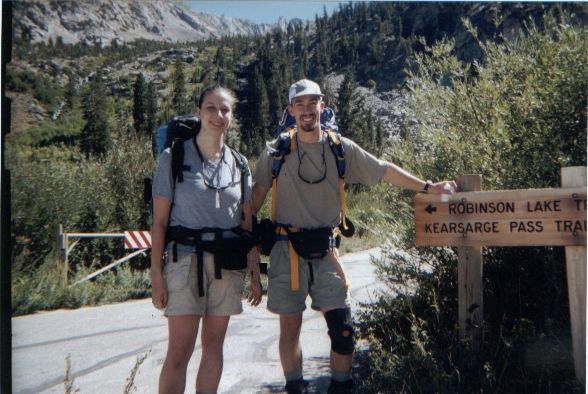
Kearsarge Pass
 The second day took us over the beautiful Kearsarge Pass before noon.
 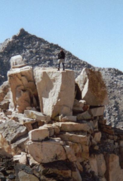 It is a well-known secret that I crave altitude, and mountain passes (which are usually lower spots or saddles in a chain of mountains where the trail can more easily pass) are great opportunities for me to climb the side of a mountain without having to diverge from the trail! This trip took us over three such passes and I was definitely inspired by each view to conquer more. Looking backward from Kearsarge Pass we could see out to the flat plains that we had driven up from. The sight to the east was rugged without roads, without buildings, and as far as we could see...without people. Those that hiked this far deserved to experience nature only slightly spoiled by our human presence.
We ate lunch after dropping down to one of the lakes we gazed at earlier.  Jumping from rock to rock brought us to an inviting flat rock island where we could stretch out and bask in the noon sun. We ate a filling lunch of summer sausage, cheddar cheese, and Ritz� crackers, refilled our water, and took our time getting back to the trail. As we were rejoing the trail I almost stepped in our first solid (literally) sign of bear. A few miles down the trail we intersected with both the Pacific Crest Trail and the John Muir Trail. Here we turned south joining these trails toward Whitney.
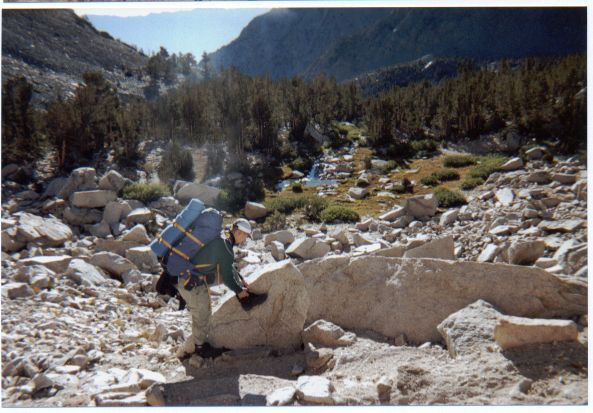
Tough Decision
Only a few miles down the road we reached a fork and made our decision to cut our trip down by 1-2 days. 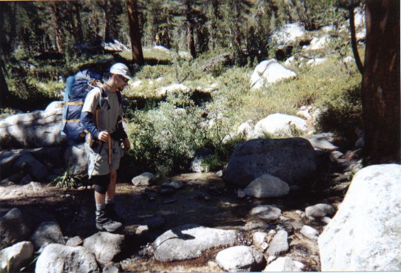 We took off an extension that would have brought us over the next mountain ridge on a foot trail not printed on most maps. It is unkept, and would certainly be more difficult. We considered a number of factors including our uncertainty of whether the trail was even passable, how we would be unlikely to make it to Whitney if we had to backtrack, and the fact that we were really enjoying the trail we were already on. In the end we decided to cross at Forester Pass and leave the Lucy's Foot Pass for another day (yet knowing how way leads on to way...).
The advantages of packing iron (boxes)
That afternoon we hiked through a fairly lush valley (considering the terrain) and stopped for the night when we found a "bearbox". This is a thick metal box about 4x2x2 feet with a swinging side and metal clips to keep it shut.
 I felt quite sympathetic for the mule who brought this thing in. We camped about 100yds away and were thankful that we had stayed near enough to use the box. It was much easier on the nerves than wondering if bears would play field hockey with your canister all night until it sought freedom down the nearby stream.
  We had found a good spot relatively early and set up camp, pumped water, and ate a delicous meal of my favored raviolleti, sauce, and cheese in the fading light. As evening settled, heavy clouds rolled in very low and we could feel the extra chill in the air. The night was long and cold again, but we hadn't had the worst of it yet.
Cold breakfast - Warm Hiker
The next morning we broke camp a little late (still earlier than I normally wake up), and headed toward Forester Pass.  The morning was very cold and we had spent a little extra time taking down our campsite. Fortunately the sky had cleared overnight without storms. Jen, who is normally cold on a hot summer day, warmed up after only a few minutes of hiking. I, however, walked on frozen stumps and pawed at my gear with frozen hands until the sun finally rose over the valley walls. Here we stopped for breakfast and a nice, warm morning basking break. This has become my favorite morning ritual. We prepare our food for the next day the night before including placing a bowl of cold cereal (granola, dried milk, blueberries or rasberries) in an easy to access spot. In the morning we get up, take down camp, pack up and start hiking (warming up) as quick as possible. At some point while packing the food we pull out a Cliff Bar (or something tasty) for a mobile snack and we don't take our first break until we are warm. Here we stop, throw down the foam pad and enjoy our breakfast without shivering, fumbling with cold fingers, or trying to remember exactly how long it has been since you could feel your toes.
Speed Racer
Our trip up Forester Pass was beautiful. As we began to hike out of the valley we could look back at the beautiful green below us and forward to the imposing rock above. On our way we were passed (Jen claims she saw nothing more than a blur and a flash of trekking poles) by a speedy ex-marine carrying a small daypack manufactured by Go-Lite (designed by Ray Jardine). Sensing an opportunity to gain more insight from an obviously lightweight backpacker, I picked up the pace and hiked with him for a short way up the trail.  (I think the talking might have slowed him down to single digit speeds or I would have no other explanation of how I kept up with him! )
His planned mileage for the day was 29 miles. He had his sleeping destination planned for nearly every night. He wasn't using a tarp, but instead a lightweight single-person tent. In fact, he wasn't using any real "Ray-Way" techniques besides the daypack. His pack actually weighed a bit more than mine, but he had merely packed it much more densely (down sleeping bag) and had a lot of stuff strapped to the outside. After a bit, I said my farewell - he paused briefly to shake my hand - and he was gone. I waited for Jen to come along and did my best to pretend that I wasn't breathing hard.
He (and a few other hikers) were great focal points for a number of long conversations. We couldn't imagine sticking so tightly to his regimented plan. We liked to stop for camp when it felt good or looked like a good spot. We were happy to change our trail plans in mid-hike because it was what we felt like doing. In fact, when we started we weren't even sure if we would exit at Whitney or not. The first day this seemed to bring shocked looks from a number of faces, but it gave us a lot of freedom to hike on our own terms.
Forester Pass
 Well, sometimes those terms can turn around and bite you. We had already gotten a late start and then took an exceptionally long lunch at an absolutely gorgeous stream above treeline that looked across the mountains towering over the valley we had hiked up from. We didn't cross Forester Pass until much later than we should have. We had misjudged how long it would take us to cross and we soon realized we were in for a hard push that afternoon. Still, we were confident in our strength and kept a fairly steady pace through the rest of the day. Cold wind battled with our sweaty bodies dehydrating us quickly. We were replenishing ourselves, but the dry air was winning and we were feeling it. At one point the trail split and it appeared that both led straight to the pass. They did.
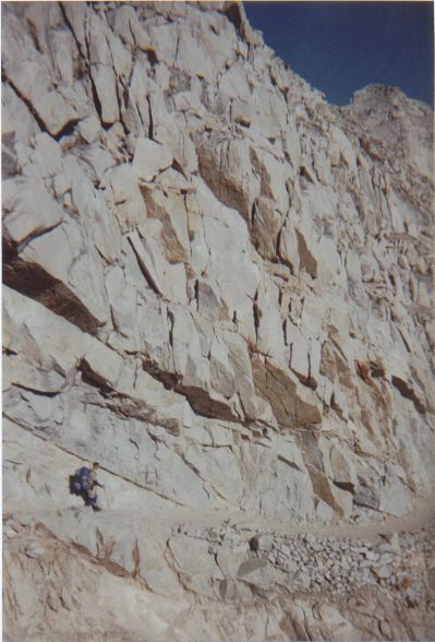
 The one WE picked, however involved the trail being completely wiped out by a rockslide and a 100 yard scramble straight up a very tricky face of loose rock. Jen took a little slide and added a battle scar to her list of things she would bring back from this trip. The last half-mile to the top at 13,200 feet was a lot more will than strength. The sun had already dropped behind the steep face we were climbing and with it went the day's warmth.
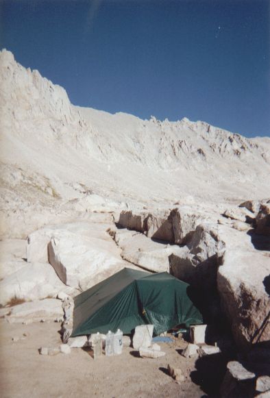
Windy Night
 The top of the pass brought back our sun for a little while longer and it felt good to see our destination ahead. We spent only a couple of minutes resting at the top before we charged down the north side. This side was extremely steep from the pass to about 12,500 feet. It was a series of switchbacks that wound back and forth along the face of the mountain. The quality of the trail was amazing. I couldn't believe the effort made to put the trail there. We could see that the bottom of this cliff flattened out into a rough plain for the next mile or so and that we wouldn't be able to drop any more altitude before night fell. We eyeballed some spots on the way down, but didn't find anything useful until we were actually on the trail searching. The wind in this spot was ferocious. Funneled by the narrowing mountains on either side it was a fight to walk against it. We picked out the largest boulder we could find and pitched the tarp behind it. In this wind it was definitely a challenge. The light was fading and our fingers were numb. It took longer than I would have liked to get the tarp up, but once up it was solid. It really amazed us how stable it became once the guy lines were strung out to rocks (the ground wouldn't have held stakes). I went over to a nearby lake to pump water and Jen set up the tent and got our dinner ready to cook. When I came back we boiled water from under our sleeping quilt, and enjoyed warm minestrone soup in our stomachs. That night we pulled out the emergency mylar sleeping bags right away and crawled in. They reflect 90% of radiated body heat and act as a vapor barrier liner preventing evaporative heat loss. They really work! It was the first time I had ever needed to use one even though I always take it along as a backup. The real source of warmth that night however was Jen's new discovery that a fleece shirt tied correctly around the head can be VERY warm and becomes a pillow that doesn't get lost at night.
 BTW, I have it tied wrong in the picture. For future reference in case we forget: Turn the shirt inside-out but leave the arms inside-in. Put the shirt all the way over your head as if you were about to put the whole thing on. Instead, zip the neck back up halfway and pull it inside right over your head and letting the neck stay wrapped around the top of your skull. Drape the rest of the shirt to the back and tie the arms around your neck. Definitely warmer than even my usual winter setup.
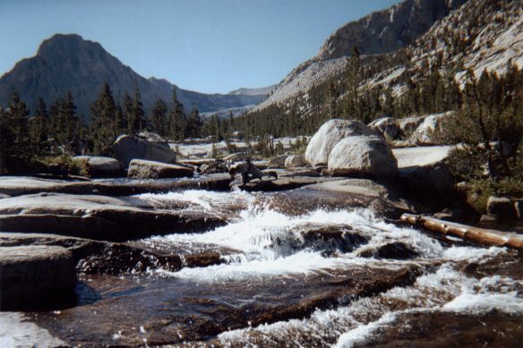
Sun = Fun
 The next morning was an ugly example of submission to the cold. We refused to break camp or even leave our sleeping quilt/mylar bag until the sun reached down into the valley where we were camped (around 8:30am). Our water was frozen solid, but we lounged, talked, and wrote in our journals. When the sun finally hit, it quickly made a difference. We began our hike and were soon stripping layers again. We stopped for breakfast at a small series of waterfalls flowing over smooth granite stone. We snapped some pictures and took off. A good stretch down the trail I realized that I had forgotten my balaclava at our breakfast spot and decided that anything keeping me warm was worth the hike back up. Fortunately it was laying near the waterfall in plain sight and I was soon back to my pack and the trail.
High road
 The trail here was much less strenuous and we made excellent time. We decided not to drop down into the Kern Valley (which would have added an extra day) and stayed on the higher JMT. We stayed at altitude and looked down at the river valley below us. It really boosted our spirits to have an easier day and we reached a great spot to make camp relatively early.
 It was an area with a bear box so we crossed the nearby river to get away from the traditional campsites and set up our tarp in a stand of trees. We met two hikers finishing up the JMT loaded with food that sounds fine now that I'm in junk food mode sitting in front of this computer, but at the time it seemed completely unappetizing to both Jen and I. Jelly beans, Pop Tarts, a huge tin of sardines, and some kind of processed desert cakes. It seemed appetizing to the wildlife around us though. While chatting with both of them I noticed a ground squirrel exiting their pack with a mouthfull of food despite the fact that we were standing less than 4 feet away from it (an additional bonus of bear canisters). The hikers were didn't seem to care much since they had brought way too much food anyway. Another animal trained to steal.
Good food = Good spirits
 That night we cooked up store-bought freeze-dried lasagna. Wow! Now THAT is good stuff. We knew the 2.5 servings would be too light for the two of us, but it was a bit bulky for our bear cans so we had made the choice to cut the extra serving before we left. Next time we'll bulk it up with an extra serving or some TVP. Instead we just added some more gorp as dessert. Learning from the night before, we dropped the back end of the tarp to the ground and raised the front end to a comfortably tall height. I made a small stone wall as a wind break and prepared for what we thought would be a warmer night (we had dropped below 10,000 feet).
Another cold night
While warmer than the night before, it still dropped down to 15� F that night. We didn't use the mylar and Jen and I were once again amazed at how warm we could get by sleeping close together. When sleeping apart, the sleeping quilt is probably only rated for 35-40 degrees. With the two of us next to each other, we were less comfortable but much warmer. It still was not really enough to get good sleep. It would have been better if we had taken the time to sew a few velcro patches onto the quilt before we left so that the sides didn't lift as we rolled at night.
Another cold morning
 The next morning we didn't get up until 6:25am, but it only took us 37 minutes to hit the trail. We found another reason to appreciate the tarp. The cold morning motivated us to get hiking and it took us a little longer to warm up enough to stop for breakfast. We waited for the sun again and placed my black jacket under the water bottles to help them thaw better. We tried freeze-dried rasberries with our granola for the first time and found them to have much more flavor than the freeze dried blueberries. Quite refreshing. While lounging around in a sunny spot, our new friends came hiking by at a good speed. Maybe Jelly beans and Pop Tarts are the secret to good hiking. :) After a good break, we again hit the trail toward Whitney.
Goal in sight!
 As we turned East at the last fork toward Whitney our excitement grew. During water breaks we would pull out the map and try to figure out which peaks we could see and if we could view the back of Whitney yet.
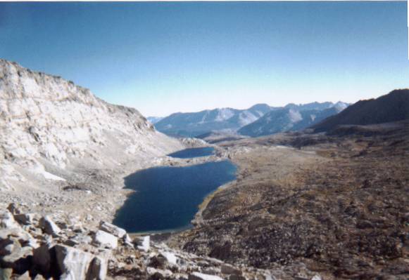
 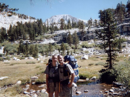 Soon we could and our pace quickened. At one stop we met a couple (Warren and Nancy) who took our picture for us. They had hiked up a shorter route from the south and were having a great time as well. They were friendly and laid back...a nice addition to the trail. We met again while getting water at a stream at Guitar Lake. We ate lunch together and then went our separate ways. They planned on camping at one of the few spots on the next lake up (actually two lakes up) and we thought we would take advantage of a large outcropping to block the wind. Besides, higher up just meant colder temperatures.
More friends
The forest service was doing trail work on the trail that day and no one was allowed on it from either side,
 so we met a few extra hikers that were ready to take on Mt. Whitney the next day (includeing our Pop-Tart friends). The last group we met as we were readying dinner was a group of four young Hungarians in constant party-mode. They had packs towering over their heads packed with every convenience you could imagine. We would see them again.
Tarpology
 I used every trick in the book to secure our tarp to the leeward corner of a rock outcropping. I used stakes and rocks as "pro" or wedges and levers to pull the tarp snug against the rock.
 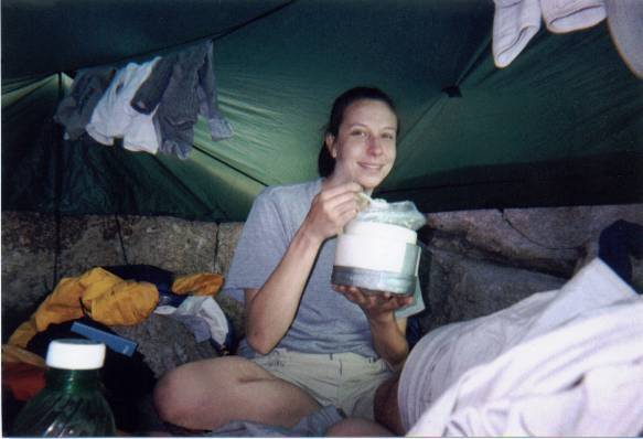 On the far sides it was about a foot off the ground, so I built a rock wall on the remainng two sides and built a doorway by tying weighting a loop of cord with two rocks that we could move to enter/exit. We didn't realize it until it was set up, but our configuration had enough room to easily sleep 4 people and gear. While the sun was up it was a sauna inside. It was too hot even sitting around in shorts. Despite the wind, it only dropped down to 28� that night and we were plenty warm. We both slept soundly and woke up fresh and ready for "game day".
Game Day
 We woke up at 4:35a (5-minute snooze on my watch) and we were on the trail an hour later. By this time we had little food left, so we made great time going up the back side of Whitney. We waved to Warren and Nancy as we passed their camp and we caught up to the four Hungarians about halfway up to Trail Crest where the trail turns and follows the ridgeline to the top of Whitney. As I had passed I noticed that their water bottles were full. We were following a number of switchbacks that allowed us to see back and I realized that the two women were suffering poorly from the hike. I had Jen keep going and I went back down to help out. I insisted that they drink more water and that the symptoms they were suffering were more likely caused by dehydration than altitude sickness (they had been hiking in the high country for the four previous days). I left to catch up with Jen, and they took a long break to guzzle water.
Summit!
 The sun rises on the other side of the mountain, so the air remained cold all morning. We didn't catch our first rays until we were about 1/2 mile from the top where it was so amazingly windy (the wind came from our side of the mountain) that the sun's heat was unnoticeable.
  We dropped our packs off at the crest of the trail and headed up the ridgeline with water, emergency gear, and snacks. The trail was still closed from the other side, so there was no one but the groups coming up from the back side on the mountain that day. Once the group of Hungarians dropped off their packs they flew. They had definitely recovered from dehydration and we reached the summit together. Right before summiting we met the Pop-Tart guys on their way back down and they said that they would hang out for a half-hour after getting to their car so that we could catch a ride back with them
 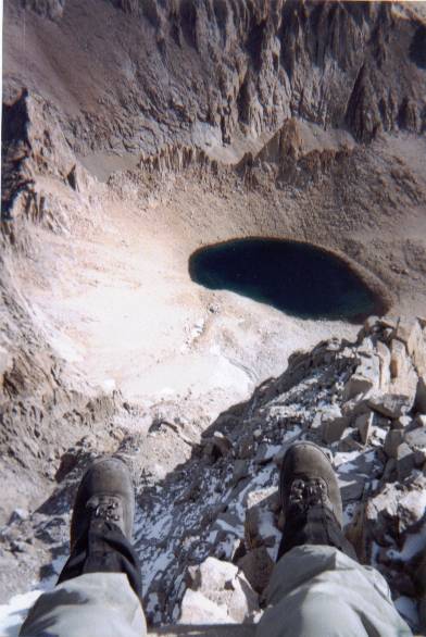 (I already knew that they probably hiked too fast for us to catch them in that window). We shared some chocolate snacks with the Hungarian group and took each other's pictures. The view was spectacular. We could see for miles in every direction.
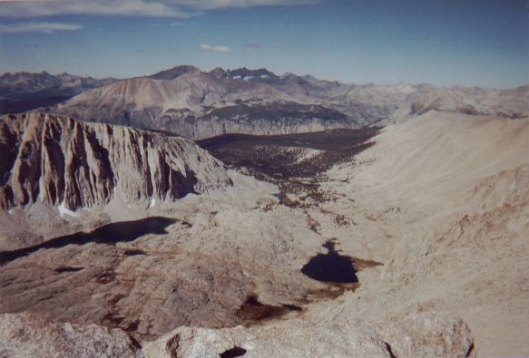
 The eastern face was an extremely steep drop down to a distant lake. It was quite the change from the sloping side that we had ascended (quite the norm for the sierras). Eventually we made our way back to our packs (2.4 miles) and started on our trek down to the Whitney Portal. It was only 8.7 miles from the Trail Crest to the parking lot, but it was nothing less than hours of pounding our feet into stone over and over again. For most of the trip down I wasn't sure if my knees were sore or numb. Vitamin-I (Ibuprofen) helped, as did my one knee brace, but it was amazing how much I longed to be hiking up rather than down.
Its Who You Know
 About two-thirds of the way down we ran into Calder (our new friend who had helped us pick out our trail plans). We thanked her profusely and chatted for a while on the trail. We happened to tell her of our plans to hitchike back to our car (despite how difficult it would be to find someone driving to Onion Valley at this time of the evening) and she suggested a fellow Ranger who might be willing to take us up there. Offering our thanks once again, we took off down the rest of the trail. After a seeming eternity, we finally saw the parking lot down below...and saw our Pop-Tart friends driving away. (I yelled out Steve's name as loud as I could, but to no avail). It was frustrating knowing we had been so close to getting an easy ride back to our car.
Ride for two?
At the parking lot we decided to hitchike down to Lone Pine and check with the ranger that Calder had mentioned. I left to use the bathroom and by the time I returned, Jen had found a ride for us (she's just too nice to say 'no' to) . Our benefactors drove us down to the ranger station where we caught them moments before they were closing up shop. We returned our bear canister and walked to the back barracks to find Bruce (the other ranger). When we walked in Bruce was the first person we met. He had no problem with giving us a ride. He claims he has a soft spot for those living on a tight budget. He should know. His is a life of freedom and travel. He was generous and kind, however, and recognizable traits like that can win the friendship you need to live happy and comfortable. We talked about our trip, his job as a ranger, differences between the Park service and the Forest service, and his own through-hike of the PCT! It was great to hear his experiences first hand. I had to nearly force him to take some money for taking us to Onion Valley despite the fact that it was well over 50 miles round-trip. We were really grateful for his help. When we arrived, three cars had their windows smashed in by bears seeking food left on the seats, but our car was untouched.
Unwind
We drove down to Independence and unwound at an artsy little pizzaria called Rockin' Rhino's. Here, beleaguered by fatigue yet emboldened by victory, we made the poor choice to attempt Boundary Peak, the highest point in Nevada, the next day. But that is another story.
Our small trek through the mountains had been a huge success. This was our first taste of the Sierras and we wanted more. We had tested new lightweight gear in circumstances that pushed their limits and learned a bit more about both our gear and ourselves. It was a great opportunity for Jen and I to share time with each other (we currently live in different states), and, of course, we managed to conclude our trip with a view from California's highest peak. It is certain that these memories and experiences will remain with us for a long time to come.
 |
 |
|
|
|

|

|
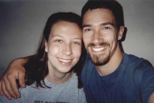
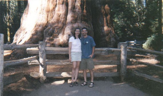
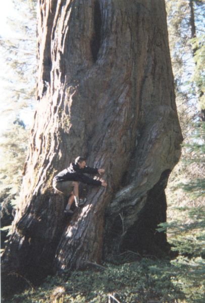
| The outstretched arm self-portrait. The PG-13 shot is here. | Jen and I standing in front of General Sherman Tree, the worlds largest living thing (most volume: trunk alone equals 52,500 cu.ft.). | And I used to think that climbing trees was easy | Hard to see here, but I'm wearing the fashionable 'backpackers tan'. They almost threw me off for glare violations. | Jen walking through a patch of aloe vera plants. Instant aid for beach glass. :) |
