| Last Name: | COOPER |
| First Name: | Daniel |
| Second Name: | |
| Third Name: | |
| Title: | |
| Sex: | Male |
| Birth Date: | |
| Birth Place: | |
| Death Date: | 03/11/1853 |
| Death Place: | Sydney |
| Education: | |
| Residence: | |
| Occupation: | |
| Closest Friend: | |
| Neat Traits: | |
| Misc. Information: | |
| Branch: | Root Branch |
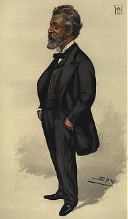
| Notes: | A Short History of Waterloo Published by South Sydney City Council (provided by the office of Councillor Vic Smith, Mayor) The area known as Waterloo had the Aboriginal name of Illpah (meaning "plentry of raspberries")(1) and it was peopled by the Kamilaroi Tribe and various sub-tribes whose language was Turruwul. (2) The area consisted of swamps and low sandy hills and the vegetation included coarse grasses, ti-trees and reeds. Mount Lachlan (now Mount Carmel) was the watershed of the Lachlan Swamps (Centennial Park) - the source of Sydney's early water supply. (3) Waterloo was undoubtedly named as a result of the British victory at the Battle of Waterloo in 1815 but there is some controversy as to how the name actually came to be applied to that suburb. Part of the area that is now Waterloo was included in a land grant of 1,400 acres made to William Hutchinson by Governor Brisbane in 1823 and according to records entered by the Colonial Registrar on 27th May 1823, this grant was to be called "Waterloo". (4) On 25th January 1825, this land was purchased by Daniel Cooper, his brother Robert and Solomon Levey for L2,700 to be paid in Spanish Dollars. Cooper and Levey were well known Sydney merchants and their establishment on the corner of George and Market Streets, Sydney was known as "Waterloo House." (5) Even if this building was the origin of the name of the suburb, it in turn was named after the Battle of Waterloo, and so Waterloo was named at least thirty five years before its proclamation as the Borough of Waterloo in 1860. The rest of the Waterloo area was included in a grant of 185 acres made to John Thomas Campbell on 30th June 1825 and this was purchased by Daniel Cooper and William Hutchinson on 29th October 1829. (6) From this time until his death on 3rd November 1853, Daniel Cooper sold some of the Campbell grant but out of the whole area now comprising Waterloo, only a few acres were disposed of. (7) Almost the whole of the Municipality was to remain within the Cooper estate until the twentieth century and members of this family included Sir Daniel Cooper, who was the first speaker of the Legislative Assembly (8) in 1856. The earliest land use in Waterloo included market gardens and dairies and there was even a successful attempt at wheat-growing. (9) As the suburb progressed, the local manufacturing included ropeworks and wool-washing and industries which relied upon water power for their operation. Water mills played a vital role in the development of Waterloo and one of the earliest examples was an experimental mill set up in 1813 by John Hutchinson and Simeon Lord to manufacture cloth, pottery and glass. (10) Although this experiment failed, other mills were established and five years later a mill was set up by Fisher and Duncan to manufacture paper. (11) This mill produced the paper on which the Sydney Gazette was printed on 29th July 1820. (12) A flour mill owned by William Hutchinson, Daniel Cooper, George Williams and William Leverton was named the "Waterloo Mills" by Governor Macquarie and after the Waterloo Mills took over the Lachlan Mills in 1820 it was possible to grind 1,600 bushels of wheat each week. (13) The Municipalities Act of 1858 led to the formation of the borough of Redfern the following year and Waterloo was a ward of this Borough. About six months later a petition was presented to Governor Denison by residents wishing to secede from Redfern and Waterloo was proclaimed a Borough on 16th May 1860. (14) Part of the area just south of the then boundary line was incorporated into the Borough in 1861 and on 31st August 1868 this Borough was divided into the two Boroughs of Waterloo and Alexandria. (15) The first election for the Borough of Waterloo was held on 27th June 1860 and the first Chairman, Edward John Hawksley was elected two days later. (16) The first meeting was held at the residence of Mr William Brown on the corner of Botany Road and Buckland Street and later meetings were held in a room attached to Quin's Bakery, the site of the present Cauliflower Hotel. (19) The land measuring 60ft X 220ft on which the Town Hall stands was originally leased from the Cooper family at a rental of L10 per annum and in 1912 the freehold title of the land was given to the Borough by Sir William Cooper. (20) A design for the Town Hall was adopted by Waterloo Council on 26th August 1880 (21) and on 3rd June 1881, the tender of Bretnall and Poulton was accepted for the building of the Town Hall. (22) The design of the Town Hall was described as being in the Italian style and features of the building included an entrance porch and a hall terminating in a staircase leading up the first floor. (23) The building was to include accommodation for the Council Chambers, a reading room and the clerk's residence and an ornamental verandah faced Elizabeth Street. (24) The extensions to the Town Hall, which now accommodates the South Sydney Municipal Library were added in 1915. The architect of the Town Hall was John Smedley (25) and on Saturday 20th August 1881 the foundation stone was laid by Patrick Hogan Esquire, J.P., Mayor of the Borough. (26) The contents of the foundation stone included a parchment scroll, newspapers of the day, coins and appropriate Government Gazettes. (27) The trowel used by the Mayor was made by Hardy's of Hunter Street and had an ivory handle. The following inscription was engraved on the blade of the trowel "Presented to Patrick Hogan Esq. J.P. on the occasion of his laying the foundation stone of the Town Hall by his Brother Aldermen." On 28th April 1882 Waterloo Council resolved that a stone be installed above the porch of the Town Hall with the following inscription in gold letters: "Town Hall Waterloo erected A.D. 1881 P. Hogan J.P. Mayor" (30) The first meeting of the Council to be held in this building was on Friday 18th August 1882 and from the second half of 1882, all Council business was carried on from the Waterloo Town Hall. (31) The official opening of the Town Hall was scheduled from Saturday 22nd August 1882 (32) and at the meeting of 18th August that year, use of the Hall was granted to the local Fire Brigade. (33) Waterloo rapidly progressed as an industrial area. In 1910 there were only about a dozen industries within the Municipality but by 1914 there were over a hundred. (34) In 1920 an Industrial Exhibition was held at The Waterloo Town Hall and the exhibitions included such companies as Australian Glass Manufactures, Wormald Bros., Waterloo Brick Co. and Gordon Marr & Sons. (35) Rosebery was established by the Rosebery Town Planning Company of Australia which bought 300 acres in 1911 and built factories and cottages (36) and Zetland took its name from a lodged leased from the Cooper family by Sir Hercules Robinson, Governor of N.S.W. who had racing stables there in the 1870's. (37) During this period Elizabeth Street had been extended from Wellington Street and declared a main road by the N.S.W. Government. (38) Waterloo Public School was opened in 1884 and has recently been renovated and other buildings include the Waterloo Congregational Church (1865), the Mt. Lachlan Methodist Church in Raglan Street, (now the Uniting Church) and Mt. Carmel Church (foundation laid 1859). (39) St. Silas Church and Botany Road (now demolished) was built by John Horbury Hurst, (Blacket's Chief Assistant) in 1868. (40 Cooper, Daniel Sir Online Sources Published Sources Merchant and Philanthropist Cooper was one of the original partners of the Colonial Sugar Refining Company when it was formed in 1855. Online Sources See Also Academy of Technological Sciences and Engineering, Technology in Australia 1788-1988, Australian Science and Technology Heritage Centre, 2000, http://barney.asap.unimelb.edu.au/tia/tia-dynindex.php3?EID=P003457. The beginnings of industrial chemical research - in the sugar industry The earliest chapter in industrial research in chemistry belongs not to the chemical but to the sugar industry. Almost half a century before the foundation of Australia's premier research organisation, the CSIRO, CSR (then the Colonial Sugar Refineries) employed the first research chemists. The value of chemical analysis was clearly recognised by CSR's General Manager E. W. Knox and Sir Daniel Cooper,[21] one of its directors; it led them to employ around 1873 a Scottish chemist, Thomas Utrick Walton, and later, 1883, a German scientist, Dr. Gustav Kottman. Both men were to have a major impact on research in CSR, setting up laboratories and field stations and imposing upon them the disciplines and control methodology which are still evident in today's practice. Walton in particular laid down chemical process control which ensured that residual sugar in various residues, particularly bagasse, was recovered. Kottman improved crushing efficiencies further and developed the formulae by which extraction efficiencies are measured to this day. His most important contribution, however, was probably in field work, improving strains of sugar and nutritional value. The Cooper Estate had been amassed by Daniel Cooper who arrived at Sydney Cove in 1816 as a convict; by 1821 he had been granted an unconditional pardon and was a leading businessman in Sydney. When Captain Piper was in financial trouble, Cooper had the foresight to purchase most of the Piper Estate, which became the bulk of his real estate empire. Cooper had been in partnership with Solomon Levey. However by the time Tom Raine was appointed trustee of the Cooper Estate, levey's son had renounced all claim to any share in the partnership's real estate. The Cooper Estate included the real estate we know today as Rose Bay, Bellevue Hill, Woollahra, Point Piper, Double Bay, Waterloo, Alexandria, Rosebery, Zetiand, Beaconsfield, Kensington, Kingsford, Erskinevilie, Pagewood, Eastlakes, Daceyville, Redfern, Surry Hills, part of North Sydney, Cremorne, Neutral Bay, Kurraba Point and Cammeray. About 1830 William Wiseman purchased large tracts of land around Lyttelton and Christchurch on behalf of daniel Cooper and Solomon Levey. No documents have been found to support this purchase, and the transaction is hidden in obscurity owing to the untimely death of Wiseman in 1831. There was trading in flax, pigs and potatoes with the Maoris from about 1830. Port Lyttelton, near Christchurch, was known as Port Cooper, and a port close to the north was called Port Levy. The names had been given to the Ports by William Wiseman who was employed by Daniel Cooper and Solomon Levey. In 1848 the names of the two bays were changed. Ports Cooper and Levy, were thus called Ports Victoria and Albert, after the Queen and the Prince Consort |
| Cemetery: | |
| Section: | |
| Plot: | |
| Individual record created: | 23/02/2002 at 10:17:51 AM |
| Individual record last updated: | 28/02/2002 at 3:53:24 PM |
| Spouses: |
 |