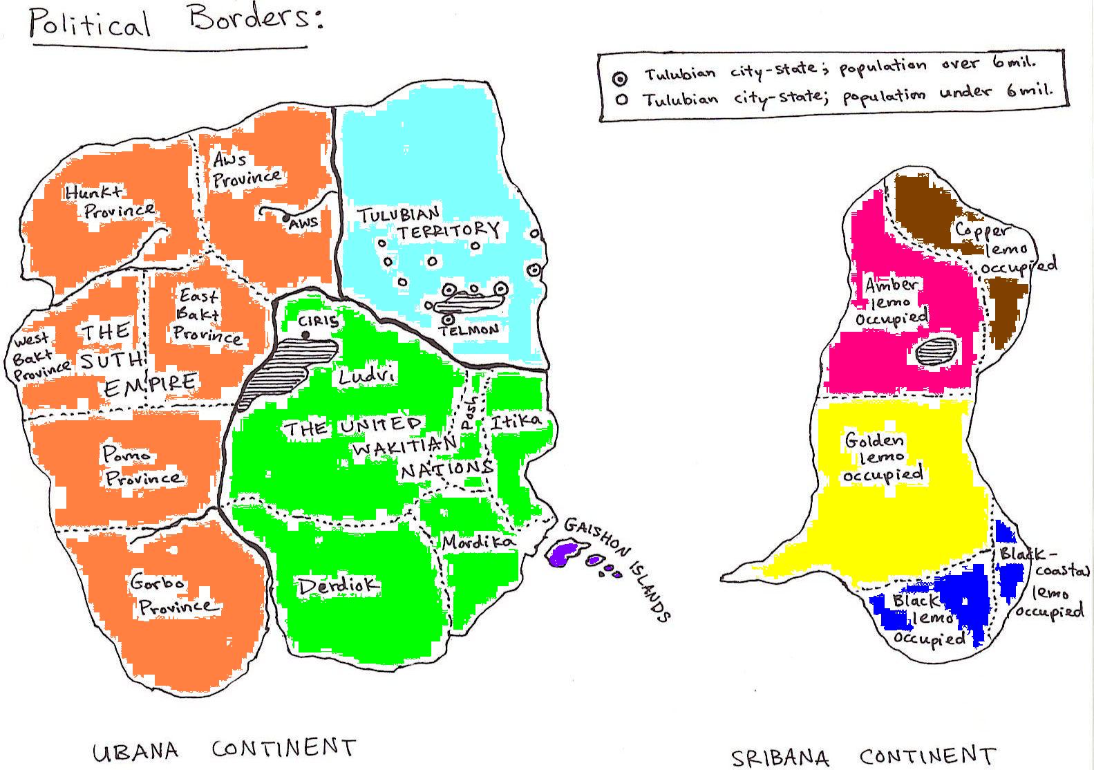
To the left is the continent of Ubana; the home of the liiten species. In orange is the Suth Empire (population 500+ million), the light blue being the isolated Tulubian Territory (population 40 million), in green are the five United Wakitian Nations (population 400 million), and in purple is the sixth Wakitian nation: The Gaishon Islands (population 2 million).
To the right is the continent of Sribana. No liiten nation has ownership of Sribana, and the intelligent species that occupies Sribana (the lemos) are foragers that live in small, nomadic groups. The different colors simply give a general idea of which lemo race/cultural grouping occupies what part of the continent. It should be noted that lemos have a low population and low population density.