CLEVELAND
|
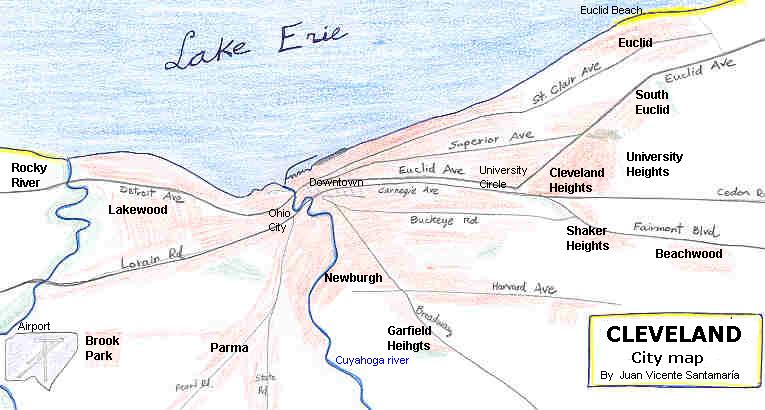

This great American metropolis at the shores of Lake Erie was founded in 1796. At the beginnings of XX century was the largest city of Ohio. No wonder, as Cleveland was the hub of an extense network of railways, waterways and maritime freight traffic. Industry grew up with such patrons like John Rockefeller. Steel Mills along the Cuyahoga river (US Steel, Otis Steel, Republic Steel, Jones & Laughlin), automotive industry (White Motor, Winton, Ford, GM), chemicals, garment, aeronautics . .
Cleveland memories . . as it was in the 1920´s. Elegant mansions along Euclid Ave. University Circle. And more to the east: Fairmont Boulevard, Euclid Golf, Shaker Square, Beachwood . .
 |
You can feel the
breeze of the immense Lake Erie, from Lakewood to
Euclid. A summer afternoon in the beach? In Geneva-on-the-Lake, of course. And a visit to Ashtabula harbor, to see the impressive vessels loaded with ore iron (and the famous bridge, of course). |
Despite some decadence of the heavy industry in the 1970´s, Cleveland is today a brilliant and cosmopolitan city, with research and high technology industries (Case Institute, Lewis Research Centre), modern automobile assembly plants of Ford Motor (Brook Park), GM (Parma), and the TRW Co.
Cleveland is the cultural hub of northeast Ohio with museums (like the University Circle area), new cultural venues (Great Lakes Aquarium, Rock & Roll hall of fame) and successful urban renewal areas like Ohio City, the Flats, Warehouse District.
© TEXT: Juan Vicente Santamaría Gil. 2004
