| LAND COVER LAND USE CHANGES Indonesian case study |
| LAND COVER LAND USE CHANGES Indonesian case study |
|
|
||
|
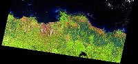
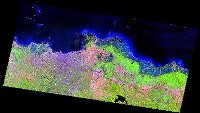
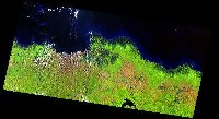
Quicklook of: .- Citarum watershed .- Lower Mahakam watershed .- Lower Batanghari watershed Data: Landsat TM 5 Source: BSRSI - Michigan State University |
Citarum
Watershed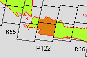 |
|
| Citarum watershed located at Path/Row 122/064 and 122/065 of Landsat TM. |
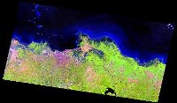
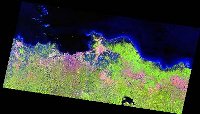
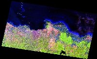
| Path / Row : 122 / 064 |
| Path / Row : 122 / 064 Acq. : 1989 |
 |
| Path / Row : 122 / 064 Acq. : 1990 |
 |
| Path / Row : 122 / 064 Acq. : 1991 |
 |
| Path / Row : 122 / 064 Acq. : 1993 |
 |
| Path / Row : 122 / 064 Acq. : 1997 |
 |
| Path / Row : 122 / 064 Acq. : 1998 |
 |
| Goto : Path / Row 122 / 065 |
| Back to: Study Area |
| Introduction | Team | Study Area | Publication | Links | Site Map |
| LCLUC Indonesia © 2001 |