|
|
||||||||||||||||||||||||||||||||||||||||
|
History
The Zambals gained a notoriety for sanguinary activities, which they directed at lowland Christian settlements. In 1660, a Zambal army was raised in support of the revolt of Andres Malong of Pangasinan and sent to conquer the towns of Ilocos. The Zambals ruthelessly crushed opposition and ravaged loyalist towns until they were routed in the vicinity of Bauang, La Union. The region of
Zambales was first administered as part of the province of Pangasinan. Although
it lay In the 19th century, through government encouragement, Ilocano migrants from the provinces of Ilocos Norte and Sur settled in the extreme north and south of Zambales while Tagalogs and Kapampangans settled in the vicinity of Subic. New towns were established and the population of the province grew rapidly. In 1903, several towns of northern Zambales (Alaminos, Bolinao, San Isidro, Infanta, Anda, Bani and Agno) were ceded to Pangasinan. In 1895, the Spaniards constructed a naval base in Subic Bay, which the Americans took over in 1898. The Subic Bay Naval Base, became the largest US Navy support station in East Asia and an important forward position in the region. Even after Philippine Independence in 1946, the Americans maintained Subic Base because of its strategic location, until it was finally dismantled in 1992 and turned into a Freeport. In 1991, the long dormant Mount Pinatubo volcano erupted and spewed billions of cubic meters of ash into the atmosphere. Southern Zambales was heavily affected by ashfall and lahar flows.
People, Culture and the Arts
Small Aeta communities in the vicinity of Subic Bay and in the town of Botolan have showcased the uniquely adapted culture of the small, dark-skinned, nomadic peoples. Mostly forest foragers and hunters, the Aetas were a highly mobile people, who followed wild game and gathered rootcrops and fruits from the forested highlands of Zambales. The demands of the hunting-gathering culture of the Aetas discouraged permanent settlement and the accumulation of material goods and made it difficult for Christian missionaries to minister to them. About the only materials the Aetas bring with them are bows and arrows. They have also developed a popular wind instrument called the bansik, a four hole flute fashioned from mountain cane. At the same time,
their intimate relationship with the forest and wilderness have made the Aetas There are many observances in Zambales that speak of a strong Aeta presence in the province. Upstream from the town of Botolan, Catholic missions cater to the needs of Aeta communities around the shrine of the Virgin of Poonbato, patroness of the Aetas. It is believed that the Virgin Mary appeared before the Aetas and many converted to Christianity. There is a Binabayani celebration, which is a reenactment of the war between the Aetas and the Christians in the form of dance. This is the culmination of a fiesta that is also held to assure a bountiful harvest in the succeeding month. Another festival called the Kalighawan is held on the 4th week of April and celebrates the richness of the Zambaleño heritage.
Trade and Investments Host to the Subic Bay Free Port, the premier investment zone in the Philippines, the province of Zambales is the port’s vast and fertile ‘backyard’. The province’s 3,714 square kilometer area provides expanses of agricultural land along the coastal plains. Large tracts of forested mountains cover more than half the province’s area. The continuous shoreline of sandy beaches, sheltered coves and underwater coral reefs teem with an assortment of marine life while the mountains hold vast reserves of minerals such as chromite, gold, nickel, iron, limestone and sand. A population of close to 570,000 (in 1995) individuals provides the needed supply of highly-trained and multi-skilled manpower. The province is easily accessed through a system of well-paved roads that hug the coast, linking the province to Manila via the Gapan-Olongapo highway, and western Pangasinan. Limited access roads run from the coast into the eastern mountains. Several bus companies provide daily commuter service from various points in the province to Manila and back. The province has top grade international sea port and airport facilities in Subic, which can accommodate both cargo and people moving to and from a number of international destinations. There is also a small feeder airport in Iba for smaller aircraft. With the completion of the Masinloc Power Plant, electric supply within the province is more than sufficient. Zambales is still overwhelmingly agricultural. Rice, mangoes, sugarcane and coconuts are the main products of the land. However, the province is also home to some of the biggest mining operations in the country, in the municipalities of Santa Cruz, Masinloc and San Marcelino, that extract metallurgical and refractory chromite for industrial use in Japan and the United States. The provincial government is promoting the development of industrial hubs in Zambales to complement the capacities of Subic Bay. The port of Masinloc is the focus of development, building around existing port facilities of the Benguet Consolidated Mines, Inc. and encouraging other industries, businesses and tourist facilities to locate in the easily accessible port. Zambales is a prime area for tourism. High-end tourism in the scenic bays, off shore islands and blue water shores of San Antonio, easily accessible from Subic Bay, are currently being developed. The Island of San Salvador, a fish sanctuary in the vicinity of Masinloc, boasts of manta rays and lobsters in an unspoiled marine setting. Masinloc Bay is a prime tourist destination waiting to be developed, with good diving, watersports and eco-tourism possibilities. The province’s varied forest and wildlife ecosystems have also attracted the attention of an increasing number of eco-tourists. Subic’s primary growth forest is visited by hundreds of tourists who are eager to see the diversity of life within the rain forest. Mount Pinatubo has also drawn hiking enthusiasts who visit the ruggedly beautiful, and eerie landscape altered by the volcano’s eruption. Tourist-related endeavors such as hotel and lodging accommodations, resorts, restaurants, and transportation are encouraged.
Development Initiative Highlights:
|
||||||||||||||||||||||||||||||||||||||||
 boundaries with Pangasinan on the north, Tarlac and Pampanga on the
east, and Bataan on the south. The China Sea lies on the west. The
terrain is irregular as the whole Zambales Mountain Range traverses the
whole length of the province. The mountains occupy the eastern and
central portions while the coastal plains lie along the west. It is dry
from November to April, and wet from May to October. The mountains offer
some protection from the storms coming in from the east but it is
vulnerable to the southwest monsoons and tropical cyclones.
boundaries with Pangasinan on the north, Tarlac and Pampanga on the
east, and Bataan on the south. The China Sea lies on the west. The
terrain is irregular as the whole Zambales Mountain Range traverses the
whole length of the province. The mountains occupy the eastern and
central portions while the coastal plains lie along the west. It is dry
from November to April, and wet from May to October. The mountains offer
some protection from the storms coming in from the east but it is
vulnerable to the southwest monsoons and tropical cyclones.

 along important sea routes to between Manila, Ilocos and China, it
remained sparsely settled. In the late 18th century, Zambales was
constituted as a separate province covering an area from Subic up to Alaminos.
along important sea routes to between Manila, Ilocos and China, it
remained sparsely settled. In the late 18th century, Zambales was
constituted as a separate province covering an area from Subic up to Alaminos.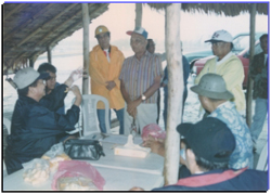 Zambales was
named after the Sambalis, who were the original inhabitants of the coastal
plains and the interior highlands of the province. Today, they comprise a small
part of the population of the province concentrated in the north and central
areas of Zambales and are indistinguishable from the mainstream lowland culture
except for their distinct language. Ilocanos form a majority in the central and
northern portions of the province, while the Tagalogs are concentrated in the
vicinity of Subic. Negritos or Aetas live in the mountains of the Zambal
Mountain Range, although many were forced to migrate as a consequence of the
eruption of Mount Pinatubo in 1991. Filipino and Ilocano are widely spoken.
Zambales was
named after the Sambalis, who were the original inhabitants of the coastal
plains and the interior highlands of the province. Today, they comprise a small
part of the population of the province concentrated in the north and central
areas of Zambales and are indistinguishable from the mainstream lowland culture
except for their distinct language. Ilocanos form a majority in the central and
northern portions of the province, while the Tagalogs are concentrated in the
vicinity of Subic. Negritos or Aetas live in the mountains of the Zambal
Mountain Range, although many were forced to migrate as a consequence of the
eruption of Mount Pinatubo in 1991. Filipino and Ilocano are widely spoken.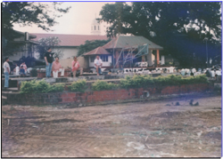 unparalleled experts in jungle survival. The Aetas of Subic were tapped to train
American soldiers to live on the plants and resources of the forest. They have a
stock knowledge of plant cures and poisons, sources of food and water, as well
as fire making, food cooking, shelter building and animal trapping technologies
using readily available forest materials.
unparalleled experts in jungle survival. The Aetas of Subic were tapped to train
American soldiers to live on the plants and resources of the forest. They have a
stock knowledge of plant cures and poisons, sources of food and water, as well
as fire making, food cooking, shelter building and animal trapping technologies
using readily available forest materials.