|
|
||||||||||||||||||||||||||||||||||||||
|
History
Spanish conquest and colonization began in 1571 under Martin de Goiti, who penetrated the region from Pampanga. A year later, Juan de Salcedo sailed up the western coast and landed at the mouth of the Agno River. Governor Gonzalo Ronquillo de Peñaloza made Pangasinan an Alcaldia Mayor in 1580, and in 1611, this region became a province. At the time, its territory included the present province of Zambales and parts of La Union and Tarlac with Lingayen as its capital. Soon after the Spaniards conquered Pangasinan, it came under threat of another foreign invasion. Limahong, the Chinese corsair who failed to take Manila, tried to build a settlement at Lingayen, in 1574. However, he was also forced out of Lingayen leaving only the Limahong Channel, a tunnel dug for six months that served as his escape route as the only lasting legacy of his failed attempt. Several disturbances centered in Pangasinan attest to the Pangasinense’s struggle for liberty during the Spanish era. In 1660, Andres Malong tried to establish a kingdom over an area from Ilocos to Pampanga free of Spanish domination. Malong sent able generals to conquer the region, threatening the hold of Spanish colonial government over the areas. In 1762, another Pangasinense leader, Juan de la Cruz Palaris rebelled against the Spanish imposition of the tribute. For two years Palaris led the revolt, which spread across Pangasinan and affected other provinces of northern Luzon. In the 19th
century the province rapidly developed as a result of the extension of
agriculture into the During the Filipino-American War (1899-1901), Bayambang was a temporary capital of the Republic. It was in Bayambang that General Emilio Aguinaldo disbanded the regular Revolutionary Army and organized guerrilla units to fight the American forces. The Americans established civil government in Pangasinan in 1901. During the Second World War, Lingayen Gulf was strategically important in the plans of both Japanese and American forces to take Luzon. In December 1941, Japanese invasion forces led by General Masaharu Homma landed at White Beach and began the Japanese occupation of the Philippines. The Americans also landed in San Fabian in the Lingayen Gulf in 1945, which signaled the beginning of the liberation of the island of Luzon from the Japanese.
People, Culture and the Arts
The Pangasinenses constitute one of the six major lowland groups converted into Christianity by Spain. They practiced a self-sufficient economy of fishing and wet agriculture supplemented by hunting and bartering and had an intimate relationship with the tidal flats. Salt making has given rise to the province’s name. The marshlands around the Lingayen Gulf have also been converted into artificial ponds that culture shrimp, fish and all manners of marine products. The ponds have also been extended up the Agno River, to breed and grow fresh water fishes. The tidal flats also supply the Pangasinenses with nipa sap used in the production of native wine. The Pangasinenses
are also noted for their industry and their enterprise. Buri hat making,
mat weaving, The introduction of Roman Catholicism has blended with the ancient beliefs and practices to forge a folk Christian devotion to Catholic saints and lending a Christian veneer to ancient rites. The image of Our Lady of the Holy Rosary in Manaoag, Pangasinan draws devotees who flock to the Pangasinan church in search of miracles. Among Pangasinan’s most popular festivities is the yearly Pista’y Dayat held in Lingayen, Dagupan and all towns in the rim of the Lingayen Gulf. This May time religious festivity, is a thanksgiving rite "for the bounty of the sea that gives sustenance to life" and whose origin predates the coming of the Spaniards.
Trade and Investments Pangasinan envisions to become an ecologically balanced and environmentally stable world-class center for tourism, trade, agriculture, and industry in the Asia-Pacific region. Pangasinan is the biggest province in the Ilocos Region covering an area of 5,368 square kilometers. Much of the land is flat and devoted to agriculture and the province has the highest amount of irrigated fields in the region. The Lingayen Gulf is a rich fishing ground and is a major source of marine products. The mountain ranges to the east and west of the province are sources of metallic minerals like gold and chromite and non-metallic minerals like clay, limestone, silica and guano. Pangasinan holds the largest pool of labor in northern Luzon at 840,000. With the support of more than 50 technical institutions, this labor force can adequately respond to the needs of traditional as well as highly specialized manufacturing activities. Pangasinan is approximately four hours from Manila using the North Luzon Road. A network of secondary roads crisscrosses the province facilitating the movement of people, commodities and goods. Dozens of bus firms connect trading centers like Dagupan with Manila, Baguio and San Fernando. The San Fernando Seaport serves as Pangasinan’s major sea access point. The Sual International Seaport, once completed, will connect the province with major markets of East Asia. Pangasinan enjoys the highest telephone density in the country outside of the National Capital Region and the four telecommunications firms have continued to provide the province ample communications facilities. Potable water is available in more than 90% of households. Power supplied by the Luzon Grid is adequate but with the completion of the Sual Coal-Fired Thermal Plant, another 1000 megawatts will be available. There are 89 rural banks, 48 commercial banks, 31 thrift banks, 8 specialized government banks as well as 150 non-banking financial institutions catering to the financing needs of the province. Agriculture remains a strong base on which to build the province’s economy. Pangasinan produces enormous amounts of rice, corn, legumes, vegetables and fruits. Its long coastline and inland waterways have been developed into aquaculture farms for milkfish or bangus, shrimps, crabs, oysters and mussels. The province is also a major livestock and poultry producer for the Ilocos region and a leading producer of salt. Food processing and feeds production is a growing economic activity in resource rich Pangasinan. The provincial government has also worked to attract investors in light and medium manufacturing activities, such as aircraft and automotive assembly, into special economic zones that have been constructed specifically to cater to the needs and requirements of these industries. There are two specified industrial estates, the Sual Industrial Estate and the Mabini Special Economic Zone. Handicrafts, furniture making and basketry, which have always been strong export performers, can take advantage of the highly skilled craftsmen in the province. Tourism remains a strong area for further investments. The Hundred Islands National Park, a traditional tourist destination, is currently being developed to accommodate more tourists and provide better facilities. The far west of Pangasinan has also been seen as the next tourism mecca with its rugged landscape, white sand beaches and unique marine ecosystems. The Bolinao Tourism Estate and Retirement Village hopes to transform Bolinao into a haven for retirees. Investments in hotels, lodging places, watersports facilities and support industries are needed.
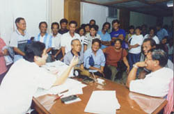
Development Initiative Highlights:
|
||||||||||||||||||||||||||||||||||||||


 forested interior regions. The influx of migrants from the
provinces of Ilocos Norte and Ilocos Sur into the western and eastern portions
of the province spurred the transformation of Pangasinan into the main rice
granary of Luzon. By 1855, the port of Sual was opened to foreign commerce. In
1891, the Manila-Dagupan Railroad was opened, vastly improving transportation
between Pangasinan and Manila and opening more lands to agriculture.
forested interior regions. The influx of migrants from the
provinces of Ilocos Norte and Ilocos Sur into the western and eastern portions
of the province spurred the transformation of Pangasinan into the main rice
granary of Luzon. By 1855, the port of Sual was opened to foreign commerce. In
1891, the Manila-Dagupan Railroad was opened, vastly improving transportation
between Pangasinan and Manila and opening more lands to agriculture.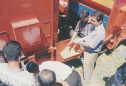 Several ethnic
groups live in Pangasinan, enriching the cultural fabric of the province. About
half the people of Pangasinan are Pangasinenses a distinct ethnoliguistic group
found along the central coast and interior plains of the province. The rest of
the province’s people are descendants of Ilocano migrants who settled the
eastern and western parts of Pangasinan. In the vicinity of Bolinao, about
30,000 people speak Sambal-Bolinao.
Several ethnic
groups live in Pangasinan, enriching the cultural fabric of the province. About
half the people of Pangasinan are Pangasinenses a distinct ethnoliguistic group
found along the central coast and interior plains of the province. The rest of
the province’s people are descendants of Ilocano migrants who settled the
eastern and western parts of Pangasinan. In the vicinity of Bolinao, about
30,000 people speak Sambal-Bolinao. wooden shoe manufacture, brick and pottery making and metalcraft
are among the traditional industries that continue to thrive in Pangasinan.
Lingayen was once the primary center of commerce in the province and had a
thriving Chinese community to direct its trade. Industries such as bakeshops,
soap and candle-making, and the manufacture of shoes and slippers are centered
in the town. Native Pangasinenses also engage in trade, investing in expensive
shawls, blankets, white and blue cloth, needles, scissors and mirrors from China
as well as other products which they bring to nearby northern provinces. The
ubiquitous cattle-drawn wagons that travel across northern Luzon and Manila are
from Pangasinan.
wooden shoe manufacture, brick and pottery making and metalcraft
are among the traditional industries that continue to thrive in Pangasinan.
Lingayen was once the primary center of commerce in the province and had a
thriving Chinese community to direct its trade. Industries such as bakeshops,
soap and candle-making, and the manufacture of shoes and slippers are centered
in the town. Native Pangasinenses also engage in trade, investing in expensive
shawls, blankets, white and blue cloth, needles, scissors and mirrors from China
as well as other products which they bring to nearby northern provinces. The
ubiquitous cattle-drawn wagons that travel across northern Luzon and Manila are
from Pangasinan.