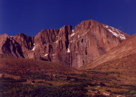
Long's Peak Trailhead
(click on any of the small pics to see the full size image)
![]()
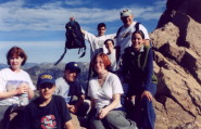
Long's Peak Photo Album
![]()
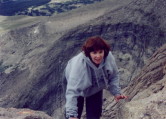
Step by step up Long's - August 2, 2001
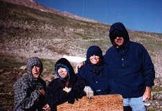
Thursday morning began with the sound of the alarm clock at 1:30AM. We (Bob, Flo, Alli, Andy, Mike and Heidi) stumbled out of bed, threw our packs in the car, met Betsie and Jason at the McDonald's parking lot, and drove to the Long's Peak Trailhead. After sorting out our gear, we signed the registration book at the ranger station and were on our way up the mountain at 2:40. We walked in darkness as the full moon had already set. The sight of flashlights and headlamps snaking up the trail ahead and behind us was the only way we could tell we weren't alone on the mountain.
Betsie had made the summit a few years ago when she worked at Cheley Camp, but the rest of us had no idea what to expect. We had read "The Longs Peak Experience" by Mike Donahue so we had some idea of what was ahead, but beyond the Trough we found that the book lied.
We were a happy bunch starting off, joking and singing as we walked through the predawn darkness. As we moved up the trail, we ran into several groups who were turning back because of the weather. It seemed far too early to be heading back so we decided to hike above treeline and get a look at things when the sun came up. We're glad we did.
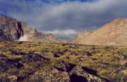
The hike up to treeline was uneventful. We had already passed the split in the trail that leads to Chasm Lake, and were on the section of trail leading to Granite Pass when the sun came up.
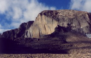
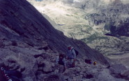
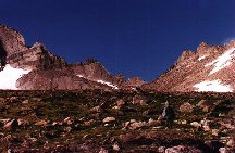
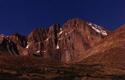
Granite Pass is a minor milestone on the trip. There's a sign there that tells you it's "only" 3.3 miles to the summit. After the pass there's a series of switchbacks which leads to the Boulderfield and a great look at the North Face of Long's. A few step farther along gives you a view of the Keyhole.
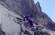
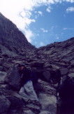
We took a break in the Boulderfield and decided to leave all our extra gear there before heading for the Keyhole. It's an interesting rock scramble up to the Keyhole. There are cairns, but it's hard to tell if one route is any easier than another.
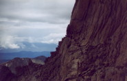
The Keyhole is where things get interesting. We'd been this far before but the route beyond was still snow covered and was open to technical climbing only. This time the route was clear and we were determined to summit.
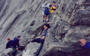
We were lucky to have a calm day. The last time we'd been there the wind was fierce and made it a very uninviting place. Dropping through the Keyhole, we made our way along the Ledges. The Ledges have a few narrow spots and some exposure to falls, but it's nothing like the Narrows. The worst part about the Ledges is something you don't think about until the return trip: it's downhill from the Keyhole to the bottom of The Trough.
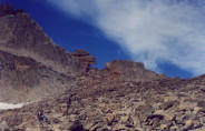
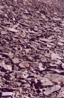
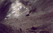
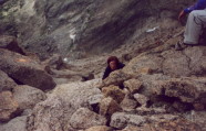
The first glance at the Trough is enough to make you rethink your plans. It's 800' of loose rocks, and it looks to be nearly straight up. We took it one small section at a time, concentrating on getting from one "bullseye" another. The bullseyes are red and yellow circles painted on the rocks to help with route finding.
While climbing on loose rocks it's almost impossible not to kick one loose and start it rolling downhill. Yelling "ROCK" warns the people below you that one might be on the way down. Alli slipped and started sliding down, and being a good hiker, yelled "ALLI" to let the people below know that she was on her way.
Heidi decided she'd had enough when we got to the top of the Trough. She had planned on only going to the Keyhole, but we'd been able to talk her into going just a bit farther.
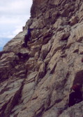
The book had said the Trough was Long's last attempt to keep you from the summit. The book lied. Your reward for reaching the top is a view of the Narrows. The Narrows aren't horrible, but the view of the first few feet makes taking those first steps a nerve wracking experience. There's an overhanging rock to scoot around with a long drop and VERY little room for error. Fortunately it widens out beyond that point and the rest of route to the Homestretch isn't bad.
Seeing the Homestretch reminds you that the book lied once again. It's about 400' of steep, sheer granite. Standing is an option, but you're more likely to need your hands to hold onto the cracks in the granite face as you work your way up. I didn't get any pictures of the Homestretch. Everything was put in my pack for this section of the climb and the camera didn't come back out until we were on the summit.
I've always had a rule that we turn back from any hike when we'd hear thunder. I figure whatever we're going for will always be there and it's not worth the risk. I heard thunder about 20' from the summit but against my better judgement kept going. I didn't want to EVER go through this again.
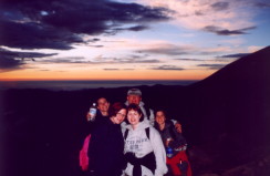
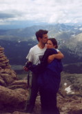
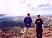
Andy, Mike, Betsie and Jason were the first ones to summit. Hearing them cheering us on as we neared the top gave us the energy to climb those last few feet. Jason yelled "slap that bullseye" as Flo made the final scramble. We were on top at last.
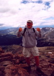
We didn't get to stay long. The thunder we heard was getting closer and we could see the storm moving in at eye level. We only had time for a few pictures, and then headed back down from the summit, sliding down the Homestretch, recrossing the Narrows, descending the Trough and crossing the Ledges back to the Keyhole, uphill. As we neared the Keyhole, lighting struck near by, and the crack of thunder got us moving faster than we thought possible in our tired condition.
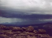
As scarey as it was for us, I heard from someone else who had been on the mountain that day. This is how they described their descent: Megan and I literally ran from the trough to the keyhole...it was Megan's job to watch my hair...and mine to find our way back. Everytime Meg would see my hair stand up on end we would squat in the lightning position...I've never been so scared!!
Altogether, it was a 15 hour round trip. Nine up, six down. It was the hardest thing most of us have ever done, both physically and mentally. On the way down, we all agreed we'd never do it again, but by the next day as the exhaustion wore off, and the impact of what we'd done started to sink in, we started talking about what we'd do differently the next time. Who knows, we just might try it again some day.
Reaching the summit as a family made the climb even more rewarding. Sharing the thrill of making a dream come true was the high point of the trip. We have to thank Jason and Betsie. Without their encouragement and enthusiasm, we might have listened to the voices telling us to turn back. You two are awesome. Thanks.
Having reached the summit, you'll never look at the mountain the same way again. Only one of a thousand people who enter the park reach the summit of Long's. Knowing you're one of them sets you apart from the rest. As you walk the streets of Estes, you wonder how many of those around you have ever stood on top of the mountain that dominates the park. As you drive through the park, your eyes are constantly drawn to the peak. People stop their cars and take pictures. It's as close as most of them will ever get. We've been to the top, and it feels great.
![]()
Chasm Lake Hike
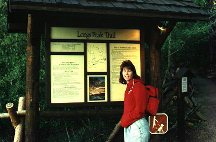
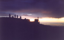
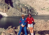
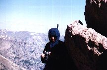
Flo at 6 AM
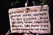
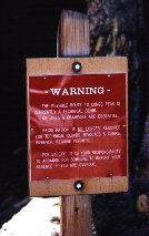
The Chasm Lake hike follows the Keyhole route for the first 3.5 miles to the Chasm Lake cut off. You don't get much of a chance to warm up, the trail starts climbing right away. Just before you get to tree line, you come to a sign that reminds you of the danger of lightning and makes you glad you got an early start.
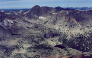
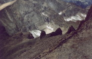
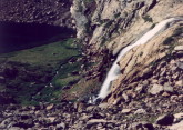
Once you're above tree line the wind really hits you, fortunately the scenery takes your mind off the cold. At about the point where the trail to Long's Peak branches off, you get a great view of Peacock Pool shimmering below you, followed by Columbine Falls.
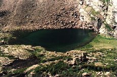
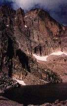
It's an easy walk from here to the shelf where Chasm Lake sits. A short scramble up the rocks along side Columbine Falls bring you to Chasm Lake. Chasm is spectacular in it's stark setting. The East Face of Long's rises 2,500' above it. At 11,760' it's the 7th highest lake in the park.
![]()
Keyhole Hike
1995 was going to be the year we finally did it. We hit the gym and were in pretty good shape hoping to get a shot at doing Long's Peak. We never got the chance. The heavy snow of March and April was still on the mountain in August. The trail past the Keyhole was under winter climbing conditions, open to technical climbs only.
We started for the Keyhole on a chilly August morning, it seemed to get colder the farther we went. By the time we got to Granite Pass we were really bundled up.
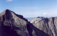
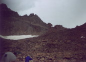
After a few switchbacks, we arrived at the Boulderfield and got our first look at the Keyhole.
It's an easy walk through the Boulderfield, but the Keyhole is a scamble up loose rocks. The wind in the Keyhole is amazing, it nearly blew me over. Luckily Betsie grabbed me and pulled me down. Steve's hat flew off and I think it's still flying.
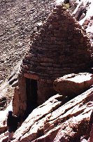
The view was worth the distance and the cold. It was amazing to be able to look down into lakes that were all day hikes themselves. Just below the Keyhole sits a stone shelter with a plaque telling the tragic tale of Agnes Vaille.
The Keyhole sits at 13,150' and is a 12.5 miles hike. We were disappointed at not being able to reach the top of Long's, but the great views made it a worthwhile trip.
![]()
Distances from Long's Peak Trailhead.
| Destination | From Trailhead | Elevation | Elevation Gain | |||
|---|---|---|---|---|---|---|
| Chasm Lake | 4.2 | 11,760' | 2,360' | |||
| Granite Pass | 4.2 | 12,080' | 2,680' | |||
| Boulderfield | 5.9 | 12,760' | 3,360' | |||
| Keyhole | 6.25 | 13,150' | 3,750' | |||
| Summit | 7.5 | 14,255' | 4,855' | |||
![]()
Long's Tips
I'm hardly an expert, but these tips should help anyone attempting to climb Long's.
Start Early!!!!!!!!!! Unless you're really fast, leave earlier than we did. We started at 2:40AM and were chased off the peak by a storm at 11:30. Next time we try it, we're starting at 1AM.
Figure out how much water you'll need and take more. Unless you're carrying a filter, you can't take too much water. Trust me, you need water more than food.
Sun screen! You'll fry in that thin air.
Know what you're getting into. The Trough is long and steep. The first few steps of the Narrows are scarey. The Homestretch is long and even steeper. The Ledges seems a lot longer on the way back than it does on the way out. All these things can be very discouraging if you're not prepared for them. Learn as much as you can ahead of time. If you can find it, read Paul Nesbit's "Longs Peak". It's a much more realistic description of the climb than Mike Donahue's "The Longs Peak Experience".
![]()
Back to Rocky Mountain National Park
![]()