I started the day walking around the ship for and hour. Four
laps equal a mile. I returned to our room and joined Mona for breakfast
in bed, our daily start of the day. Today we heard 3 lectures one on
the tours in the port cities of our cruise, another on the first port
city of Bridgetown, Barbados and one on the history of the Caribbean
given by Dr Jay Wolff. We had lunch on the 11 floor stern,
called the Lido restaurant. We sat outside in perfect weather and
viewed the coast of Cuba.
We met several of our shipmates and crew from the previous world
cruise.
Jan 7
We are passing Haiti. We will still be at sea tomorrow. We arrive in
Barbados at 7 am on Monday. At Sea days are a lot alike, but we look
forward to them. In port days are exhausting but stimulating. At Sea
days are relaxing, a time to rest up for the In Port days. Dr Wolfe's
lecture was very informative about the history of Haiti. Probably
without the revolution against the French in 1801 requiring cash for
Napoleon to fight the Haitians, the French would not have sold the
Louisiana Purchase to us. The lecture yesterday was well attended but
today the auditorium was packed. Dr Wolfe is that good. So far the ride
has been good.
Jan 8
Tomorrow we arrive in Barbados. The island was a British colony
from 1625 until they were granted independence in 1966. The
island is 21 miles long and 14 miles wide and is just east of the
Windward islands aprx 500 south of Puerto Rico. Strong British
atmosphere still prevails, but the European custom is wrapped in a
unique blend of African lifestyles. African language and speech
patterns also have a noticeable influence and local cuisine includes
dishes with names like cou-cou. The most evident African influence is
the rhythm of the Tuk band, calypso and other inventive styles of
music.
There are no volcanoes or rain forest (hardly any rivers) but there are
plenty of clean beaches, lots of pleasantly rolling countryside, and
fields of sugar cane. Houses are brightly painted, and anything that
blooms seems to grow. Because of its geographical position, trade winds
favor the island and humidity is relatively low. Jews were not
permitted to worship in public until 1654, three years before such
worship was permitted in England. True Blue was originally a private
home, but it is now a historic and working Synagogue, under protection
of the government as part of the Barbados National Trust. There is a 50
acre flower gardens. There are benches throughout where visitors can
rest and enjoy the scenery. There are numerous other sites to visit but
the main attraction on Barbados is its beaches.
Jan 9
We spent our first day in port today in Barbados. Our land tour was
five hours on a catamaran. First we snorkeled in an area of three
sunken ships. We then sailed to an area with large turtles. We had an
excellent buffet lunch aboard the boat then sailed to a beach for more
snorkeling etc. All beaches are public in Barbados. This particular
beach was in front of the hotel Tiger Woods and his bride were married
and spent their honeymoon last October. Starting nightly cost is $700
highest is $100,000.00. To circumnavigate the island is 69 miles. While
we didn't circumnavigate we did considerable sailing at an average
speed of 20 mph. From the ocean it looks like Barbados is home to
hundreds of beautiful houses.
Jan 11
We are at Devil's Island, French Guyana off the north east coast of
South America. For more than a century, beginning in 1850, a number of
prisons were set up along the coast of French Guyana. Of these
the most notorious were offshore on French Guayana's ironically named
Iles du Salut, or Salvation Islands. It was a place of
exile. The cells were meant to hold only the most infamous
criminals and political outcasts. Though there are three islands
in the group, it is Devil's Island that is most vividly etched in the
minds of people around the world as the bleak home of some of the most
unfortunate prisoners in human history. Two 650 foot channels
separate the three outcroppings. Ile Royale, the largest and
central island is sandwiched between the other two. Though the
passages are narrow, extremely strong currents are characteristic, and
rough waters are common. Because there are lots of sharks, prisoners
were often left unguarded. Their fear kept them captive. Ile du
Diable is still inaccessible due to rocky shores, currents, and rough
sea. A rickety cable across the channel was the penal colony's supply
route. Because of its inaccessibility, tourist view Devil's Island from
a neighboring island. There are no landings on Devil's Island. A link
in the larger French South American penal colony system, the government
relied upon malaria and severe climate to finish off "undesirable"
citizens. Ile du Diable, considered escape proof with strong
currents and shark-invested, waters, was akin to a death sentence-70%
of the inmates died. The most famous resident, Captain Dreyfuss,
was a political prisoner falsely accused of espionage (his true "crime
was being Jewish) The best known account is the novel and Hollywood
film Papillon (butterfly) In fact, Henri Charriere, was sentenced to
life in prison (for a murder he did not commit) in the French colonies,
but was never sent to Devils's Island- the fictional tale was based on
accounts taken from other prisoners. Mona rested today. She is doing
fine. I went ashore via a tender boat and walked the 70
acre island. It has ruins of the prison including the chapel,
children's cemetery, old barracks, lighthouse and prison hospital. The
former guard's mess hall has been restored and converted into a
restaurant and hotel. We are taking a lot of digital photos. Some will
be on the web site after we return. Those who want a CD should notify
me when we return home April 20.
Jan 12
Early this morning we started cruising up the Amazon. The blue
ocean waters turned into brown muddy waters of the
Amazon. The Nile is the world's longest river with the Amazon 2nd.
It accounts for 20 % of the world's fresh water reserves. It shelters
the largest variety of life forms on earth. Fifty per cent of the
world's known species live in the Amazon region. Of the estimated
15,000 species of Amazon creatures, thousands of birds and fish and
hundreds of mammals have not been classified.Brazil makes up half of
all South America. It is nearly as large as the continental US and
shares borders with all other South American countries except Ecuador
and Chile. It is 2700 miles wide and nearly the same length north to
south. It ranks 6th in the world in terms of population. Brazil is
a young nation not only in terms of its own independence, but its
people are also youthful.. More than half the population is under
the age of 30 years, and the represent a broad mixture of indigenous,
European, African and Asian ethnic groups. Tomorrow we
will make our first port in Brazil at Santarem. Mona and I will cruise
on Rio Tapajos in a small tour boat. It is said its
waters are similar to the Bahamian blue green crystal clear
waters.
Jan 14
Today we are back on the Atlantic. We will cross the equator,
which is an imaginary reference line that encircles the earth and
divides our planet into Northern and Southern hemispheres.
Latitute lines are one of two measurements needed to locate points
precisely on the earth's surface. Running north to south,
Longitude lines have their zero-point running through the Royal
Greenwich Observatory in England. This "longitudinal equator" is
called the prime meridian. The equator is 0 point and going north the
degree number increases to the north pole and as you go south the
degree number increases as you approach the south pole. Longitude lines
or either East or West and Latitude lines are either North or South.
Jan 15
As the center point of the earth, the equator is also the center of the
tropics. The tropic is the area lying between the Tropic of
Cancer and the Tropic of Capricorn at 23 degrees 26' north and south of
the equator. The climate in the tropics varies; some areas have
heavy rainfall and others are very hot and dry. The sun's heat
near the equator easily evaporates water from the oceans, so the hot
tropical air is also moist. This is why there are rain forests at
the equator. Also, at the equator, the sun's rays are unaffected
by the tilt of the earth, so the area is always exposed to the sun and
receives direct solar rays year-round, regardless of season. We
think of it as being very hot at the equator. The heat is most
intense at sea level, but as you move into the mountains, it can also
get very cold. In fact, you might find snow at the equator! The
equator also marks a turning point for the seasons, which are versed in
the northern and southern hemispheres.
Jan 16
Today is another At Sea day. Tomorrow we will be in Natal and Wed in
Recife both cities in Brazil. Thursday and Friday are At Sea days and
Saturday and Sunday we are in Rio de Janeiro. We like At Sea days.
There is a lot to do on the ship. There 52 scheduled activities, plus 3
person basketball, golf, swimming, gym activities, casino, library,
movie theater and TV in with 15 channels. We have two lectures one
about Rio de Janeiro and the other a continuing seminar on the Amazon.
There is a bread baking demonstration, Spanish classes, classes about
playing bridge. Last night's showtime was 7 dancers and singers who
were great. Tonight it is an Irish Flautist. All of this and time for a
nap.
Jan 17
We were scheduled to visit Natal, Brazil, today but weather
conditions necessitated a by pass. The winds are over 30 knots expected
to increase on our beam. Also we have a long very narrow channel to
travel into the port and it is narrowed by a bridge under construction.
There also is a 3 knot current. I am happy the Captain places safety of
his passengers over our convenience. Natal is a city on the northeast
coast of Brazil. Because of its strategic position as one of the cities
in Brazil nearest to Africa and Europe, an American military base was
built in the outskirts of Natal during WW II; this base provided
support for allied troops combating in the north of Africa. Thousands
of American soldiers were sent to Natal, and their presence left traces
in the culture of the city. It is a modern city that has retained
its colonial flavor and is beautifully situated among white
palm-studded beaches. Its port is important in the handling of coastal
shipping and in the export of tungsten. It was founded on Christmas
Day, 1599. We would have been the largest ship to have ever docked in
the city had we docked. It is becoming one of the largest tourist
destinations in Brazil.
Jan 18
We are in Recife, Brazil. Recife is the capital of Pernambuco
state, northeastern Brazil. It lies on the Atlantic Ocean south of
Natal and is the chief urban center of northeast Brazil and an
important transportation hub. It lies partly on the mainland and partly
on an island. Dissected by waterways, surrounded by rivers and crossed
by bridges, Recife is full of islands and mangrove swamps that magnify
its geography. It is known as the American Venice, thanks to its
fluvial similarity with the European City, and is considered one of
Brazil's cultural capitals. Its fine natural harbor is enclosed by a
coral reef. Recife exports great quantities of sugar, cotton and
coffee. First settled in 1535 by fisherman and sailors, the Portuguese
officially founded it in 1548 as the port for nearby Olinda. The city
plundered by the British in 1595 and was occupied by the Dutch from
1630 to 1654, prospering under Maurice of Nassau. After the Dutch
occupation, Recife replaced Olinda as capital of the Pernambuco
captaincy. During WWII, an Allied air base was there. The city
has three universities and several research centers and museums; it has
long been famed for its intellectual groups and political ferment. In
addition to its modern buildings, Recife has a 17th century cathedral,
a Dutch fort, an elaborate government palace, and the ruins of what is
believed to be the first synagogue in the New World, which flourished
during the Dutch period. We took a 5 hour bus tour of the area. We
visited two churches, Sao Coasme and Damiao. They were built in the
1700s. We visited Fort Orange built by the Dutch during the aprx 20
year period they occupied Recife 1630-1650. We also visited the
Manatee Center and watched Manatees sucking fresh water from pipes.
They hold over 50 gals of fresh water. They don't drink salt water. One
of the Manatees is 45 years old.
Jan 20
We will arrive in Rio de Janeiro tomorrow. The Portuguese thought
when they discovered Rio de Janeiro that the large bay was the mouth of
a river, so they named the area the river of January the date of their
discovery. Many say the harbor is the world's most beautiful.
Copacabana and Ipanema beaches are famous in part due to the song.
Christ the Redeemer statute dominates the harbor and sits on top of Mt
Corcovado (Hunchback). Sugar Loaf Mountain is another landmark. The
harbor also has Urca Mt. There is a modern planetarium and
tropical forest and Rio is noted for entertainment and nightlife.
Theater, opera, and Brazilian dances abound. It is a "late" city and
the atmosphere of Carnaval prevails year-round. The lush Tijuca Forest,
for example, is one of the largest urban forests in the world. Part of
it spills right down through the heart of the city.
Rio has many museums. Unimaginable wealth came to early South
American ventures such as those of colonial merchant Elias Antonio
Lopes, who donated his palace to Prince-Regent John VI in 1808. At
the end of the century, the complex was converted into a
storehouse for a growing collection of valuable scientific
artifacts. Now the massive National Museum, it showcases a wide
range of relics from fossilized dinosaur skeletons, and ancient pottery
fragments to Egyptian mummies and fragments of the Bendigo
Metorite that struck earth in 1888. The ethnographic
collection reveals cultural details about Rio's diverse populations.The
utilitarian, but historic Santa Teresa barrio clings to the side
of a steep hill south of the steel-and-glass high-rise mass that mark
the Central District. The neighborhood is an enclave for the "the old
ways" even as the urban area sprawls below. The tram route that
leads to the district traverses Arcos da Carioca, a 17th-century
Roman-style aqueduct. Businessman and avid art collector Raymundo
Ottoni de Castro Maya amassed an impressive modern art
collection. His private villa at
Rua Murtinho Nobre, 93, is a showcase for his collection and opulent
lifestyle. The array of modern art include works by Picasso, Miro,
Matisse and "Savador Dali as well as important Brazilian artists like
Heitor dos Prazeres. The home, designed by Wladimir Alves de
Souza, commands a sweeping view of the city and Guanabara Bay.
Priceless historical maps follow Brazil's development. Thje
décor is lavish and eclectic-Tang Dynasty horses came from
Beijing, for example.
Jan 21
This afternoon we are taking a bus tour of Rio. It is the capital of
Rio de Janeiro State, in southeast Brazil, on Guanabara Bay of the
Atlantic Ocean. It is the second largest city and former capital of
Brazil, as well as the cultural center of the country and a financial,
commercial communications, and transportation hub. It has an
international airport and a subway.We had a fantastic day in Rio. In my
opinion it ranks with San Francisco, Hong Kong and Sydney as the most
beautiful harbors I've seen. There are so many mountains surrounding
the harbor that the city has 20 tunnels. We took a cable car to the top
of Sugar Loaf Mtn where the view was spectular. We toured the city and
its beaches. I would love to visit again someday but for at least two
weeks. There is so much to see. There are 6 million residents in the
city proper another 4 million in the suburbs. Fortunately we have one
more day to explore this lovely city.
Jan 22
Mona didn't feel up to going on the tour today. As the day progressed
she felt better then suddenly she was in pain. Her pill relieved her
pain. She has moments of pain but all in all she is doing fine. She
loves her little scooter. I took the 7 hour bus tour. It was excellent.
It took us 1 and half hour to get to the mountain city of Petropolis.
It has 300,000 population. It is the second home of many of the
citizens of Rio de Janeiro. Very few cities in the world have as many
mansions as Petropolis. It is cold in the winter. Dom Pedro II, the
second self proclaimed emperor of Brazil, founded the city in 1843. He
gave the city his own name. We visited his palace and viewed his crown
weighing 4 pounds. It is studded with 265 diamonds and many precious
stones and pearls. We were required to put soft slippers over our shoes
to protect the floors, which were the original wood. After a fabulous
lunch we went to the Cathedral where the King and his family lie in
vaults. Tropical flowers and leafy trees line the drive into the
mountains. Brightly colored bougainvillea and hibiscus are abundant. In
town, German and Swiss style homes fill the streets.
Jan 24
Today and tomorrow we will be at sea. We arrive Montevideo (view
mountain) Uruguay on Thurs. We have three lectures today. One on the
port of Buenos Aires, Argentina, our Friday destination. The second
lecture is by Dr Wolfe my favorite lecturer on a cruise ship. He tells
the history of the various parts of the world in story form. The new
lecturer is Terry Hughes. He was the head of BBC TV Variety and was
producer and directory of many British films and shows. In 1980 he
moved to Hollywood where he produced and directed many TV shows
including the Golden Girls, Rock from the Sun, Friends etc. Tonight
Mona, Dick, Ann and I dine with 6 others and the Captain in his
quarters. Last time we had a delightful evening so we are looking
forward to this evening. I am doing sessions with a fitness person
hoping to improve my conditioning. I am off for today's session.
Jan 25
A water color instructor came aboard at our last stop and has free
classes. Ann is an accomplished water color artist but is attending
anyway. Tomorrow we arrive in Montevideo, Uruguay, where nearly half
(1,350,000) of all the people of Uruguay live. Gaucho the Uruguayan
cowboy has a museum. Uruguayans are known for their good manners and
low crime rate. Circa 8000 BC nomadic Catalan and Cuareim tribes live
in the area. Other groups begin to establish settlements in 2000 BC. In
1516, Diaz de Solis explores Rio de la Plata (river) all are killed by
the Indians. Ferdinand Magellan anchors off present day Montevideo. In
1603, cattle and horses are introduced to the area. In 1720, a fort is
built to stop Portuguese expansion. In 1806, Spain and England battle
over Montevideo and Buenos Aires. In 1808, Napoleon's brother Joseph is
installed on the Spanish throne. In 1810, General Artigas declares
independence for Uruguay and is revered to this date. In 1828, the
British aid in establishing the Oriental Republic of Uruguay. In 1843,
siege of Montevideo begins and last for 8 years. Brazil, Argentina and
Uruguay fight Paraguay for five years. Uruguay's domestic factions
struggle for the rest of the century. Jose Batlle y Ordonez is elected
president. His social democratic policies modernize the country. In
1933 Gabriel Terra suspends the Uruguayan Constitution. In 1945, just
after Uruguay declares war on Germany, WWII ends. In 1973, civil war
ends when the government enacts the State Security Law. Military law
ensues under Bordaberry. In 1984, democracy returns when Julio
Sanguinetti is elected President and in 1995 he leads reform. In 2000,
a truth committee opens investigation surrounding 160 people who
vanished during past military dictatorship. In 2002, Argentina's
ongoing financial crisis threatens Uruguayan economy.
Jan 26
We took our bus tour of Montevideo. There are many squares in the city
with monuments to the country's heroes and events. They are pretty
parks with bronze statutes. The country has 25 million sheep and 20
million cattle. They have a divorce rate of 86%. Education is free
through college and is mandatory until 18. At eighteen an apartment is
provided to all if the parents established a savings account of a
certain percentage. Tax rate is 45 % but their medical services are
free after $30 month payment. Medicine is aprx $5.00 prescription. We
visited the Palacio de Legislativo built in 1908. Home to the Uruguayan
Parliament, the structure was fashioned from locally quarried marble. A
high dome covers the main hall, and frescos and stained glass liberally
adorn the interior. There is a well stocked library inside and the
carpet on the entrance floor was hand loomed in Izmir. We view the
Teatro Solis said to have superb acoustics, the theater is used year
round.There are no homeless here as public housing is provided for the
poor. Mona and I plan to return to Hotel Belmont in the near future.
The river looks like the ocean as you can't see across it because it is
so wide. It is fresh water. The beaches are beautiful and many people
were at the beaches because it is summer until March 25.
Jan 27
We arrived 7 am in Buenos Aires, the capital of Argentina. City proper
is 3 and half million people with another 11 million in the surrounding
area. City proper is 77 square miles and the surrounding area 1500
square miles. The city is 150 up river from the Atlantic Ocean. It is
still too wide to see the opposite shore.
It is another World Class City. It has many parks, squares with
monuments and palaces. Its streets are extremely wide one the Avenida 9
de Julio is 18 lanes wide. Our bus tour lasted 3 hours. We did not stop
and explore any building. Perhaps our 8 hour tour tomorrow will include
stops. I would like to combine a visit to Montevideo with and equal
amount of time in Buenos Aires. We saw the statute of Eva Peron. We saw
the Plaza de Mayo a square whose building include the Casa Rosada (pink
house), the office of the Argentine president, and the cabildo, the
former meeting place of the colonial town council and now a national
museum.
We got off the bus and shopped on Calle Florida the main shopping
thoroughfare. We took over a hundred still photos and 2 hours of video.
Buenos Aires is often described as Latin America's most European city.
The population is made up largely of the descendants of immigrants from
Spain and Italy who came to Argentina in the late 19th or early 20th
century. There are also significant minorities of Germans, British,
Jews from central and eastern Europe, and Middle Eastern peoples, who
are known collectively as turcos. Roman Catholicism is the predominant
religion.
Since the 1930s, most of the immigrants to the city have come from the
north of Argentina, where the population is predominantly mestizo
(mixed Indian and European). Today, the mestizos make up between
one-fourth and one-third of the population in the metropolitan area. It
is mostly the mestizos who live in the poorest sections of the city, in
the villas miserias and the distant suburbs. The area's black an
mulatto population is negligible in size.
While there are no ethnic neighborhoods, strictly speaking, many of the
smaller minorities tend to settle lose to one another in tightly knit
communities. Villa Crespo, for example, is known as a Jewish
neighborhood; the Avenida de Mayo is a centre for Spaniards; and Flores
is the home of many turcos. The assimilation of these groups has been
less than complete, but the Argentine identity has been flexible enough
to allow ethnocentric mutual-aid societies and social clubs to emerge.
Even the dominant Spanish language has been affected by other European
cultures and has undergone changes; in the slums and waterfront
districts an Italianized dialect has emerged, and Italian cuisine is
popular in the city. We went to a Tango show tonight. It was excellent
but Jan and Burt would have given their money's worth in a
contest.
Jan 28
Today we took a bus tour for 10 hours to the "Gaucho" country. In the
1700s cattle roamed wild throughout the Pampas (prairie grass) country
side and were hunted by gauchos. Today there are 37 million Argentines
and 50 million cattle and similar number of sheep. Much of the country
side is also growing soybeans, corn, sunflowers etc. There are two
soybean crops a year. We passed a Pioneer Seed factory processing
sunflower seeds.
Our trip took 2 and half hours to get to the ranch where we spent the
day. We rode horses, rode old fashion horse drawn carts, walked around
the beautiful well cared for home site. The 100 year old mansion is in
the process of restoration. In the meantime the rancher is living in
another beautiful home on the grounds. He has a chapel, horse barns, a
large open air dining area where aprx 250 of us from the Prinsendam ate
a great lunch. We had BB pork, chicken cooked over an open flame. We
then watched gauchos sing and dance with ladies. The gauchos were
dressed to the T in elegant gaucho style. They also competed against
each other riding their horses at full speed and attempted to take a
stick and poked into a small circle and unhooked a flower that was then
presented to a lady who in returned rewarded him with a kiss. Other
competitive events were conducted. The country side looked a lot like
Iowa. It was green and lush. Argentinas grow 2 soybean crops a year. We
are headed for Puerto Madryn, Patagonia, Argentina.
Jan 29
We left Buenos Aires last night at 8 pm. We are two hours later than
EST. We headed south on the Rio de plata (river of Silver) toward
Montevideo. Looking astern I can see the skyscrapers of the city. In
another hour we will disembark our river pilots. When we pass Punta del
Este we will head south toward the Port of Puerto Madryn in Patongia,
Argentina. Encyclopaedia Britannia says:
"It is a semiarid
scrub plateau that covers nearly all of the southern portion of
mainland Argentina. With an area of about 260,000 square miles (673,000
square kilometers), it constitutes a vast area of steppe and desert
that extends from latitude 37° to 51° S. It is bounded,
approximately, by the Patagonian Andes to the west, the Colorado River
to the north (except where the region extends north of the river into
the Andean borderlands), the Atlantic Ocean to the east, and the Strait
of Magellan to the south; the region south of the strait- Tierra del
Fuego, which is divided between Argentina and Chile-also is often
included in Patagonia.
The name Patagonia is said to be derived from Patagones, as the
Tehuelche Indians, the region's original inhabitants, were called by
16th-century Spanish explorers. According to one account, Ferdinand
Magellan, the Portuguese navigator who led the first European
expedition into the area, coined that name because the appearance of
the Tehuelche reminded him of Patagon, a dog-headed monster in the
16th-century Spanish romance Amadís of Gaul.
Desert and semi desert cover the Patagonian tableland that extends from
the Andes to the Atlantic Ocean. The general aspect of this tableland
is one of vast steppe like (i.e., virtually treeless) plains, rising in
terrace fashion from high coastal cliffs to the foot of the Andes; but
the true aspect of the plains is by no means as simple as such a
general description would imply. The land along the Negro River rises
in a series of fairly level terraces from about 300 feet (90 meters) at
the coast to about 1,300 feet at the junction of the Limay and
Neuquén rivers and 3,000 feet at the base of the Andes. The
tableland region rises to an altitude of 5,000 feet.
South of the Negro River, the plains are much more irregular. Volcanic
eruptions occurred in this area until fairly recent times, and basaltic
sheets covered the tableland east of Lakes Buenos Aires and
Pueyrredón. Near the Chico and Santa Cruz rivers, the plains
have spread to within about 50 miles (80 kilometers) of the coast and
reach almost to the coast south of the Coig and Gallegos rivers. In
places, basaltic massifs (mountain masses) are the salient features of
the landscape.
The coast consists largely of high cliffs separated from the sea by a
narrow coastal plain. Thus, the plateaus are formed of horizontal
strata, some of sedimentary rocks and others of lava flows. Areas of
hilly land, composed of resistant crystalline rocks, stand above the
plateaus.
Jan 30
Today we heard John Splettstoesser speak about Antarctica. He is a
geologist with extensive experience in the polar regions, particularly
in Antarctica. He has authored more than 175 publications in his field,
including 5 books and received two polar medals (US and USSR) for his
work in Antarctica, where he has a glacier and a mountain named for
him. He is currently President of the American Polar Society
(2003-2006). He is one of 3 experts who will give lecturers on
Antarctica.
Tomorrow we will be spending the day in Puerto Madryn, Patagonia. Mona
and I have a 7 and half hour bus tour of the area including Punta
Tombo. Most penguins live in Antarctica and Patagonia. More than
500,000 Magellanic penguins nest in shallow burrows at Punta Tombo, a
preserve.
When Europeans first explored the Americas, the lands south of Buenos
Aires and the River Plate were pretty much ignored. Explorers searching
for gold or other means of quick profit, could hardly have known about
the rich mineral deposits that would be unearthed in the following
century. Even after the first Patagonian settlements were established,
colonists ignored the harsh inland regions. Finally, Parry Madryn led a
small group of Welsh refugees to the coast in 1865, having appealed to
the Argentine government for refuge. In their new home, they hoped to
escape British rule, which they perceived as a threat to their proud
heritage. Life was not easy for them. Arriving in winter with little
agricultural knowledge, they suffered food shortages even after the
growing season began. Somehow they persevered with the bounty from the
sea, and eventually managed to install irrigation systems that
increased crop yields to reasonable levels. After 1900, other European
immigrants were attracted to the new community. The colony later spread
along the valley.
Feb 1
Yesterday while we were in Puerto Madryn, Argentina, we took a bus tour
to Punta Tombo to view 750,000 Magellan Penguins. The first hour was on
a good asphalt highway, however the next 2 hours was on a gravel road.
The trip was worth it. The hillside sanctuary offers access to a long
beach below a cliff face down to the ocean. The penguins had burrowed
into the ground a shallow nest where they raised their young. We were
instructed to give right of way to the penguins in their waddling march
to the ocean a few feet away. The penguins migrate every year from
southern Brazil to this area where they mate and lay their two eggs.
Both parents set on the eggs and raise the young. They remain in the
area until adults and young have molded. Molding allows the young to
rid themselves of their down and replace it with feathers that have the
oil that keeps the bird warm and floatable. The Galapagos Islands are
the northern most natural region. Most penguins live in Antarctica and
Patagonia.
Puerto Madryn was a dying community in the 1970s when they attracted an
aluminum processing business. It had dwindled to 17,000 but now is
55,000. They have a deep water port but nothing else related to the
business. The bauxite is shipped in and the electricity comes from 50
miles away. The process is electrolis. The area receives 6-8 inches a
rain a year. Water is carried in an aqueduct for 50 miles to the city
and surrounding farmland. Tomorrow will be another day at sea then we
will visit Ushuaia part of Tierra del Fuego provincia, Argentina, on
the Beagle Channel. It lies on the main island of Tierra del Fuego
Archipelago at the southern tip of South America.
The site was first settled by Wasti H. Stirling, an English missionary,
in 1870. In 1884 an Argentine naval base was established, and in 1893,
after the archipelago was partitioned between Argentina and Chile,
Ushuaia was declared a city. Lumbering, sheep raising, fishing,
trapping, and tourism are the city's principal economic activities.
Ushuaia has the distinction of being the southernmost city in the
world. Pop. (1999 est.) 57,334.
Today we heard again from John Splettstoesser who spoke on glaicers. We
also heard Dr. Bernard Stonehouse who spoke on the wild life in
Antarctica. After his 3 years in the British Navy in WWII he spent 3
years in Antarctica as a meteorologist, pilot, dog-sledder, surveyor
and biologist. He lived two summers and a winter with king penguins on
South Georgia. He has since spent many summers in both the Arctic and
Antarctic, leading university-based research expeditions to study
marine mammals and birds. This may be the last email until we leave the
Anarctica due to the angle of the earth in relation to the satelites.
We may have one more day depending.
Feb 2
Today (2-2) was our first rough day at sea. Mona brought me broth soup
and crackers. I took sea sick pills and laid down most of the day.
Winds were up to 60 mph on our right side.
Tomorrow morning we will arrive in Ushuaia, Patagonia, Argentina. It is
in the Beagle Channel the strait separating the islands of Tierra del
Fuego (land of fire) archipelago in extreme southern South America. It
separates Isla Grande de Tierra del Fuego from several smaller islands
to the south. When Magellan approached the area the natives had many
campfires and their were active volcanoes. The eastern portion is part
of the border between Chile and Argentina, but the western part is
completely within Chile. Beagle Channel is about 150 miles long and is
about 3 miles wide at its narrowest point.
Although it is navigable by large ships, there are safer waters to the
south, such as Drake Passage, and to the north, such as the Strait of
Magellan. Several small islands near the eastern end were the subject
of a long-running territorial dispute between Chile and Argentina; by
the terms of a 1985 treaty they are now part of Chile. The main
settlements on the channel are Puerto Williams, Chile and Ushuaia,
Argentina.
Until a few decades ago, Ushuaia had a population of only a few
thousand people, but now there are more than 40,000 residents, many
lured by government incentives. Because staples must be imported, the
region is also one of Argentina's priciest, but if beauty is the prize
for a little inconvenience and high prices, Ushuaia residents are well
rewarded. The town's steep (really steep) streets laid out along the
whirling green Beagle Channel. The Channel is named after the boat
Charles Darwin was a 22 old shipboard naturalist.
Today (2-3) was a beautiful day. It was 55 and party sunny. We took a 4
hour bus tour into the mountains. We stopped at a ski lodge and viewed
the husky dog pens used in the winter to take lodgers to explore. We
viewed the ski lifts. We were totally surrounded by snow capped
mountains. We stopped at another ski lodge on Lake Escondido (hidden).
Most of the time when you come thru the pass the lake is not in view
because of clouds. Today it was visible and beautiful. The area reminds
me of Alaska especially the city of Ushuaia.
Feb 4
Robert Scott ( 1868-1912)
British naval officer and explorer who led the famed, ill-fated second
expedition to reach the South Pole (1910–13).
Scott joined the Royal Navy in 1880 and by 1897 had become a first
lieutenant. While commanding an Antarctic expedition on the HMS
Discovery (1901–04), he proved to be a competent scientific
investigator and leader and was promoted to captain upon his return to
England.
In June 1910 Scott embarked on a second Antarctic expedition. Its aims
were to study the Ross Sea area and reach the South Pole. Equipped with
motor sledges, ponies, and dogs, he and 11 others started overland for
the pole from Cape Evans on Oct. 24, 1911. The motors soon broke down,
the ponies had to be shot before reaching 83°30′ S, and from there
also the dog teams were sent back. On December 10 the party began to
ascend Beardmore Glacier with three man-hauled sledges. By December 31
seven men had been returned to the base. The remaining polar
party—Scott, E.A. Wilson, H.R. Bowers, L.E.G. Oates, and Edgar
Evans—reached the pole on Jan. 18, 1912. Exhausted by their 81-day
trek, they were bitterly disappointed to find evidence that Roald
Amundsen had preceded them to the pole by about a month.
The weather on the return journey was exceptionally bad. Evans died at
Beardmore (February 17). Food and fuel supplies were low. At the end of
his strength and hoping to aid his companions by his own disappearance,
Oates crawled out into a blizzard on March 17, at 79°50′ S. The
three survivors struggled on for 10 miles (16.1 km) but then were bound
to their tent by another blizzard that lasted for nine days. With quiet
fortitude they awaited their death—11 miles from their destination. On
March 29 Scott wrote the final entry in his diary:
Every day we have been ready to start for our depot 11 miles away but
outside the door of the tent it remains a scene of whirling drift. . .
. We shall stick it out to the end, but we are getting weaker, of
course, and the end cannot be far. It seems a pity, but I do not think
I can write more.
On Nov. 12, 1912, searchers found the tent with the frozen bodies,
geological specimens from Beardmore, and Scott's records and diaries,
which gave a full account of the journey. After his death Scott was
regarded as a national hero for his courage and patriotism, and his
widow was given the knighthood that would have been conferred on her
husband had he lived.
ROALD AMUNDSEN (1872-1928)
Norwegian explorer who was the first to reach the South Pole, the first
to make a ship voyage through the Northwest Passage, and one of the
first to cross the Arctic by air. He was one of the greatest figures in
the field of polar exploration.
Amundsen studied medicine for a while and then took to sea. In 1897 he
sailed as first mate on the Belgica in a Belgian expedition that was
the first to winter in the Antarctic. In 1903, with a crew of six on
his 47-ton sloop Gjöa, Amundsen became the first man to sail
through the Northwest Passage and around the northern Canadian coast;
his east-west journey ended at Herschel Island in the Yukon in 1905.
This achievement whetted his appetite for the spectacular in polar
exploration.
Amundsen's next plan, to drift across the North Pole in Fridtjof
Nansen's old ship, the Fram, was affected by the news that the American
explorer Robert E. Peary had reached the North Pole in April 1909, but
he continued his preparations. When Amundsen left Norway in June 1910
no one but his brother knew that he was heading for the South Pole
instead of the North. He sailed the Fram directly from the Madeira
Islands to the Bay of Whales, Antarctica, along the Ross Sea. The base
he set up there was 60 miles (100 km) closer to the pole than the
Antarctic base of the English explorer Robert Falcon Scott, who was
heading a rival expedition with the same goal. An experienced polar
traveler, Amundsen prepared carefully for the coming journey, making a
preliminary trip to deposit food supplies along the first part of his
route to the pole and back. To transport his supplies, he used sled
dogs, while Scott depended on Siberian ponies.
Amundsen set out with 4 companions, 52 dogs, and 4 sledges on Oct. 19,
1911, and, after encountering good weather, arrived at the South Pole
on December 14. The explorers recorded scientific data at the pole
before beginning the return journey on December 17, and they safely
reached their base at the Bay of Whales on Jan. 25, 1912. Scott, in the
meantime, had reached the South Pole on January 17, but on a difficult
return journey he and all his men perished.
With funds resulting from his Antarctic adventure, Amundsen established
a successful shipping business. He acquired a new ship, the Maud, and
tried in 1918 to complete his old plan of drifting across the North
Pole, but he was forced to abandon this scheme in favor of trying to
reach the North Pole by airplane. In a flight (1925) with the American
explorer Lincoln Ellsworth he arrived to within 150 miles (250 km) of
the pole. In 1926, with Ellsworth and the Italian aeronautical engineer
Umberto Nobile, he passed over the North Pole in a dirigible, crossing
from Spitsbergen (now Svalbard), north of Norway, to Alaska. Disputes
over the credit for the flight embittered his final years. In 1928
Amundsen lost his life in flying to rescue Nobile from a dirigible
crash near Spitsbergen.
ERNEST SHACKLETON (1872-1922)
British Antarctic explorer who attempted to reach the South Pole.
Educated at Dulwich College (1887–90), Shackleton entered the
mercantile marine service in 1890 and became a sub-lieutenant in the
Royal Naval Reserve in 1901. He joined Captain Robert Falcon Scott's
British National Antarctic (Discovery) Expedition (1901–04) as third
lieutenant and took part, with Scott and Edward Wilson, in the sledge
journey over the Ross Ice Shelf when latitude 82° 16′ 33″ S was
reached. His health suffered, and he was invalided out on the supply
ship Morning in March 1903. In January 1908 he returned to Antarctica
as leader of the British Antarctic (Nimrod) Expedition (1907–09). The
expedition, prevented by ice from reaching the intended base site in
Edward VII Peninsula, wintered on Ross Island, McMurdo Sound. A
sledging party, led by Shackleton, reached within 97 miles (156 km) of
the South Pole, and another, under T.W. Edgeworth David, reached the
area of the South Magnetic Pole. Victoria Land Plateau was claimed for
the British crown. On his return Shackleton was knighted and was made a
companion of the Royal Victorian Order.
In March 1914 the British Imperial Trans-Antarctic Expedition (1914–16)
left England under Shackleton's leadership. He planned to cross
Antarctica from a
base on the Weddell Sea to McMurdo Sound, via the South Pole, but the
expedition ship Endurance was beset off Caird coast and drifted for 10
months before being crushed in the pack ice. The members of the
expedition then drifted on ice floes for another five months and
finally escaped in boats to Elephant Island in the South Shetland
Islands. Shackleton and five others sailed 800 miles (1,300 km) to
South Georgia in a whale boat and then made the first crossing of the
island, to seek aid. He led four relief expeditions before succeeding
in rescuing his men from Elephant Island. A supporting party, the Ross
Sea party led by A.E. Mackintosh, sailed in Aurora and laid depots as
far as latitude 83° 30′ S for the use of the Trans-Antarctic party;
three of this party died on the return journey. Shackleton died at
Grytviken, South Georgia, at the outset of the Shackleton-Rowett
Antarctic Expedition in Quest; his exertions in raising funds to
finance his expeditions and the immense strain of the expeditions
themselves wore out his strength.
RICHARD BYRD (1888-1957)
Byrd's first Antarctic expedition (1928–30), the largest and
best-equipped that had ever set out for that continent, sailed south in
October 1928. A substantial and well-supplied base, called Little
America, was built on the face of the Ross Ice Shelf, a wide plain of
shelf ice fronting the Ross Sea near an indentation in the ice cliff
named the Bay of Whales. Flights were made from this base over the
Antarctic continent. A range of high mountains, named the Rockefeller
Mountains, was discovered; and a large tract of hitherto unknown
territory beyond them was named Marie Byrd Land, after Byrd's wife. On
Nov. 29, 1929, Byrd, as navigator, and three companions made the first
flight over the South Pole, flying from Little America to the Pole and
back in 19 hours with no mishap. Byrd was afterward promoted to rear
admiral for this achievement.
In 1933–35 a second Byrd expedition visited Little America with the aim
of mapping and claiming land around the Pole; he extended the
exploration of Marie Byrd Land and continued his scientific
observations. During the winter of 1934 (from March to August) Byrd
spent five months alone in a hut at a weather station named Bolling
Advance Base, buried beneath the ice shelf face 123 miles (196 km)
south of Little America, enduring temperatures between −58° and
−76° F (−50° and −60° C) and sometimes much lower. He was
finally rescued in a desperately sick condition, suffering from
frostbite and carbon monoxide poisoning. This was perhaps his most
controversial exploit.
At the request of President Franklin D. Roosevelt, Byrd took command of
the U.S. Antarctic service and led a third expedition to Antarctica in
1939–41, this one financed and sponsored by the U.S. government. Bases
were located at Little America and Stonington Island, off the Antarctic
Peninsula. Byrd's discovery of Thurston Island greatly decreased the
length of unexplored coast of the continent.
During World War II Byrd served on the staff of the chief of naval
operations and, among other duties, evaluated Pacific islands as
operational sites. After World War II Byrd was placed in charge of the
U.S. Navy's Operation High Jump. This Antarctic expedition, his fourth,
was the largest and most ambitious exploration of that continent yet
attempted and involved 4,700 men, 13 ships (including an aircraft
carrier), and 25 airplanes. Operation High Jump's ship- and land-based
aircraft mapped and photographed some 537,000 square miles (1,390,000
square km) of the Antarctic coastline and interior, much of it never
seen before. Byrd flew into Little America from the deck of the
aircraft carrier Philippine Sea north of the ice pack, about 700 miles
(1,100 km) from the camp. He made a second flight over the South Pole
and took part in several other flights.
In 1955 Byrd was made officer in charge of the United States' Antarctic
programs and became the senior authority for government Antarctic
matters. In this capacity he helped supervise Operation Deep Freeze, a
major scientific and exploratory expedition sent to the Antarctic under
navy auspices as part of the program of the International Geophysical
Year (1957–58). Byrd accompanied the expedition aboard the icebreaker
Glacier and took his last exploratory flight over the South Pole on
Jan. 8, 1956.
===== ===== ===== ===== ===== ===== ===== ===== ===== ===== ===== =====
We passed Cape Horn at 7 am this morning. Due to relationship between
Chile and Argentina, actually rounding Cape Horn would require the ms
Prinsendam to sail in Chilean water and involves a long and complicated
clearance procedure for the ship. As a result, and due to regulations,
we must maintain a 3 nautical mile distance when we pass Cape Horn. The
Cape was first rounded on 1-26-1616, by the Dutch expedition of Willem
Schouten and Jacob LeMaire who named it Kaap Hoorn after the city of
Hoorn, Schouten's birthplace. The Cape is notorious because of poor
weather conditions that make it difficult to round in sailing ships. We
had ideal weather and was able to clearly view the rock island.
Today we heard Captain Pat Toomey, the person designated to navigate us
thru the ice bergs in the Antarctica. He commanded ice breakers in
eastern Canadian waters and the Canadian artic. He is retired as a
Captain but spends about 10 months of the year either in the Artic or
Antarctica assisting cruise ships through the area.
Later we had another lecture from Dr Stonehouse. He spoke about the 4
most important explorers of the Antarctica in the 20th Century. In a
second email I have summarized these 4 person's biography. I believe
cruising Antarctica willbe the highlight of this cruise.
Feb 5
Today we have been cruising 1 month. Also today at 9 am we arrive in
the Antarctica. The ice packs are enormous. The mountains are rugged
and rise right out of the sea. There is no color anywhere, everything
is white except where the mountain is too steep to hold the ice. We
enter at Anvers Island. We went to 65 degrees and 5 minutes south
Latitude into Lemaire Channel. We saw many seals, penguins and whales.
There is more ice then anywhere else in the world. Although it was cold
outside dressing warm made it tolerable to film the adventure.
Tonight we are scheduled to watch the Super Bowl on ESPN at 8 pm our
time So far (5pm) the signal is holding. Tomorrow if the scenery is not
too spectacular I will compose a more detail description of the
Antarctica.
Feb 6
Antarctica is 5,500,000 square miles. US is aprx 3 million square
miles. Antarctica consists of two major regions: west Antarctica (aprx
2,500,000 square miles) a mountainous archipelago (large expanse of
water with scattered islands) that includes Antarctic Peninsula. This
where we are now.
East Antarctica is 3,000,000 square miles, geologically a continental
shield. They are joined into a single continental mass by an ice sheet
thousands of feet thick. At the seaward margins of the ice sheet masses
of ice break off and float away as icebergs, leaving ice cliffs.
Where the outward creep of the ice is channeled into ice streams (zones
of more rapid flow), great floating ice tongues project into the sea;
where mountains retard outward movement the flow is channeled into
great valley glaciers. Less than 5 % of Antarctica is free of ice;
these areas include mountain peaks, arid and dry valleys, small coastal
areas and islands. Except for mountain ranges (some buried beneath the
ice), much of east Antarctica's rock surface is near sea level;
however, the continent's domed, snow-covered glacial surface rises to
about 13,000 feet. In west Antarctica there is great variation in the
sub-glacial relief, suggesting mountainous islands or submerged ranges
separated by deep sounds beneath the ice cover. Since 1970s lakes of
liquid water have been found underneath the continental ice; the
largest know of these is Lake Vostok 174 by 36 miles 1600 feet deep.
Today we continue to cruise at a slow pace around the floating ice
bergs. There are thousands of them and they range from a foot square to
thousands of square feet. They rise out of the water from 1 foot high
to hundreds of feet high. They look like they were sculpured by an
artist. Some resemble the super dome, the pentagon, a castle, the
Empire State Bldg., skyscrapers etc. We cruise into bays, sounds,
straits etc with hugh mountains all around us.
We were able to watch all of the Super Bowl on ESPN. We had a choice of
watching in our room in the bars, or the 3 big screens in the big
theatre called the Queen's Lounge. It seats about 600 people.
Feb 7
We continue to cruise in the Antarctic. We were to go to Paulet Island
today but the fog was too thick and the ice bergs too numerous. We will
arrive earlier than planned at Elephant Island. Tomorrow we will cruise
the South Orkney Island. We will continue to cruise the Antarctica
until we visit Edinburgh at Tristan da Cunhaon Feb 14. Then we will
have 3 days at sea before arriving Feb 18 at 8 am at Cape Town, South
Africa.
Last year 25,000 tourists visited the Antarctic in 39 cruise ships.
There were also 6 sailing ships. Just a few years ago the number
tourists were in the hundreds. This number does not include the many
people who man the various stations. We passed Palmer Station the large
research station run by the US. The largest activity occurred during
the International Geophysical Year (IGY) from July l957 thru December
1958, planned to correspond with a period of maximum sunspot activity
in the Antarctica. As part of the IGY, 12 nations maintained 65
stations and operational facilities in the Antarctica. The more
difficult logistical problems of establishing inland bases were
undertaken by the US and USSR. The US planes covered 2 million square
miles in 1955 to 1956. These and later support flights, the tractor
journeys to build bases, and geophysical traverses by tracked vehicles
during the IGY left little of the continent that had not been seen. We
are only visiting the 5 % that is not covered by the ice shelf.
The ice shelf is thousands of feet thick and rises hundreds of feet
above the ocean. We have seen parts of the shelf. It is unbelievable.
Last night we viewed Deception Island named because the harbor is
hidden. There is a small opening into volcanic wall known as Neptune's
Window. Ships steer clear of the shallowly submerged Raven Rock in the
middle of the channel. Because of the rock we were not able to enter
the harbor because our ship is too wide. The multi-hued cliffs are
spectacular. After the fog raised today we were able to view many ice
bergs including one with many penguins on it.
There are 36 marine bird species in the polar region including the
albatross, petrels, skuas, cormorants, terns and sheathbills. The
albatross has a wingspan of more than 11 feet and travels over 500
miles a day. There are 18 recognized penguin species but only four of
them (Adelie, Emperor, Chinstrap and Gentoo) breed on the continent
itself. They can't fly, but are believed to have evolved from
petrel-like flying birds some 50 million years ago. Common features
include torpedo-shaped bodies, and paddle-like wing vestiges that are
more useful for swimming than flight. Narrow feet and snub tails act as
rudders. Thick feathers form a waterproof coat, and blubber both
insulates and stores energy.
Feb 8
1030 am: After departing Elephant Island last night, we proceeded on an
easterly course in the Powell Basin. We expect to make landfall with
the South Orkney Islands today at 1200 noon. We will then scenic cruise
south of Coronation Island, where Laws Glacier and Sunshine Glaciers
are located, and then pass south of Laurie Island. At aprx. 6:00 pm, we
will continue on a northeasterly course to Cumberland Bay, South
Georgia.
The South Orkney Islands are a group of sub-Antarctic islands situated
southeast of Cape Horn in the South Atlantic Ocean. The archipelago
comprises four main islands. In total these islands have a surface of
about 372 square miles most of which is covered with ice. The South
Orkney Islands
were discovered in 1821 by two sealers: American Nathaniel Palmer and
British George Powell. In 1823, James Weddell visited the islands, gave
the archipelago its present name and also frequently visited the
islands, but no thorough survey was done until 1903. A meteorological
station was established renamed Orcadas is still in operation today and
is the oldest research station continuously staffed in the Antarctic.
We are hoping the dense fog will lift by noon so we can see the South
Orkney Islands.
Feb 9
Another day at Sea. Tomorrow we will go ashore on South Georgia Island
then have 7 days at sea with a stop in between at Edinburgh before
arriving in Cape Town, South Africa. We have left the Antarctic and now
are cruising in the South Atlantic.
Sir Ernest Shackleton left South Georgia Island in 1914, planning to
cross the Antarctic continent. Within a few weeks his ship HMS
Endurance became trapped in ice and remained stuck for a year and half.
When the ice finally began to break, the unrelenting pressure crushed
the ship and the 28 man party was marooned on the ice. Five months
later they left the ice in life boats landing on Elephant Island.
Shackleton and five crew members went in one of the life boats 850
miles to the whaling station on South Georgia Island. All the men were
saved.
Whaling continued in South Georgia until 1965. At the peak of the
whaling industry 2000 residents lived on South Georgia Island. Today
there are two research stations at Grytviken, Cumberland Bay, South
Georgia Island. King Edward Point Staation has been restored as the
local government offices (British). The Post Office is in the same
Building. The structure also houses the offices of the British
Antarctic Survey Applied Fisheries Research Station. Just past the
Research Station, a memorial cross was placed at Hope Point to honor
Sir Ernest Shackleton. He died 1922 at age 48, on South Georgia Island
of a heart attack. He was preparing to leave for another crossing of
the Antarctic continent.
Feb 13
Yesterday Mona and I celebrated our 6th anniversary with Dick and Ann.
We had dinner in the fancy restaurant that costs extra but is elegant.
Tomorrow we are scheduled to go ashore at Edinburgh, Tristan Da Cunha,
an island in the middle of nowhere. It is a volcanic island with very
little flat land. Three hundred people inhabit Edinburgh and most of
them are distantly related. Most of the people work for the territorial
government. There is no airport. A volcanic eruption in 1961 required a
forced evacuation of all residents to Britain. Most of them later
returned. There is no television on the island. There is one school,
hospital, post office, museum, café, pub and swimming pool. At
the age of 16, those who wish to can continue studies in Britain. The
main source of foreign income is stamp sales and South Atlantic
lobster.Because of seasonal gales all gardens are walled in. Each
family on the island has several patches of potatoes and other
vegetables. The soil is very fertile. The harbor is not protected so
our chance of going ashore is weather dependant.
Feb 14
We were able to go ashore today in Edinburgh, Tristan da Cunha; however
we had to go in a single inflatable craft that only held 10 people.
Everyone had to wear a life jacket. The town site is very green and
pretty. The town is at the base of a huge mountain that covers the
whole of the island. What qualifies as flat land is on a slope up the
mountain side. Today is Valentine Day. Everything is beautifully
decorated and a special Ball will be held this evening.
Feb 17
Tomorrow we should arrive in Cape Town, South Africa. We have been at
sea 6 out of the last 7 days. Also we have been without CNN. Last night
we finally received the signal via satellite from Cape Town. Cape Town
legislative capital of South Africa and capital of Western Cape
province. The city lies at the northern end of the Cape Peninsula some
30 miles, at its southernmost boundary, north of the Cape of Good Hope.
Because it was the site of the first European settlement in South
Africa, Cape Town is known as the country's “mother city.” Cape Town
has a beautiful setting: parts of the city and its suburbs wind about
the steep slopes of Table Mountain (3,563 feet high) and
neighboring peaks and rim the shores of Table Bay; other parts lie on
the flats below the slopes or stretch southward across the flats to
False Bay. The city covers an area of 116 square miles. South Africa
has undergone tremendous change in the past few decades, and it is
perhaps a testament to the Truth and Reconciliation Committee, led by
Bishop Tutu, that even though the changes have been revolutionary,
there has been little trouble. For many years the Dutch governed the
Cape so there is a large contingent of them called the Boers. There are
90,000 Jews in the city. One of the city's main cultural sites is the
Old Synagogue (1863) which is now a museum for ceremonial Jewish
treasures. The new Synagogue next to the old was opened in 1905. We
will be in Cape Town for 3 days.
Feb 18
We arrived 7 am this morning in Cape Town, South Africa, a city of 2,
900,000. We are 7 hours ahead of EST. The harbor is one of the best in
the world but doesn't equal San Francisco, Sydney, Hong Kong or Rio De
Janiero. The city is in a bowl with the table (mountain) in the
background. We took a tour bus to Table Mountain. At 1000 ft we took a
cable car to the 3500 ft peak. The cable car rotated 360 degrees as we
ascended the mountain. We could see about 20 miles in all directions.
At the top there were paved walk ways in all directions. We remained
for 2 hours then drove thru to rich communities on the water's edge.
The beaches are beautiful but few go in the water. The surfers do in
the wet suits. The Indian and Atlantic Oceans meet here and the water
is about 50 degrees most of the time. There is a lot of wealth here
judging by the beautiful homes. There is a political campaign on with
many posters. Some of them say: "End ANC racism by voting for the NP
(white party)".
Tonight we took a cultural tour to West Cape a black community of
53,000 with 700 deaths per month from Aids. The homes varied from
shanties to nice small homes. The shanties are unsanitary and very sad
and are next to the new homes. The government has a big housing
program. We went to a community center and watch a demonstration of 20
native musical instruments. We watched a native dance program. We went
to a native restaurant in a house in housing project. During dinner we
had native music played on xylophones (4) drums (3). We heard a
fantastic tenor singer (age 20) see an opera. Then we went to another
home that is a local tavern at night where three female singers
performed. There are several more communities like West Cape in the
area.
Feb 19
The area known as Cape Town was settled by the San and Khoikhoi tribes,
collectively known as the Khoisan, long before the Dutch East India
Company (VOC) established a supply depot in Cape Town in 1652. By and
large the indigenous people refused to deal with the Dutch so the VOC
imported slaves from Madagascar, India, Ceylon. Malaya, and Indonesia
to deal with the colony's chronic labor shortage. There was also
a shortage of women in the colony, so the Europeans exploited the
female slaves for both labor and sex. In time the slaves also mixed
with the Khoisan. The offspring of these unions formed the basis of
sections of today's Cape population and also helps explain the unique
character of the city's Cape Malay population. During 150-odd years of
Dutch rule Kaapstad, as the Cape settlement became known, thrived and
gained a wider reputation as the "Tavern of the Seas", a riotous port
used by every sailor traveling between "Europe and the Orient. But by
the end of the 18th century, the VOC was nearly bankrupt, making Cape
Town an easy target for British imperialist interests in the region.
Following the British defeat of the Dutch in 1806 at Bloubergstrand,
15.5 miles north of Cape Town, the colony was ceded to the Crown on
August 13, 1814. The slave trade was abolished in 1808, and all slaves
were emancipated in 1833.
Feb 20
We leave Cape Town at 6 pm tonight. I am very impressed with Cape Town.
It is a very clean and prosperous community. From the outside looking
in it appears to have overcome much of its recent past. The following
is a brief overview of that past. Bubonic plague in 1901 gave the
government an excuse to introduce racial segregation: Africans were
moved to two locations, one near the docks and the other on the western
flank of Table Mountain. This was the start of what would later develop
into the townships of Cape Flats. In 1948, the National Party stood for
election on its apartheid policy and won. In a series of bitter court
and constitutional battles, the limited rights of blacks and colored to
vote in the Cape were removed, and the apartheid was erected. This
resulted in whole communities being uprooted and cast out to the Cape
Flats. The government tried for decades to eradicate squatter towns. In
the last attempt between May and June 1986, an estimated 70,000 people
were driven from their homes. But this attack was unsuccessful in
eradicating the towns, and the government accepted the inevitable and
began to upgrade conditions. Hours after being released from prison
(after 27 yrs) on Feb 11, 1990, Nelson Mandela made his first public
speech in decades from the balcony of Cape Town's City Hall, heralding
the beginning of a new era for South Africa. Much has improved in Cape
Town since; property prices are increasing greatly and the city centre
is becoming safer, with the development of loft-style apartments in
grand old structures. Full integration of Cape Town's mixed population,
however, remains a long way off. The African National Congress (ANC)
black and the New National Party (NNP) white are jointly controlling
the City Council, which is headed by Mayor Nomaindia Mfeketo, a black
women. The reason the minority whites were able to match the majority
blacks was because the coloreds supported the whites. The coloreds are
mixed black and white.
Feb 21
Another Sea Day. Every Sea Day for the past month I have particapated
in the Exercise and Yoga classes. It is beginning to tell. Today we
will receive our first lecture from Ambassador Howard K. Walker. He was
Ambassador to three countries in the area and Director of the State
Department office responsible for formulating US foreign policy in 17
countries. In retirement he teaches at Universities. He and his wife
live in Maryland, New Hampshire and Cape Town. We also will have a wine
tasting seminar.
Tomorrow we will arrive at Port Elizabeth, South Africa. It lies on
Algoa Bay of the Indian Ocean. Port Elizabeth was established in 1820
as a British settlement around Fort Frederick (1799), the oldest
British building in southern Africa, and was named by Sir Rufane
Donkin, the acting governor of the Cape Colony, for his deceased wife,
Lady Elizabeth. Completion of the Kimberley Railroad (1873) spurred
development of the port, which at times handles imports for Zambia and
Zimbabwe and exports manganese and iron ore, wool, coal, and citrus
fruit. Its deepwater harbor is enclosed by a breakwater. The city
climbs the foot of a 200 to 300 foot plateau and occupies both banks of
the small Baakens River. The residential area is on flat tableland,
with an industrial sector at the north end. Port Elizabeth is dotted
with parks, notably St. George's Park and Settlers' Park Nature
Reserve, and is known for its oceanarium. The University of Port
Elizabeth was founded in 1964. Excellent communications, cheap power,
and water combine to create one of the country's busiest manufacturing
centres, mainly concerned with the automotive industry. Tourists are
attracted by fine beaches, excellent surfing, and the nearby Addo
Elephant National Park. Inc. town, 1861; city, 1913. Pop. (1985)
272,844.
Feb 22
Today we went to Kwantu Game Reserve for 8 hours. We are in Port
Elizabeth, South Africa. We drove 1 hour into the country side to the
Reserve. It is aprx a 10,000 acre farm converted to a tourist
attraction. There was a nice gift shop and an excellent dining
facility. Ten of us to each vehicle then traveled over pasture like
land looking for wild game. The vehicles were open air with canvas
covers overhead. The Land Rover was 4 wheel drive and in one ravine we
would still be there without it.
We saw lions in a 20 acre fenced in area. Our driver went into pen and
played with lion cubs of 1 yr 3 months. We saw tigers also in a penned
area. The rest of the animals were in the open area. We saw
hippopotamuses, many kinds of antelopes including gissels ,wildebeest,
ostriches and many birds. A group of black young people performed
native dances with drums. The weather was perfect and the scenery
fantastic. The day was great. Mona lost her key for her scooter but the
ship made her a new one from scratch.
Feb 23
Tomorrow we will arrive in Richards Bay, South Africa. It is part of
KwaZulu Natal Province one of South Africa's most culturally diverse.
The majority of the people are ethnic Zulus, but there is a healthy
blend of Indian and European peoples as well. The eastern
seacoast climbs to the hilly north before reaching the majestic and
rugged Drakensberg Range. We have cruised just off the coast viewing
this beautiful mountain range all day today. The peaks are over 10,000
feet high.
Named for British Admiral Sir FW Richards, Richards Bay is a gateway to
the traditional Zulu homeland. Richards Bay was first developed as a
resort destination. Richards Bay is situated on the north KwaZulu-Natal
coast, marking the point at which the Mhlatuze (forceful) River empties
into the coastal lagoon. The wetland area is home for a large
population of hippos and marine birds. Richards Bay Game Sanctuary was
created in 1925 to preserve the delicate wildlife habitat. Richards Bay
harbor opened in 1976 to manage mineral transport from the interior. An
industrial zone, the naturally sheltered inlet features fine beaches
and lovely unspoiled dunes. The port is also KwaZuluNatal's busiest.
The traditional Zulu nation homeland has not changed much during the
many centuries of Zulu civilization. Zulu means heaven. Zululand covers
most of the central portion of the province. The British defeated the
Zulu nation in 1879.
Tomorrow Mona and I will be going on a catamaran boat cruising Lake St
Lucia. St Lucia Wetlands Park was named a UNESCO World Heritage Site in
1999. It surrounds Lake St. Lucia. The brackish swamp sections of the
park host a thriving population of crocodiles. The swampland is also
home to a healthy population of hippos.
This afternoon we will have a lecture by Ambassador Howard K. Walker on
the political change in South Africa.
Feb 24
We took a boat tour on Lake St. Lucia, South Africa's largest lake. The
surrounding region forms a series of wetlands, swamp forests and
grasslands, serving as important habitat for the entire region. The
park surrounding the Lake covers 580,000 acres. Fossil found along the
shore date back more than 25,000 years and even though European
explorers nearly damaged the habitat beyond repair, a group of
conservationists proclaimed it a game reserve as early as 1897. The
park was one of the first protected habitats in South Africa and is
held up as a model for other preserves.
We saw many hippo and birds. One looked like the American Eagle its
wing span was 7 feet. It was magnificent in flight. We saw many
Crocodile at a Center.
There are two dinner sittings every evening 6 and 8:15 pm. Our dinner
is at 6 pm. Tonight Dick and Ann couldn't join us because there tour
was late. Mona was at the dentist. Fortunately he was able to cure the
pain and she was able to join me late.
Holland America makes you feel like family on all their cruises but
especially on the World Cruise. Tonight was special because everyone
seemed sincerely concerned about Mona.
Feb 26
Today we have reached the half way point time wise. We have 3 lecturers
today. One on the next port and one by the Ambassador and one by the
international relations professor.
Our only stop in Madagascar is at Nosy Be an island lying about 5 miles
off the northwestern shore of Madagascar. The name means “big island.”
It is 19 miles long and 12 miles wide and has an area of 120
square miles. Nosy-Be is a volcanic island that has forests and
numerous craters and crater lakes. Its highest point is Mount Passot
(1,079 ft). It has an annual rainfall of 78–118 inches. The island's
products, chiefly sugar and oils for perfumery, also include rum,
vanilla, black pepper, and bitter oranges. The capital, in the south,
is Hell-Ville, a resort and port for foreign shipping and trade along
the west coast of Madagascar. There is an airfield at Fascène, 7
miles away.
Madagascar a country lying off the southeastern coast of Africa. It
occupies the fourth largest island in the world—after Greenland, New
Guinea, and Borneo—with a surface area of 226,658 square miles. Located
in the southwestern Indian Ocean, it is separated from the African
coast by the 250-mile wide Mozambique Channel.
In spite of Madagascar's proximity to the continent, its population is
primarily related not to African peoples but rather to those of
Indonesia, more than 3,000 miles to the east. The Malagasy peoples,
moreover, do not consider themselves to be Africans, but, because of
the continuing bond with France that resulted from former colonial
rule, the island has developed political, economic, and cultural links
with the French-speaking countries of western Africa. French and
Malagasy are the country's official languages.
Madagascar remains a geographic and historical paradox, linked in
practice to Africa but identified in feeling with Indonesia, which is
so far away as to have hardly any awareness of Madagascar or to
maintain any contemporary ties of substance with it. The animal life
and vegetation of the island are equally anomalous, differing greatly
from that of nearby Africa and being, in many respects, unique.
Although the coastlands have been known to Europeans for more than 400
years and to Arabs for much longer, recent historical development has
been more intense and concentrated in the central plateau, which
contains the capital city of Antananarivo (formerly Tananarive).
The road network and communications are generally better on the
plateau, where the majority of the inhabitants have received some
school education and are professing Christians, while in the coastal
areas the majority follow traditional religions and generally have not
attended school.
Madagascar carries on a relatively small foreign trade, and the annual
value of imports is usually higher than the value of exports. The main
imports are metals, machinery, petroleum, transport equipment, consumer
goods, and food products. The leading exports are coffee, vanilla,
shell fish sugar, textiles, chromite, and petroleum products.
Feb 28
We are in Nosy Be, Madagascar. We are surrounded by tree covered
mountains. It would be great to import this island to US. It wouldn't
be long and there would be hundreds of expensive homes on the island.
This morning we had at least 50 dug out canoes with a sail with one to
five people in the boat. They surrounded the ship and wanted to sell
fruits and carvings. We went into town via our tenders (small boats) as
we had to anchor as there was no large pier. We were met by many many
people trying to sell us beautiful carvings. Many children were begging
for money. The people appear like Indoneasins.
Mar 1
Mayotte, southeasternmost island of the Comoros archipelago and a
French dependency, situated in the Mozambique Channel of the Indian
Ocean, about 193 miles northwest of Madagascar. Pamandzi, an islet
lying about 1.5 miles east of Mayotte, is connected by a 1.2-mile
causeway to the rocky outcrop known as Dzaoudzi, site of the capital
city and port. Area 144 square miles. Pop.(1991 est.) 85,800. We are
anchoring off Mamoudzou the largest town. I can see 3 ferries at the
moment going between Mamoudzou and Dzaoudzi. The ferries have ramps
fore and aft.
A volcanic mountain range forms a north-south chain on Mayotte island,
with summits of from 1,600 to 2,000 feet in elevation. Protected waters
for shipping and fishing are created by surrounding coral reefs some
distance from the shore. The climate is warm, humid, and maritime, and
average monthly temperatures range from 75° F (24° C) in August
to 81°F (27° C) in December. The island's average annual
rainfall is 200 inches. The vegetation comprises lush green tropical
forest.
The pilot joined our ship at 6 am and helped the Captain guide us thru
coral reefs surrounding the huge bay area. The contrast from the
poverty of Nosy Be and the resort appearance of Mayotte, from the ship
is amazing. The geography of Nosy Be and Mayotte is very similar.
We went ashore on the tender. The same type of people that were in Nosy
Be are in Mayotte. Also there were hundreds just standing around. The
difference was the people were not begging for money nor trying to sell
merchandise. There is a large outdoor market with individual covered
stalls with everything imaginable. The women were very colorfully
dressed in full length material sari style. No one said hello or
expressed any friendliness perhaps because they speak French.
Mar 2
Tomorrow we will dock in Zanzibar, Tanzania, Africa.
Zanzibar is the city and port of the island of Zanzibar, Tanzania. The
island's principal port and commercial center, it is on the western
side of the island behind a well-protected natural deepwater harbor. In
1824 Sultan Saīd ibn Sultān of Oman established his capital there,
shifting it from Muscat on the Arabian Peninsula. During the remainder
of the 19th century, the city flourished as the base for Arab and
European activities in eastern Africa, becoming infamous for its trade
in slaves. Zanzibar subsequently declined in importance as the ports of
Dar es Salaam and Mombasa, Kenya (on the coast of the eastern African
mainland) took over much of its trade. Zanzibar's port is still a major
exporter of cloves, coconuts, citrus fruits, and other tropical
products. Pop. (1988 prelim.) 157,634.
Zanzibar is an island in the Indian Ocean 22 miles off the coast of
east-central Africa. In 1964 Zanzibar, together with Pemba Island
(q.v.) and some other smaller islands, joined with Tanganyika on the
mainland to form the United Republic of Tanzania. Zanzibar island
covers 637 square miles. Coconut palms and other vegetation cover the
land surface. It is 53 miles at its greatest length and 24 miles broad.
The highest point of the central ridge system is Masingini, 390 feet
above sea level. Higher ground is gently undulating and gives rise to a
few small rivers, which flow west to the sea or disappear in the coral
country.
The climate is typically insular, tropical, and humid, with an average
annual rainfall of 60 to 80 inches. Rainfall is reliable and
well-distributed in comparison with most of eastern Africa. Northeast
trade winds blow from December to March and southeast trade winds from
May to October. The “long rains” occur between March and May and the
“short rains” between October and December.
Small patches of indigenous forest and isolated large trees support the
view that much of the island was originally covered by dense evergreen
forest. The open coral-outcrop country supports a dense thicket
vegetation. The flat clay plains are grass-covered. The major wild
animals include leopard (a variety peculiar to Zanzibar), civet cat,
mongoose, two species of monkey, lemur, the African pig, forest duiker,
pigmy antelope, about 20 species of bats, and 30 forms of snakes.
Mosquitoes breed freely during the rainy seasons. Insect pests such as
the coreid bug, which attacks coconuts, and animal pests and parasites,
such as tsetse fly and ticks (which transmit east coast fever to
cattle), have been the subject of research and control.
The southern and eastern portions of Zanzibar island have been mainly
populated by a Bantu-speaking people known as the Hadimu; the northern
portion of Zanzibar island and the adjacent Tumbatu island have been
occupied by another Bantu-speaking people known as the Tumbatu. These
two groups represent the earliest arrivals in Zanzibar. Throughout the
19th century, and after, they were expropriated from the western and
more fertile parts of the island by later arrivals, notably Arabs. The
nationalization of land in 1964, however, was followed by economic
reforms that redistributed the land. Fishing has traditionally been
highly important in coastal villages and remains so.
The language most widely spoken is a highly Arabicized form of Swahili
(Kiswahili). Among the Arabs, the language of the home is usually
Swahili, and use of pure Arabic is confined to scholars and recent
arrivals from Arabia. Gujarati, Hindī, Urdu, and Konkani are spoken by
the Asian communities, and English and Swahili are widely used and
understood.
Before the development of eastern African mainland ports, Zanzibar was
the trade focus of the region and enjoyed an important entrepôt
trade. The island's economy now depends on agriculture and fishing.
Considerable areas of fertile soil and a favorable climate enable the
production of a variety of tropical crops, most importantly cloves and
coconuts. Local food crops, such as rice, cassava, yams, and tropical
fruit, are also important. Fish is an important part of the diet, and
local fisheries employ perhaps about one-tenth of the population.
Zanzibar's history was greatly shaped by its geography, the prevailing
winds of the region placing it directly on the Indian Ocean trade
routes and making it accessible to both traders and colonists from
Arabia, south Asia, and the African mainland. The first immigrants were
the Africans; the next were the Persians, who began to land in Zanzibar
in the 10th century and who, over a brief period, became absorbed into
the local population and disappeared as a separate group. Their
influence was left in the gradual consolidation of disparate villages
and rural populations into what came to be recognized as two peoples,
the Hadimu and the Tumbatu. This African-Persian population converted
to Islām and adopted many Persian traditions. (Even today, most of
Zanzibar's African population calls itself “Shirazi,” in echo of the
ancient Persian principality of Shīrāz, from which the earliest
Persians came.)
Arabs had the deepest influence on Zanzibar, because the island's
position made it a perfect entrepôt for Arabs mounting slave
expeditions into Africa and conducting oceangoing commerce. Arabs from
Oman became especially important, for they began establishing colonies
of merchants and landowners in Zanzibar. Eventually they became the
aristocracy of the island.
The Portuguese then came in the 16th century and conquered all the
seaports on the eastern African coast, including Mombasa, the richest
and most powerful, as well as such islands as Zanzibar and parts of the
Arabian coast, including the Omani capital of Muscat. The purpose of
the Portuguese, however, was largely commercial rather than politically
imperial, and, when their power dwindled in the course of the 17th
century, they left few marks of their stay.
The Omani Arabs, who expelled the Portuguese from Muscat in 1650 and
were the leading force against them in the entire region, gradually
established at least nominal control over many settlements, including
Zanzibar. After a lengthy turmoil of dynastic wars and losses and gains
on the African coast, the ruling sultan of Oman, Saīd ibn Sultān,
decided to relocate his capital from Muscat to Zanzibar. The rapid
expansion of the slave trade in the late 18th and early 19th centuries,
caused by the demand for plantation slaves in North and South America,
made Zanzibar central to the slave (as well as the ivory) trade routes
into the interior of Africa. Zanzibar itself also had significant
resources of coconuts, cloves, and foodstuffs. The sultan of Oman made
it his capital in 1832.
In 1861 Zanzibar was separated from Oman and became an independent
sultanate, which controlled the vast African domains acquired by Saīd.
Under the sultan Barghash (reigned 1870–88), however, Great Britain and
Germany divided most of Zanzibar's territory on the African mainland
between them and secured economic control over the remaining coastal
strip. In 1890 the British proclaimed a protectorate over Zanzibar
itself; the sultan's authority was reduced and the slave trade
curtailed.
In 1963 the sultanate regained its independence, becoming a member of
the British Commonwealth. In January 1964 a revolt by leftists
overthrew the sultanate and established a republic. The revolution
marked the overthrow of the island's long-established Arab ruling class
by the Africans, who were the majority of the population. In April the
presidents of Zanzibar and Tanganyika signed an act of union of their
two countries, creating what later in the year was named Tanzania
(q.v.). Pop. (1988 prelim.) 375,539.
Mar 3
We arrived at 7 am but were not cleared to land until 930 am.
Apparently there were security concerns. The dock was under repair so
we had to anchor and tender into port. The tide was low and landing was
a little problem but we made it and boarded our van. We were the only
guests on our van probably due to the confusion. We toured the old and
new part of town and visited the Zanzibar National Museum. Built in
1925, the collection is laid out in two buildings and details Zanzibar
history from the time of the Sultans through the colonial period. Some
of Dr. Livingstone's personal effects are part of the collection and
rare old photographs provide and excellent visual historic record. He
lived in Stone Town (Zanzibar) and used it as a base for his famous
travels.
Next we visited Beit-el-Ajaib (House of Wonders). Sultan Barghash built
the palace in 1883. It is the tallest building in town (four stories).
The Portuguese cannons at the entry date from the 16th century. The
British navy attacked the building in 1896 as they tried to win control.
We viewed the city fortress it dates from 1700. Although the Portuguese
built it, it is referred to as the Arab Fort. The courtyard is used for
performances.
Mar 4
We have docked in Mombasa, Kenya. We will be here for 3 days. Tonight
we are going on a bus tour of the city then going to a sailboat for a
cruise and dinner. It is billed as "Arabian Nights-An Evening on the
Tamarind Dhow". It is a 3 and half hour tour. We got off the ship and
braved the merchants selling thousands of wooded carved items. We
bought a giraff who is 3 and half feet tall. Mona has a spot in our
house she says will be his home.
Mobasa is the second largest city in Kenya and the center of the
coastal tourism industry. In Kiswahili it is called Kisiwa ya Mvita,
which means "Island of War", due to the many changes in its ownership.
The city has a population of around 900,000 and is located on Mombasa
Island, which is separated from the mainland by two creeks; Tudor Creek
and Killindini Harbor. The island is connected to the mainland to the
north by a bridge, to the south by ferry and to the west by a causeway
along which runs the Uganda Railway. The port serves both Kenya and
countries of the interior linking them to the Indian Ocean. The Muslim
Miji Kenda/Swahili people mainly occupy the town but over the centuries
there have been many immigrants from the countries of the Middle East
and Indian sub-continent. More recent immigrants are peoples from the
interior of Kenya brought to the area by opportunities to work in the
tourist industry. Traditional dress for the Swahili women is a brightly
colored, printed cotton sheet called a kanga, which may have
inspirational slogans printed on it, and a type of black headdress and
veil called a bui bui. Men wear a type of sarong, which is colored in
bright bands, called a kikoy.
Mar 5
We enjoyed the sailboat dinner cruise on the creek (river). The weather
was perfect the dinner excellent and delightful musical group playing
and singing our vintage music plus a little African music, too. We view
Fort Jesus and the two Mosques plus many homes of the Europeans. We are
still in Mosbasa but Mona and I are taking a lump day.George (the
giraffe) goes into the freezer today for 48 hours to kill any bugs.
The ship's program sheet said today:
The Republic of Kenya is located in east Africa and lies astride the
equator. It is bordered by Somalia on the east, the Indian Ocean on the
southeast, Tanzania on the south, Lake Victoria on the southwest,
Uganda on the west, Sudan on the northwest, and Ethiopia on the north.
The country is made up of several geographical regions. The first is a
narrow, coastal strip that is low lying except for the Taita Hills in
the south. The second,an inland region of bush-covered plains,
constitutes most of the country land area. In the northwest, straddling
Lake Turkana and the Kulal Mountains are high-lying scrublands. In the
southwest are the fertile grasslands and forests of the Kenya
highlands. In the west is the Great Rift Valley, an irregular
depression that cuts through west Kenya from north to south in two
branches. It is also the location of some of the country highest
mountains, including Mount Kenya (17,058 feet). People of African
descent make up about 97% of the population; they are divided into
about 40 ethnic groups, of which the Bantu-speaking Kikuyu, Luhya,
Kalenjin, Kamba, and Gusii and the Nilotic-speaking Luo are
predominant. Small numbers of persons of Indian, Pakistani and European
descent live in the interior, and there are some Arabs along the coast.
The official languages are Swahili and English although many indigenous
languages are also spoken. About two-thirds of the population is
Christian, while a quarter follows traditional religious beliefs; the
remaining are Muslim or Hindu.
Mar 6
We took a bus tour of the city of Mombasa, Kenya. This is our third day
in port. We went to a Hindu temple. We have many beautiful photos of
the temple. Then we went to the old city port where only wooded
sailboats now offload their cargo. Then we went to Fort Jesus built by
the Portuguese in 1589. It was a fairly good condition and gave us a
good indication of the manner of living by its occupants. Then we
toured the city of Mombasa. Kenya has 55% unemployment and until
recently education was not mandatory. The current President was elected
on a promise to raise teachers salary 200%. He has a year to go and has
raised the salaries 150%.
The Omani Sultan ruled Mombasa 1660 to 1741. The British gain control
of large parts of the African coast, including Mombasa in 1873.
Following WW II the British offered Kenyan farmland to war vets. The
Mau Mau Rebellion lasted from
1953-1956. In 1963, Kenya becomes an independent member of the British
Commonwealth of Nations.
Since independence, Kenya has maintained relative stability despite
changes in its political system and crises in neighboring countries.
Particularly since the re-emergence of multiparty democracy, Kenyans
have enjoyed an increased degree of freedom. A parliamentary reform
initiative in 1997 revised some oppressive laws that had been used to
limit freedom of speech and assembly. This improved public freedoms and
contributed to generally multiparty national elections in December 1997
that was marred by violence and saw the incumbent President Daniel arap
Moi win by 30% of the votes. In December 2002, Kenya held democratic
and open elections and elected Mwai Kibaki as their new president under
the NARC coalition. The elections, which were judged free and fair by
local and international observers, marked an important turning point in
Kenya's democratic evolution.
This was written by the ship's staff prior to the recent raid by the
President's police on a TV station and newspaper who wrote things the
President didn't like.
Mar 7
We are at sea. We will arrive 3-9 at Victoria, Seychelles.
Britannica says:
Victoria, town and capital of the Republic of Seychelles, located on
the northeastern coast of Mahé Island,the largest island
in the Seychelles group. Victoria is the only port of the archipelago
and the only town of any size in Seychelles. Three-fourths of the
people of Mahé Island live in Victoria. The port has deep water
for large ships and is capable of accommodating four ships at one time.
An inner harbor provides facilities for smaller craft. An international
airport was built near Victoria in 1971, subsidized by British funds in
compensation for the temporary removal of certain islands from
Seychelles hegemony. As the business and cultural centre for the
country, the town has modern facilities including a hospital and a
teacher-training college. Victoria is connected by paved roads to major
points on Mahé Island. Pop. (1980 est.) 23,880.
The land Republic of Seychelles island republic in the western Indian
Ocean, consisting of about 115 islands. Situated between latitude
4° and 11° S and longitude 46° and 56° E, the major
islands of the Seychelles are located about 1,000 miles east of Kenya.
The capital is Victoria. Area 175 square miles. Pop. (1993 est.)
71,000. Seychelles is composed of two main island groups: the
Mahé group of 40 central, mountainous granitic islands, and a
second group of over 70 outer, flat, coralline islands. The islands of
the Mahé group are rocky and typically have a narrow coastal
strip and a central range of hills. The overall aspect of these
islands, with their lush tropical vegetation, is that of high hanging
gardens overlooking silver-white beaches and clear lagoons. The
coralline islands, rising only a few feet above sea level, are flat
with elevated coral reefs at different stages of formation. These
islands are largely waterless, and very few have a resident population.
The climate is tropical-oceanic, with little temperature variation
during the year. Daily temperatures rise to about 86° F in the
afternoon and fall to about 73° F at night. Rainfall varies greatly
from island to island; on Mahé, the annual rainfall ranges from
90 inches at sea level to 140 inches on the mountain slopes. Humidity
is persistently high but is ameliorated somewhat in locations windward
of the prevailing southeast trade winds. Wildlife includes giant
tortoises and green sea turtles.
The people
The original French colonists on the previously uninhabited islands,
and their black slaves, were joined in the 19th century by deportees
from France. Asians from China, India, and Malaya arrived later in
smaller numbers. Widespread intermarriage has resulted in a population
of mixed descent. Nearly 90 percent of the people live on Mahé,
a great number of them in the capital city, Victoria. Emigration has
kept the annual population growth rate to a minimum. More than
one-third of the population is less than 15 year sold, and about
nine-tenths is Roman Catholic. As of July 1981, Creole, also called
Seselwa, the mother tongue of most Seychellois, replaced English and
French as the prescribed national language, but all three are
considered official languages.
The economy.
Seychelles has a mixed, developing economy that is heavily dependent
upon tourism. Despite a visible trade deficit and high inflation rates,
the economy has experienced steady growth. The gross national product
(GNP) is growing more rapidly than the population. The GNP per capita
is significantly higher than those found in most of the nearby
continental African countries.
Agriculture accounts for less than one-tenth of the gross domestic
product (GDP) and employs about one-tenth of the workforce. Arable land
is limited and the soil is generally poor, but coconuts, cinnamon bark,
vanilla, and essential oils are produced for export. The Seychelles has
a modern fishing industry that supplies both domestic and foreign
markets. The extraction of guano for export has also become an
established economic activity. The nation's relatively small
manufacturing sector is composed largely of food-processing plants.
Services account for the largest share of the GDP and employ the
largest proportion of the workforce. Since the opening of Mahé
international airport in 1971, the tourism industry has grown rapidly,
currently providing almost three-fourths of all foreign exchange. The
Seychelles' main imports are petroleum products, machinery, and
foodstuffs. Canned tuna, copra, frozen fish, and cinnamon are the most
important exports, together with the reexport of petroleum products.
Government and social conditions.
Seychelles is a socialist one-party state whose 1979 constitution
provides for a president as head of state and commander in chief and a
unicameral People's Assembly. The president also appoints the Council
of Ministers. The normal life of the legislature is four years. The
political party that dominates the republic is the Seychelles People's
Progressive Front (FPPS), which nominates the president, who is then
subject to approval by popular vote.
The basis of the school system is a free, compulsory, nine-year
primary-school education. Education standards have risen steadily, and
nearly all children of primary-school age attend school. Radio
Seychelles is under government control, and in the mid-1980s the
government launched television broadcasting to some islands. There are
several newspapers.
History.
The first recorded landing on the uninhabited Seychelles was made in
1609 by an expedition of the British East India Company. The
archipelago was explored by the Frenchman Lazare Picault in 1742 and
1744 and was formally annexed to France in 1756. The archipelago
was named Séchelles, later changed by the British to
Seychelles. War between France and Britain led to the surrender of the
archipelago to the British in 1810, and it was formally ceded to Great
Britain by the Treaty of Paris in 1814. The abolition of slavery in the
1830s deprived the islands' European colonists of their labor force and
compelled them to switch from raising cotton and grains to less
labor-intensive crops such as coconut, vanilla, and cinnamon. In 1903
the Seychelles became a British crown colony. A Legislative Council
with elected members was introduced in 1948. In 1970 the Seychelles
obtained a new constitution, universal adult suffrage, and a governing
council with an elected majority; self-government was granted in 1975
and independence in 1976 (within the Commonwealth of Nations). In 1975
a coalition government, with James R. Mancham as president and
France-Albert René as prime minister, was formed. In 1977
René became president in a coup d'état. In 1979
René revised the constitution and created a one-party socialist
state in the Seychelles. The FPPS began moving toward more democratic
rule in the early 1990s, however."
Mar 9
We are in Victoria, Seychelles. It is a tropical paradise. It is clean
and no large groups of people standing around doing nothing. Here the
government gives unemployed people jobs improving the island. I wish
our governments would do the same.
There are many beautiful birds and thousands of colorful flowers.
Victoria is on Mahe island. There is six other islands near by. All are
mountainous.
We took a bus tour around the north end of the island. The bus was not
air conditioned. The bus driver said there wasn't room for Mona's
electric cart. We went to a Botanical Gardens. There was a collection
of native plants and flowers. The Coco de Mer palms, the orchid garden
and the resident giant tortoises were most interesting. The tortoises
live up to 200 years. There were 12 tortoises.
Next we went to the market for one half hour of shopping. We watched a
white bird cover its offspring on a limb. We were informed it does not
build a nest. We drove for over an hour up the mountain side. It
was a very winding road but the scenery was spectecular. We We stopped
at a resort hotel on the beach where we had drinks.
We would love to spend a month (Mona two weeks) visiting this beautiful
island.
Mar 10
We are at sea for the next 3 days. Our next port of call is Cochin,
India, a city of aprx 1 million 300 thousand. The following is an
introduction to India from Britannica:
officially Republic of India , Hindi Bhārat or Bhāratavarsha country
that occupies the greater part of South Asia. It is a constitutional
republic consisting of 28 states, each with a substantial degree of
control over its own affairs; 6 less fully empowered union territories;
and the Delhi national capital territory, which includes New Delhi,
India's capital. With more than one-sixth of the world's total
population, India is the second most populous country, after China.
The land of India—together with Bangladesh and most of Pakistan—forms a
well-defined subcontinent, set off from the rest of Asia by the
imposing northern mountain rampart of the Himalayas and by lesser
adjoining mountain ranges to the west and east. In area, India ranks as
the seventh largest country in the world, covering 1,222,559 square
miles (3,166,414 square kilometres), just slightly more than 2 percent
of the Earth's total land surface.
India's frontier, bordered by six countries, is 9,425 miles (15,168
kilometres) long, of which 3,533 miles (5,686 kilometres) is coastline.
Neighbouring countries of particular concern to India are Pakistan to
the northwest and China to the north, both of which have intractable
border disputes with India, and Bangladesh, which is surrounded on
three sides by Indian territory. The other nations on India's frontier
are Nepal and Bhutan to the north, situated between India and China,
and Myanmar (Burma) to the northeast.
Much of India's territory lies within a large peninsula, surrounded by
the Arabian Sea on the west and the Bay of Bengal on the east; Cape
Comorin, the southernmost point of the Indian mainland, marks the
dividing line between these two bodies of water. Off the extreme
southeastern coast, the Gulf of Mannar and the Palk Strait separate
India from the island nation of Sri Lanka. India has two union
territories composed entirely of islands: Lakshadweep, in the Arabian
Sea, and the Andaman and Nicobar Islands, which lie between the Bay of
Bengal and the Andaman Sea.
It is known from archaeological evidence that a highly sophisticated,
urbanized culture—the Indus Civilization—dominated the northwestern
part of the subcontinent from about 2600 to 2000 BC. From that period
on, India functioned as a virtually self-contained political and
cultural arena, which gave rise to a distinctive tradition that was
associated primarily with Hinduism, the roots of which can largely be
traced to the Indus Civilization. Other religions, notably Buddhism and
Jainism, also originated in ancient India, but their presence in India
is now quite small.
Throughout its history India was intermittently disturbed by incursions
from beyond its northern mountain wall. Especially important was the
coming of Islām, brought from the northwest by Arab, Turkish, Persian,
and other invaders beginning early in the 8th century AD. By the 13th
century much of the subcontinent had fallen under Muslim domination,
and it largely remained so until the mid-18th century. In the
intervening period the number of Muslims steadily increased, and by the
early 20th century they formed almost one-fourth of India's population.
Only after the arrival of the Portuguese navigator Vasco da Gama in
1498 and the subsequent establishment of European maritime supremacy
did India become exposed to major external influences arriving by sea,
a process that culminated in the absorption of the subcontinent within
the British Empire.
Direct administration by the British, which began in 1858, effected a
political and economic unification of the subcontinent, the legacy of
which is found in many aspects of the current Indian state, including
its parliamentary system of government. When British rule came to an
end in 1947, the subcontinent was partitioned along religious lines
into two separate countries—India, with a majority of Hindus, and
Pakistan, with a majority of Muslims. (The eastern portion of Pakistan
gained independence as Bangladesh in 1971.) Although Hindi was declared
India's official language, English continued to be a widely used lingua
franca, especially by educated Indians in business and government.
India remains one of the most ethnically diverse countries in the
world. Apart from its many religions and sects, India is home to
innumerable castes and tribes, as well as to more than a dozen major
and hundreds of minor linguistic groups from several totally different
language families. Religious minorities still account for one-sixth of
the population, and Muslims alone for more than one-ninth. Earnest
attempts have been made to instill a spirit of nationhood in so varied
a population, but tensions among neighbouring groups abound and not
infrequently result in violence.
Economically and socially, India has made great strides since
independence: it has a well-developed infrastructure and a highly
diversified industrial base, its pool of scientific and engineering
personnel is reputedly the third largest in the world, and the pace of
its agricultural expansion has more than kept up with the growth in its
population. Social legislation in India has done much to alleviate the
disabilities previously suffered by formerly “untouchable” castes,
tribal populations, women, and other disadvantaged segments of society.
At independence, India was blessed with several leaders of world
stature, most notably Mohandas (Mahatma) Gandhi and Jawaharlal Nehru.
Not only were these leaders able to galvanize the masses in their own
country but, because of their prestige and enduring legacy, they also
helped enable India to play an important role in global affairs, often
as a champion of the causes of the world's colonially exploited and
less developed nations.
Mar 12
Today is our third day at sea. We arrive in Cochin, India, tomorrow.
Today we had a lecture by Ambassador Peck, and a violin concert, among
the other 50 some things to do on the ship. Tonight we have a night at
the opera-featuring popular opera arias and ensembles including the
music of Mozart, Verdi, Rossini, Bizet and Puccini.
The following is the ship's info of today re India:
Stone age rock shelters with paintings at Bhimbetke in Madhya Pradesh
are the earliest known traces of human life in India. The first known
permanent settlements appeared 9,000 years ago and developed into the
Indus Valley Civilization, which peaked between 2600 BC and 1900 BC.
From around 500 BC onwards, many independent kingdoms came into being.
In the north, the great Mauya dynasty contributed greatly to India's
cultural landscape. From 180 BC, a series of invasions from Central
Asia followed, with the successive establishment in the northern Indian
subcontinent of the Indo-Greek, Indo-Scythian and Indo-Parthian
kingdoms, and finally the Kushan Empire. From the 3rd century onwards
the Gupta dynasty oversaw the period referred to as India's Golden Age.
In the south, several dynasties including the Chalukyas, Cheras,
Cholas, Palliavas, and Pandyas prevailed during different periods.
Science, art, literature, mathematics, astronomy, engineering,
religion, and philosophy flourished under the patronage of these kings.
Following the Islamic invasions in the beginning of the second
millennium, much of India was ruled by the Delhi Sultanate, and later,
much of the entire subcontinent by the Mughal dynasty. Nevertheless,
several indigenous kingdoms remained in or rose to power, especially in
the relatively sheltered south.
During the middle of the second millennium, several European countries,
including the Portuguese, French and English, who were initially
interested in trade with India, took advantage of the fractured
kingdoms to colonize the country. After a failed insurrection in 1857
against the British East India Company, most of India came under the
direct administrative control of the British Empire. The Indian
independence movement followed, eventually led by Mahatma Gandhi, who
was regarded as the father of modern India. On August 15, 1947 India
gained independence, later becoming a republic on January 26, 1950. As
a multi-ethnic and multi-religious country, India has its share of
sectarian violence and insurgencies. Nonetheless, it has held itself
together as a secular democracy. India has unresolved border disputes
with China, which escalated into a brief war in 1962, and Pakistan,
which resulted in wars in 1947, 1965, and 1971. In 1974, India
conducted an underground nuclear test, making it an unofficial member
of the Nuclear Club, which was followed up with a series of five more
tests in 1998.
Mar 13
We are in Cochin, India.
staff says:
Cochin is both a city and a former state (known as Princely State) in
southwest India on the Arabian Sea. Now part of Kerala state, the
region of Cochin has one of the highest population densities in India.
Agriculture is the chief economic activity. Ernakulam was the former
capital and Kochi (formerly Cochin) the chief port. Thought of as the
finest port south of Bombay, Kochi, with its naval base and
shipbuilding industry, is the primary training center for the Indian
Navy. After Vasco da Gama visited the city in 1502, the Portuguese
established a settlement. The Dutch captured it in 1663 and the British
in 1795. In adjoining Mattancheri there is a small community of
descendants of Jews expelled from Portugal in the 16th century, thought
to be the oldest Jewish enclave in India. India is a large,
triangular-shaped country in southern Asia, buttressed by the long
sweep of the Himalaya in the north and protruding into the Indian Ocean
in the south. It's bordered by Pakistan to the northwest, Chine, Nepal
and Bhutan to the north, and Bangladesh and Myanmar to the east. Sri
Lanka is the teardrop-shaped island hanging off its southern tip. India
covers a land area of some 1,281,930 square miles, though disputed
borders with Pakistan and China make this figure somewhat arbitrary; it
still remains that India is the seventh largest country in the world.
Our tour today was a short bus ride to a dock where we boarded a boat
and cruised the islands of Cochin harbor. It was a totally different
view of Cochin from the last time we were here in 2004. There was a
delightful breeze cooled by the water that kept us comfortable for the
4 hour trip. We were able to up close view the fishing boats bringing
in their daily catch. We watched them unload the fish into the
factories or to the ice houses where they were packed on ice. We
stopped at a fancy hotel and restaurant on one of the islands. We saw
many nice homes lived in by the fisherman and also some fancy
condominums and expensive homes. My previous image of poverty stricken
Cochin is not universal. I even felt like I would like to visit Cochin
again. The national TV station was interviewing tourists as we got off
the boat and they selected Mona to interview. Even she said on TV she
would like a return visit to Cochin.
Mar 14
We left Cochin last night and are heading for Mumbai (Bombay) arriving
tomorrow at 6 am.
Staff says:
Mumbai was originally made up of seven isles. Artifacts found near
Kandivali in northern Mumbai indicate that these islands had been
inhabited since the Stone Age. In the 3rd century BC, they were part of
the Maurya empire, ruled by the Buddhist empperor Ashoka. The Hindu
rulers of the Silhara dynasty later governed the islands until 1343,
when the kingdom of Gujarat annexed it. Some of the oldest edifices of
the archipelago Elephants Caves and the Walkeshwar temple complex date
to this era. In 1534, the Portuguese appropriated the islands from
Bahadur Shah of Gujarat. They were ceded to Charles II of England in
1661 as wedding gifts of Catherine de Braganza. They were in turn were
leased to the British East India Company in 1668 for a sum of 10 pounds
per annum. The company found the deep harbor at Bombay eminently
suitable, and the population rose from 10,000 in 1661 to 60,000 by
1675. In 1687, the East India Company transferred their headquarters
from Surat to Bombay. From 1817 the city was reshaped with large civil
engineering projects aimed at merging the islands into a single
amalgamated mass. This project, Hornby Vellard, was completed by 1845
and resulted in the area swelling to 168 square miles. Eight years
later, in 1853, India's first railroad line was established, connecting
Bombay to Thana.
Mar 17
In a few minutes we will leave Mumbai and head for Oman. It has been a
much more pleasant experience then it was in 2004. Mumbai is very much
cleaner then before. The shacks have been removed from the city proper
and moved out in the country side as they do in Cape Town, South
Africa. The beggars are not so numerous. There aren't as many people
sleeping on the sidewalks.
I went on a tour to the Elephanta Caves. Mona was unable to go as there
were 132 steps to climb. We took a boat ride for 45 minutes to get to
the mountain where the caves are. We took a ten minute tiny train ride
and then climbed the mountain side. There were 4 bearers who had long
bamboo poles with a chair on top and they carried people who didn't
want to climb. The ever present peddlers lined the walk to the caves.
The caves were sculpted between the 5th and 8th centuries and its
magnificent carvings are dedicated to Shiva, a 3 part god, creator,
destroyer and sustainer.
In the afternoon Ann and I took a taxi to purchase drug store items.
Dick has a sore throat and lung congestion and feels terrible. It is
quite an experience to travel in a city of 17 million. Everyone drives
with their hand on the horn.
Mumbai is worth a repeat visit.
Mar 18
The wireless has been not working for two days. We are crossing the
Arabian Sea on our way to Salalah, Oman. The current Sultan overthrew
his uncle and has been a benevolent dictator.
Britannica says:
Oman is governed by a monarchy (sultanate). The sultan is assisted by
the Council of Ministers, the members of which he typically appoints
from among Muscat merchants, informal representatives of interior
tribes, and Dhofaris. The sultan is the head of state and commander in
chief of the country's armed forces. Although he acts as the prime
minister, the sultan is allowed to appoint one if he chooses. There are
no political parties or elections.
The Consultative Assembly, formed by the sultan in 1981, was replaced
in 1991 by a new Consultative Council (Majlis al-Shura), whose 82
appointed members serve three-year terms, represent the wilāyāt
(provinces) of the country, and discuss legislative matters. In 1994
women from a few constituencies were given the right to serve on the
council. In 1996 the sultan announced the establishment of the Basic
Law of the State, which outlined a new system of government, placed the
Consultative Council within what was named the Oman Council, and
clarified the succession process; in addition, the right to serve was
extended to all Omani women. A Council of State (Majlis al-Dawlah),
comprising 41 members appointed by the sultan, was also created as an
upper house of the Oman Council to discuss policy issues. Local
government is carried out by a combination of traditional walis
(representatives of the sultan) and by more recently established
municipal councils.
Oman has a two-tiered judicial system: Islamic courts, based on the
Ibāḍite interpretation of the Sharīʿah (Islamic law), handle personal
status cases (family law and probate), and secular courts oversee
commercial matters. There are also courts of the first instance and
criminal and specialized administrative courts.
The Sultan's Armed Forces, formed in 1958 from several smaller
regiments, has grown since 1970 to more than 40,000 personnel, spurred
in part by the rebellion in Dhofar in 1964–75.
Mar 20
We took a 5 hour bus tour in Salalah, Oman. We stopped at a native
Bosellia tree. Our guide demonstrated how the bark is cut to enable
them to extract the white resin to produce frankincense. Next we
visited the beach and observed blow holes where the sea bubbles up thru
holes to produce a spray. We also saw caves in the mountains where
people live especially during the cooler months. Today the government
is offering free housing in town with jobs to improve their living
conditions. We then visited Job's Tomb. The mountainside setting is
lovely and offered a splendid view of Salalah. Just beyond the small
mosque, the tomb is a tiny white building with a gold (painted) dome.
We finally shopped in bazaar locally called a souk. Merchants set up
stalls and sell a variety of items on a specialty basis.
Salalah is the capital and seat of the governor or Wali of the southern
province of Dhofar. It is the second largest town in the Sultanate of
Oman and a traditional stronghold and birthplace of the Susltan Qaboos
bin Said. The Sultan traditionally lives in Salalah rather than in
Muscat, the capital and largest city in Oman. Salalah, despite lying in
the Arabian desert, enjoys a temperate climate through most of the
year. The town is also subjected to the southeast monsoons between late
June and early September. Visitors from across the Persian Gulf flock
to Salalah to enjoy the monsoons and avoid the harsh heat faced by the
rest of the region during the same period. Also in this period, the
town's population nearly doubles and various fairs are organized. The
town has a large expatriate community, mainly from India, as well as a
private Indian school, known as Indian School Salalah. The city of
Salalah is known as the perfume capital of Arabia. The city is a
popular destination for tourism due to the natural attractions of the
Jabal al Qar mountains and abundant stands of frankincense trees lining
mountain stream courses. Around the city and into the mountains the
country side is lush and green with the vegetation supporting herds of
cattle and camels.
Mar 22
We are into our 2nd day at sea. We are in the Red Sea. We have two more
days at sea before we arrive at the Suez Canal. We will travel aprx 12
hours thru the Canal then head for the city of Alexandria, Egypt. The
Captain notified us today that Libya refused to change its policy that
denies US citizens entering the country for short visits. HAL had
thought there was sufficient reason to expect the change; it was one of
the major selling points of this cruise. I am not disappointed because
we are getting 3 new ports to replace the two ports in Libya. The new
ports are: Kusadasi, Turkey, Piraeus, Greece the port city for Athens,
and Valletta, Malta. We are happy for the rest the AT SEA days gives
us. We are thoroughly entertained with 3 excellent lectures a day and
the continuation of great entertainment at night.
Mar 25
We have entered the Mediterranean. The Suez Canal community has made
many improvements since we were here in 2004. Most of the security
people are on the Sinai side of the canal. Pursuant to the Cape David
agreement a military build up is not permitted in the Sinai. The US
troops make certain the agreement is kept. We have not seen any of
those troops. The security people are very friendly waiving their arms
at us sometimes those arms include a AK 47. Tomorrow we visit the
pyramids.
The Suez Canal is a sea-level waterway running north-south across the
Isthmus of Suez in Egypt to connect the Mediterranean and the Red
seas. The canal separates the African continent from Asia, and it
provides the shortest maritime route between Europe and the lands lying
around the Indian and western Pacific oceans. It is one of the world's
most heavily used shipping lanes. The canal extends 101 miles
between Port Said (Būr Saīd) in the north and Suez in the
south, with dredged approach channels north of Port Said into the
Mediterranean, and south of Suez. The canal does not take the shortest
route across the isthmus, which is only 75 miles, but utilizes several
lakes, from north to south, Lake Manzala (Buayrat al-Manzilah), Lake
Timsah (Buayrat at-Timsā), and the Bitter Lakes: Great Bitter Lake
(Al-Buayrah al-Murrah al-Kubrā) and Little Bitter Lake(Al-Buayrah
al-Murrah a-ughrā). The Suez Canal is an open cut, without locks, and,
though extensive straight lengths occur, there are eight major bends.
To the west of the canal is the low-lying delta of the Nile River; to
the east is the higher, rugged, and arid Sinai Peninsula. Prior to
construction of the canal (completed in 1869), the only important
settlement was Suez, which in 1859 had 3,000 to 4,000 inhabitants. The
rest of the towns along its banks have grown up since, with the
possible exception of Al-Qanarah.
Mar 26
Today was a fantastic day. We took a 3 hour bus trip from Alexandria,
Egypt to the Cairo and the Egyptian Museum of Antiquities. The hour and
half spent in the museum was 1 month too short. We had an excellent
lunch at a 5 star Hotel Hilton, browsed at a souvenir shop and then
visited the Great Pyramids of Giza and the Sphinx. Our tour lasted 12
hours and tonight I don't have the words to describe the incredible
sight of the Pyramids.
Mar 27
I went into Khafre pyramid. The walk way was only tall enough to walk
with my back 90 degrees from my legs. It was hot and stuffy. It was
mostly uphill. Part of the way the walkway enlarged to tall enough for
me to stand. This was only a quarter of the way. It seemed like a long
ways until I was in a chamber about 70 ft long 40 wide and 80 ft tall.
There was an empty tomb site. I was surprised by the size of the
pyramids; they are huge. It truly is one of the Wonders of the World.
Britannica says of Pyramids of Giza:
three 4th-dynasty (c. 2575–c. 2465 BC) pyramids erected on a
rocky plateau on the west bank of the Nile River near Al-Jīzah (Giza),
northern Egypt; in ancient times they were included among the Seven
Wonders of the World. The ancient ruins of the Memphis area, including
the Pyramids of Giza, aqqārah, Dahshūr, Abū Ruwaysh, and Abū Ṣīr,
were collectively designated a World Heritage site in 1979.
The designations of the pyramids—Khufu, Khafre, and Menkaure—correspond
to the kings for whom they were built. The northernmost and oldest
pyramid of the group was built for Khufu (Greek: Cheops), the
second king of the 4th dynasty. Called the Great Pyramid, it is the
largest of the three, the length of each side at the base averaging 755
3/4 feet (230 metres) and its original height being 481 2/5 feet (147
metres). The middle pyramid was built for Khafre (Greek:
Chephren), the fourth of the eight kings of the 4th dynasty; the
structure measures 707 3/4 feet (216 metres) on each side and was
originally 471 feet (143 metres) high. The southernmost and last
pyramid to be built was that of Menkaure(Greek: Mykerinus), the
fifth king of the 4th dynasty. Each side measures 356 1/2 feet (109
metres), and the structure's completed height was 218 feet (66 metres).
All three pyramids were plundered both internally and externally in
ancient times. Thus, most of the grave goods originally deposited in
the burial chambers are missing, and the pyramids no longer reach their
original heights because they have been almost entirely stripped of
their outer casings of smooth white limestone; the Great Pyramid, for
example, is now only 451 2/5 feet (138 metres) high. Khafre retains the
outer limestone casing only at its topmost portion.
Khufu is perhaps the most colossal single building ever erected on the
planet. Its sides rise at an angle of 51°52′ and are accurately
oriented to the four cardinal points of the compass. The Great
Pyramid's core is made of yellowish limestone blocks, the outer casing
(now almost completely gone) and the inner passages are of finer
light-colored limestone, and the interior burial chamber is built of
huge blocks of granite. Approximately 2.3 million blocks of stone were
cut, transported, and assembled to create the 5,750,000-ton structure,
which is a masterpiece of technical skill and engineering ability. The
internal walls as well as those few outer-casing stones that still
remain in place show finer joints than any other masonry constructed in
ancient Egypt.
The entrance to the Great Pyramid is on the north side, about 59 feet
(18 metres) above ground level. A sloping corridor descends from it
through the pyramid's interior masonry, penetrates the rocky soil on
which the structure rests, and ends in an unfinished underground
chamber. From the descending corridor branches an ascending passageway
that leads to a room known as the Queen's Chamber and to a great
slanting gallery that is 151 feet (46 metres) long. At the upper end of
this gallery a long and narrow passage gives access to the burial room
proper, usually termed the King's Chamber. This room is entirely lined
and roofed with granite. From the chamber two narrow shafts run
obliquely through the masonry to the exterior of the pyramid; it is not
known whether they were designed for a religious purpose or were meant
for ventilation. Above the King's Chamber are five compartments
separated by massive horizontal granite slabs; the likely purpose of
these slabs was to shield the ceiling of the burial chamber by
diverting the immense thrust exerted by the overlying masses of masonry.
The question of how the pyramids were built has not received a wholly
satisfactory answer. The most plausible one is that the Egyptians
employed a sloping and encircling embankment of brick, earth, and sand,
which was increased in height and in length as the pyramid rose; stone
blocks were hauled up the ramp by means of sledges, rollers, and
levers. According to the ancient Greek historian Herodotus, the
Great Pyramid took 20 years to construct and demanded the labor of
100,000 men. This figure is believable given the assumption that these
men, who were agricultural laborers, worked on the pyramids only (or
primarily) while there was little work to be done in the fields—i.e.,
when the Nile River was in flood. By the late 20th century, however,
archaeologists found evidence that a more limited workforce may have
occupied the site on a permanent rather than a seasonal basis. It was
suggested that as few as 20,000 workers, with accompanying support
personnel (bakers, physicians, priests, etc.), would have been adequate
to the task.
Constructed near each pyramid was a mortuary temple, which was linked
via a sloping causeway to a valley temple on the edge of the Nile
floodplain. Also nearby were subsidiary pyramids used for the burials
of other members of the royal family.
To the south of the Great Pyramid near Khafre's valley temple lies the
Great Sphinx. Carved out of limestone, the Sphinx has the facial
features of a man but the body of a recumbent lion; it is approximately
240 feet (73 metres) long and 66 feet (20 metres) high. (See sphinx.)
In 1925 a pit tomb containing the transferred burial equipment of
Khufu's mother, Queen Hetepheres, was discovered near the upper end of
the causeway of Khufu. At the bottom of a deep stone-filled shaft was
found the queen's empty sarcophagus, surrounded by furniture and
articles of jewelry attesting to the high artistic ability and
technical perfection of the 4th-dynasty craftsmen.
Surrounding the three pyramids are extensive fields of flat-topped
funerary structures called mastabas; arranged in a grid pattern, the
mastabas were used for the burials of relatives or officials of the
kings. Besides the core mastabas of the 4th dynasty, numerous mastabas
have also been found that date from the 5th and 6th dynasties (c.
2465–c. 2150 BC), as well as from the 3rd dynasty (c. 2650–c. 2575 BC).
In the late 1980s and ‘90s, excavations in the environs of the pyramids
revealed labourers' districts that included bakeries, storage areas,
workshops, and the small tombs of workers and artisans. These tombs
range from simple mud-brick domes to elaborate stone monuments that
appear to emulate, in miniature, the mausoleums of kings. Statuettes
and other artwork depicting scenes from daily life were found within
some of the structures; hieroglyphic inscriptions on tomb walls
commonly identify the deceased, and many invoke curses on would-be tomb
robbers.
Mar 28
We are in Antalya, Turkey. We took a 5 hour bus tour thru the city into
Aspendos and Perge.
Brittanica says: Greek Aspendos , modern Belkis ancient city of
Pamphylia, now in southwestern Turkey. It is noted for its Roman ruins.
A wide range of coinage from the 5th century BC onward attests to the
city's wealth. Aspendus was occupied by Alexander the Great in 333 BC
and later passed from Pergamene to Roman rule in 133 BC. According to
Cicero, it was plundered of many of its artistic treasures by the
provincial governor Verres. The hilltop ruins of the city include a
basilica, an agora, and some rock-cut tombs of Phrygian design. A huge
theatre, one of the finest in the world, is carved out of the northeast
flank of the hill. It was designed by the Roman architect Zeno in
honour of the emperor Marcus Aurelius (reigned AD 161–180).
We viewed the theatre. It is made of evenly cut stone blocks, with
limestone decoration on the gates and window frames. There are five
entries, the largest in the center of the eastern wall. The stage,
featuring a double tiered façade and four rows of windows is
extraordinary for it looks pretty much as it did 2000 years ago.
In Perge, we viewed an Agora (shopping mall) ruins. A church and a
Roman bath are nearby. A 1,000 foot long street lined with marble
pillars, extends from the entry gate. It ends at an ornamental fountain
or nympheum. Just west of the fountain, the well preserved palaestra
was dedicated to Roman Emperor Claudius in 50 AD.
Brittanica says re Antalya:
Ancient Greek Attalia, city and Mediterranean port, southwestern
Turkey, on the Gulf of Antalya. Attalia was founded as a seaport in the
2nd century BC by Attalus II, a king of Pergamum. It was bequeathed to
the Romans by his successor, Attalus III. St. Paul and St. Barnabas
embarked from the seaport on their evangelical mission to Antioch. The
“Hadrian Gate,” a marble portal of three identical arches, was built to
commemorate a visit by Hadrian in AD 130.
During the Middle Ages the city was a Byzantine stronghold and an
important embarkation point for troops going to Palestine during the
Crusades. It was captured by the Turkish Seljuq ruler Kay-Khusraw in
1207 and soon became the most important town and port of the region.
Although it was first occupied by the Ottoman sultan Bayezid I in 1391,
its incorporation into the Ottoman Empire was delayed until the late
15th century because of the disruption caused by the invasion of Timur
(Tamerlane). In the tripartite agreement of 1917 for the postwar
division of the Ottoman Empire among Italy, France, and the United
Kingdom, Italy claimed Antalya and its hinterland. Italian troops
occupied the district in 1919 but were driven out in July 1921 by
Turkish nationalist forces.
With a subtropical warm climate and an abundance of ancient sites
nearby, Antalya is the chief tourist resort on the Turkish Riviera. The
old town, surrounded by fortified walls restored during Roman,
Byzantine, and Seljuq periods, occupies the summit of a low cliff
overlooking the harbour. Notable monuments in the town include an
ancient tower, probably once used as a lighthouse, and a Seljuq
religious college and mosque dating from 1250. Yivli Minare, a former
Byzantine church converted into a Seljuq mosque, now houses the local
archaeological museum. Pop. (1990 prelim.) 378,726.
Mar 29
Today we watched the total eclipse of the sun. It can only be seen in a
limited band around the world. This was one of the reasons for the
planned stop in Lybia. So the astrologer and the Captain selected a
spot out in the Aegean Sea where the band would allow our viewing. I
don't know the width of the band. We cruised from 8 pm last night until
1200 pm today. The eclipse took about one hour and half from the first
black spot at 4 o'clock on the sun until the sun was blacked out. It
got colder, we could see Mercury and Venus. The horizon got red as it
does at sunset. Darkness was as it is one half hour after sunset. The
darkness lasted for 3 and half minutes. It will take another hour to
restore the sunlight to fullness. We were able to see the Sun's corona
and the diamond shape that last for a second when the last and first
rays of the sun are visible.
There was a big hype on the ship. As I watched for the hour and 15
minutes for the black to fully cover the sun I felt like I was watching
grass grow. When the eclipse blacken the sun, my sense of amazement
surprised me. It was spectectular.
The staff says: A solar eclipse occurs when the Sun, Moon and Earth are
on a single line with the Moon in the middle. Seen from the Earth, the
moon is in front of the Sun and thus the Moon eclipses part or all of
the light of the Sun. Thus it may seem that a piece has been taken out
of the Sun, or that it has suddenly disappeared. The Sun's corona can
only be seen during a solar eclipse. Total eclipses both occur when the
Moon lines up with the Sun exactly, but since the Moon's orbit is not
perfectly circular it is sometimes farther away from Earth and doesn't
always cover the entire solar disc from an Earthly vantage point. A
solar eclipse can only be seen in a ban across the Earth as the Moon's
shadow moves across its surface, while a total or annular eclipse is
actually total or ring-formed in only a small band within this band
(the eclipse path), and partial elsewhere (total eclipse takes place
where the umbra of the Moon's shadow falls, whereas a partial eclipse
is visible where the penumbra falls). Total solar eclipses are rare
events. Although they occur somewhere on the Earth approximately every
18 months, it has been estimated that they recur at any given spot only
every 300 to 400 years. After waiting so long, the total solar eclipse
only lasts for a few minutes, as the Moon's umbra moves eastward at
over 1,056 miles per hour.
Mar 30
Today we took a 6 and one half hour bus tour of the Kusadasi, Turkey
area. We first visited a couple of the 28 sites of the ruins of
Ephesus. Then we went to Selcuk and viewed Temple of Diana. Only one
pillar remains. It was one of the Seven Wonders of the Ancient World.
Some of the original pillars were removed from the site and can be seen
in the Basilica Cistern in Istanbul. Ephesus became a center of the
fledgling Christianity movement. St. Paul is said to have visited, and
the Basilica of St John was erected to honor its namesake's tomb.
Nearby, in the House of Mary, the virgin is said to have spent her last
days. We viewed the foundations of the Basilica of St Johns and
Ayasuluk Fortress.
Then we went to Sirince a pretty hilltop (mountains in Iowa and
Florida) village where favorable climate fosters a number of wineries
and fruit orchards. It is a Greek looking town with Turkish
inhabitants. We walked the market area and I felt like we were back in
time to the middle ages. We had lunch in a home of a widow and her
sister. She had lived there 60 years (she was 79). She moved in when
she was married. She cannot modify the house as the community is a
historical site. She told us thru the interpreter some of her life's
experiences. After we drank the Turkish coffee she told our fortunes.
We went to a local café and tasted the excellent local wines.
The country side is beautiful and clean and look very prosperous.
Mar 30
We are in Iraklion, Crete, Greece. We took a bus tour of the highlights
of the city and the ruins of the Palace Phaestos. The most memorable
sight for me is the lush country side. There are hills and mountains
everywhere. Both are covered almost every square inch with either
beautiful wild flowers or grape vines or olive trees. The vineyards
patches are of every shape and dimension. The tallest mountains are
always snowcapped. It is spring here and all the fruit and nut trees
are in bloom. It is one of the most beautiful sights I have ever
seen.
Brittanica says: Iraklion also spelled Herakleion historically Candia
largest city, principal port of the Greek island of Crete, and
capital of the nomós (department) of Iráklion. The city
lies on the north coast just northwest of the ancient Minoan capital of
Knossos. Its name derives from the ancient Roman port of Heracleum,
which likely occupied the same site. As the capital of Saracen Crete in
the 9th century AD, it took the Arabic name Khandaq (“Moat”), which was
corrupted to Candia by the Venetians, to whom the island was sold in
1204. Most of the extensive system of walls built around the city by
the Venetians survives.
In 1669 the city was ceded to the Turks after a siege of more than 20
years. During the long Turkish occupation, which ended in 1897, Candia
was known as Megalokastro. The Turks permitted its harbour to silt up,
and the port of Canea (Khaniá), the future capital of Crete,
took over Megalokastro's former commercial preeminence. The Turkish
rule ended after an insurrection (1897) by the Greek population,
demanding union with Greece. Iráklion was part of the
international protectorate of Crete (1897–1913) and then became part of
Greece. During the German invasion in 1941 the city suffered heavy
damage from bombing.
After World War II the city gained considerable commercial prominence,
with a new harbour with moles, an airport, and several hotels to serve
the tourist trade. Among the port's principal exports are grapes
(especially sultanas), olives and olive oil, wine, carobs, citrus,
almonds, soap, vegetables, and leather. Numerous earthquakes, notably
in 1664, 1856, and 1926, have taken their toll of the city's buildings
and monuments, including many fine churches and mosques. A modern
museum contains one of the finest collections of Minoan antiquities in
Greece. Pop. (1981) city, 102,398; nómos, 243,622.
Britticania says of Phaestos Palace: Phaestos, ancient city on the
western end of the southern plain of Crete, about 3.5 miles (5.6 km)
from the sea. The site was occupied from the 4th millennium BC, and its
importance grew in the Early and Middle Bronze ages (c. 3000–c. 1600
BC). In the latter period its palace was first built and later
remodeled. In the Late Bronze Age, about 1400 BC, it was destroyed in
the same earthquake that destroyed Knossos and other sites on Crete. It
was reoccupied in the final phase of the Late Bronze Age (13th century
BC) and was widely known in classical and Hellenistic times (c. 6th–1st
centuries BC) until neighboring Gortyn eclipsed it under the Roman
Empire.
Apr 1
We are in Piraeus, Greece. Mona and I took separate bus tours of Athens
and the Acropolis. The climb up Acropolis hill would have been
impossible for her. She was able to view the Parthenon as her bus
stopped at the base of the hill. I was amazed at the preservation of
the building that was completed in BC 438. Several of our shipmates
remarked at the improvement in the City of Athens since the Olympics of
2004. An improved subway and many new high speed highways and many new
stadiums have added greatly. The city appears very modern, very
prosperous and very cultured. I would love to spend two weeks exploring
this great city.
Britannica says:Athens lies 5 miles (8 km) from the Bay of Phaleron, an
inlet of the Aegean (Aigaíon) Sea where Piraeus
(Piraiévs), the port of Athens, is situated, in a mountain-girt
arid basin divided north-south by a line of hills. Greater Athens has
an area of 165 square miles (427 square kilometres). The Kifisós
River, only a trickle in summer, flows through the western half; and
the Ilisós River, often dry, traverses the eastern half. The
surrounding mountains—Párnis, 4,636 feet (1,413 metres);
Pentelicus (Pendéli), 3,631 feet; Hymettos (Imittós),
3,365 feet; and Aigáleon, 1,535 feet—add to the impression of
barrenness. Yet such considerations are superficial when compared with
the fecundity of Athens' bequests to the world, such as its philosophy,
its architecture, its literature, and its political ideals.
Some three centuries after the death of Pericles (429 BC), Athenians
entered upon a period of bondage that lasted almost 2,000 years. The
city was freed in 1833, and in the following 170 years it was the scene
of more than a dozen revolutions, another brutal foreign occupation,
and a civil war of especial savagery. This long history of passion and
suffering has had considerable effect on the Athenian character. The
core of that character is an implacable will to survive, buttressed by
a profound sense of loyalty (especially to the family) and patriotism.
The Greek Orthodox Church, which is directed by a synod sitting in
Athens, was a main force in keeping alive the Greek language,
tradition, and literature when such things were forbidden, and most
people still support it.
The millennia of oppression, instead of driving the Athenians into
obtuse moroseness, have honed their wit and rendered them tough but
supple, while centuries of privation have only preserved their warmth
and generosity. The long oral tradition, alive even under the invader,
has reflected and stimulated a taste for rich talk. Of course, the
poetic impulse to make a good story better leads to considerable
exaggeration in daily conversation, suiting a vanity that goes with a
sharp-edged sense of personal and family honor and the spoiling of
children. The ancient heroes, too, were vain about both themselves and
honor, boasting as much about outwitting the enemy as about outfighting
him.
Apr 3
We are in Valletta, Malta. The earliest settlers left remains in caves
on the southwest Malta coast in 7000 BC. Malta has maintained much of
its ancient past while fostering a very modern prosperous nation. It
has suffered thru two major sieges. First in 1565 by the Turks, then by
the Italians and Germans in WW II. From 1802 until 1964, Malta was a
British colony. It is now an independent country, a member of the
British Commonwealth, the United Nations and the European Union.
Our bus tour took us thru the highlights of Valletta, the capital. We
visited Mdina known as the "old city" Malta's first capital. It was
built during the Roman Empire. Most of the country's nobles lived in
the grand palaces and lavish houses that collectively form portions of
the city walls. Its naturally strategic location at the top of a big
hill, made it a perfect spot from which to repel attack. The city's
narrow streets were not built for cars and trucks, but rather for
horses and carriages so we had to explore on foot. Mona was able to
drive her scooter all over the village. The palatial houses of Mdina
are still used, some as private residences, but many have been
converted into charming shops and restaurants.
A short distance away we visited the village of Mosta. The Church of
St. Mary, built in 1860 is the pride of the village. Also known as the
Rotunda, the church was designed by Maltese architect "Giorgio Grognet
de Vasse. The first stone was laid in 1833. Inside a series of painting
by local artists is well displayed and the structure features one of
the world's largest unsupported domes. During WW II a German bomb
pierced the dome and landed on the church's floor while 200 people
worshiped. The bomb did not explode. We viewed the bomb.
It appeared that every building in Malta is constructed from a golden
colored limestone. The stone buildings have survived thousands of
years. St Paul ship was wrecked off of Malta in 60 AD. He is greatly
revered here.
Britannica says:Republic of Malta , MalteseMalta , or Repubblika Ta'
Malta country located in the central Mediterranean Sea. It is a small
archipelago but a strategically important group of islands. Throughout
a long and turbulent history, the archipelago has played a vital role
in the struggles of a succession of powers for domination of the
Mediterranean and in the interplay between emerging Europe and the
older cultures of Africa and the Middle East. As a result, Maltese
society was molded by centuries of foreign rule, with influences
ranging from Arab to Norman to English.
There are five islands—Malta ( the largest), Gozo, Comino,
and uninhabited Kemmunett (Comminotto) and Filfla—lying some 58miles
(93 kilometres) south of Sicily, 180 miles (290 kilometres) north of
Libya, and about 180 miles east of Tunisia, at the eastern end of that
constricted portion of the Mediterranean Sea separating Italy from the
African coast. The islands cover a combined land area of 122 square
miles (316 square kilometres). Valletta is the capital, although
Birkirkara is the largest city.
Apr 4
We are in Catania, Sicily, Italy. It is the second largest city of
Sicily. It is located on the east coast of the island, half way between
Messina and Siracuse and is at the foot of the active volcano Mount
Etna. It was founded as Etna in the 8th century BC by Greek colonizers.
Earthquakes extensively destroyed it in 1169 and 1693 AD, and by lava
flows, which ran over and around it into the sea. The city has been
buried by lava a total of seven times in recorded history, and in
layers under the present day city are the Roman city that preceded it,
and the Greek city before that. Today, the tops of the immense Greek
and Roman amphitheatres are at street level and several places the
adventurous can descend into the numerous and uncharted tunnels under
the city, although the perils of finding pockets of poisonous gas or
being found down there by nasty people make this highly unadvisable.
Under the city runs the river Amenano, visible in just one point.
Catania is also the Italian city with the highest number of theaters
per square mile, with numerous professional and amateur theater
companies based here.
We took a bus tour to near the top of Mount Etna. The long, winding
drive offers a glimpse at Sicily's natural beauty. Fertile rising
fields dwindle into a stark lunar-like surface as we ascended the
slopes. Evidence of the geothermal rumbling is not hidden-there are
more than 250 active vents and craters on the sides of the mountain. We
saw several houses half buried by the lava of 2001. It takes 100 years
for the lava to be fertile for growing things. It was still snow where
we visited but the weather was perfect. There were no clouds covering
the mountain.
Apr 5
We are in Naples, Italy. I took a 4 hour bus tour of the ruins of the
city of Pompeii destroyed by an explosion of Mount Vesuvius in 79 AD.
Our guide said the cities including Naples a city of more than 1.5
million people have drills to prepare them to evacuate in the event
there is another eruption. The volcano is still active. The last
explosion was in 1944. I was impressed by how much of the original site
has been preserved and how large it is.
Britannica says:Mount Vesuvius erupted on Aug. 24, AD 79. A vivid
eyewitness report is preserved in two letters written by Pliny the
Younger to the historian Tacitus, who had inquired about the death
of Pliny the Elder, commander of the Roman fleet at Misenum.
Pliny the Elder had rushed from Misenum to help the stricken population
and to get a close view of the volcanic phenomena, and he died at
Stabiae. Site excavations and volcanological studies, notably in the
late 20th century, have brought out further details. Just after midday
on August 24, fragments of ash, pumice, and other volcanic debris began
pouring down on Pompeii, quickly covering the city to a depth of more
than 9 feet (3 metres) and causing the roofs of many houses to fall in.
Surges of pyroclastic material and heated gas, known as nuées
ardentes , reached the city walls on the morning of August 25 and soon
asphyxiated those residents who had not been killed by falling debris.
Additional pyroclastic flows and rains of ash followed, adding at least
another 9 feet of debris and preserving in a pall of ash the bodies of
the inhabitants who perished while taking shelter in their houses or
trying to escape toward the coast or by the roads leading to Stabiae or
Nuceria. Thus Pompeii remained buried under a layer of pumice stones
and ash 19 to 23 feet (6 to 7 metres) deep. The city's sudden burial
served to protect it for the next 17 centuries from vandalism, looting,
and the destructive effects of climate and weather.
Apr 6
We arrived in Civitavecchia, Italy the port city for Rome. We took a 11
and half hour bus tour to Rome. I was amazed at the size of St Peter's
Basilica. It is touted as the world's largest church. I felt like the
size of an ant inside the Basilica. I was also surprised at the size of
the Coliseum. Built in 80 AD it is enormous stadium, with a
circumference of 1,580 feet, and a height of 137 feet, once
accommodated 50,000 onlookers. Eighty separately numbered entrances
allowed huge crowds to quickly claim their marble seats. Every turn of
the bus there was a statute or an ancient ruin.
Britannica says:Italian Roma historic city and capital of Roma
provincia, of Lazio regione, and of Italy.
A capital of kingdoms and of republics and of an empire the armies and
polity of which defined the Western world in antiquity and left
seemingly indelible imprints thereafter, a city called eternal, as the
spiritual and physical centre of the Roman Catholic Church, and a city
whose name evokes major pinnacles of artistic and intellectual
achievement, Rome has retained all of these attributes: the capital of
Italy, a font of religious authority, and a memorial to the creative
imagination of the past. Probably more than any other city in the West,
possibly more than any other in the world, it is a city whose history
continues to shape nearly every aspect of its being but, at the same
time, whose contemporary consciousness of that history projects it into
the very core of modern life.
For well over a millennium, Rome controlled the destiny of all
civilization known to Europe, then fell into dissolution and disrepair.
Physically mutilated, economically paralyzed, politically senile, and
militarily impotent by the late Middle Ages, Rome nevertheless remained
a world power—as an idea. The force of Rome the lawgiver, teacher, and
builder continued to radiate throughout Europe. Although the situation
of the popes from the 6th to the 15th century was often precarious—at
times tragic, ridiculous, or shameful—Rome knew glory as the
fountainhead of Christianity and eventually won back its power and
wealth and reestablished itself as a place of beauty, a source of
learning, and a capital of the arts.
Apr 7
We took a 4 hour bus tour of the island of Corsica, France. We went
high into the mountains and stopped at the Village of Vivario. Two
hundred and fifty people inhabit the village. We ate at a local
restaurant sampling local food and wine. We ate food with various
ingredients of sheep milk cheeses, sweet chestnuts, and half wild
boors, and sipped red, white and rose wine; while viewing the snow
capped mountains surrounding us. Today's tour was the perfect antidote
for the constant hammering of visual stimulants of Rome. We returned to
Ajaccio, a city of 60,000 inhabitants and capital of the southern
district of Corsica.
Our guide says most mountaineer's life philosophy is: Life is good if I
have a roof over my head, food in my stomach, wine to drink and time
for myself. It is not important to be the richest in the cemetery.
The staff says: Coastal resorts draw ferry passengers from France and
Italy and those seeking sand and surf are never disappointed. The
island's magnificent resort areas are as blessed with natural beauty as
the rest of the island. Ajaccio, Bastia, the fortress city of Corte,
and Calvi are linked by rail, but Bonifacio is accessible only via bus
or taxi. Much of the island has been set aside as national parkland to
preserve a variety of microclimates and habitats. The rugged coastline,
rocky as it may be in places, is fringed with perfect sandy beaches.
Outdoor enthusiasts enjoy interior mountains, and there are many hiking
trails with varying degrees of difficulty.
Apr 8
We took a 2 and half hour bus tour of Barcelano, Spain a city of 3
million people. First we went to the top of a mountain Montserrat and
viewed the city. We viewed the Monastery and Shrine of the Virgin of
Montserrat. Because of her dark complexion, the virgin is also known by
the name La Moreneta or the Black Virgin. Not only is the monastery
gorgeous, but its setting in the eerie mountains is lovely as well.
Then we toured much of downtown and stopped at the Holy Family Basica.
Begun in 1882 it is expected to be finished in 2020. Antonio Gaudi a
famous architect from Barcellano died in 1926 before he finished his
beloved Cathedral. His designs combine stone, iron and ceramics in a
rather commanding fashion. It is a magnificent landmark. The city was
founded in 79 BC by the Romans. There are 70 museums, 3 universities
and 16 parks.
Britannica says:
Barcelona, long the principal Catalan province, is the heart of
the greatest industrial concentration of Spain, and its main city is
the chief seaport. It produces three-quarters of the textile
manufactures and a high proportion of the output of the chemical and
engineering industries. Exports include table and sparkling wines and
manufactured goods. The province has utilized the hydroelectric power
sources of the Pyrenees and its strategic location to good advantage.
Pop. (1982 est.) 4,949,892.
Apr 10
We took a bus tour of the highlights of the city of Cadiz, Spain. The
city has two downtowns, the old city and the new one. The old one dates
back to 1100 BC when the Phoenicians arrived. We visited a sherry wine
factory and learned how the the Polomino grapes are processed into
sherry and brandy. The web site is: www.gonzalezbyass.es Then we went
to the Government owned and operated stable to train horses in the
unique Spanish dance. The horses and their special gate are unique in
all the world and a beautiful sight to behold. We viewed the many
lavish estates and opulent churches and returned to Cadiz and our ship.
Britannica says:
Cadiz, city, capital and principal seaport of Cádiz provincia,
in the comunidad autónoma (“autonomous community”) of Andalusia,
southwestern Spain, on a long narrow peninsula extending into the Gulf
of Cádiz (an inlet of the Atlantic Ocean). With a 6- to 7-mile
(9.5- to 11-kilometre) circumference, hemmed in by the sea from which
it is protected by walls, the city has only one land exit.
Traditionally founded as Gadir (meaning “an enclosure”) by Phoenician
merchants from Tyre as early as 1100 BC, it was occupied by the
Carthaginians about 501 BC. Credence was given to the city's Phoenician
origins by the discovery in 1980 and earlier of Phoenician sarcophagi
at two separate sites.
At the close of the Second Punic War the city willingly surrendered to
Rome, and from that time, as Gades, its prosperity steadily increased.
A Roman theatre, one of the oldest and best-preserved in Spain, was
discovered in the suburb of Pópolo in 1980. In the 5th century
the city was destroyed by the Visigoths. Moorish rule over the port,
which was renamed Jazīrat Qādis, lasted from 711 until 1262, when
Cádiz was captured and rebuilt by Alfonso X of Castile.
Its renewed prosperity dated from the discovery of America in 1492,
when it became the headquarters of the Spanish treasure fleets. During
the 16th century it repelled a series of raids by Barbary corsairs; in
1587 its harbour shipping was burned by an English squadron under Sir
Francis Drake. After being blockaded (1797–98) and bombarded (1800) by
the British, it was besieged by the French in 1810–12, during which
time it served as the capital of all Spain not under the control of
Napoleon. There the Cortes (Spanish parliament) met and proposed the
famous liberal constitution of March 1812, which led to the
1820revolution.
The loss of the Spanish colonies in the Americas dealt a blow to the
trade of Cádiz from which it never recovered. Its decline was
later accelerated by the disasters of the Spanish-American War of 1898
and by its antiquated harbour works. After 1900, considerable
improvements were made in quayside construction, and recovery proceeded
steadily. In the Spanish Civil War of 1936–39 Cádiz fell to the
Nationalists almost at once and served as an important port of entry
for reinforcements from Spanish Morocco. In 1947 the city suffered
great damage from the explosion of a naval arms store.
Industrial development is rather limited, but important naval and
mercantile shipbuilding yards and various factories exist on the
mainland, and there are tuna fisheries off the coast. The city is
primarily a commercial port, exporting wine (principally sherry from
Jerez de la Frontera), salt, olives, figs, corks, and salted fish; and
importing coal, iron and machinery, timber, cereals, coffee, and other
foodstuffs. Several shipping lines call there, and passenger traffic is
important. A military airfield and a Spanish-U.S. air base are nearby.
Notable landmarks include the old cathedral, originally built by
Alfonso X of Castile (1252–84) and rebuilt after 1596; and the Baroque
cathedral, begun in 1722 and completed in 1838, where the composer
Manuel de Falla (1876–1946) is buried. It also holds a magnificent
collection of art treasures. Other landmarks include San
Sebastián and Santa Catalina castles, numerous museums, and the
famous Torre de Vigía (100 feet [30 m]), a signal tower in the
centre of the city. Pop. (1982 est.) 146,048.
Apr 12
We went on a 7 and half hour bus tour of West Madeira. We visited
Camara De Lobos, Cabo Girao, Ribeira Brava, Encumeada, Sao Vicente,
Porto Moniz, Ponta do Sol. This island is our first choice of all the
places we have visited, to visit for a two week stay. It is
fantastically beautiful. The mountain are very tall with their slopes
terraced with banana trees and vineyards for hundreds of feet up the
mountain side. Attached is one of the photos we took today. At 6 pm
tonight we are continuing our cruise across the Atlantic Ocean. It will
take us 7 full days at sea and we arrive at 8 am Thurs April 20 in Ft
Lauderdale. Tomorrow I will give you more details on
Madeira. (click image to
enlarge)
Apr 13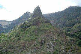
The staff says: Thanks to the exceptional climate, fruit trees from all
over the world thrive on their shores. Passion fruit, papaya,
pineapple, cherimoya, various nuts, and sugar cane are grown. Even
bananas are exported, but Madeira' most famous agricultural product is
the grape. The vineyards are plentiful and lush. Local wine is
excellent and the archipelago is famous for its special fortified
varieties. Funchal is the largest city on the largest island, but
Madeira has no shortage of beauty. Not only is the landscape exquisite,
the climate supports an amazing variety of plant life. Since everything
seems to grow, a hodgepodge of shrubs and flowers have been imported
from all over the world. Majestic mountains not only add a dramatic
touch to the countryside, they help regulate temperature. They are also
responsible for the existence of several microclimates that enable
various plant species to thrive. The island's tree species number in
the hundreds. Some are rare and originate from places as far flung as
China, Japan, or the Andes. Some are native only to the archipelago.
Another photo is attached.
(click image to enlarge)
Apr 15
We have changed course to go to Bermuda. One of the crew has
appendicitis and will be put ashore in Bermuda for medical care. The
Captain says he thinks he can make Fort Lauderdale same time as
scheduled I.e. 8 am Thurs April 20.
Apr 21
We arrived in the Villages after a 3 hour drive from Ft Lauderdale.
During the cruise we did not have one rain out of our 34 port stops.
When we arrived at our house we had to wait 20 minutes during a
downpour before we could enter our home.