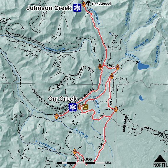
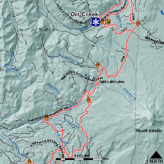
Johnson Creek
Packwood Winter Recreation Area -- (Cowlitz Valley Ranger District)
Road Access: Interstate 5 east on US Highway 12 to Forest Road 21, to
the Forest Road 21/2130 junction.
Elevation: 2,400 feet
Vehicle Parking Capacity: 10
Cross-Country Ski Trails: None
Snowmobile Trails: 21 miles of groomed snowmobile trails
Facilities: None
Remarks: 21 miles of groomed trails. Motorized vehicles are not allowed
in the adjacent Goat Rocks Wilderness. Violations may result in fines up
to $5,000 and/or six months in jail.
Current Conditions: 03 November 2003 - 1220 Hours: No snow information
available yet for the 2003/2004 season. We anticipate updates to begin
in mid-November, weather permitting.
Featured Trails: Road 21 Trail
Road 21 Trail
Volume Of Use: Medium
Length: Forest Road 21 to 2160/56 (2329/5603/56) through Orr Creek
Sno*Park return to 2160/21 to Johnson Creek Sno*Park. (approximately 50
miles round-trip).
Elevation: Low: 2,400 feet; High 4,440 feet
Maps: Packwood Lake, Hamilton Butte, and Green Mountain Quadrangles
Access: I-5 to U.S. Hwy. 12 to Forest Road 21 to Johnson Creek Sno-Park
Jct. 21/2130
Nearby Town: Packwood, Washington
TrailHead: Johnson Creek Sno*Park
Scenic Attractions: Groomed snowmobile trail consists of Forest Roads
21, 2160, 56, and part of Forest Road 2329. Connects with Randle and Mt.
Adams winter recreation areas. Ungroomed areas include Forest Road 2160
to Walupt Lake, Forest Road 2164 to the top sale area, Forest Road 2150
to 2152 to 2160.
Remarks: Motorized vehicles are not allowed in the adjacent Goat Rocks
Wilderness. Violations may result in fines up to $5,000 and/or six
months in jail.
Have no idea where you're going? Here are a couple of maps to help you!