prev |
Bega River Junction |
next |
Bega_River_Junction.jpg
prev |
Bega River Junction |
next |
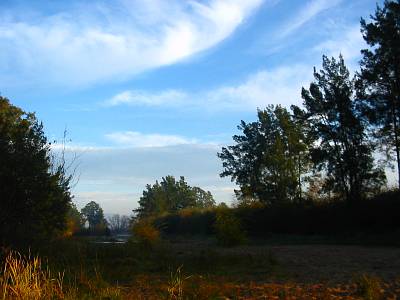
The town of Bega is built, not only beside the Bega River, but beside a huge aquifer occupying the river bed and surrounding flats, stretching from Kingswood to the coast along the river and nearly to the coast at Bournda along Penuca Swamp. The Bega aquifer has been test bored at 42 meters deep and I suppose it would be about 20 km long by a up to a couple of km wide. Once again the river is dry, the product of the drought and continious pumping by the irrigators along the river. In the sandy part of the river, from Kingswood downstream to the tidal limit on Jellat Jellat Flat, the irrigators are able to excavate the river bed to form pumping holes. This drops the water table in the aquifer several meters below the river bed level. However, the Brogo River is running because of the irrigation water being released from the Brogo Dam. This means that there is a small flow in the Bega River downstream from the junction, most of which will be pumped out before it reaches the tidal limit.