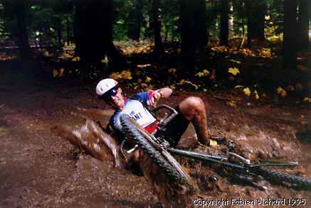
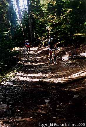
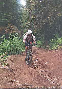
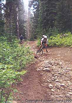
Nachess pass is extremely steep, deeply rutted, littered with loose boulders,
cut by innumerable tree roots, splattered with cow patties, and guaranteed to
challenge the most experienced rider. This entire area is so crosscut by
logging roads that the surviving trails have been designated for ORVs. However,
because the Forest Service lacks funds to upgrade thc area, the trails are
unimproved and cyclists will find only limited competition from the motorized
users.
| Trail Description: | Road (maintained), Trail well maintained |
| Best During: | July to mid-September |
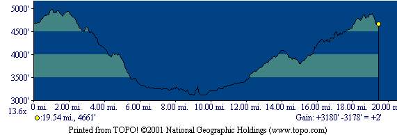
| Trip Distance: | 20 |
| Ride Time: | 3 to 5 hours |
| Overall Rating: | Skilled in good shape |
| Elevation Gain: | 3180 feet |
|
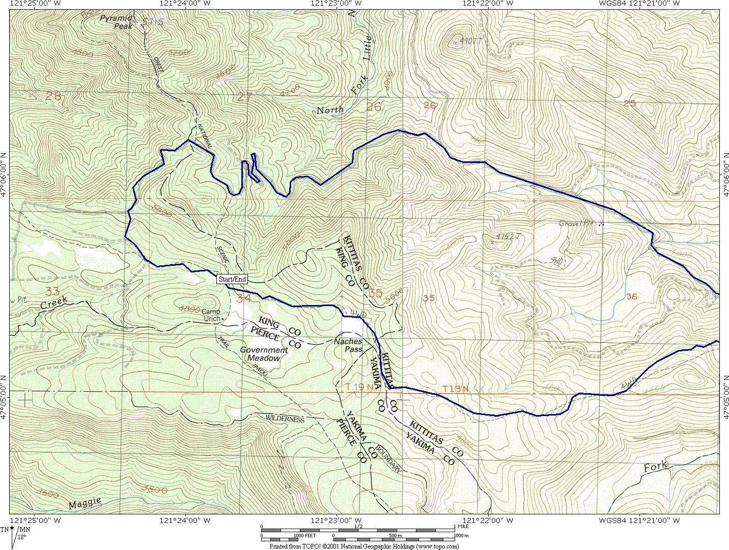
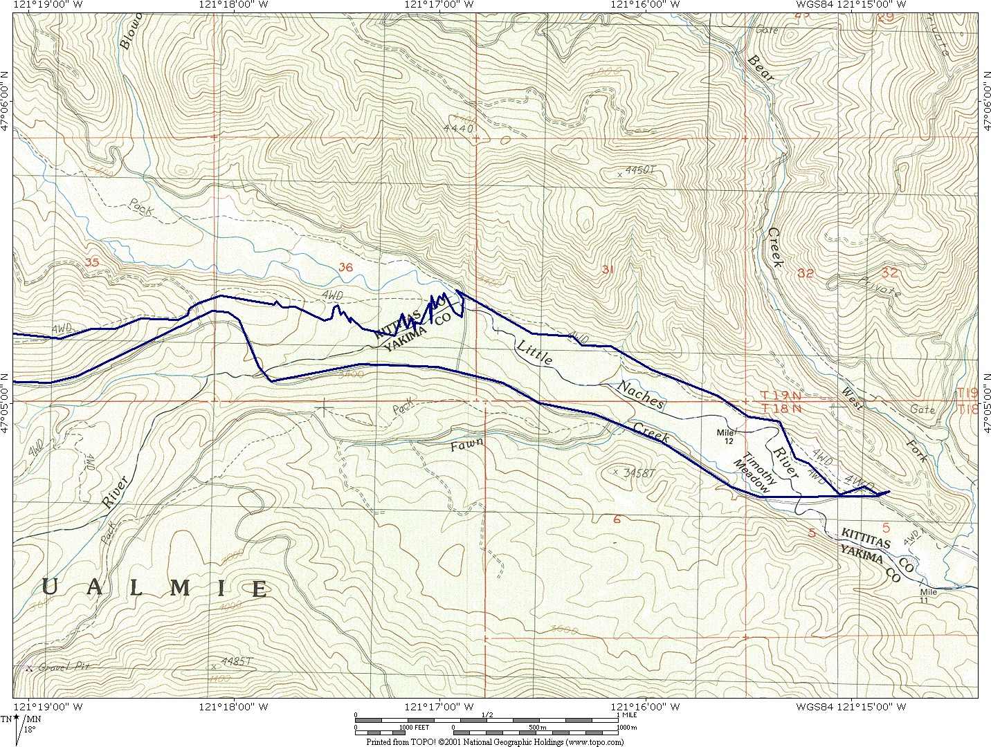
Drive east from Greenwater on Highway 410 for 2 miles. At the wooden overpass, turn left on Forest Road 70 and drive 15.9 miles to the end of the road at the base of Government Meadow. Only the last section of road is confusing. At 15.6 miles go left at an unmarked intersection, and at 15.8 miles go right at a second unmarked intersection. At 15.9 miles, the road ends in a pile of logs and the trail begins on your right (elevation 4,800 feet). You can try to to cross a river... Foolish me! Look at the serie. 1, 2, 3, 4, Here are the 3 maps ( 350k, 250k, 250k) the Topo!, MapSource. The route, and waypoints are zipped together. |
|
|
|
0.0 (4800ft) |
Take the jeep road up, choose the least muddy and go for it, they all go up in the same direction. |
|
0.5 |
Cross the pacific crest trail. To the south lies gouvernement medows. |
|
1.5 (5600ft) |
Reach Nachess Pass. The route heads down to the other side of the mountain. |
|
1.6 |
Cross a rough logging road. |
|
4.5 (4040ft) |
|
|
6.1 |
Cross another unmarked logging spur road. |
|
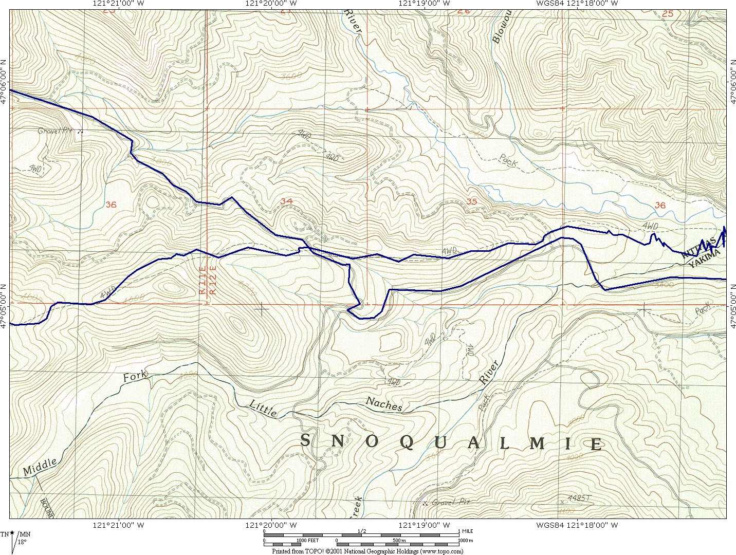
7.0 (3259ft) |
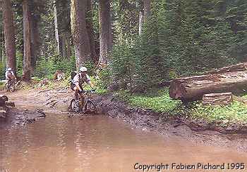
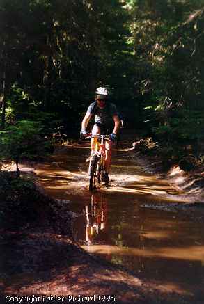
The Wagon Trail crosses the North Fork Naches River. Pioneers forded the river;
cyclists may do the same, or look around for a log or the concrete bridge on
Road 1913 just a few hundred feet downstream. Cycle through a small riverside
campsite, cross Road 1913, and then head on downriver past a giant mud wallow
created by 4-wheel-drives. |
|
8.8 (3200ft) |
Naches Wagon Trail ends at the paved Little Naches River Road No. 19 (3,200 feet). Turn right and ride up valley to the end of the pavement. The road has no shoulder, so use caution. |
|
13.0 (3876ft) |
|
|
13.6 (4040ft) |
Pass the point where the wagon trail crossed the road (mile 4.5). Shortly after that, the road descends for 1 mile. |
|
15.3 |
Pass a road gate (almost always open) dividing private land from Forest Service land. Shortly thereafter, stay left at an unsigned intersection. |
|
16.0 |
A major intersection with no signs; stay left. The road is level for nearly a mile and then begins a long, switchbacking climb to the west side of the mountains. Pass numerous spurs but stay on the most used road. |
|
18.5 (4601ft) |
A gate marks the top of the first pass. |
|
19.2 |
Second summit and view overlooking the start of ride. Steep motorcycle trails drop straight back to the start. If not up to that, continue on down the road. |
|
19.8 |
Road bisects the old wagon trail. Go left and follow the trail back to the start. |
|
20.4 (4800ft) |
Wagon trail runs into Road 70 just below parking area. |