
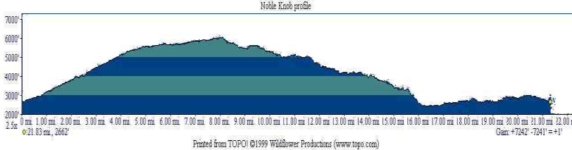
Noble Knob is steep, hard and guaranteed to challenge the most experienced
rider, it will take you 7.2 miles to reach the highest point at 6019ft.
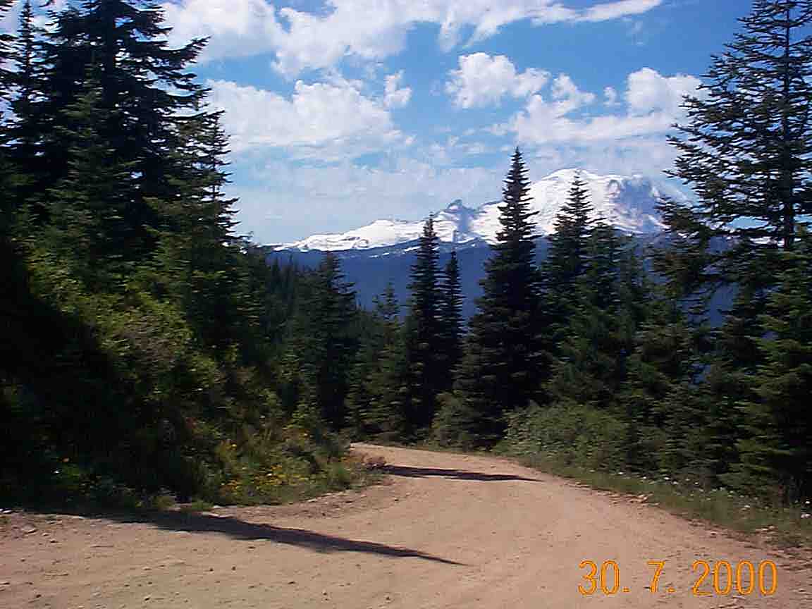
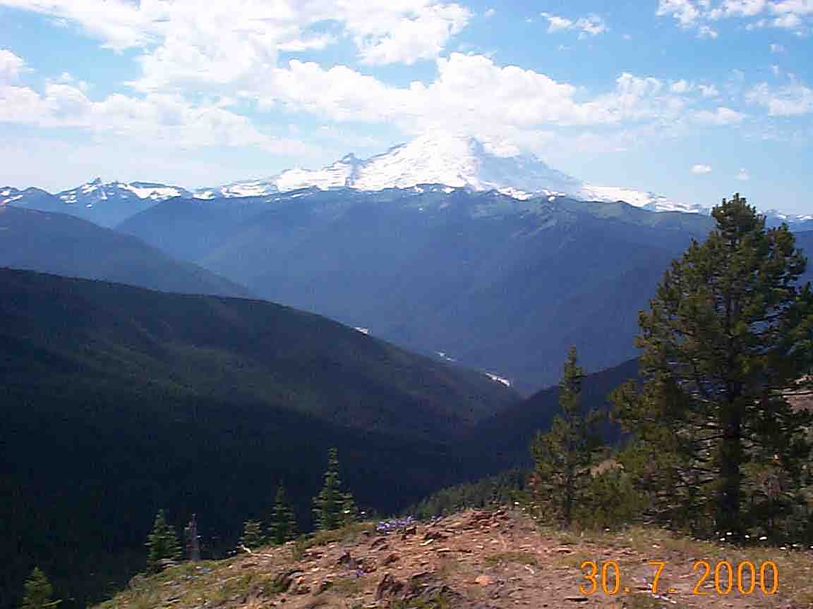
During the ride, you will have an incredible view of Mt. Rainer (Tahoma) and
the White river valley. I rate it 3 75oz CalmelBack on a hot day.
The Noble Nob ride as described in John Zilly's
Kissing the Trail. The trail is in superb shape and Zilly's description
of the ride is very accurate. It is the most aesthetic, exciting and exhausting
ride I've ever done! My quads AND my forearms were completely trashed at the
end of this ride. However, I recommend to leave the car DOWN and climb first.
Climbing at the end of the ride is hellish :)
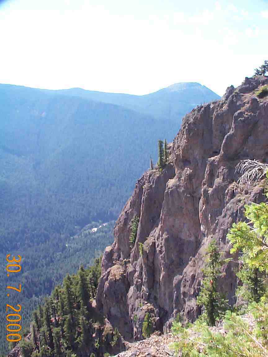
The only real problem with riding along the top of the Palisades is the view
may distract you. I never found myself close enough for the exposure to be an
issue. You could lose control and roll off the top, it almost happened to me.
Just be sure to stop and pull off the trail if you want to enjoy the view.
Finally, a couple of warnings, probably unnecessary. Don't ride this one alone
and don't try it in wet conditions.
| Trail Description: | Road (maintained), Trail well maintained |
| Best During: | July to mid-September |
| Trip Distance: | 22+ |
| Ride Time: | 4 to 7 hours |
| Overall Rating: | Expert, or Skilled in very good shape |
| Elevation Gain: | 7250 feet total. |
|
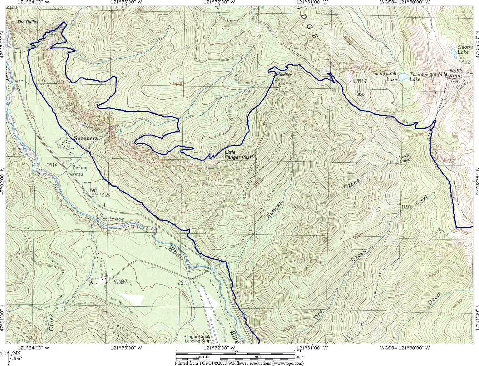
Drive east from Greenwater on Highway 410. After milepost 56, turn LEFT on dirt road #7174. Park in a convenient place where it does not black or bother anybody and get ready to rock & roll. The elevation is 2,922 feet). Here are the 2 maps ( 250k, 250k) Zip file (493k)) the Topo! route, and waypoints and the MAPsource waypoints |
|
The trail log has been formatted to fit on 1 letter size page. The width should fit in on a Cycoactive BarMap OTG.
|
| 0.0(2922ft) | Start climbing on road #7174. |
| 0.5(2880 ft) | Intersection, stay on the left and climb to Corral Pass |
| 0.75(2932ft) | Trial on the LEFT side, that's where you will be coming from, continue on the main road and climb :). There will be some nice views of Tahoma, enjoy them! |
| 5.6(5663ft) | At Corral pass, find the Noble knob #1184 trail on your left. |
| 5.75(5664ft) | Reach an intersection, stay on the LEFT side. From here you should be able to see Mt. Rainier on your left side. |
| 6.35(5710ft) | Reach a fork, stay left. |
| 7.55 (5858ft) | Stay RIGHT on Noble Knob trail #1184. Toward 28 Mile rd, Continue through the woods, traversing the Dalles Ridge. After several short & steep switchback reach an intersection. |
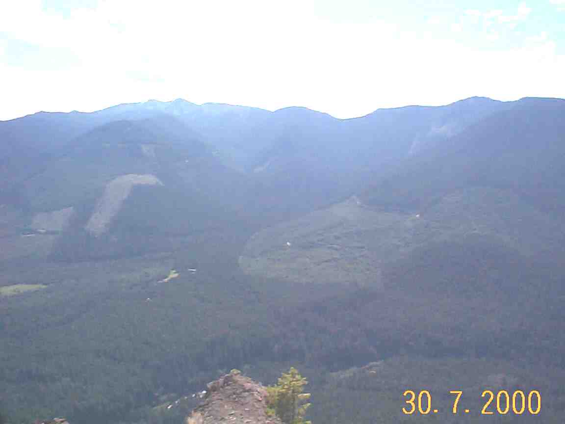
| 8.57 (5717ft) | See Noble Knob across the ridge. The Noble Knob trail divides right and enters the Nose Peak wilderness, instead TURN LEFT onto Dalles Ridge trail #1173 (even if it's allowed for horses, that make a lot more damage, to go in the wilderness, it's not allowed for mountain bikers to go in there). A small lake sits in a pocket below this intersection; in the distances the Olympics and Mount Baker are visible. |
| 9.75(5449ft) | Take the LEFT fork down the Ranger Creek trail #1197. |
| 10.75(5046ft) | Reach the shelter and a fork in the trail, take the RIGHT, Palisade trail #1198. From the shelter, ride along the less maintained trail and traverses the ridge above Little Ranger peak. For the next miles enjoy the amazing view points and downhills thourgh woods, often finding the edges of the cliffs that overlook the White River valley. This trail is rough and riding along the edges of the Palisades is dangerous for cyclist that suffer of vertigo. |
| 13.5(4178ft) | Cross a bridge over a small creek. |
| 15.8(3300ft) | The trail becomes too steep to ride, that's the Hikea-Bike Section... Walk your way down for about 1/2 mile, don't forget to take the stairs and if you ride the way down, DON'T SKID! |
| 16.40(2580ft) | Turn LEFT on White river trail, bypassing a junction at 16.7. |
| 17.20 | Reach the clearing of Camp Shepard |
| 17.3 | Continue STRAIGHT on the main trail, bypassing several spurs |
| 17.55(2586ft) | Continue STRAIGHT on #1199. |
| 17.9(2621ft) | Continue STRAIGHT on #1199. |
| 18.9(2600ft) | Ignore a spurs that goes down to HWY 410, continue STRAIGHT, up the hill reach a fork: The Ranger Creek trail cuts up to the left, Instead continue to on White river trail towards Corral Pass rd. |
| 20.5(2910ft) | The trail divides up at Deep Creek, take the LEFT fork upstream. |
| 20.7 | After a dismount, take the RIGHT fork and cross the bridge. |
| 21.9(2934ft) | Reach Corral Pass rd, turn right and back to your vehicle. |
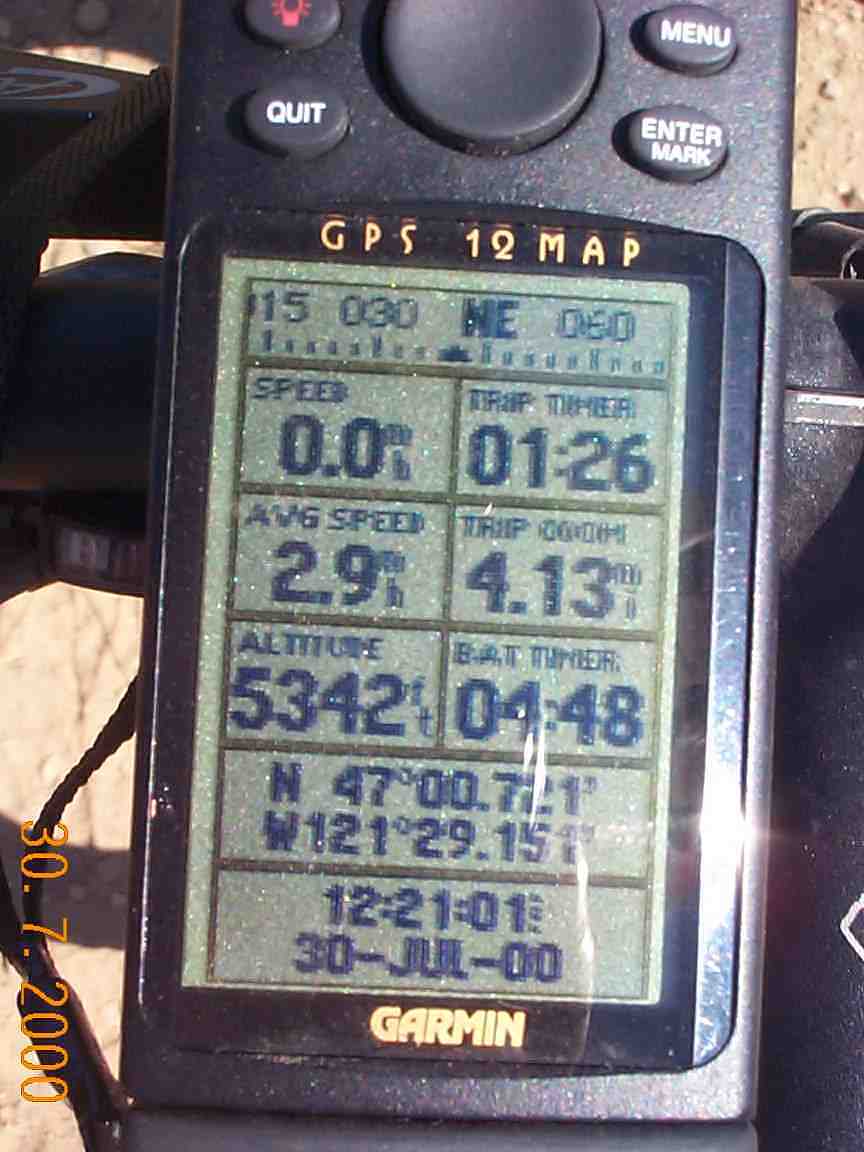
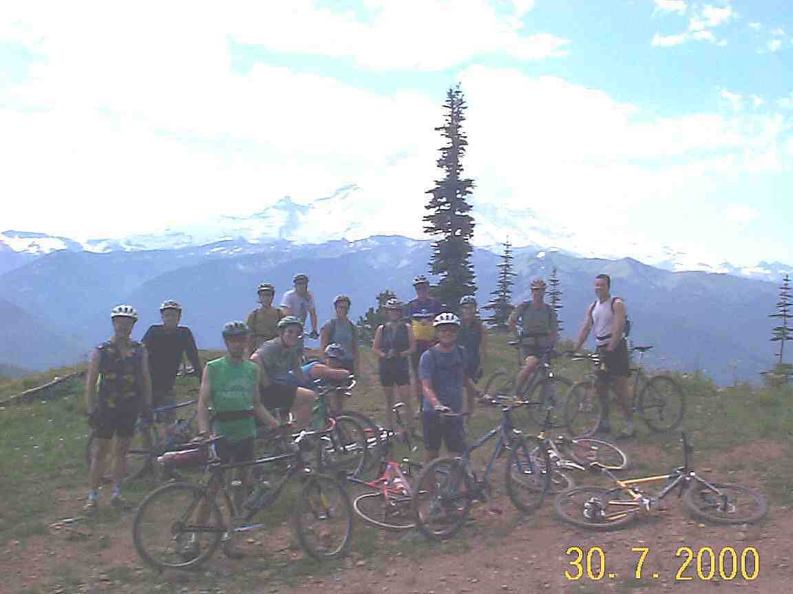
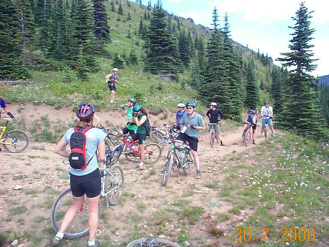
If you are interested, we did this ride with the BBTC
(moutain biking club from the Seattle area on 07/30/00.
Here are some pictures of the group,
again.
This ride is based on one of Kissing the trail, a book from John Zilly.
Back to Western Washington's trails.
Or back to the top.