|
Mike Read's Lewis & Clark Internet Resources
|
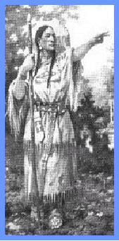
Sacajawea Revisited |
|
| Planned Lewis & Clark Western Trail Reconnaissance-July....2004 | ||
|
Lewis & Clark Section 4 Product #: BC-4004 (from adventurecycling.org):
The fourth section of the Lewis & Clark Bicycle Trail starts close to the Missouri River in Williston(ND) but then veers south of it for over half the map section between Fort Peck and Fort Benton. This part of Fort Peck Lake/Missouri River carries many additional designations: the Charles M. Russell National Wildlife Refuge, the Upper Missouri National Wild and Scenic River and, most recently, the Upper Missouri River Breaks National Monument. There are very few access roads down to the river on this map section. If you'd like a closer look, check with one of the many guides listed on the map that offers tours. Services are few and far between through eastern Montana; you will want to plan your days accordingly. The terrain continues to be rolling to hilly; by the section's end in Great Falls you'll be able to see the Front Range of the Rockies on the western horizon.
Lewis & Clark Section 5 Product #: BC-4005
Rich with historical locations, an option, an alternate and a spur, you can easily pedal more than the cover value of 479.5 miles if you choose Section 5 of the Lewis & Clark Bicycle Trail. At Three Forks, the Missouri River splits into the Gallatin, Madison and Jefferson rivers, and you will leave the Missouri for the final time. Just south of Dillon, there's a choice to remain on the main westbound route or take the Big Hole Option. The main route over Lehmi Pass includes 24.5 miles of gravel while the Big Hole Option is slightly shorter and is entirely paved. An additional Continental Divide crossing may be made via the 18-mile gravel Gibbon's Pass Alternate. From North Fork, Idaho, on the main route, you have the opportunity to ride along "The River of No Return,", on the 18.5-mile Shoup Spur. From North Fork, it is nearly a straight shot north to Lolo, Montana, the site of Travelers' Rest State Park. This is the site where Lewis and Clark stopped in each direction to rest and regroup for the next stages in their journey.
Product #: BC-4006
Section 6 of the Lewis & Clark Bicycle Trail can be broken into two segments based on the Corps multidirectional travels. Missoula, Montana to Clarkston, Washington, is a continuation of Lewis and Clark's 1804 travels westbound. The Blackfoot Option from Missoula, Montana, to Great Falls, Montana, follows the route Captian Lewis used eastbound in 1806. Both segments are described below. Main Route The main route follows the course of the Lochsa and Clearwater rivers and is fairly level after crossing Lolo Pass. The 145.3-mile Lolo Trail closely follows the approximate route the Corps of Descovery took through the Bitterroot Mountains. The rugged, mountainous terrain is on mostly one-lane, narrow, gravel/dirt roads. Services and water are scarce. Once you arrive in Kamiah, there are two options to Clarkston. The 68-mile River Option is more true to history but there are concerns on U.S. Highway 12 due to traffic volumes and nonexistent shoulders with concrete barriers. From the main route, you still get to make a choice on your way into Clarkston: either the seven-mile Lapwai Option on U.S. Highway 95 or the 22.5 mile Hell's Gate Option on smaller roads through Hell's Gate State Park. Blackfoot Option Missoula, Montana, to Great Falls, Montana. This option traces Captain Lewis' 1806 eastbound journey. It is mostly on two-lane highways that follow the Blackfoot and Sun rivers all the way to Great Falls. The Alice Creek Spur is 13 miles in length and you can ride/hike to the top of Lewis & Clark Pass. The Sierra Club has sponsored this section of the Lewis & Clark Bicycle Trail and major funding has been provided by REI.
|
||
|
<< Previous Next>> |
||
|
|
from Jim Damico...biking now May,2004 |
|