 |
 |
 |
 |
 |
 |
 |
 |
 |
 |
 |
 |
 |
| I headed back into Houma, taking one more picture. It was getting late and I just knew what I was looking for was not there. Surprisingly, it was. My old house was gone but I saw where it had been, now the middle urban unplanning. But the other thing was exactly as it was, who could have changed it? |
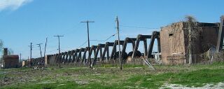
| The Houma Airport had been an Army Air Corp Field during World War II. It was a training base. I remember my father pointing out the trainers. He explained the structure above, also. I don't remember exactly, but it had to do with derigibles, aka, blimps. I think this is where the helium was stored or blimps teathered. Anyone know? I was an impressionable kid and this impressed me. Nothing's changed. |
| It was time to head home, but the party was not over. To heck with that New 90, I was following the romantic one as she coursed through the little towns and under the sheltering oaks. It is much better than looking at semis through rubber at me. |
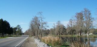
| A last look at Bayou Black Road as it heads up and northward. This is one of the few places without a house in the scene, almost. |
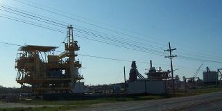
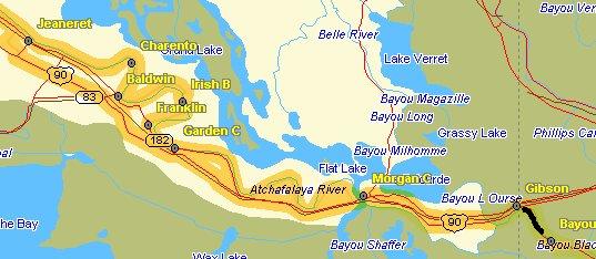
| Old 90 turns west and goes through Amelia on its way to Morgan City. The Intracoastal Waterway lies south, not far from the road. This area is all about the Oil Industry. The benefits and negatives can be debated. The Morgan City area has been about fishing and oil forever. Take the old road through here. See the old town. It is so neat. I'm coming back when I'm not so rushed. |
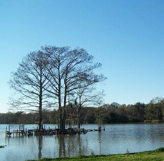
| I stopped and went with the late evening traffic though the quaint little towns of Patterson and Burwick. They will be part of the Morgan City article. They are old and have the old architecture to prove it. There I picked up Bayou Teche. Old 90 rides the Teche north. Below is the Teche (Indian for "snake") at her grandest, a far shade from the stream across the street from my house. |
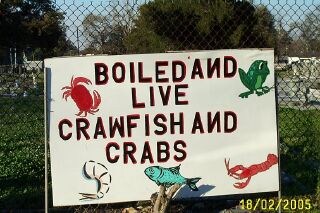
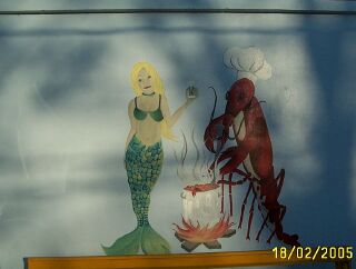
| In Franklin I saw this restaurant next to the graveyard. Notice the graves behind the sign. I liked the painting. Why would a crawfish be working for the enemy, ie., boiling crawfish? Oh, the mermaid. |
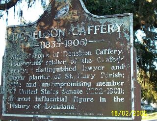
| I always shoot these Historical Markers. And, sometimes question them. This one was in pretty rough shape, so I'll read it to you. "?'s" mean I can't read it, not that I question what is written. "Donelson Caffery (1835-1906) Site of home of Donelson Caffery, a courageous soldier of the Confederacy, distinguished lawyer and sugar planter of St. Mary Parish; ? and uncompromising member of the United States Senate (1882-1901): ? most influential figure in the History of Louisiana." The marker can be seen off of 322 after it leaves La. 182 east of Franklin. A lot of stuff is hidden on these back roads. A great start to this "adventure game" would be to get a book on all the historical markers and then go find them. Then do a website. |
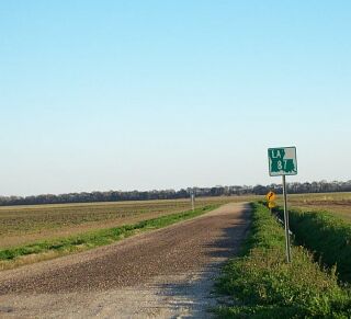
| I took Irish Bend Road out of Franklin as I wanted to check on Mr.Martin (90++) at his store. His car was parked in front of his house, but the store was closed. From Irish Bend I hopped the Teche and got on 87 at the point where it turns to gravel and then dirt/mud. I went west, the paved way, which follows the "snake" toward home on some of the most gorgeous stretches and best riding in South Louisiana. What a way to end the day. Hope you enjoyed the outing. More to come on a return to the Morgan City area. |
| Back Home |
| On to Garden City (Old 90) |
| On to Sugarcane Alley (Old 90) |
| Ever been to Burns? It hangs off Old 90 |