 |
 |
 |
 |
 |
 |
 |
 |
 |
 |
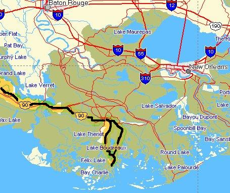
| Old US 90/now La.182 and the Houma/Cocodrie Ride |
| Wondering where I should go next, Henri from Amelia wrote and suggested a loop south of Houma, La. I'd lived in Houma in my early youth. I'd never been south of the town much. Actually, I remember two times. My mother picked up a hitchhiking Indian woman and took her home to Dulac. And, we had gone to eat down there at a place that hung out over the bayou. I remember kids rollerskating around the place.. It was where I first ate crabs (age 6). I decided the time was ripe for a trip South, way South. So South I didn't get all of the ride on the gps figuring there was nothing there to include, wrong. The map below is of the trip (in black). Notice that the highway sign right above Lake Theriot says "90". Wrong, that is Bayou Black Road and the number has been changed to La.182, something that has me steamed. |
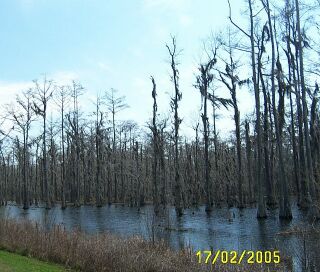
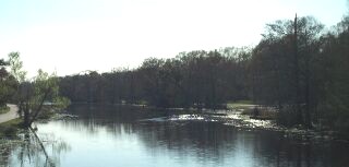
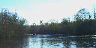
| In my articles about Louisiana, I try to emphasize that Louisiana is not all swamp and marsh. Where we are going is mostly that. The green is marsh and swamp. It always that way. The beige is "higher ground", sometimes. Here the bayous are very important.. The only high ground around is the natural levees of the bayous. With flooding, alluvial deposits were laid down and the levees built up. The water has built the land where the highways travel. The bayous meanders and so do our roads, making for excellent riding if you like "da curves". |
| I'm starting this ride on the eastern side of Morgan City. Morgan City is on the dividing line between the East Achafalaya Basin and West. The Atchafalaya River emties through Morgan City. Morgan City is very important to Louisiana and I'll go into that later. Descending the raised portion of US 90 leaving town, you enter the swamp. It is beautiful no matter the season. Come see the Cypress Trees bloom soon, they are flouresant. The new four-laned 90 should be called something else and soon will be, I-49. It is not deserving the rich heritage with which the true US 90 is endowed. The new road does not run throught the beautiful old towns and villages. It does not follow Bayou Teche. It is the fast way to New Orleans. I got of New 90 at Gibson. There I took Old 90, now numbered 182 south. |
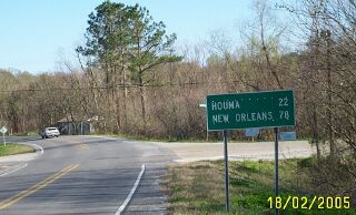
| Turning South, the sign gives you the numbers if you plan to go to New Orleans this way. Don't. This road, Bayou Black Rd., is for visiting Houma and points South, only. For New Orleans stay on the elevated road (New 90) across the swamp which is so much better than taking I-10 (50 miles north). Locals agree. I-10 is a killer. |
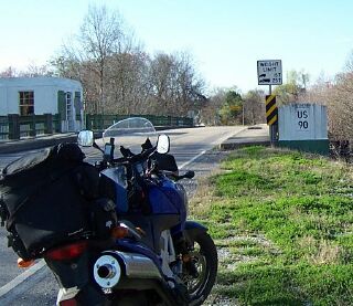
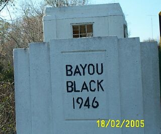
| Above is the Bayou Black draw bridge, a swinger, no longer swinging. See, it says "90". It marks the historical gateway to this part of Louisiana. At least my history. |
| Why is it called Bayou Black? |
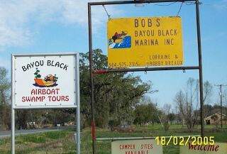
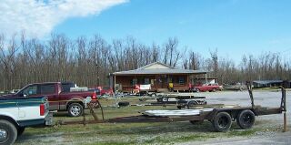
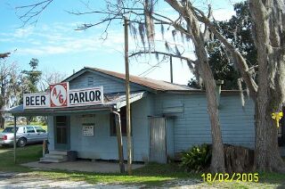
| Bob's caters to the locals, it is not a tourist trap, it is an authenic landing/suppy headqurarters for those headed into the swamp and Bayou Cocodrie. Yes it's another Bayou Cocodrie (meaning "crocodile"). |
| For the Proper Beer Drinker |
| It is further down the road in the Humphrey's area, I think. I almost fell off the bike laughing. |
| Now some of the sights. |