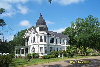
I headed up La.25 (Causeway Blvd. coming out of N.O.), went through Folsom and turned northwest on La.450. 450 is a newly blacktopped road heading exactly where you want it to go, to Mississippi. Between La.25 and La.10 it is a straight, tree formed tunnel increasing in altitude and rolling hills passing through beautiful horse raising country. At La.10, the fun begins. The road continues to rise, rock and roll. It does this until its climax at State Line Road. At the stop sign take a right (east) and then in a mile or so take a left (north) on Shady Grove Road. At the next stop sign take a left on Smith Alford Road. Then north on Progress School Rd. Don't think this whole thing is going to be left-right-straight, soon it'll smooth out.Then straight onto Magnolia-Progress Road hiting MS.48 into Magnolia, see that was easy. You were in Osyka-Chatawa-Progress country. Remember that from the Ridin' the Line article? If you need to refresh your memory do now or you won't understand the countryside because all I shot of it this time was a steak house on Sunday morning. It was at the corner of Magnolia-Progress and Dudley Rimes Road. That may come in handy one day, so jot it down. I followed MS.48 into Magnolia and rode south in front of the Courthouse and then west and saw the Victorian. What regal architecture they are. They remind me of the old Queen. (the 1800's English one, so no wise cracks)
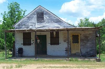
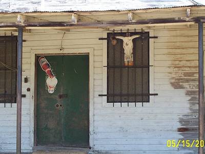
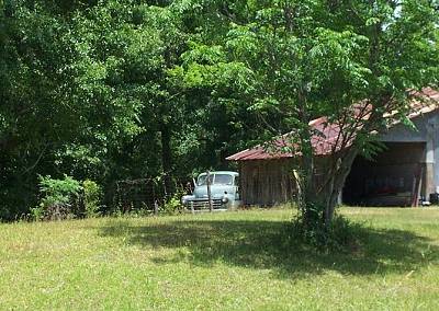
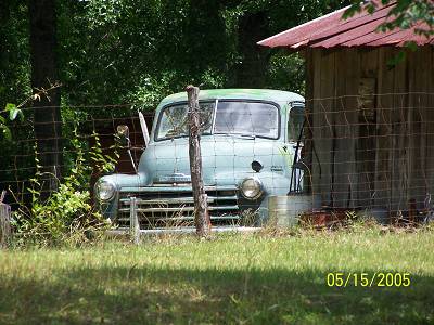
The pictures to the right are "down the road". Don't know which one. But one of them you'll be on. This guy had more interesting stuff on his property. My guess is he had a bar at one time, what do you think? Then I spied the Chevrolet truck. It was in great condition. The close up was taken with my far away lens so I can't tell you anymore about it. Besides, I want it. What a great yard car.
I left Magnolia (my dog's name) on MS. 48, going by Percy Quin State Park. Percy Quin is really pretty. It has cabins for rent so it could be a base camp for this ride. I went in and tried to get a Mississippi map as I had left mine on the table, duh. They had no map, can you imagine? The gps was also tuned for east of 51 so soon I would be flying blind. The gps would at least be as good as compass until I found a map.
Where 48 meets 24, I continued straight on Magnolia Pisgah Rd., riding it until I got to Ms.570 where I went west on that road for about a mile and a half until I reached Country Line Road turning north on it. I was following my nose This was a hoot.
It dead ends at US 98 which is a two laned shaded road here, not the big four laned monster it becomes.. It was climbing. I stayed on it until reaching Jackson Libery Drive and headed north and rode a long way on it until it deadended at Ms.550. I took 550 east down the hill into Brookhaven and stopped at a gas station to top off and get a map. I talked with the nice lady there who reminded me of how lucky I was to be able to do this sort of thing. She was stuck behind a counter and I was flying free. It was a reflective moment. Moments over, let's ride.
Leaving the gas station I headed north on old US 51 (the souce of a new article at some time). It went northeast, I went northwest on New Sight Dr. It dead ended at Mount Zion where I went west until I met Lott Smith going north. This was an important moment of the trip. I crossed the beginnings of Bayou Pierre. Bayou Pierre travels as I will, to Port Gibson. It is a very important stream in Mississippi and US history. I didn't know it when I crossed it because the gps was not programmed to tell me. It was a lost moment but meaningful non the less. Moment's over, let's ride.
Rode Lott up to Sylvarena Road where I went west. Up. Hit 28 and went northeast a little bit until I hit Barlow Rd. going west and Up.
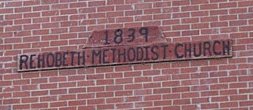
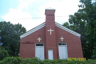
I came to the Barlow community. It was about 12:30. The church goers were having a "social" by the side of the historic Church. I wanted to photograph the folks but decided to not since two big old linebacker looking fellas were not smiling at me. So I just took the church, built 1839. Rehobeth Methodist Church. Dr. Fagan, MSMT, says that if it was a Baptist church, the "social" would be referred to as a "dinner-on-the-grounds" since "social" is not used due to its liberal con- notation.
Now the above is just an "in fun" assumption, so no hate mail please. The scene was one out of "Long Hot Summer", the movie, for those who remember that far back. Geez and I'm one who does. In fact, part of the movie was filmed in Clinton, La. and my aunt and counsins had a part in it, minor as those were. Very minor, Letisha.
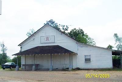
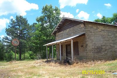
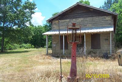
I had seen the old gas station coming into town, so I doubled back to take a closer look, oh yea, the building was old. The pump was old and that 76 sign was old.
I had also seen a school bus down the embankment of the road. As you can see it had been given a psycodelic paint over of sorts. Now I felt old. Had I found the Strawberry Alarm Clock's Incense and Peppermint tour bus, having come to its final rest? Picture on lower right of this page. |