 |
 |
 |
 |
 |
 |
 |
| Wiggins McDonalds.
S.McGregregor to Clubhouse (my first scare) Crossing Flint Creek the creek is down stream from Flink Creek Water Park Big Four Rd Oil Well Rd. Oil Well Rd U turned to Bluff Cr. Rd Fairly Bridge Rd. Benndale Rd (picture of house ) Crossed Black Cr. Deep Creek (picture) Turned on Jim Jam Rd. still going east Jim Jam hit MS 57 go north. 57 north to Merrill -Salem Rd. Crossed Pascagoula River right below Confluence of Leaf River and Chickasawhay (big bridge pics) entered Merrill Passed Merrill Crossroads Rd. (It called me, later) Illinois Central RR , (that was the train bridge picture) Merrill Rd North on US 98 to MS 57 East North on Neely Rd, A Fagan quote reguarding Neely,"not much and still not much. Crossed Old Ms.24 Post Office Rd. (Neely-Avera Neely Rd (north) West on Pleasant Hill Rd. (west Hintonville Rd. South on Wingate Rd west on Calvary Ch. Road North on Pat Hinton Rd. South on Old Augusta Rd. Crossed Bogue Homo River North on Buck Creek East on Henry James North on MS 29 Picture on 29 after bridge. Right on Thomas Creek Rd. North on Corinth Church Rd. Changes to Old Richton Rd when it crosses MS 42. North on Macedonia Rd. Merge into Augusta Rd. West on Ovett Union-Moselle rd. Hit US 11 North. Ray stopped and quizzed 2 locals about the where abouts of a restaurant. I noticed an aire of panic. He was lost off his planned route and needed a refueling. Moselle Seminary Rd West to Monroe Rd South Sanford Rd. Guthrie Carter Rd North Louie Bullock Rd West David Ingram Bethal Ch. Old Hwy 49 South to Grass Locke Rd . to Ms 598 west took picture oo4. Union Ch. Rd. West Marson Trigg Rd. MS. 589 south through Sumrall South on Oloh Rd. was singing. to Purvis Oloh Rd. Bay Cr. Road to Purvis Columbia West to Tatum Salt Dome Rd. (sounds interesting) MS 13 East to Bilbo, sand sand sand Baxterville Rd Spring Hill Rd. (thankfully) Into Poplarville. |
| Wiggins McDonalds.
S.McGregregor to Clubhouse (my first scare) Crossing Flint Creek the creek is down stream from Flink Creek Water Park Big Four Rd Oil Well Rd. Oil Well Rd U turned to Bluff Cr. Rd Fairly Bridge Rd. Benndale Rd (picture of house ) Crossed Black Cr. Deep Creek (picture) Turned on Jim Jam Rd. still going east Jim Jam hit MS 57 go north. 57 north to Merrill -Salem Rd. Crossed Pascagoula River right below confluence of Leaf River and Chickasawhay (big bridge pics) entered Merrill Passed Merrill Crossroads Rd. (It called me, later) Illinois Central RR , (that was the train bridge picture) Merrill Rd |
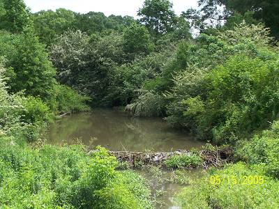
| Here's a picture of Deep Creek taken early on in the ride. I think that's a beaver dam down there, definitely making Deep Creek deeper. |
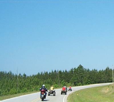
| It never fails, all rides include meeting off road vehicles piloted by juvenille delinquents. This was a week day, why weren't these kids in school? Here you see Ray trying to keep up. They finally let the old man pass, well, two old men. I'll put this one away for future use. |
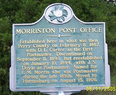
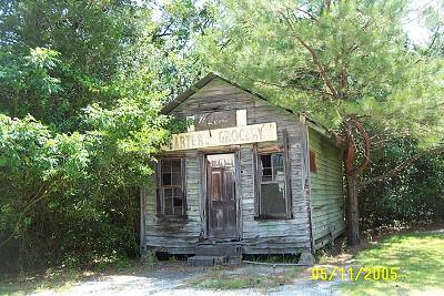
| You know I take pictures of all these things They are interesting. I have a complete list of MS historical markers back on Mississippi's Home Page. I forgot about that. I will check this one off. Notice D. L. Carter was the first Postmaster. I wonder if the PO was out of Carter's Store, seen below. I'm not clear, did F.M.Morris move to Hattisburg or did the Post Office which would then make it the Hattisburg Post Office not the MPO. Sometimes history is confusing. Actually, most times. |
| Pretty good theory even if they are counties apart. But maybe they aren't counties apart. I don't know. Wouldn't that be something? I have no idea about the progession of thes pictures. |
| Carter's Store |
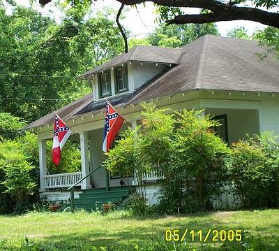
| I thought at first the flags were alike. I went back and saw they were different. One I believe is the State of Mississippi Flag and the other one of the National Flags of the Confederacy. |
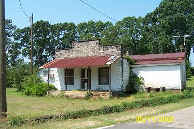
| The next two pictures are of local stores along our route. They were the centers of rural society along with the churches. That's why you see a lot of churches and stores on these pages. They are the points of interest along with the roads and bridges that joined them. I should just change the name of this site to "Stores, Chuches, Roads and Bridges". |
| I stopped and shot this picture. Ray didn't. Ray asked what it was. I told him a jail. Well it had bars on the windows. That use to mean it was a jail. Not anymore. |