 |
 |
 |
 |
 |
 |
 |
 |
 |
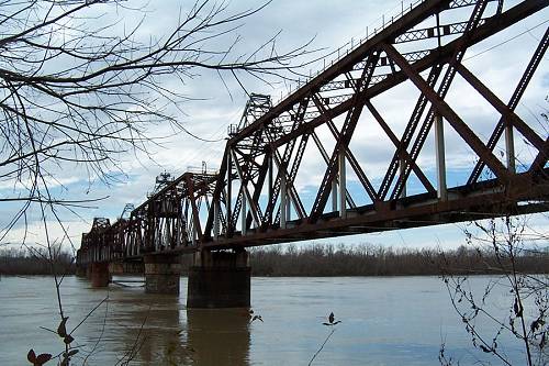
| This time our entry into Pointe Coupee Parish will be on US.190 coming from Port Barre and Opelousas. Back in January of 2003 I made this trip in preparation for the old article catching the bridge in an odd condition. US.190 crosses the Atchafalaya on twin spans. Originally, there was just one bridge named after Governor O.K. Allen. I believe he was a henchman of Huey P. Long. I haven't seen that name on the bridge since the new one was added. |
| Pointe Coupee: Crossing Over at Krotz Springs |
| Are you noticing that the chapters are taking on a pattern. Yes, another train bridge is pictured here crossing the river. It will not be the last one in this series. I know that will keep you following along. |
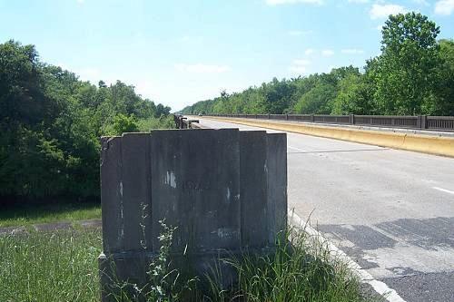
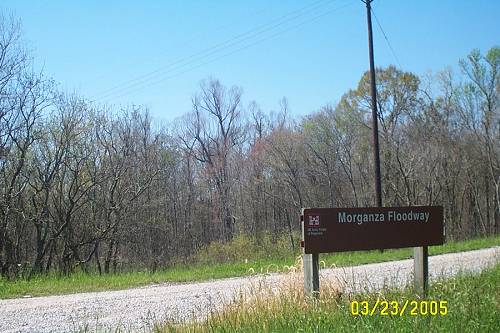
| I crossed over from Krotz Spirngs and decided to check something out since I wasn't in a hurry. No, just curious. I have seen on the GPS that a parallel road follows the elevated cement bridge across the Morganza Spillway. I've always used the elevated one not knowing about its predecessor. The mystery road is labeled as "Old US.90. I like old and would have much rather have ridden on it than that scary bridge. The bridge is about 6 miles long with narrow lanes and no shoulder. When you're on it, you're on it, with semi-trucks, many carrying logs which are shedding their bark at 75 mph. Make sure you have sealed eye protection. I found where Old 190 took off. Looks great. It had one problem and I'm getting tired of it: It's been snatched. |
| So I did the 6 miles of bridge across the Morganza Spillway, previously mentioned and viewed from the levee top, remember? I looked off the side and could see the old road down there close to Nature and the Swamp. |
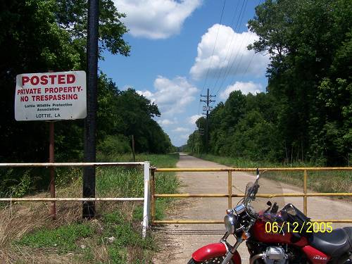
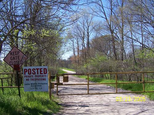
| I decided to see if the other end of Old US.190 was open. Look down there. It's a national historical treasure surely more meaningful than that old route 66 thing. That's a concrete road still in great condition after decades of probably being flooded a bunch. They are hiding it so we won't see it and be further annoyed by the inability of our representatives to build a road or bridge that last for more than 3 years. I just had to show you another possible conspiracy. Or Maybe: " Lottie Wildlife Protective Association", my foot. Huntin' Club I'll bet. Protecting the wildlife for their freezers. And, using our road. I'm through. Point is: When you see that road you can't ride on it. Take the bridge pictured above and be careful. |
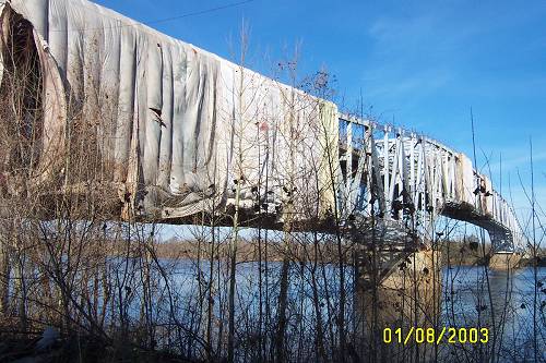
| The govenor covered the bridge after hearing it was constructed of "cold steel", Being January she felt sorry for it. Urg, that was weak. I saw a "Mummy Bridge". A cold "Mummy Bridge". Weaker. |
| Now you know that's awesome. It opens for river traffic. I've seen it. If you're not in a hurry you could hang out. Just take the exit marked Sherburne as you descend the US. 190 bridge. |
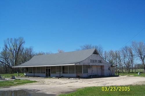
| Approaching Lottie on 190 you'll see this deserted old building with the name "Country Store" on it. That was its last reincarnation. It began life as one of the "Stuckeys" tourist traps that lined the highways of America. Its presence here reaffirms 190's importance in history. |
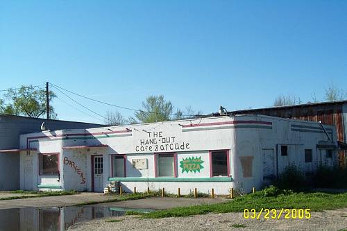
| "The Hang-Out was not the first use of this building. I'd say it may have been a "service station" or truck stop. The architecture I'd call "art deco". |
| This was a full service gasoline station. The beer trade wasn't enough to keep her going. It had clean restrooms, free air and water, tires and a lift. Need a grease job? Fan belt change? A map? Directions in English? |
| Lottie is not a ghost town. People live here and there is some neat stuff which we'll get to when we explore Pointe Coupee south of US 190. |
| We are headed north right here at La.81. |