![]() able below shows basic information needed for ground water vulnerability assessment and mapping. This is the most comprehensive list; not all information can be easily collected nor entered into a Ground Water Information System (GWIS). The table serves as a reminder for data collection and data base design. Table is modified from the Guidebook on Mapping Groundwater Vulnerability. IAH, 1994.
able below shows basic information needed for ground water vulnerability assessment and mapping. This is the most comprehensive list; not all information can be easily collected nor entered into a Ground Water Information System (GWIS). The table serves as a reminder for data collection and data base design. Table is modified from the Guidebook on Mapping Groundwater Vulnerability. IAH, 1994.
| �Elevation, slope variability of land surface; surface runoff paths, stream network density. | |
| �Land use, subsurface water pathways, recharge and discharge areas, fracture traces and lineaments, contaminant potential. | |
| �Long records of precipitation, average temperature, humidity, solar radiation, evaporation, evapotranspiration; effective precipitation assessment. | |
| �Thickness, structure, texture, mineralogy, chemical and physical properties, porosity, permeability, moisture, infiltration capacity. | |
| �Streamflow discharge, hydrograph analysis, baseflow, flow ratio, water exchanges with underlying ground water systems. | |
| �Depth to water; thickness, lithostratigraphy, mineralogy, geometry, fracture index, karst index, effective porosity, and saturation ratio of surficial deposits; vertical effective permeability, effective flow velocity, infiltration rate index, net recharge. | |
| �Lithostratigraphy, geological structure, geometry, effective porosity, permeability type (primary or secondary), transmissivity, storativity, and hydraulic conductivity of an aquifer; aquifer type (unconfined, semiconfined, confined); water level fluctuations, hydraulic gradient, flow directions, effective flow velocity and discharge, ground water divides, exchanges with surface water bodies or/and adjacent aquifers. | |
| �Water-discharge points (spring, wells) and location of ground water extraction works; surface and ground water sources, distribution, and usage; yield and drawdown of pumping/dewatering plants, location and inflow rate of recharge systems. | |
| Physical and chemical properties of surface and ground water, chemical markers, isotope content, age and residence time of water, characteristic ratios; natural surface and ground water quality distribution. | |
| �Changes in water quality; contaminants present and their physical and chemical characteristics, concentration, half-life, persistence, mobility, dispersivity, cation exchange capacity, biodegradability, etc. | |
| �Extent of urban areas, location and type of industrial complexes, existing and potential contamination sources, potential contamination entries, main objects of protection. |
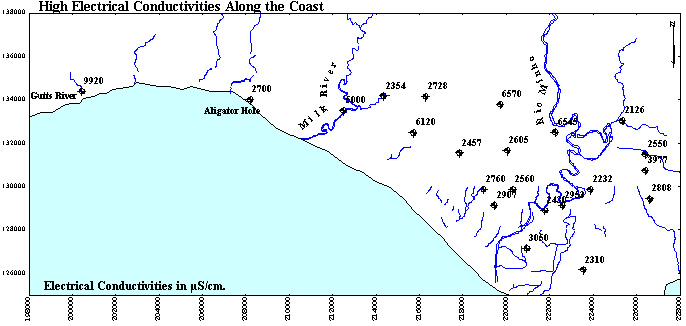
![]() oastal belt.
oastal belt.
The quality of ground water near the coast is not good. Electrical conductivities above 3000 microS/cm result from (a) tidal effects, (b) high abstraction in the past along the coast and/or several kilometres inland. One map shows the sites with increased electrical conductivities:
To fight back the sea water intrusion, one would have to cut back on abstraction - a highly unpopular and difficult to implement measure. Higher, "historic" ground water levels could be restored only by reducing the pumping from many kilometres back inland. The "protective" steps should be taken from the highway May Pen - Mandeville all the way down to the coast.
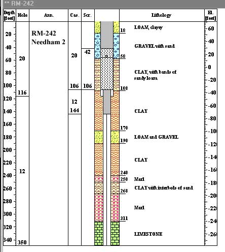
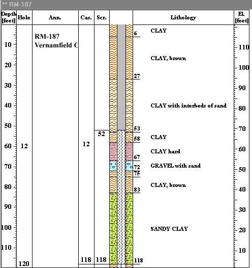
![]() mproper Well Construction.
mproper Well Construction.
Many wells drilled in alluvium have been completed by improper placing of well screens. In some wells the screen has been set opposite clayey materials rather than permeable sand and gravel. Examples are:
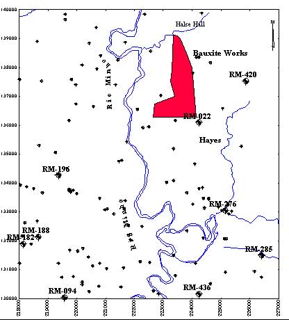
![]() ells Near Rio Minho
ells Near Rio Minho
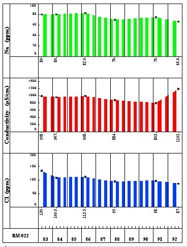
![]() ndustrial Waste Ponds
ndustrial Waste Ponds
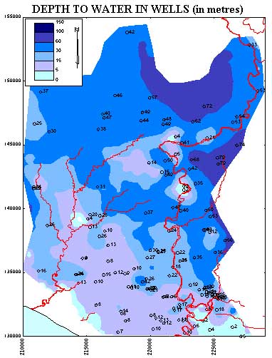
Depth to water in wells shows the following:
![]() oil Cover
oil Cover
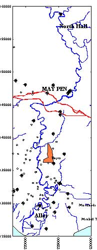
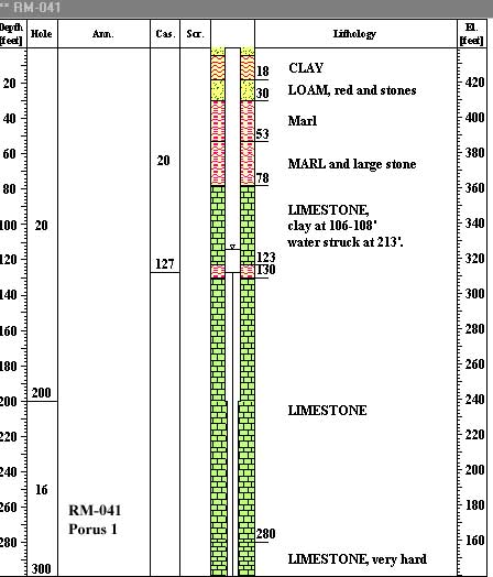
Soil cover, soil texture, permeability and storage capacity are important parameters in a study of vulnerability of aquifers. The limestone aquifer in the Rio Minho Basin is particularly vulnerable, considering poor filtration capacity of limestones and their karstic nature.
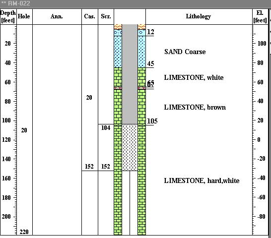
A map is prepared for a limestone area between May Pen and Mandeville showing thickness, in feet, of more or less impermeable soil overlying permeable limestone. One may select one of 27 wells to display their lithological logs and check the thickness and characteristics of soil.