|
| |
You may see lithological logs from individual wells by either clicking on the first line (Lithological and Construction Logs) or on the third line (Lithological logs of wells in karstified and/or fractured limestone aquifer). The latter option presents wells in which karstification process has been described by either loss of circulation (of drilling fluid) or by presence of fractures and cavities. A map will also be displayed showing the location and distribution of wells drilled through karstic limestone.
You may also select one of the following wells to display directly (without the help of a map) their lithological logs.
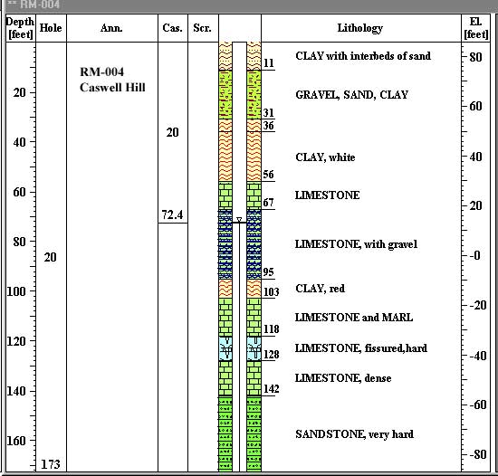
| RM-004 |
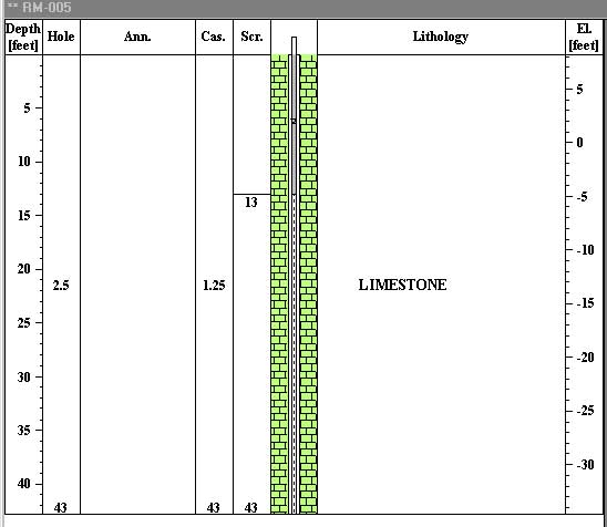
RM-005 |
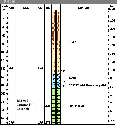
RM-010 |
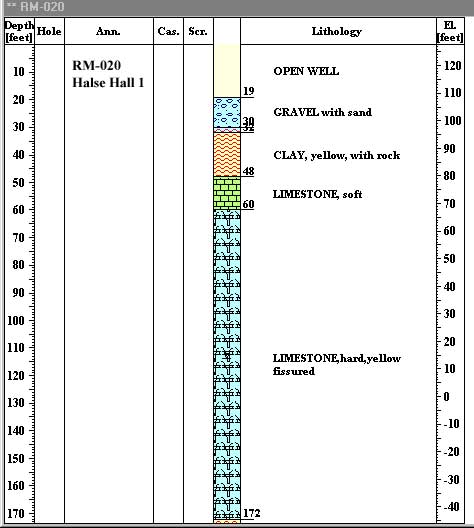
RM-020 |
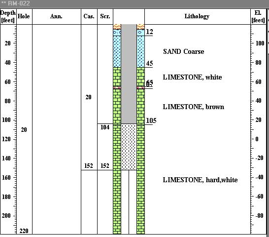
RM-022 |
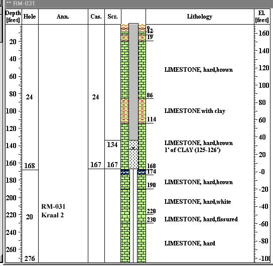
RM-031 |
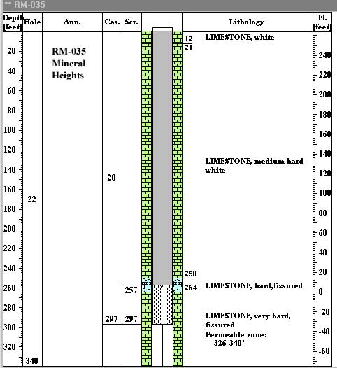
| RM-035 |
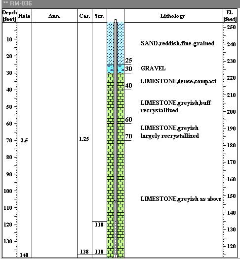
RM-036 |
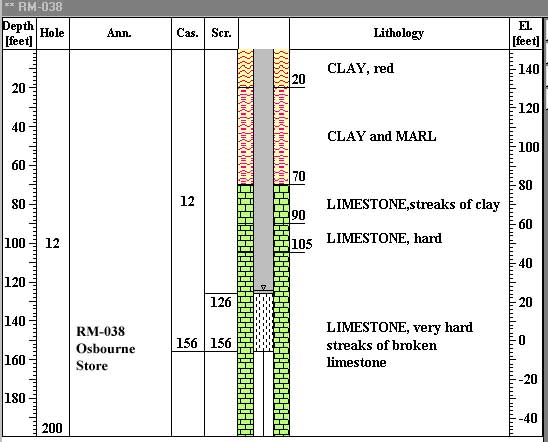
RM-038 |
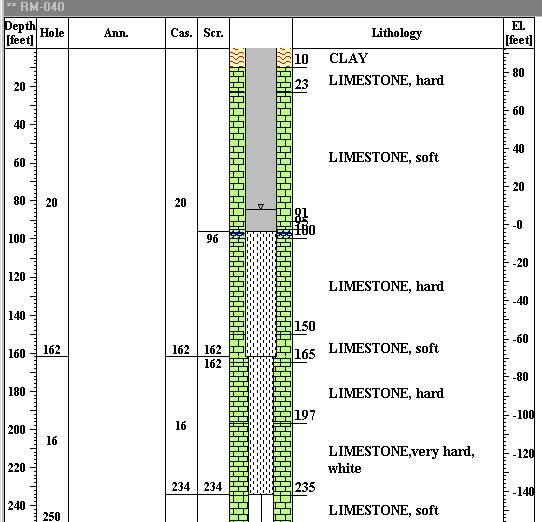
RM-040 |
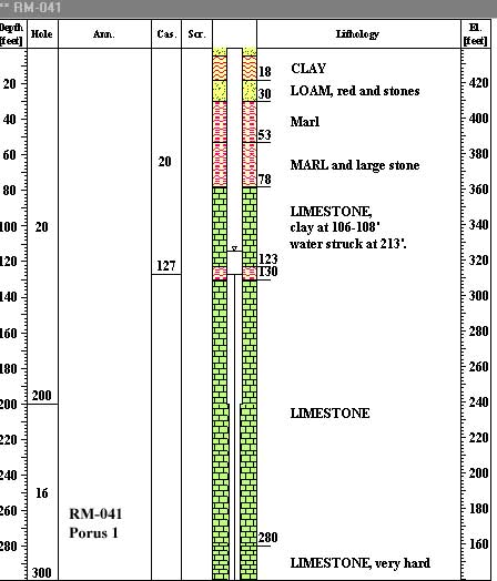
RM-041 |
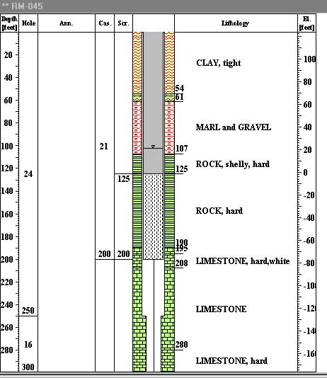
RM-045 |
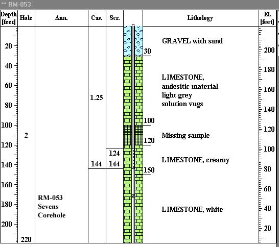
| RM-053 |
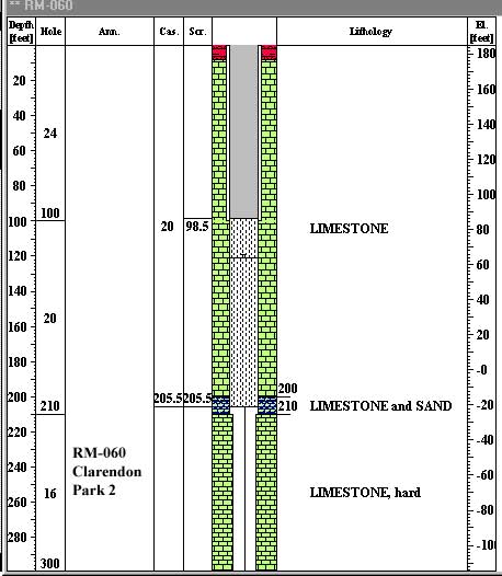
RM-060 |
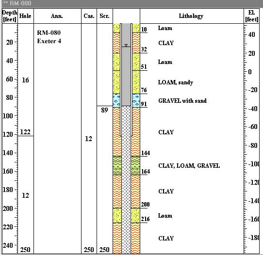
RM-080 |
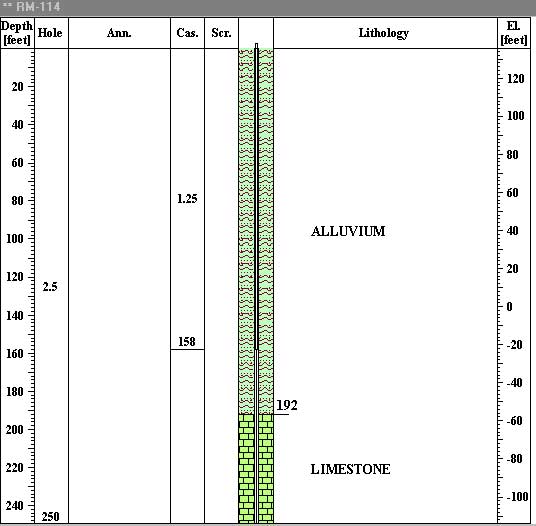
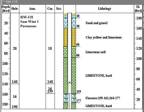
RM-114| RM-118 |
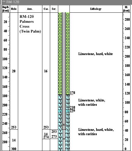
RM-120 | |
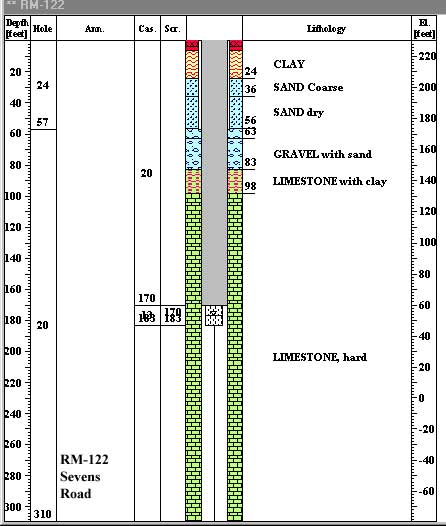
| RM-122 |
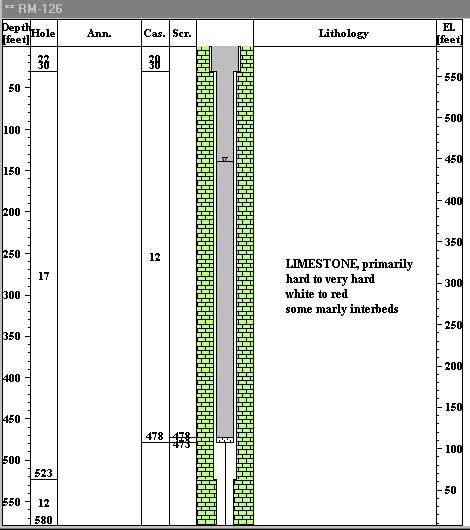
RM-126 |
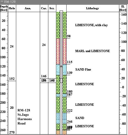
RM-128 |
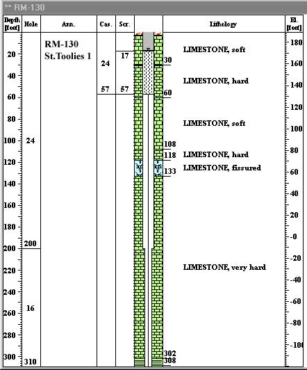
RM-130 |
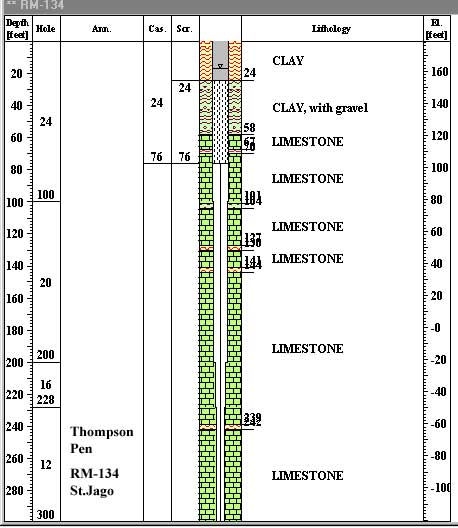
RM-134 |
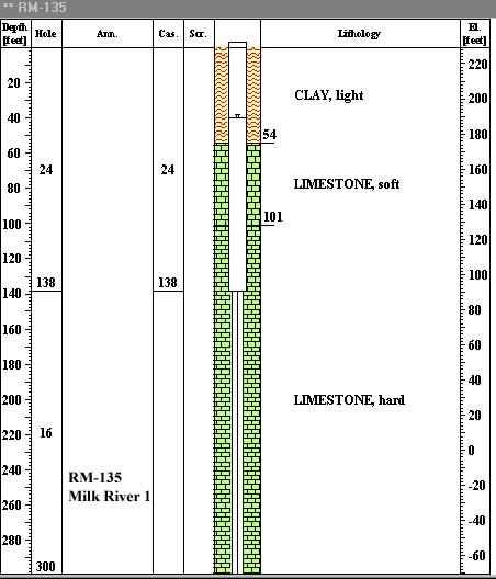
RM-135 |
| RM-136 |
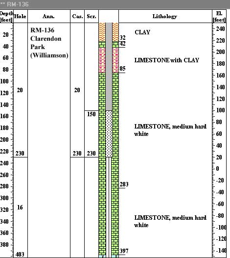
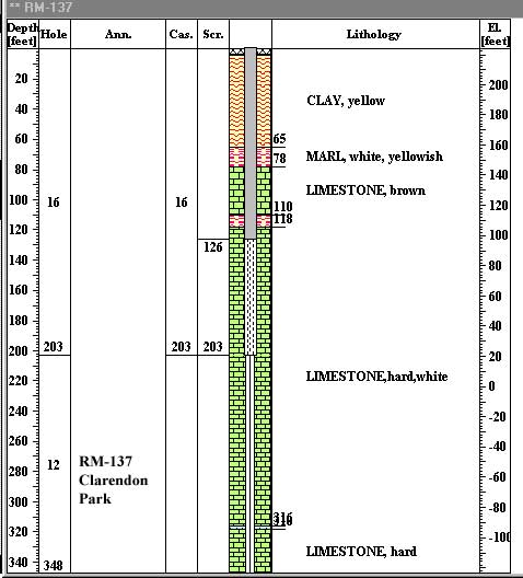
RM-137 |
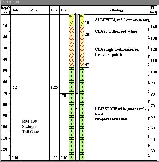
RM-139 |
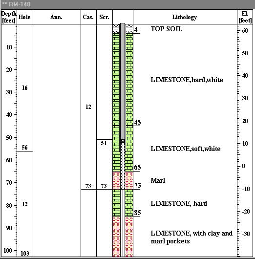
RM-140 |
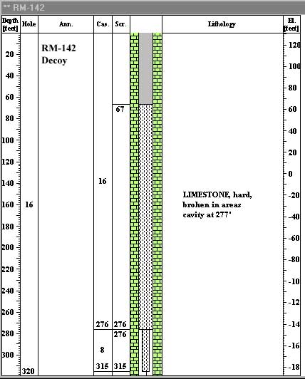
RM-142 |
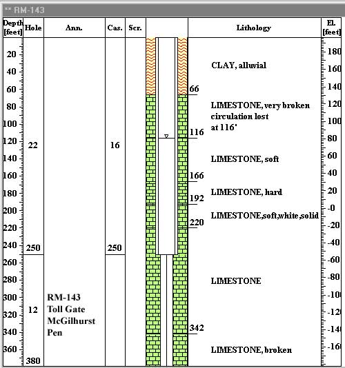
RM-143 |
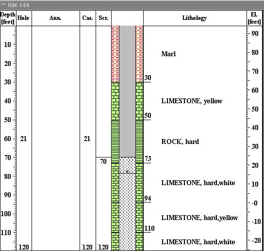
| RM-144 |
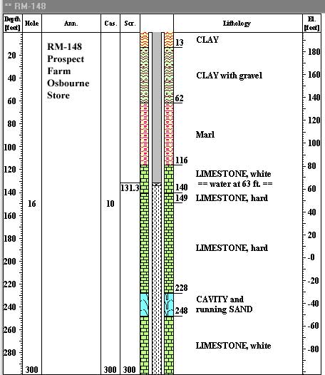
RM-148 |
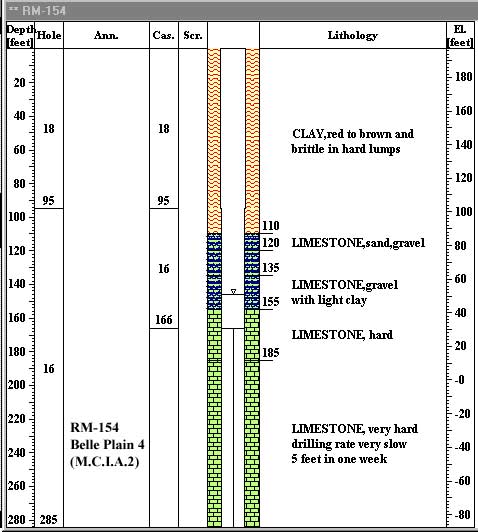
RM-154 |
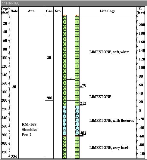
RM-168 |
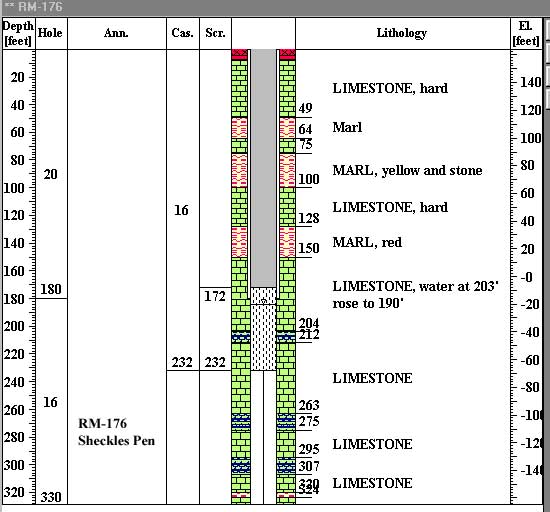
RM-176 |
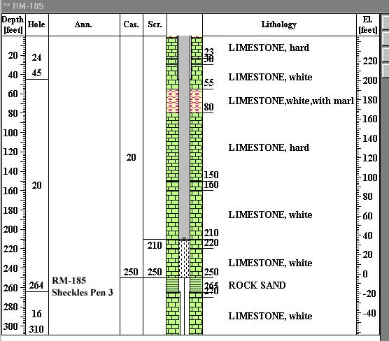
RM-185 |
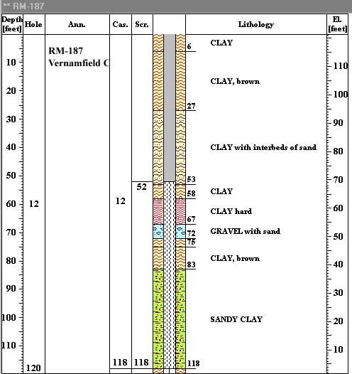
| RM-187 |
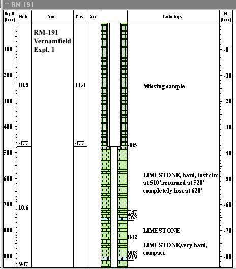
RM-191 |
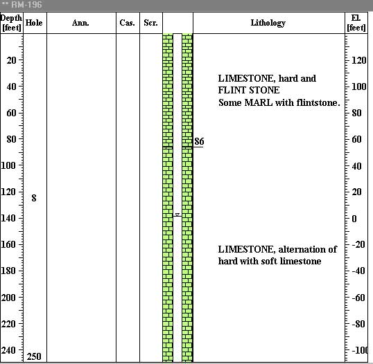
RM-196 |
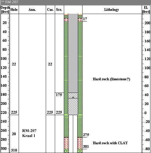
RM-207 |
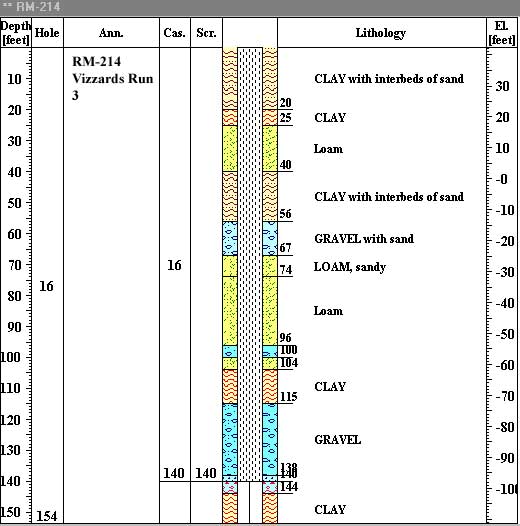
RM-214 |
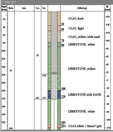
RM-223 |
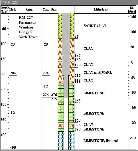
| RM-227 |
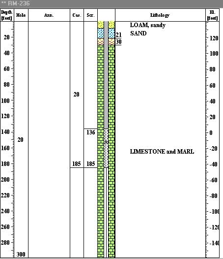
RM-236 |
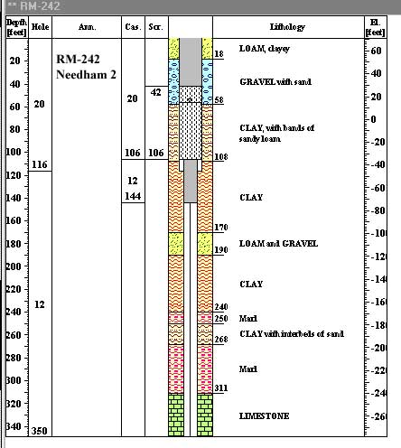
RM-242 |
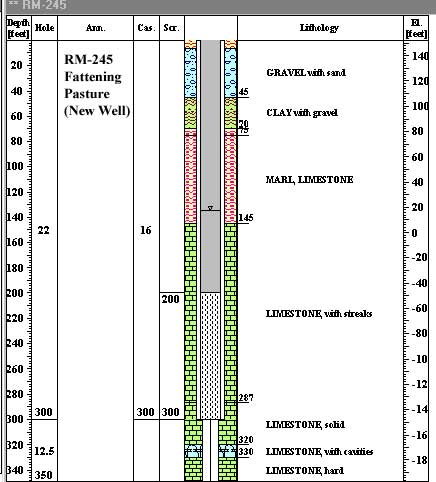
RM-245 |
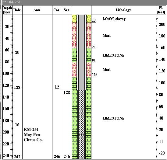
RM-251 |
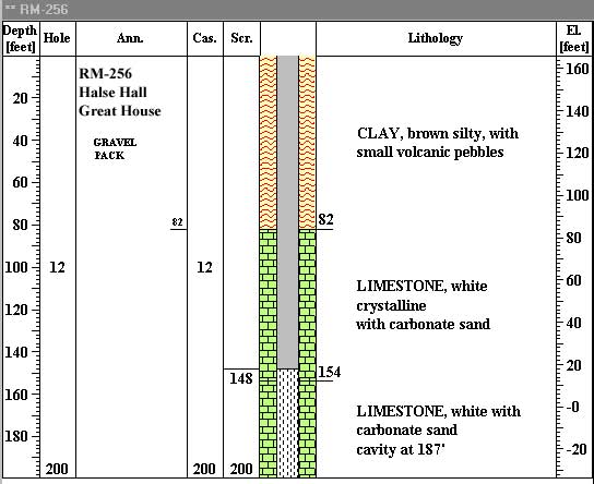
RM-256 |
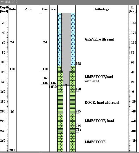
| RM-262 |
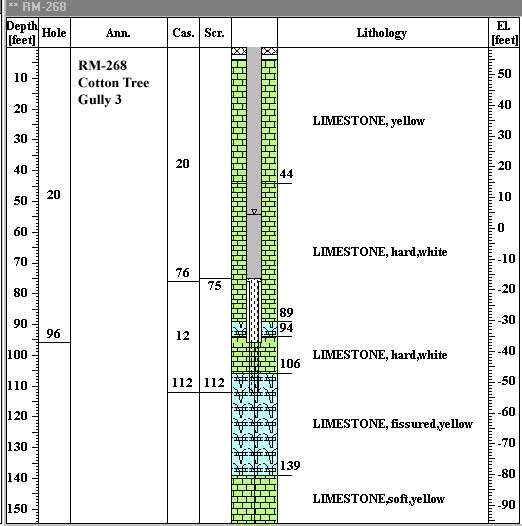
RM-268 |
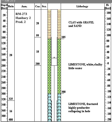
RM-273 |
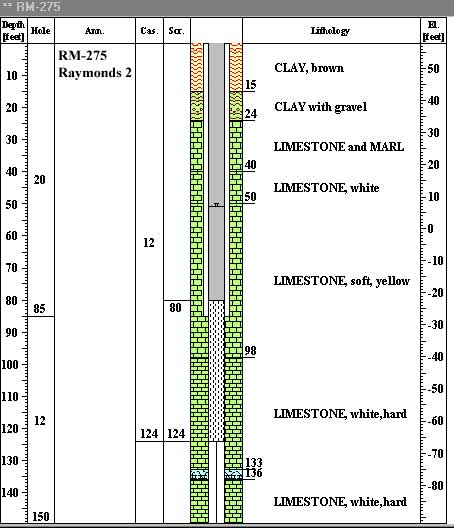
RM-275 |
RM-276 |
RM-279 |
| RM-286 |
RM-289 |
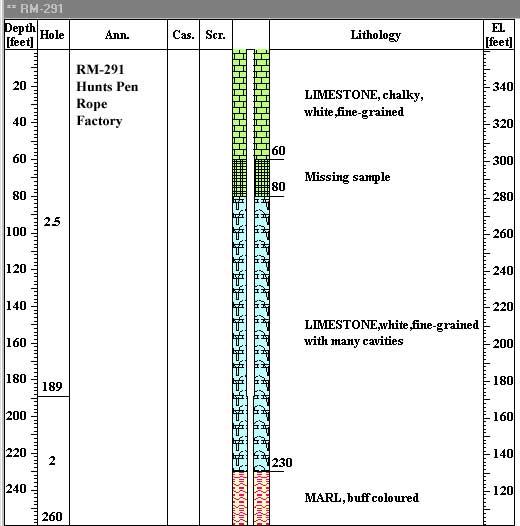
RM-291 |
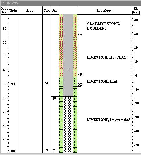
RM-295 |
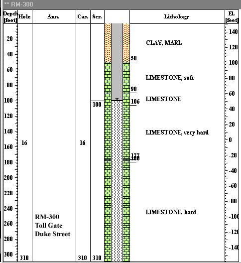
RM-300 |
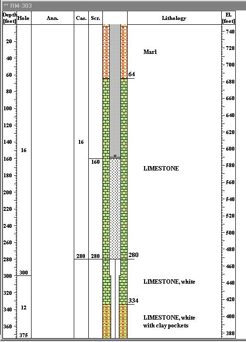
RM-303 |
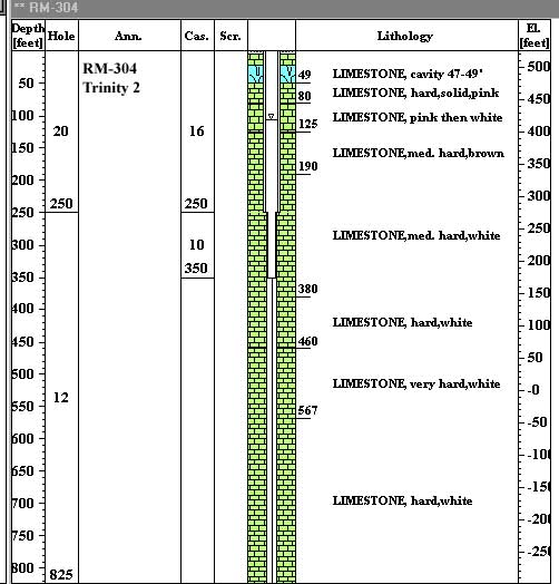
| RM-304 |
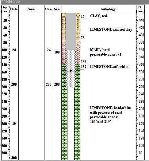
RM-305 |
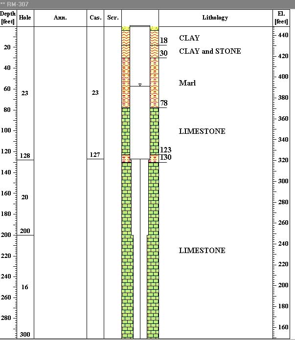
RM-307 |
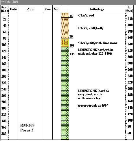
RM-309 |
RM-312 |
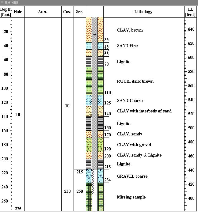
RM-459 |
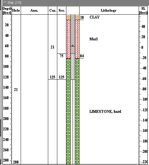
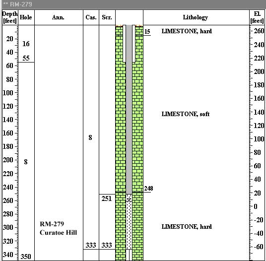
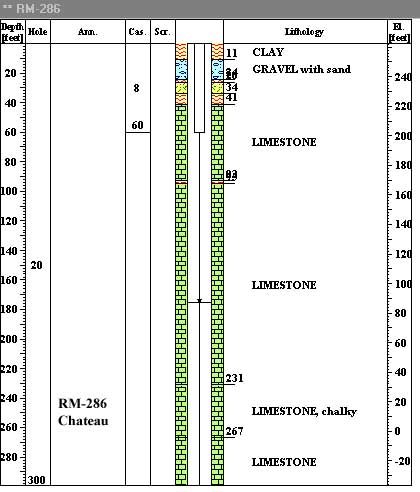
![]() arstic developments are characteristic for the limestone in Manchester Highlands and underlying Clarendon Plain. The high porosity and permeability resulting from solutional processes within the limestone, coupled with high recharge and sufficient rainfall, result in high production rates of limestone wells.
arstic developments are characteristic for the limestone in Manchester Highlands and underlying Clarendon Plain. The high porosity and permeability resulting from solutional processes within the limestone, coupled with high recharge and sufficient rainfall, result in high production rates of limestone wells.
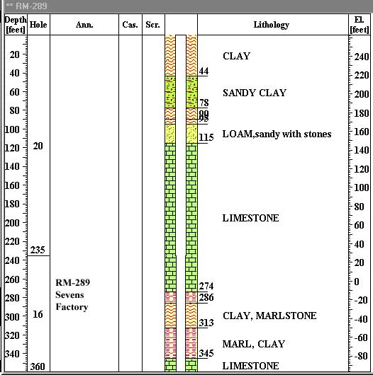
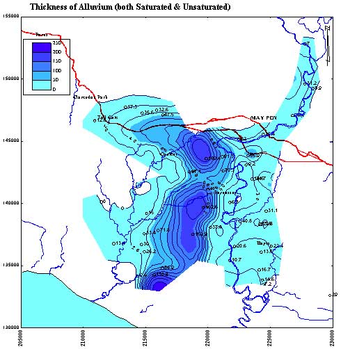
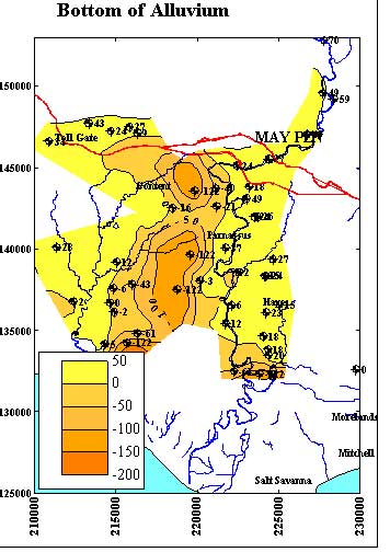
![]() lluvial sediments, which overly the limestone under the Clarendon Plain, have rather limited areal extension. Two maps illustrate the geometry of the alluvium:
lluvial sediments, which overly the limestone under the Clarendon Plain, have rather limited areal extension. Two maps illustrate the geometry of the alluvium:
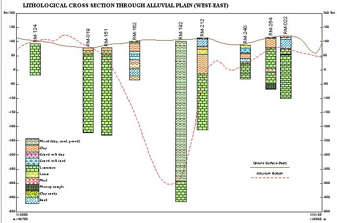
The geometry of the alluvium can also be seen on one of cross sections (from the west to the east, the middle part of the plain).