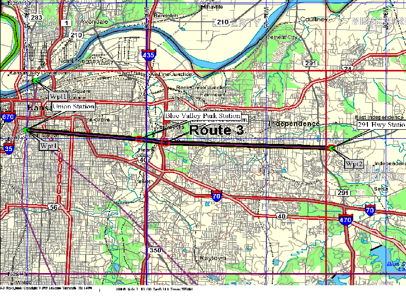
Union Station to Highway 291
(Route 3)
Plan View
This route somewhat follows the 23rd Street corridor. A possible alternate location would be to angle over to the 12th street corridor. These alignments allows the rapid underground route to use existing bridging over the Blue River. A possible spur route can tie into the stadiums which are just south of the East Blue River Station.
Profile of Route 3
(23rd Street alignment)
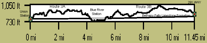
Elevations taken from USGS topographic maps at quarry sites were used to help set the elevation of the Bethany Falls Limestone formation. For preliminary design of alignments, a satelite positioning device should be used to affirm the elevations used in this proposal. Quarry sites for elevation verification are located off a possible 95th Street Station location and also just south east of the Blue River Station location.