KARIBA ANGLING SOCIETY
Manicalands - Osborne Dam - Odzi/Mutare

Dam Fact | Directions | Species | Facilities | Map

Dam Facts
Capacity :- 401 million cubic metres Length :- 16 kilometres
Greatest Width :- 4 Kilometres Surface Area :-  2550 Hectares
Wall Type :-  Wall Size :- 67 m high x 1007 m wide 
River System :- Odzi River Function :- Irrigation/Mutare Water supply 
Built : - 1994 First Filled : January 1997
Top
Directions
From Harare, turn left at the 229 kilometre peg just before the Odzi Bridge .
From Mutare, take the Juliasdale turn off, at the 253 kilometre peg , go 10 kilometres and turn left along the gravel Koodoosberg Road and travel a further 14 kilometres, crossing the Odzani River and Odzi river bridge below the dam wall and then turn right into the National PArks site.
Access to the dam can be obtained through the National Parks Site where they have offices and a slipway.

Top
The Angling Species available are :-

Bass Mozambique Bream
Barbel
Redbreasted Bream
Robbies
Trout ??
(For fishing notes see Chapter 6 of the fishing booklet which covers most of the species in the dam.)
Top
Facilities
Angling Societies
There are currently no Angling Societies or clubs on the dam
Other
At the launch Site it is believed that there have ben ablutions etc constructed, and development is continuing under DNPWM

DNPWM do charge for fishing and boating on the Lake.
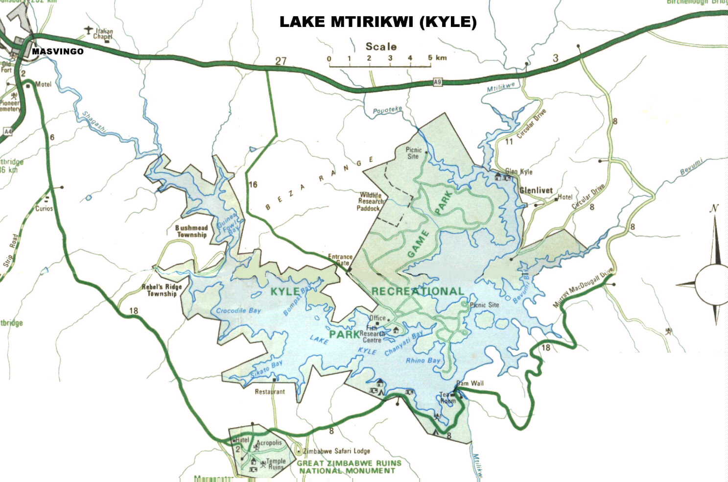
For a larger picture please click on the map or right click and select "View Image"


  Mashonaland | Matabeleland | Back to Manicaland | Midlands
Hosted by www.Geocities.ws

1