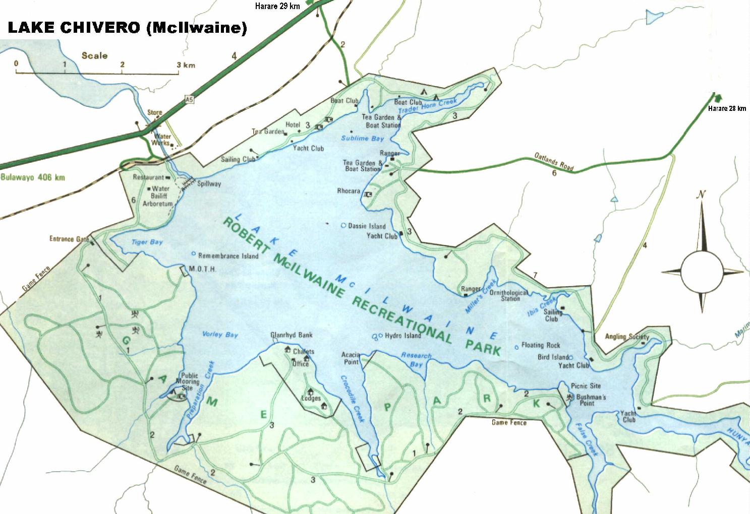
KARIBA ANGLING SOCIETY
Mashonaland - Lake Chivero - Harare

Dam Fact | Directions | Species | Facilities | Map

Dam Facts
Capacity :-  247 million cubic metres Length :- 10 kilometres
Greatest Width :- 5 kilometres Surface Area :- 2630 hectares
Wall Type :- Earthen Wall Size :- 40 m high 200 m long
River System :- Hunyani River Function :- Water Supply for Harare
Built : - 1952
Top
Directions
Lake Chivero is Harare's main water source, and is approximately 35 kms from the town centre. There are several roads that lead to the lake dependant on where you wish to go. The easiest route to the north shore, is to use the Harare/Bulawayo road and either turn at Lakeside Service Station or at the Turnpike Service Station. Should you wish to go to the National Park then turn left after the Hunyani Bridge.
There is access to the lake via the Beatrice Road. Turn into Amalinda Road and simply follow the road which goes through a farming area and leads to the river end of the lake.
Top
The Angling Species available are :-
Bass Green Happy's
Barbel Bulldog and Churchill
Red breasted Bream Tigerfish
Greenhead Bream Labeos
Niloticus Bream Bottlenose
(For fishing notes see Chapter 6 of the fishing booklet which covers most of the species in the dam.)
Top
Facilities
Angling Societies and Venues
These abound around the lake, and most have guest or launching facilities. The more popular are Marimba Angling Society, Postals Angling and of course Admirals Cabin resort where one can walk around the bird garden and have access to launching etc.
There is a large variety of Bird Life and there are also Bushmans paintings which can be see at Bushmans point.
Almost all have a wide variety of good facilities.
Top
Notes
Beware of submerged Rocks and Anthills when boating on the Lake. Some are marked but some have lost their marking and are very dangerous. Close to the shore, in some areas, there are also a lot of stumps.

DNPWM do charge for fishing and boating on the Lake.
For a larger picture please click on the map or right click and select "View Image"


Lake Chivero Map
Top

Back to Mashonaland | Matabeleland | Manicaland | Midlands


Hosted by www.Geocities.ws

1