GEOG5222 Lesson 2Manipulating and Summarizing Attribute Data:Summarizing and Displaying Property Damage from TornadoesJohn Taber Procedure: The attribute table of a shapefile
showing counties in Oklahoma(counties.shp) was joined to a table
( countydamage.dbf) using FIPS code as the shared attribute.
Records for seventeen counties with tornado data were then selected, and
converted to a new shapefile, (tornadocounties.shp). This shapefile's
attribute table was joined in turn to an additional table (countystatistics.dbf
) so that additional data could be derived. The Calculate Geometry
analyst was used to determine each county's area in square miles.
New fields were then added to this attribute table, to derive additional statistical information. Data on apartments, previously separated by building size, was consolidated into a single field, as was data for housing size (combining single-family homes, mobile homes, and apartments). Additional data generated was used to create the thematic maps that follow, as explained below. |
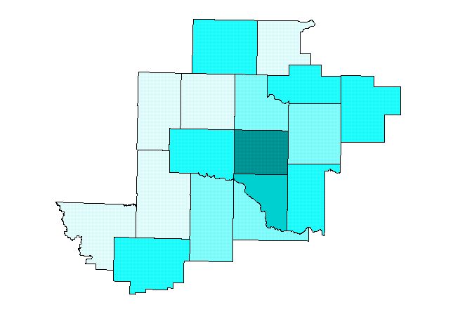
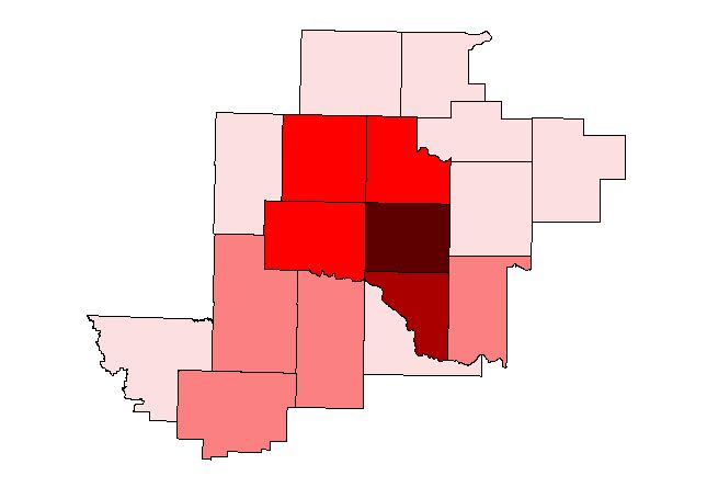 Figure 1: Personal property damage (housing units). Data
for this field was derived by combining existing data for single-family homes,
apartments, and mobile homes.
Figure 1: Personal property damage (housing units). Data
for this field was derived by combining existing data for single-family homes,
apartments, and mobile homes. 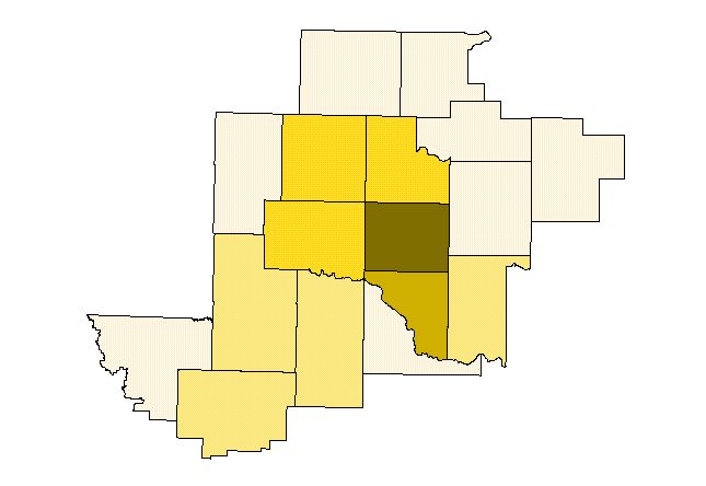 Figure 2: Personal property destroyed (housing units): Likewise,
data for this field was gathered by combining data for houses, apartments,
and mobile homes destroyed.
Figure 2: Personal property destroyed (housing units): Likewise,
data for this field was gathered by combining data for houses, apartments,
and mobile homes destroyed.  Figure 3: Personal property destroyed (dollars). Data for
this field was derived by multiplying data used to create Figure 2 with each
county's median home value.
Figure 3: Personal property destroyed (dollars). Data for
this field was derived by multiplying data used to create Figure 2 with each
county's median home value.