The
Mountain Cedar Pollen Forecast
Metropolitan Area |
Exposure Risk |
|
Dallas/Fort Worth |
Low |
|
|
High
|
|
|
High
|
Date Issued: 12 January 2009
Mountain Cedar Location(s):
Regional Weather: Monday, Jan 12. TX/OK:
A series of cold fronts will move through the Texas-Oklahoma region over the
next few days causing temperatures to see-saw especially in
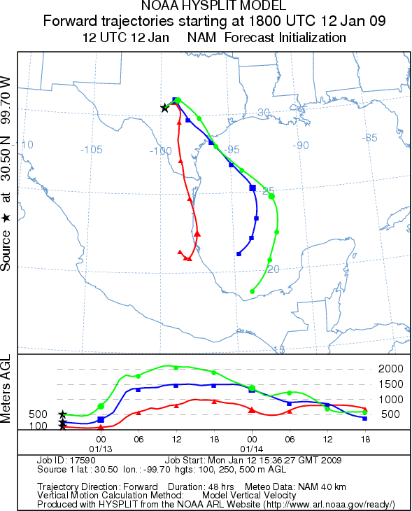
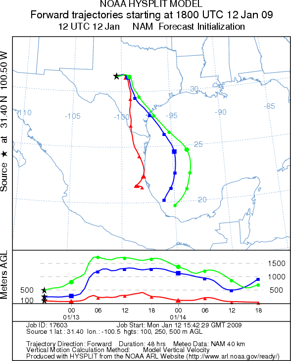
Trajectory weather: The air mass
trajectories from the Edwards Plateau begin moving north and northeast and then
turn south under the influence of the cold front that will move into Texas this
afternoon and evening. Trajectory characteristics are mixed for downwind
dispersal. At the source areas today along the Plateau temperatures will be in
the mid-60s with clear skies and moderate winds. Winds will be shifting during
the afternoon to northwest winds as the cold front moves into the area. Overnight
temperatures will be in the upper 20s to low 30s with northwest winds. Temperatures
tomorrow will warm into the upper 50s to low 60s. The trees are in the peak of
the pollination period so significant release should be expected.
OUTLOOK: *** High Threat today *** Good conditions for pollen release. Sunny skies with dry windy conditions and mild temperatures are favorable for pollen release. Since the trees are nearing their peak pollination period significant amounts of pollen release might be expected. The trajectory characteristics do not show perfect atmospheric conditions leading to entrainment and travel downwind so pollen may remain close to the source areas.
Trajectory Start (s) (shown
by * on map):
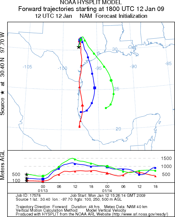
JUNCTION
EDWARDS PLATEAU COMPOSITE
Prepared by: Estelle Levetin (Faculty of Biological
Science, The University of Tulsa,
Questions: Aerobiology Lab e-mail: [email protected]
Return to Forecasting Home Page