John
G's Mountain Bike Maps Page
The intent of this page is to
provide some maps to MTB trails in the Greensburg/Latrobe,
PA area.
- Laurel Summit, aka Lynn
Run, aka Forbes State Forest.
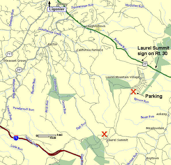
The Laurel Summit
driving map (28K) is about 7 miles east of Ligonier, PA on US Route 30.
There are cross country ski trails that are used in the summer for hiking
and biking. These are great trails for mountain biking. There
are some serious rugged rocky trails up there. Also some smoother
trails. (But don't think there are any Rails-to-Trails stuff up
there.)
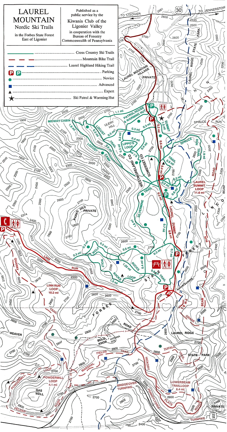
Click here to view a map of the trails, LaurelMtnMTBMap.gif
(334K)
(or Right click, select "Save Target As..." to download)
Best riding around. Hills, rocks & roots.
Bring lots of water. There is none at the top of this
scenic mountain in western PA.
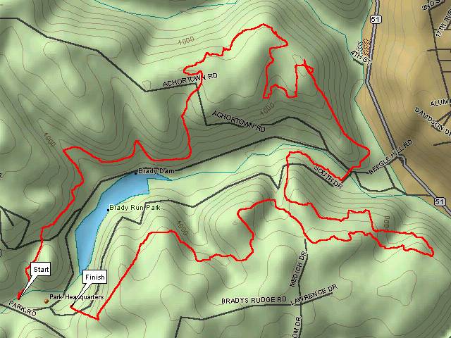
- Bradys Run Park, Beaver, PA
Nice park. There are about 10 miles of singletrack that I know
of. Probably more. Local bike shops stage a couple races a
year here. Great rolling when it's dry.
Click here to view a map of the April 2001 race course, BradyRunMap.jpg
(63K) Also available is the Latitude/Longitude
text file.
(or Right click, select "Save Target As..." to download)
NOTE: The map shows a couple dubiously straight lines near the Finsh
line. My GPS went goofy at that point. (Hey, looks like I have
to go re-ride the course.)
Click here for Brady's
Run April 2001 Race Results
John
G's Home Page John
G's MTB Page
Last
updated: 03/13/02 02:02 PM -
