| The Map Room |
 |
 |
 |
| Click on map thumbnail to view larger image. |
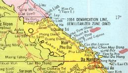
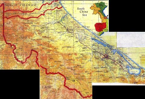
| Northern I Corps from a 1968 map showing the DMZ and familiar place names of Quang Tri, Dong Ha, Gio Linh, Con Thien, Khe Sanh, Hue, Phu Bai and Da Nang. |
 |
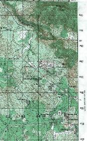 |
| Topographic map showing Khe Sanh Valley Hill 950 can be seen near the top and the village of Khe Sanh near the bottom |
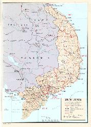
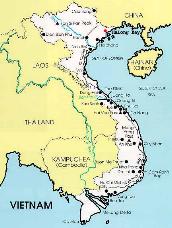
| 1973 map showing the Military Regions of South Vietnam |
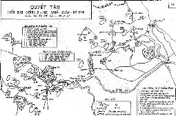 |
| Hand-drawn map by the Peoples Army of Viet Nam (PAVN) showing the locations of their units south of the DMZ on December 28, 1967. This was just prior to the Tet Offensive and the Siege of Khe Sanh in the Spring of 1968. Viewing this map gave me a greater appreciation for the necessity to reinforce the Marines in this region with the 1st Bde, 5th Inf Div in the Summer of 1968 |
 |
| Current map of Vietnam showing the former capital city of Saigon as Ho Chi Minh City. The DMZ is penciled in on the map only as a reference. |
 |
| View an annotated topographic map of firebases in Northern I Corps. This map is maintained at the 1 Bn, 40th Arty web site. When you arrive at the page, scroll down to this very large map. Allow time for it to load. |
| Next page lists Unit Citations and has link to a personal account of the "Last Seven Days of the 407th RRD". |