| Location, Maps, and History |
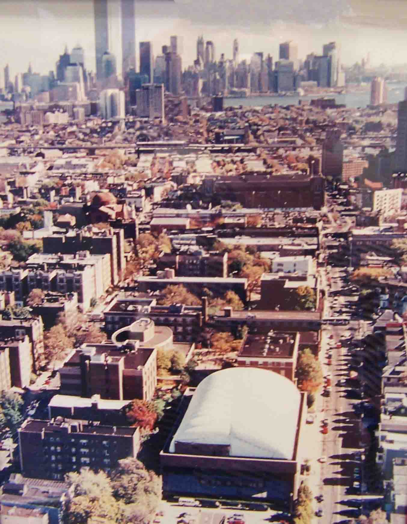
| Currently, I reside on the campus of Saint Peter's College located on the westside of Jersey City, New Jersey. I live in a single room at Saint Peter Hall on 2652 Kennedy Boulevard. This is one of the main avenues that runs all the way through town and beyond, parallel to the Hudson River. Jersey City is located across the Hudson River from the island of Manhattan, the most well-known of New York's five boroughs, and famous for its many skyscrapers. From many parts of Jersey City one may encounter spectacular views of the Lower Manhattan skyline, and until September 11, 2001, of the Twin Towers of the World Trade Center. The aerial views below look east from Jersey City towards downtown Manhattan. All the skyscrapers one can see here, including the WTC towers, are located in the lower part of Manhattan, i.e. the Financial District or downtown. As you can see, Manhattan is only about 4 kilometers or 2.5 miles away from Saint Peter's College. The lower half of the picture shows almost the entire campus of Saint Peter's College; bordered by the blue lines in the right picture. However, there are several small separate buildings, that are being being used as faculty offices, administration, student housing, or storage, that do not appear on the photograph. In the bottom of the picture one can see the Yanitelli Sports Center topped with its white roof known in the area as the 'bubble' which covers five tennis courts, a swimming pool, and many other sports facilities. For further details and pictures, please take my: Saint Peter's College Summer/Winter Campus Tour |
 |
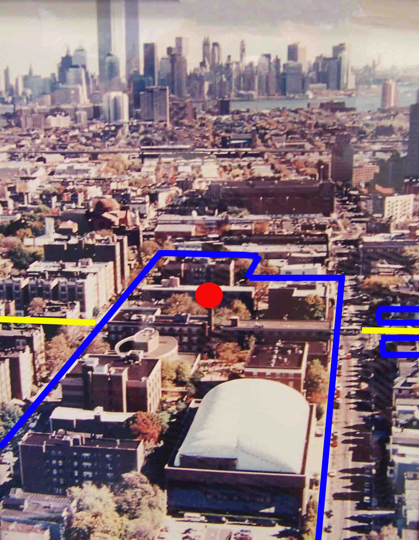 |
| Legend: The blue lines represent the edges of campus. The left diagonal blue line runs over Glenwood Avenue, and the right vertical blue line runs over Montgomery Street. The two yellow lines indicate John F. Kennedy Boulevard. The red dot indicates my location in Saint Peter Hall, however, my room faces east towards Manhattan. |
| Looking east from above SPC campus before 9/11. |
| To further explain Saint Peter's proximity to New York City, one may take a look at the maps below. In addition, I also provided some contemporary as well as historical facts about the area. |
 |
 |
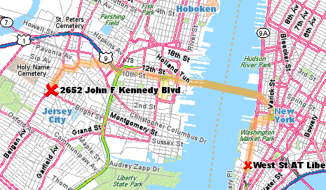 |
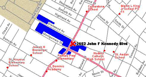
| The blue sections on this map, as do the blue lines in the picture above, indicate the SPC campus area. The pictures above were taken approximately above Westside Avenue (left) looking east. The red cross indicates my dorm at 2652 Kennedy Boulevard. |
| This map shows the route from Saint Peter's College to the World Trade Center Site (at West Street and Liberty Street on Lower Manhattan), which is approximately four kilometers away. However, first, one has to walk to the PATH station (Port Authority Trans Hudson) at Journal Square in Jersey City for about ten minutes. There, one may take the PATH train (like a subway) to either the WTC (downtown) or 33rd Street (midtown) on Manhattan. The first takes about 15 minutes, the latter about 25 minutes. |
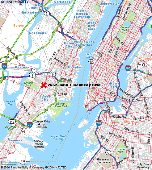
| Here you see a map of a larger area around both Jersey City and most of Manhattan Island. Again, the red cross indicates my dorm at SPC. The white dots right of Liberty State Park are The Statue of Liberty (bottom), and Ellis Island. On the right of the map we see Queens, in the bottom right is Brooklyn (named after Breukelen), and in the bottom left we see a small edge of Staten Island. The Bronx is located north of Manhattan, and not shown on this map. Across the Hudson River we have Manhattan. The diagonal line across the island from south to north is Broadway; an old Indian trail. Below Central Park is midtown Manhattan, which is the most vibrant area of the island. For instance, located at 7th Avenue, from 42nd to 48th Street, is Times Square. At 5th Avenue and 34th street one may ascend the Empire State Building (448 metres). Part of the area north of Central Park is Harlem (named after Haarlem), which is still home to many African American New Yorkers, but also to many Hispanics. Then, down from where the streets are no longer patterned as a grid system, we find the oldest part of New York, namely downtown. The Dutch settled at the southern tip of Manhattan in 1624, and named it New Amsterdam. Led by Peter Stuyvesant from 1647, the Dutch were forced to sell the island to the British, who named it New York in 1664. |
 |
| The southern tip of Manhattan in Dutch times. The wall across the island was to keep Indians out. Today it is Wall Street. |
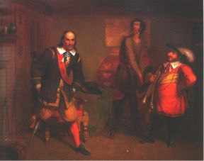 |
| Peter Stuyvesant, famous for both his ruthless regime in New Amsterdam, as well as his peg leg. |