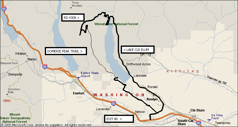
DOMERIE PEAK TRAIL (#1308)
This site is best viewed with 800x600 resolution.
(Start, settings, control panel, display, settings, desktop area, 800x600)
(Due to quality of pictures, it can take a while to load them all.)
The Domerie Peak Trail has been on the ORV trail inventory
for years. It is located just west of Lake Cle Elum.
UPDATED 8/14/01
Click
Here to get directions to FIFTY FOUR other ORV Trails!
Click
Here to see what equipment DUAL SPORT motorcycles must legally have!
The Northwest Motorcycle Association had a work party to repair several sections of the Domerie Peak Trail on August 4th and 5th, 2001.
How to get to the SOUTHERN trailhead from I90/Domerie Flats.
Take First Rosyln exit off I90.
Turn left (north).
Go .2 miles
Take left onto dirt road with Trend West sign. The road immediately veers north and goes uphill.
Reset trip odometer!
At 2.6 miles turn right.
At 5.1 miles turn right.
At 5.9 miles, cross a tiny, crude, flat wooden bridge. You are then at a T intersection. Turn left. The road gets smaller, rutted and less-used looking.
At 6.6 miles you come to another T. Turn left again.
The road curves to the north.
After about 1 mile, come to an intersection where you merge onto a better-condition road that paralells the one you are on.
Continue on that road for 2 miles. Pass several no tresspassing signs, that apply only to the land, and not to the road.
Make a left turn onto a jeep road headed west.
The trail head is about 1/4 miles up, take a right onto it, headed north.
Click
here to see a map of the way across Domerie Flats that matches these directions.
How to get to the SOUTHERN trailhead from I90/Bullfrog Flats USING A GPS.
Below are a list of turns with GPS coordinates.
Turn off the Road Way Point 001 N47.1863586 W121.0158816
First Y Way Point 002 N47.210005 W121.0305996
Second Y Way Point 003 N47.2280362 W121.0743974
Tee Way Point 004 N47.2374025 W121.0803507
Y3 Way Point 005 N47.2378984 W121.0891231
Left At Gate Way Point 006 N47.2408983 W121.0897812
Straight Way Point 007 N47.2445008 W121.0909183
Left Way Point 008 N47.2487036 W121.0918476
Trail Start N47.2570914 W121.1136288
All the above positions are in WGS84 map Datum
Click
here to see a map of the way across Domerie Flats marked with these way points.
 |
|
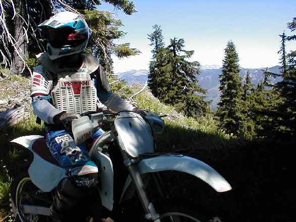
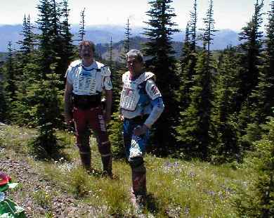
This trail has tremendous vista and challenges for motorcycle riders.
These pictures below were taken in July of 2001.
|
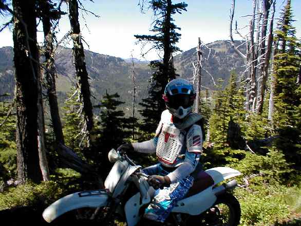
A nature lover on iron horse in full safety gear.

Looking north on the trail. There are a lot of switch-backs on those
hills!
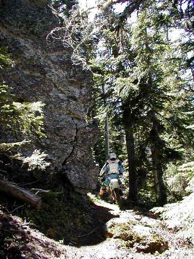
Puttin' around the rocks.
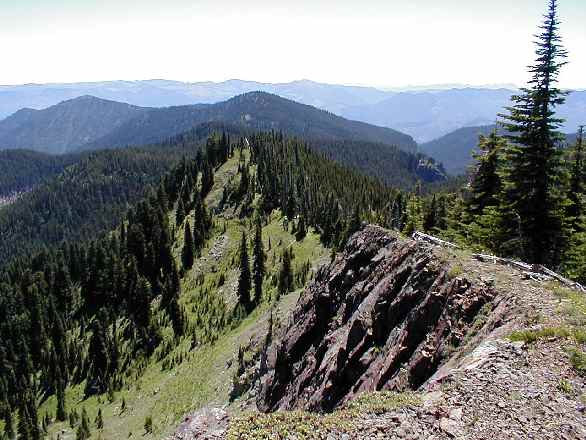
One of the viewpoints looking south.
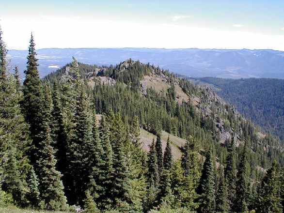
Lake Cle Elum from the top.
This is a tight, low-speed, trail that is BEAUTIFUL!
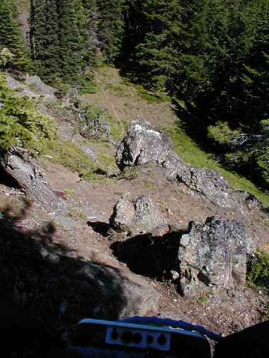
Clearing away some of the rocks would make this safer.
Right now, its best to ride the trail from north to south. Please
join our efforts to maintain this trail. Contact us via Email
at [email protected].
Directions To North End Of Domerie Peak Trail
From I-5 take exit 80 (Roslyn, Salmon La Sac) and turn north.
Reset odometer to 0.0 (watch the changing speed limits!!!).
2.8 Turn left on to Hwy 903.
10.0 Pass "Last Resort", your last chance for food, gas, etc.
(to the left you will see the ridge).
16.5 Turn left on road 4308
20.3 left on spur road 115.
20.4 Stop at camping/parking area. unload here and ride to trail (left through gate).
21.9 Domerie Peak Trail on left
Click
Here to see the ORV map of the Domerie Creek Trail
A NORTHWEST FOREST PASS is Not required. Click
here to confirm this.
What This Area Looks Like in the Winter From a Snowmobile.
Click
Here to go to the NMA - Northwest Motorcycle Association Web Page
Click
Here to get directions to the NorthRidge ORV Trail
Click
Here to go toBig Northwest Moto Academy and Guided Rides
Contact Jim Lee at [email protected] for more info on this trail.
COPYRIGHT NOTICE: The pictures and words on this page are copyrighted and are not to be used without the permission of the author unless for the purposes of promoting off-road motorcycling.
