Looks
are sometimes deceiving. Often, even. Especially views over
deserts or large stretches of water. Things look closer, farther
off, hazier. Mythical.
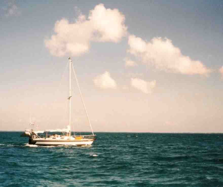
Four hours out of Governor's Harbor headed for Cape Elutherea, sailing down the western coast of the island of Eluthera in the Northwestern Bahamas, the eye sweeps from the long cliflike shore to the east, down three or four miles to where Rock Sound cuts into Eluthera then curves out to the Cape, which has been sticking out nearly dead ahead for all this time. Not particularly pretty, but from offshore most Bahamian Islands and Cays are drab and interchangeable. Not a pretty truth, but sailing and sailors have enough fantasies without buying into those of the Tourist Board. 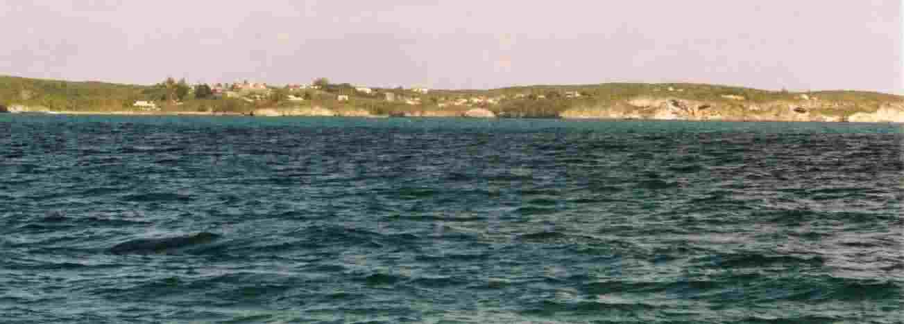 The
Bight between Eleuthera and the Northern Exumas is nowhere deep and often
very shallow. The southern end of Eluthera has a westward running
tip that does not stop at the soreline. It runs northwest all the
way to Current Island, ever so slightly submerged. The
Bight between Eleuthera and the Northern Exumas is nowhere deep and often
very shallow. The southern end of Eluthera has a westward running
tip that does not stop at the soreline. It runs northwest all the
way to Current Island, ever so slightly submerged.
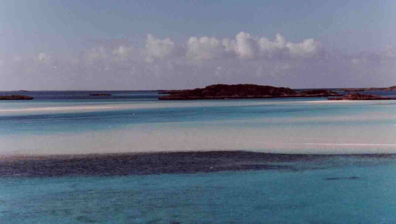
In the hazy distance, over a slightly choppy sea, a smudge of unfocused drab dark green marks the Australian Pine that are generally the highest things on any cay and thus first seen. Everywhere else, water. Well maybe, just maybe, in the far shimmering distance to the west where the grayish white of the sky meets the grayish blue of the Sound there are some trees -- low mangroves growing on the shifting sandbars the charts rumor lay between here and the Exumas some 30 miles to the west.
The last couple of days have been anticlimactic, too, looking for marine supplies in Governor's Harbor. Anticlimactic, because there were none. Zip. Bupkis. None. Nada. A couple of days earlier I had sailed, motorless, into Governor's Harbor and made happy rondevous with Querro II and another sailing acquaintance, JanBaree. They had, as expected, offered sympathy for my plight at trying to find repair parts and knowledgeable maratine assistance in the town. Looks are decieveing. Here's this beautiful harbor with a long seawall curving out to provide that Bahamian rarity, protection from the West Wind. Here's this lovely town fronting on a calm and sheltered stretch of water, and the locals do not fish. Do not own boats. Do not try to make money off the cruisers anchored at their doorstep. Ignoring the sea. Ignoring sailors who need simple parts for broken engines. Ignoring me. After an exhaustive search for the wherewithal to either fix my dirty fuel problems, or to make a substitute fuel tank, fuel line, filter, pump, etc. etc., I conclude that Governor's Harbor might just as well be in the Sahara Desert for all the marine supplies available. These people are not seafarers. They are not interested in boats. And they have no marine supplies, either. But wait! An epiphany. After two days of wandering the town and annoying the people, who were very interested, very concerned, and totally unable to help, an idea came to me. It was quite simple; My Yanmar diesel engine was a pretty stupid piece of machinery. Exceptionally non-sentient. I came to this realization about the fourth time I paused to get a coke from the gas station in town. The one with the diesel pump. It finally dawned on me that Mr. Yanmar did not know he was installed in a 34 foot Hunter sailboat. Or any other boat. Nor does Mr. Yanmar have the slightest interest in where the fuel comes from or how it manages to appear at the lift pump. It only cares that the fuel arrives regularly and is extraordinarily clean when it gets there. Instead of continuing to search for all the various and sundry parts it would take to build and install a temporary fuel tank, fuel line, fuel pump, fuel filter, and so on, why not just put a hose in a jerry can filled with clean new fuel and let suction do the job? And so I did. And it worked. The engine started and ran. I ran it for an hour. I was happy. I was set to go. My friends and traveling companions, Michelle and Michelin on Querro II had patiently waited for me and were now anxious to be off. Michelle assured me that everything I needed to make permanent repairs would be available at the Cape Elutherea Marina, an easy 4 hours down the coast. I'm enough of an old hand cruiser to try almost anything if I've got a good jury rigged solution to the latest problem. Did I mention what a beautiful anchorage Governor's Harbor had become? Well, it is when things work out well; most places are like that. Just before eleven AM, I on C's Choice and M&M on Querro II start out for the Cape Eleuthera Marina at the southwestern tip of the island, at the far end of the Davis Ship Channel -- a narrow but straight passage between the shoals that hover around out destination like sand traps before a green. Our friends on JanBaree had gone on ahead the previous day. I had started with a little over three gallons of diesel in my jerry jug, but between a couple of inadvertent spillage's -- which I used my ex-crew's tee shirts to mop up -- and running the engine to test the setup, I had about two and a half gallons left.
As soon as we cleared the breakwater and set our course due south it became obvious that the weatherman had lied, once again, and that we would get no help from the wind. It was dead against us, on the nose. No problem, we'll just motor.
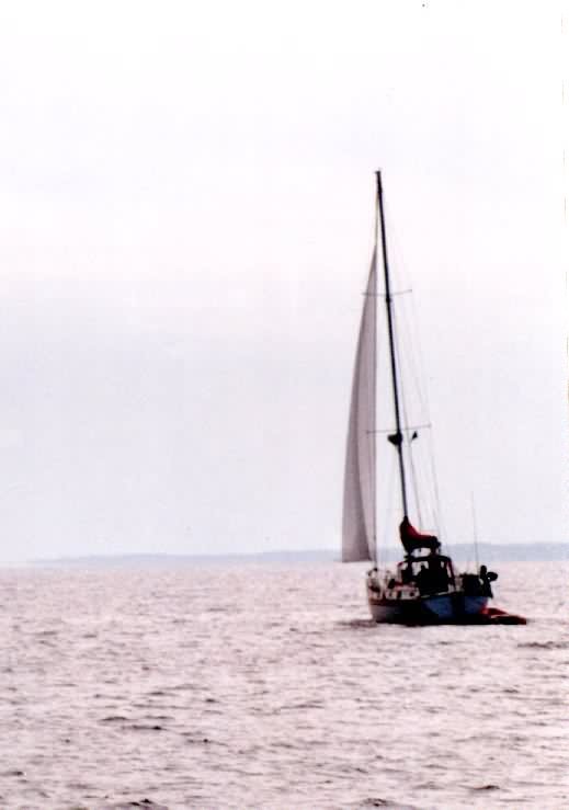
We furl sails and run the engines at route march, making about 5 1/2 knots against the wind and the waves. The waves are a foot or two and steady on the nose. We settle down into the run. I trail a line and catch Mr. Mackerel, about 20 inches and maybe four pounds. Supper. `So there I was happily headed more or less due south, more or less dead into the waves and the wind, when I saw Querro II suddenly turn thirty or forty degrees to the west and begin running off. Concern was immediate and serious. "Querro II, C's Choice." "Yes, Jim." "Michael, why are you turning already?" "I've been here last year, trust me," Michael assured. Even a stopped watch is right twice a day. This is my good buddy Michael, who ran off and left me with a torn reef point and no autopilot amid 12 foot seas in the New Providence Channel; who had me run the 50 foot wide, rock bound Current Cut against maximum ebb; who is now leading me who knows where. Maybe this was Michael's turn. So I trusted and turned. Querro rolled out her jib to pick up the wind that was now flowing from a useful quarter. Our turn had moved the apparent wind back about 35 degrees off the bow. I was thinking about rolling mine out while looking at the clearly visible line of rock ledges a few feet under the water's surface to starboard, when the engine finished off the last of the fuel and quit. Quick prayers were offered. I tried the always questionable autopilot, grabbed the sheet and loosened the furling line, ran out the jib and lost another ten pounds. Sweat. Swiveling my head from side to side, trying to track Querro II, fumbling for the radio while the boat heeled gently to starboard and settled into track... It is entirely possible to sail down the Davis Ship Channel, run off past the tip of Cape Eleuthera about a quarter mile, tack around nearly 180 degrees and run back in past the long rock arm of the breakwater into the quiet harbor at Cape Eleuthera Marina. It is possible, it is also a very long 45 minutes or so. Once in the pond I threw the sheets, furled the jib, circled nearly twice around while loosing way, and waited for someone in a runabout to come pull me into the slip. Someone did. This sailing stuff can be a lot of fun.  I spent three days there, bucketing out my fuel tank and cleaning it up. Took a very costly taxi into Rock Sound for parts. Got everything working. Used up all my ex-crew's tee shirts sopping up spilled diesel. Ate lobster a couple of nights, king mackerel another. Had a Money Moth (a 6 inch darkish moth) land on my head -- supposed to be a harbinger of good luck and fortune, but all I did was leave a big bunch of money at Cape Eleuthera. Then I sailed off to Wardrick Wells and the Exuma Land and Sea Park and into the crisp, unbelievably clear water of the Exumas. It felt like coming home.
|