is SOLO, the third LETTUCE and the last is TRUST ME. Like so many
other things, they probably make the most sense if taken in order.
|
| C's Choices |
|
Current
|
|
|
POSTED 12/07/99
|
This is the second in a four part series about my initial days as a solo sailor. The first
is SOLO, the third LETTUCE and the last is TRUST ME. Like so many
other things, they probably make the most sense if taken in order.
Royal Harbor is just that in a purple light that slowly slides through violet to mauve and pink before the dawn is firmly established. The harbor is mirrorlike, broken only when one of my neighbors ups anchor and leaves for the bight beyond, where a few small waves are idly wandering around.
By full light and a second cup of coffee, the day has turned warm in the sun, with light winds scooting about aimlessly, forming little coalitions that will eventually become the morning breeze. By the time my pancakes are gone, the dishes done and the last of the coffee carried back on deck, the wind is up to six or eight knots out of the east.
I hop into Lucky Runner and row over to my traveling Buddy- boat, Querro II. No, there's nothing wrong with Lucky's engine, not today anyway, it just seemed like a morning for rowing. While Michael and I confer, the last of the boats that spent the night with us at Royal Harbor depart.
Michael wants to head out for Current Cut and on to Hatchet Bay today, aiming for anchors up between nine and nine- thirty. He figures we should be in and settled shortly after two. I point out that the guide book says:
"We recommend that you wait for slack tide, as the water pours through Current Cut at four to six knots at the flood and ebb."
I then explain the intricacies of 'establishing the port,' which is a nautical rule that reflects the fact that on the morning after a full moon the tide will be high at 8 AM local sun time. It had been a full moon last night. We nod, more or less in agreement, then study the rock walls of the harbor trying to see where the tide is in relation to the high water mark.
The water level is pretty close to the normal high water mark on the rocks. Either it is almost high tide, or high tide has just passed. I point out that if we leave "shortly after nine," we will get to Current Cut at about ten thirty. At which time the tide will be flowing at maximum ebb. All of the water that has been trapped in the Bight of Eleuthera for the last six hours will by then be trying to get through the very small opening at Current Cut in a very short time. Quickly.
Think strong current against us.
Michael says, "No problem."
He's been through the cut before, he says, and it only goes about two knots maximum, he says. The image of Lucy snatching the football away just as Charlie Brown runs up to kick it flashes through my mind as I agree to his plan.
One of the reasons I am not a particularly good sailor is that, obviously, I am not a fast learner. This is, after all, the buddy boat I was depending on yesterday. The one who sailed off and left me to fend for myself with a blown reef point in my mainsail and a malfunctioning auto pilot and 12 foot waves, and no radio contact with my buddy boat.
So shortly after nine we are under way. It's a nice broad reach in the shallow waters, protected by the bulk of Eleuthera from the waves the easterly wind would have generated. Because of the unrepaired tear in my mainsail, I have only the jib out. It is sheeted all the way aft, back behind the edge of the dodger. This evens out the torque a bit and reduces the tendency of the jib alone to cause the dreaded "lee helm," and make keeping course a constant sturggle. We are well ballanced and I can just lounge in the cockpit enjoying the day.
Whenever I move the boat any distance at all, I trail a fishing line. If I catch something, fine. If not, it didn't cost anything. I use a 50 pound test line. We're talking supper here, not sport. About halfway between Royal Harbor and Current Cut, about opposite Lobster Cay, I get a strong strike on my trailing line. My faithful yellow lure has scored again. I luff up and pull in a very nice yellowtail snapper, about 15 inches or so. I throw him in a pail in the ding; a fish flopping around the cockpit makes it slippery and unsightly. I know. This is the voice of experience.
Once I'm back underway I am a mile or so behind Querro II. I drink coffee and enjoy the splendid day, turning to admire Mr. Snapper back there in the ding. Querro luffs up and waits for me just short of the entrance to the cut, from which I see the water rippling out into the sound.
I furl the jib, start the Yanmar and push it up to 2000 RPM's. The boat is soon making 5.6 knots across the bottom as I approach Querro II. Michael takes the lead and I follow him into the cut. He is slowed by the current, but powers through, his 35 HP diesel pushing his 32 foot boat along nicely. The 25 horses in my 34 foot Hunter are pulling uphill.
My speed over the ground drops quickly.
Instead of "two knots maximum" flowing against me as promised by my buddy Michael, who disappeared over the horizon on me yesterday, we are bucking 5 of 6 knots. I am barely able to keep steerageway. Michael should be a weatherman.
When my speed over the ground becomes less than 1 knot and the rocks onshore thirty feet away are passing by at but a slow crawl, I push the throttle to 2400 rpm, it's maximum. We struggle through the current rushing out of Current Cut. We are making maybe one or at best two knots. I am too busy twitching the wheel nervously back and forth trying to keep her headed straight into the rushing water to look at the GPS and see what it thinks is going on.
I keep surveying the water rushing and swirling through the Cut, trying to plan how I can surf back out of here if the bow gets caught in the current and spun. I cannot come up with a plan that doesn't involve rocks. It is not a pleasant thought.
Nearly through the inlet the depth sounder alarms. We have been pushed south, nearly out of the channel. The bottom leaps from 25 feet to 8 and closing. I edge gently back into the deeper water in the center, then curve around the inside edge of the Cut to pick up a southerly track only 50 feet off the rocks to starboard, praying that the current is trained to go north before it turns west and isn't going to push me into the ironshore.
After a minute or two it becomes clear that my ever faithful Yanmar is firmly, if barely, in control and we have put Current Cut behind us. I breathe again.
These close calls are getting to be far more frequent than seems absolutely necessary.
Soon after we are through the cut and start running down the eastern edge of Current Island, Michael heads out across the bight. The cruising guide suggest we go at least a mile farther sought before trying to cross the shallows around the mouth of the cut. This is the same book that was already right about the current at Current Cut. I believe them this time.
I call Querro II. Michael admits that there was a bit more current than he expected but says he had no problems powering through. He asks about my passage. I do not answer. Instead I ask about his current route. He claims there is no problem, that he's been across here before. This sounds more than slightly familiar to me. I remind him that while he has a centerboard he can raise, I have a fixed keel hanging four and a half feet under the boat.
Michael starts calling off his depthsounder readings to reassure me. They quickly go from eight feet to seven and from seven to six. At six I tell Michael that I am going to run south a ways to get some depth. He replies that he now has 5 feet under his hull and will run south with me.
Once clear of the shallows he puts up both his sails. I run out the jib and sail as close to the wind as I can, but without the main I cannot point nearly as close to the wind as Querro does.
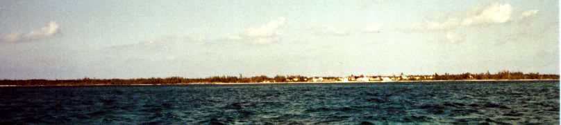
I end up tacking away from Michael, who is running south before the easterly wind that is starting to edge to the southeast towards Hatchet Bay. I take a northern tack, but try as I can I cannot lay a course that looks likely to get me to Hatchet Bay before Easter. In the distance off to port I can see the little village known as The Current, strung out along the coast of Eleuthera north of the inlet. It is a pretty place but the current and the shallows do not invite visitors.
After looking at the chart, my compass and the wind gauge, I decide on a long run northeast to the Glass Window, a very low pass between the cliffs of Eleuthera that nearly cuts the island in two. There is a highway bridge there that looks like it spans two separate islands. In 1991 a series of freak waves on a perfectly nice calm day knocked the bridge more than seven feet off center.
The bridge is at least 30 feet in the air. It looks to be made of pretty substantial concrete.
That waves from a storm several hundred miles away could do that sort of damage on a perfectly nice day like today makes a sailor want to keep one eye on the horizon.
As I am tacking towards the Glass Window I have another strike on my yellow lure, followed by a hit that bends the pole way back and down. I luff up and reel in the line, but it comes in too easily. It's just line. No fish. No lure. Just line. I had probably hooked another snapper which in turn had become bait for a barracuda or shark. Oh well, supper is already in the pail.
From the bridge south, Eleuthera rises up steeply from he bight, with high cliffs that are a departure from the usual low profile of Bahamian cays. My plan was to sail southeast along the shore in the wind-shadow the mass would provide, but the wind has shifted and is running out of the southeast, along the island.
Houses are scattered in small groups above tiny coves with tiny patches of sand. A few miles down is Gregory Town, which looks pleasant enough with its red roofs and pastel houses but has no harbor at all.
Just off Gregory Town I meet up with a very pretty Pacific Seacraft cutter under full sail. They are also tacking their way somewhere. They come about a few yards off my bow, wave and slowly slide away to the southwest.
I personally have grown tired of tacking back and forth without getting much of anywhere I want to go so I roll in the jib, start the engine, and motor directly into the wind towards Hatchet Bay, five miles and an hour's drudgery away. As usual in the Bahamas I know I am headed for an anchorage because I am headed dead into the wind. It's a rule of some sort.
Michael must have resorted to his diesel much earlier, for I see Querro II disappear into the cliff wall half an hour before I can even see the entrance to the harbor. The entrance to Hatchet Bay sits in an angled jog of coastline which hides it until you are suddenly upon it. It is a small man-made gap in the shore which leads to a formerly fresh water lake half again as large as Hope Town's lagoon or the harbor at Royal Island.
The entrance gap looks much narrower than the advertised 90 feet. I've passed through it twice on a boat only 12 feet wide and I would guess the opening is not more than 50 feet wide.
A young couple in a dingy is parked in the canter of the channel fishing. They politely and wisely move aside for me, wave and go back to fishing. I meet them later on, as they are my nearest neighbors when I finally get anchored.
The harbor is shaped sort of like a capital B, with the entrance halfway up the upright stem. I tour the southern half of the pond where the buildings and docks are and find Querro II tied up to a mooring a few yards off the concrete dock. I chat briefly with them and try to anchor nearby, but the holding is terrible. It also strikes me that this area around the docks is the homeliest part of the harbor. I move off to the southwest corner of the harbor, but the bottom shoals quickly and seems to be pure silt and poor holding.
Eventually I go around to the northern half of the pond and anchor farther out from Alice Town than any of the other boats. Splendid. From here I am surrounded by Australian pines and palm trees and lots of calm water. It is a very pretty anchorage in a harbor protected from anything except a direct hit by a hurricane.
[ In 1999 a hurricane walked directly over Hatchet Bay, reportedly sinking or stranding ashore every boat that had sought protection there. ]
The nearest boat to me is a well-traveled catamaran that turns out to belong to the couple I encountered at the mouth of the inlet. They come by with their dog, a large thing of miscellaneous ancestry, and chat a while. They have been at Hatchet for about a month and may stay another six weeks. They are a fund of local knowledge, for which I am grateful.
I tidy up, fillet Mr. Snapper and have corn and the last of my bread with him for supper.
The next morning, after chatting with another set of neighbors who are heading out for Spanish Wells, I dingy into town. I stop by Querro to learnt hey are heading out for Governor's Harbor and the Club Med there for a couple of days. I thank them for letting me buddy with them from Little Harbor and promise to catch up with them by Cape Eleuthera or Wardrick Wells.
Now, after three days aboard, it is time to go ashore and explore a new island.
Perhaps adventure awaits.
|