TRS2LL in Visual Studio 2005
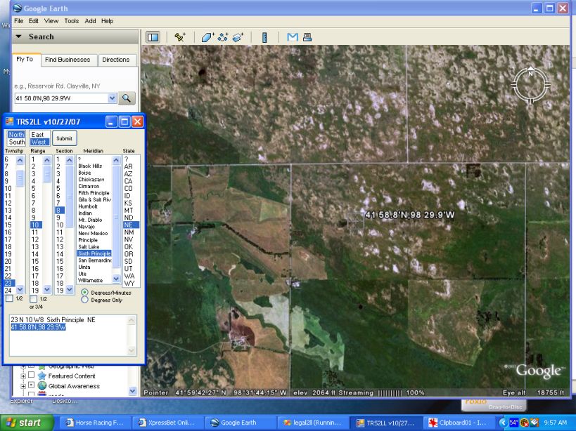
Township/Range/Section conversion to latitude/longitude
I've recently been fooling around with Visual Basic using Visual Studio 2005. I've got a Windows Version and a PDA version that runs on Windows Mobile 5.0. The latitude/longitude is displayed in the same format that Google Earth uses, so the output could be copied and pasted directly into Google Earth.
Download the Visual Studio 2005 version unzip and run setup.
If you are interested in obtaining the PDA version, let me know. This program takes a pretty big table of factors. Of course, the Windows version has no problem, but the mobile version won't take the whole set. I've got CA and NV in my test version. I don't know what the limit is.
I am only converting the TRS to latitude/longitude program. I am not planning on doing the lat/long to TRS.
Of course Visual Studio is a very powerful development system. So if I undestand correctly, this program could be integrated with Microsoft Office products. If you are interested in obtaining the source code contact me.I don't plan on becoming an expert on it. I think I'm doing pretty good for a 78 year old FORTRAN programmer. If interested contact me at '[email protected]'.