The program uses regular rectangular areas. Then 3 or more sections are picked
out of the area and the latitude and longitude of the center of the section is
entered in a regression program and coefficients are generated. Using these
coefficients the latitude and longitude of every section in the area can be
predicted If every section is exactly square, the same size, and the lines are
exactly north/south and east/west the program predicts an extremely accurate
latitude/longitude. However this is seldom the case. Township lines are
normally adjusted every 4th or 5th township to take care of the curvature of
the earth. If this were the only irregularity the program would still predict a
very accurate latitude/longitude of each section by choosing rectangular areas
delimited by these adjustments. Its seems that for no apparent reason townships
are often offset a considerable amount, sections are elongated or shrunk, 1/2
townships and 1/2 ranges are added. In Oregon even 3/4 townships are used. In
Arkansas the lines are skewed over 1 degree. This of course requires the areas
to be broken down into smaller areas, and even then the accuracy is impaired.
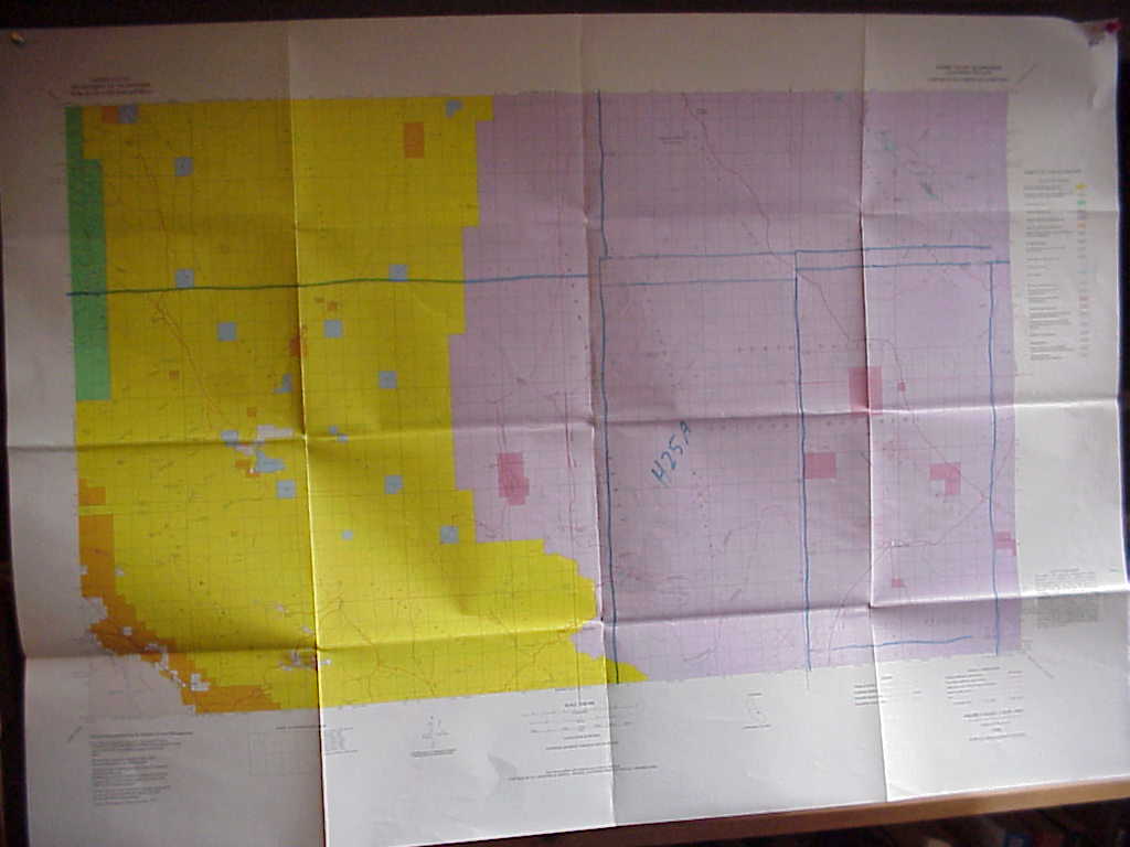
1:100000 scale BLM or USGS maps are used.
Take a look at this BLM map. Notice the area
labeled H25A. There are also some 1/2 township or range areas.
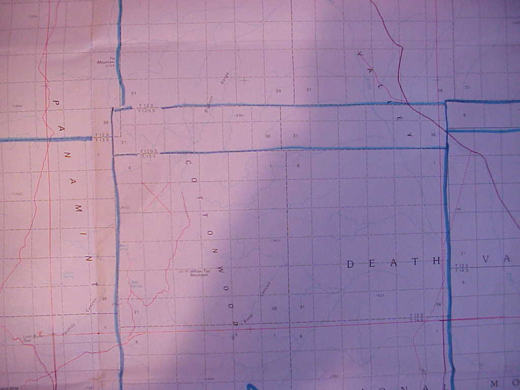
Now take a closer look at the area.
Three sections were used to calculate the coefficients. The sections, latitude, longitude, coefficients and R squared is shown in the printout.
h25a      10-27-2001        09:49:03
Long AX=   438564.78     BX=  -64.017538   R^2=  0.99998521177
Lat  AY=   136354.47     BY=  -52.173293   R^2=  0.99999880769
          - - A C T U A L - -              - - C A L C U L A T E D -
  T/R/S       LAT   /   LONG             LAT      /   LONG            T/R/S
 13S 42E 8 36  49.102   117  25.886    36  49.097   117  25.874    13S 42E 8
 16S 43E23 36  31.712   117  16.281    36  31.706   117  16.272    16S 43E23
 15S 42E 1 36  39.521   117  21.585    36  39.532   117  21.606    15S 42E 1
For 17 states totaling 1,598,615 square miles, 1980 factors were used. This breaks down into 807 sections or about 22.5 townships per factor.
Go to Marty Wefalds home page