Steens Mountain Photo Gallery #2
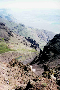
This is Little Blitzen Gorge from above the head of it. "After massive glaciers gouged out the major gorges, a second glaciation altered the landscape again. During that time, small glaciers at the top of the gorges excavated more earth and pushed it part way down the gorge. When the glacier melted, a hanging valley remained," (Secret of the Steens. Bureau of Land Management.).
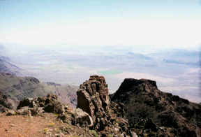
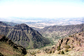
This is a view to the south from the East Rim. You can barely see it, but the Alvord Desert (12 horizontal miles away) is to the left of the little spire. It is kind of brownish-yellow, and then just above that is a bit more of the darker land and then the sky. The Alvord Desert receives less than 6 inches of precipitation a year; the Mountain gets about about 25.
This is view to the north from the East Rim which I think is the highest point at Steens. From this cliff we had a view one mile down. That is why the pictures are so hazy. There is a green circle and then Mann Lake is to the left of that.
This is another view to the north. Here you get a good idea of what the east side of the mountain looks like.
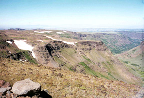
This is the Big Indian Gorge. Indian Creek runs through the bottom of this gorge. Little Blitzen Gorge is almost right on the other side of the road; for several miles, the road winds on a really crappy road between the two gorges called the Hogback. It's best to take the loop counterclockwise to avoid burning out your brakes.
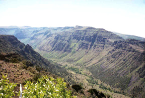
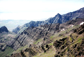
This is a side view of Little Blitzen Gorge looking to the north. The Little Blitzen River which is a branch of the Donner and Blitzen River runs through the bottom of this gorge.
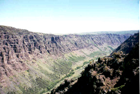
This is a side view of Little Blitzen Gorge looking to the south.
back to my home page