Mount St Helens Photo Gallery
On the morning of May 18, 1980, Mount St. Helens blew. "Instantly this caused the largest landslide in recorded history. A vertical blast blew
ash 16 miles (25 kms) into the atmosphere, and the lateral blast, gaining speeds in excess of 650 miles per hour, destroyed enough timber (trees) needed to build 300 two bedroom homes. Once a picture perfect mountain peak, Mount St. Helens lost 1300 feet of it's top and devastated 110,000 acres of mature fir forest," (http://www.co.cowlitz.wa.us/tourism/Story/Story2.htm).
These pictures were taken in July 2001.
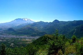
This is the first view of the blast zone. It is hard to tell in this photo, but there are no trees down in the valley; it used to be a forest. The trees were all downed like toothpicks from the power of the explosion and many became part of the mud flow that became the Toutle River valley. The area is slowly recovering on it's own;
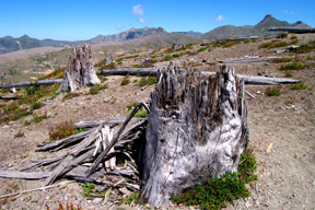
These trees approximatly 5 miles from the crater were ripped off and became part of the lateral blast.
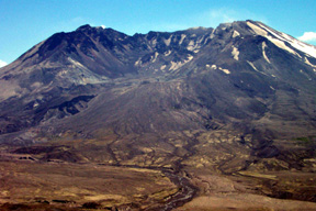
Here is a close up of the crater and the source of the Toutle River. There is usually more snow on the mountain, but it has been a very dry year.
Before the eruption, it was 9,677 feet tall, and now 8,363 feet; 1,314 feet worth of rock was blasted off.
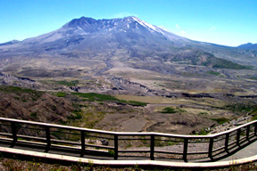
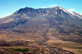
This is what the mountain looks like from 5 miles away.
back to my Washington home page