Cove Palisades State Park Photo Gallery
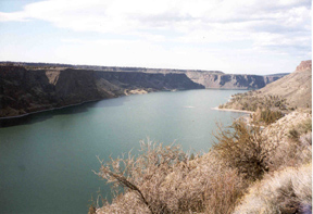
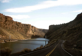
This is the view you get when you enter the park. This park is at the confluence of the Crooked River, Deschutes River, and Metolius River, and form this lake (Lake Billy Chinook) because the rivers are dammed. This is a picture of the Crooked River entering into the lake. The cliff top on the left is known as The Island.
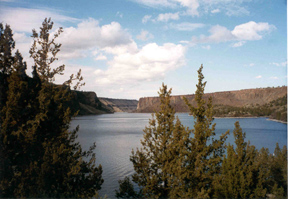
This is the Deschutes River before it enters into the lake. The Island is on the right.
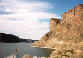
This is part of the canyon wall on the Crooked River. Over 10 millions years ago "...lava flowed from shield-type volcanoes as the base of the Cascade Mountains formed, causing the land to sink in this region. In the process, the westward flow of the Deschutes River and its tributaries was rerouted, forced into moving in north/south courses," (Oregon State Parks by Jan Bannan).
"These ancient rivers deposited sediment--ash, cinders, and thin beds of lava--and built a layer more than 1,000 feet thick, called the Dalles Formation, along their waterways," (Oregon State Parks by Jan Bannan).
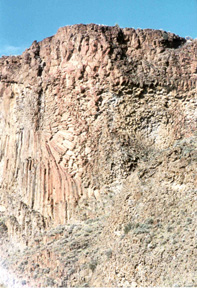
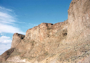
"Finally, between two and three million years ago, vocanic eruptions put a basaltic cap--the rim rock--on top of the palisades around Lake Billy Chinook," (Oregon State Parks by Jan Bannan).
"As the Cascade Mountains developed, a general uplift of this land occured, causing the Deschutes, Metolius, and Crooked Rivers to flow more swiftly and gouge canyons through the land,"(Oregon State Parks by Jan Bannan).
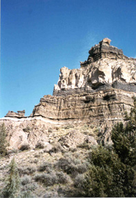
"Recent lava flows entered the upper Crooked River Canyon and were then cut through by the mighty power of flowing water. Remnants of this basalt coat the canyon walls, fused to the light, soft rocks," (Oregon State Parks by Jan Bannan).
back to my home page