Cape Perpetua Photo Gallery
Here are pictures of the central coast of Oregon. For a map of the central coast,
Click Here
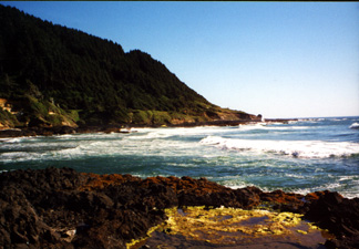
This is a picture taken at Cape Perpetua.
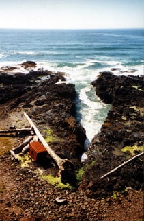
This is a bunch of beach junk at Cape Perpetua.
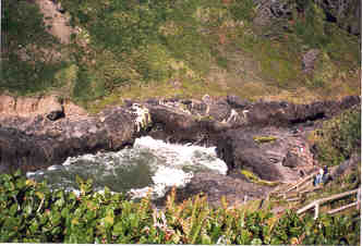
This is Devil's Churn at Cape Perpetua. I have not seen it at high tide or on a day with high waves, but I have heard it is pretty cool.
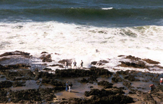
This is the Spouting Horn at Cape Perpetua. Right where the three people are standing in the middle of the photo there is a big hole in the rock. When the waves come in, they shoot up through the hole like a whale spouting water.
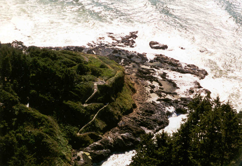
This is a close up taken from the top of Cape Perpetua. You can see the tide pools and Devil's Churn pretty well in this photo.Devil's Churn is in the bottom third of the picture below the tide pools.
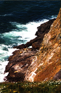
This is a picture of seals hanging outside the Sea Lion Caves on the central coast south of Cape Perpetua. The cave is the largest sea cave in the world.
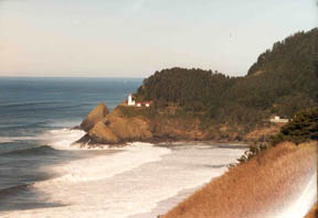
This is a January picture of Heceta Lighthouse at Devil's Elbow State Park which is just north of the Sea Lion Cave. Just north of this area, Highway 101 has been closed for over a month due to mud slides. The slope keeps moving and tree are falling onto the road.
Here are links to Web sites about the central coast of Oregon.
Guide to the Central Oregon Coast
Cape Perpetua Scenic Area
back to my home page