Silver Falls State Park Photo Gallery
The Willamette Valley (wil-AM-uht not wil-LA-met) is the valley that stretches from Portland to Eugene between the Cascades and the coastal ranges. The pictures on the page are from my November 1999 trip to Silver Falls State Park.
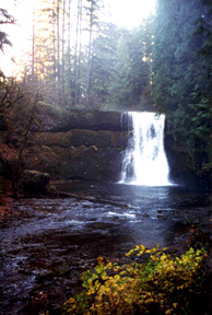
This is Upper North Falls (65 feet)at Silver Falls State Park near Salem. It is the largest state park in Oregon with 8700 acres.
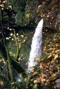
This is the top of North Falls (136 feet). There is a trail leading behind this and 3 other falls at the park. The park is a temperate rain forest; it rained the day before I went so everything was bright green and dripping.
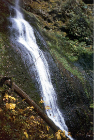
This is the bottom half of Winter Falls (134 feet) running down basalt rock. There are ten major waterfalls in the park and tons of little ones along a nearly 7 mile long canyon trail. For a mid winter (2000) view of the entire falls, click here.
This is Middle North Falls (103 feet) . Driving to the park is weird. When you get off I5 at Salem, you drive for about 25 miles through rolling farmland. You pass through 2 very small patches of forest and more farms. Then all of a sudden you are in a rain forest. To see how full this waterfall looks in February, click here.
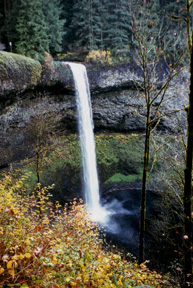
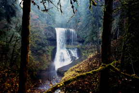
This is South Falls (177 feet). This is one of the falls you can walk behind.
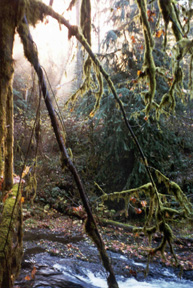
This is just a cool picture of the river and all of the growth in Silver Falls State Park.
back to my home page