ANCIENT GREEK
AND
ROMAN MAPS
Hail Caesar!
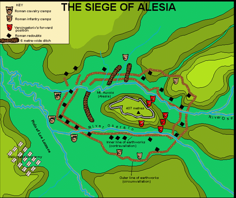
Sorry about that, but I couldn't resist! Another of my varied interests and hobbies(which are many!)Ancient Greek and Roman History, Alexander the Great, Hannibal and the other great leaders from those times I find fascinating. Last fall I was looking for a map of a battlefield and Ian R. Malcomson was kind enough to send me this one of Alesia, which I did up in CC2.
The following description comes from the book Seven Commentaries on The Gallic War by Carolyn Hammond.
"The actual stronghold of Alesia was in an extremely lofty position on top of a hill, apparently impregnable except by means of a siege. On two sides the foot of the hill was washed by rivers, and for about 3 miles there stretched a plain in front of the town. Close by in every other direction more hills of equal height girded the town. Beneath the wall, where the hill faced the east, the Gallic forces filled the entire space: they had constructed a ditch and a six-foot wall. The length of the siege-works which the Romans had started reached ten miles. Camps had been pitched at suitable locations and twenty-three forts built along the line. These forts were garrisoned in the daytime, to guard against unexpected sorties; at night sentries and reinforced patrols kept watch there.