|
This quarter in science we are investigating landforms and the
concepts of erosion and deposition as well as topographic maps.
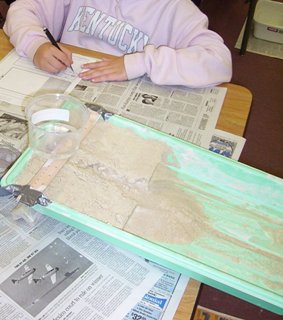
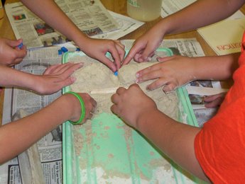
Stream Tables
In this investigation the
students had a chance to really get their hands dirty! We
conducted a series of investigations to understand the effects
of erosion and deposition. We ran water over sand in a stream
table then recorded and compared our results.
In a culminating activity we had a dam building competition.
In the competition the students used different materials
provided to try and build the strongest dam. The dam was
then tested by flood waters and a small town "built" down
stream.
Topographic Maps
In this investigation we learned that two-dimensional
topographic maps use lines called topographic lines to
represent three-dimensional landforms like The Grand Canyon and
Mt. Shasta. We learned how the United States Geological
Survey (USGS) mapped the diverse land of The United States. We
discovered that the maps they produced use the same symbols and
colors to represent different features.
Create Your Own
Mountain
In this activity the students had a chance to use all the
information they learned from the Landforms Unit to create
mountains of their own. They not only drew pictures of
their mountains, but developed a topographic map and profile
drawing of their mountain. In addition, the students
created a history for their mountain to explain how the mountain
was created as well as how it was used by people and animals.
|