Timber Hill ~ Inverted Topography
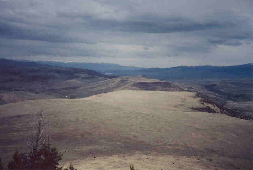
The two plains you see are the result of basalt flowing into a valley. This is a nice example of inverted topography as the basalt that was once on the bottom of a valley is now topographically higher than the surrounding landscape. The walls that reatined this flow have been eroded and the more resistant basalt still stands. Six Mile Formation Gravel (Flaxville Gravel) was deposited after the basalt flow. The gravel, which was deposited in a pediment type fashion, covers all but the top 150 feet or so of this flow. Columnar joints can be seen in the basalt but only at the top. To the left of the far flow the white spot on the photo is a ranch for scale.