Mt. Cardwell
Wasatch County
26 August 2000
Hikers
Jared Tolman, Tom Tolman
The Story
Dad found us a beautiful camp spot between and overlooking both Shepherd and Hoover Lakes in the High Uintas just beyond the famed "Baldy." We're taking about the very same Bald Mountain that Dad hiked to when he was a young Boy Scout and Uncle Ed was his Scoutmaster. I made it up there about four years ago as part of a summer camp when Dad was a Scoutmaster. On that trip, a friendly old fellow told a tale of when he teed up a golf ball on the mountaintop and launched it into the thin air. His story went that on the way back down he ran into some folks who had seen a golf ball land right near their picnic spot at the base of ol' Baldy. Sounded like a fish story to me; that would have been a whale of a shot. Yes, I know, a whale is not a fish but a mammal-and a very large one at that.
This area of the Uintas has always been very special to my dad and me. The large meadow area just southwest of Baldy is one of Dad's favorite places. It is beautiful country there for sure, as open spaces and trees team up to point the way, every way you look, to the surrounding mountains watching over this land. My very first backpacking trip was with Dad and Uncle Mitch and Cousin Eric to Wall Lake. I was probably nine or ten years old. The trail to that lake seemed about fifty miles long back then, though the map claims it's just over one measly mile. I used Dad's old military pack. Mom had sewn some padding on the straps, but I was still quite uncomfortable, and we stopped to rest often. At least I had the "Hey, I'm just a young'n" excuse back then. What is my excuse for wussy-ness nowadays? I actually did have a very fun time on that trip, and the four of us made another trip a couple years later to nearby Haystack Lake. There we made a raft out of logs and rope and floated on the lake catching fish. Those were good times.
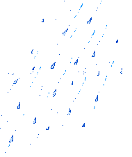
And the good times roll on. We went up Friday after work and hiked a mile or so to the place we would play the card game Phase 10 and sleep that night. I love the sound of a little bit of rain on the tent-not too much-just enough so I can appreciate the fact that I'm in a warm sleeping bag in a dry tent. That's just the way it happened; a small storm passed through in the middle of the night. I woke up, smiled, and went back to sleep.
For breakfast, Dad served up his buttered-bagel French toast specialty cooked on the camping stove. We packed up and hiked back to the trailhead, accidentally drifting away from the trail and making our own "scenic route" on the other side of a big hill. But we made it back to the van just fine, and soon we were wandering around in the mountains on foot again-this time in the general direction of Mt. Cardwell.
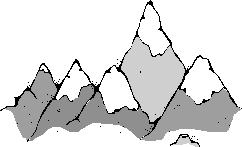
There is no trail to this remote place. "Obscure" was the word a guy we met up there used to describe the mountain peak. I was surprised we saw anyone at all in such a place. This guy and his BYU-student son were funny. The four of us bided our time under some trees right before the final ascent to the peak, waiting for a quick-hitting rain/hail/you-name-it storm to pass. This father and son duo is also working on hiking the highest peaks in the counties. These friendly, talkative folks had all the hiking gadgets you'd want and then some-tough-weather trousers, PCV-pipe walking sticks, a global positioning system or two, and a bunch of other navigational tools that I wouldn't have the foggiest idea how to use. The storm let up some, and we made a beeline to the top.
The skies had calmed down, with a placid blue peaking through and then overtaking the intimidating black and white display by the time we got there, making for ideal weather conditions for soaking in the spectacular view of the Uintas. However, it wasn't too long before threatening clouds were headed our way again. So we cruised down and ate some food after we crossed a big field full of balance-testing "teeter-totter" boulders. The walk from the peak took a lot less time than the walk to the peak. I guess this is the way it usually goes. Also, the weather delay and the fact that we didn't know quite where we were headed at first didn't help any.
The peak is really not that hard to find once you climb the first hill (starting from around mile marker 28 on the main road) and get a good look at what's on the other side. It's probably a mile to the top from there, along a wide ridge.
Having conquered the peak, we got shakes at Dick's Drive-In in Kamas, cleaned up, and watched the football season begin as BYU took on the defending champs at the Pigskin Classic in Florida. Our guys didn't fare so well against the mighty Seminoles, but the evening turned out all right as Heidi, Berkeley, Dad, and I braved the weather at the outdoor Sandy Amphitheater for the Gordon Lightfoot concert. Following the day's pattern, dark clouds and rain gave way to clear sky about halfway through the event; by then, this busily relaxing day had already given way to nightfall.