This page is currently under construction. Please check back soon!
RMIT Maps:
Design & Electronic Publishing 2 - Atlas
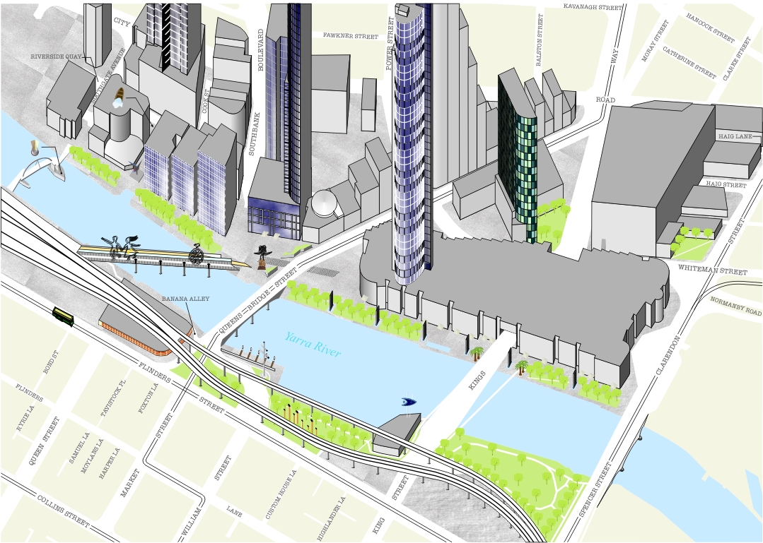
"Southbank" as part of 3D Map of Melbourne Class Project(2006)
As a final year project students undertake a year long project to plan and prepare a mapping project with a view to having it professionally published. The students in the class of 2006 chose to prepare a map of Melbourne in a 3D view, and to display it as a calander for 2007. Each student was delegated a month and area to map and try and relate the theme between the two. We also had to highlight art, cafes and park areas for a visitor at a pedestrian level.
I was given the Southbank area and the month of December. This was a much larger area than most people, who only had one or two city blocks to map, and in the course of the mapping process has its boundaries increased even further to include an even larger area. Due to these reasons this map is not quite complete as you see it but only a few minor edits and additions were required at this stage of the production. What you see here is the map as it was when submitted.
The actual finished size is an A4 size (297 x 210mm), but overall is an A3 sized page spread when combined with the calander page.
Please express your interest if you would like a copy of this calander and I will get in contact with the relevant people to try and arrange one for you. At this stage I am unaware of its stage of production.
Please contact me at [email protected] if you would like any further information or if I can be of service to you.
Jason Allan Mapping & Graffix
Page Last Edited: 17th January 2007
Back to Home Page
